Dernière mise à jour
2025
Résumé
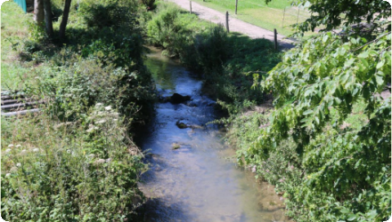
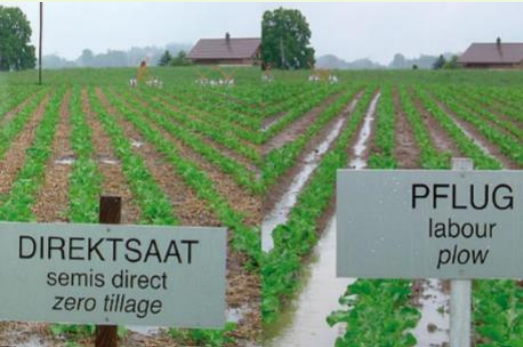
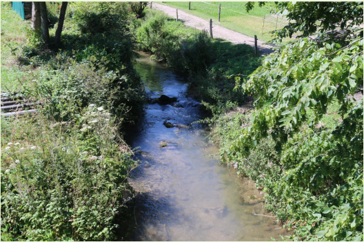
The case study area “Petite Glâne” belongs to the Broye catchment in the southwestern part of the Swiss Plateau. The river Petite Glâne is about 30 km long, repeatedly crosses borders between the cantons of Vaud and Fribourg, and has a catchment area of 94 km2. Its upper reaches have remained fairly natural and are lined with forest, whereas its lower reaches in the Broye plain have been canalized and straightened. The soils and climate here are highly suitable for arable farming. Overall, the catchment of the Petite Glâne is strongly characterized by agriculture: nearly three quarters of its area consists of pastures and cropland. However, the region is increasingly experiencing water shortages in summer, and there is often not enough water in the Broye and Petite Glâne to irrigate the fields. Climate change will further aggravate the situation. Farmers are therefore considering new options to mitigate the increasing drought events – for example an irrigation project using water from Lake Neuchâtel.
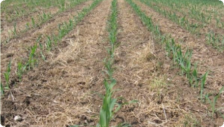
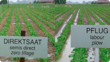
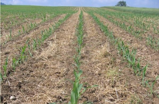
Against this background, OPTAIN explores efficient land use and land management strategies as well as technical measures that increase the capacity of soils to absorb and store water while improving nutrient retention and decomposition. These natural and small water retention measures (NSWRMs) are discussed and evaluated jointly with regional stakeholders. Based on model calculations, OPTAIN works to determine the maximum possible water and nutrient retention potential that can be achieved with NSWRMs if they are optimally combined and positioned in the catchment. Although the focus is on the Petite Glâne, the case study extends to the entire Broye catchment when it comes to modelling and stakeholder involvement.
The OPTAIN project will support the case study team with identifying and developing efficient land management strategies and small technical solutions to improve the soils’ infiltration and water holding capacities as well as its capacity to filter, buffer and transform pollutants.
Position
Latitude
46.83664
Longitude
6.89970
Biogeographical Region
Continental
Projet
OPTAIN
Carte nationale d’identité
CH_04
Date d’installation
OPTAIN project: 2020-2025
Statut de mise en œuvre
Modeled
Galerie photo
Code NUTS
CH02 - Espace Mittelland
Mesure(s) éponge mise(s) en œuvre dans l’étude de cas
Involved Partners
| Authority type | Authority name | Role | Comments |
|---|---|---|---|
Climate
Zone climatique
cool temperate moist
Annual Averages:
Précipitations
900-1200 mm/year
Température
8/10 °C
Évapotranspiration
650 mm/year
Geography
Plage de pentes
moderate (6 - 10%)
Type de sol
Cambisol
Luvisols
Scale of the project
Échelle du projet
Micro
Size of the project
Zone du projet
Petite Glâne: 94 km2 Broye: 602 km2
Bassin versant
94
Conception du changement d’occupation des sols
Financing authorities
| Authority name | Type of funding | Financing share | Comments |
|---|
Policy context
Project developed in coordination with the following stakeholders: Authorities of the agricultural sector, authorities of the environment sector, famer associations, local farmers, NGOS, and AGRIDEA
Participation de la communauté
No
Design consultation activity
| Activity stage | |
|---|---|
|
Screening phase
|
Policy target
| Target purpose | |
|---|---|
|
Improved Biodiversity
|
Policy area
| Policy area type | Policy area focus | Name | Comments | |
|---|---|---|---|---|
|
Primary
|
Water Framework Directive
|
Water management
|
Partie d’un plan plus large
0
Type de plan plus large
| Wider plan type | Wider plan focus | Name | Comments | |
|---|---|---|---|---|
Directive d’exigence
| Requirement directive | Specification | |
|---|---|---|
Type de facteur de réussite
| Success factor type | Success factor role | Comments | Order |
|---|---|---|---|
Type de moteur
| Driver type | Driver role | Comments | Order |
|---|---|---|---|
The in-depth description of the case study