Last update
2025
Summary
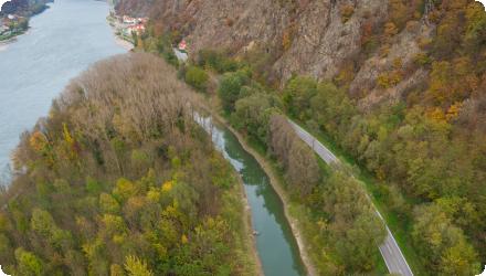
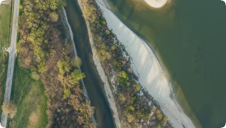
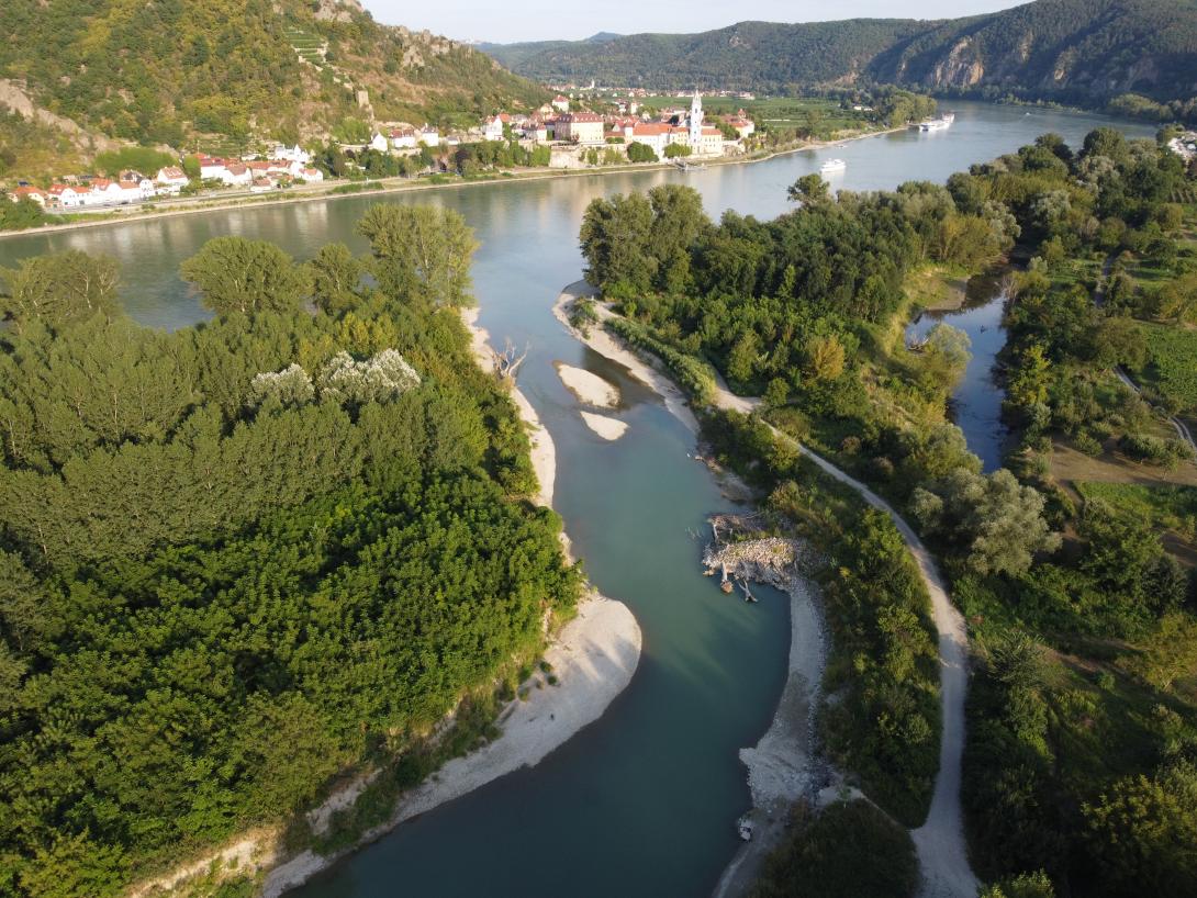
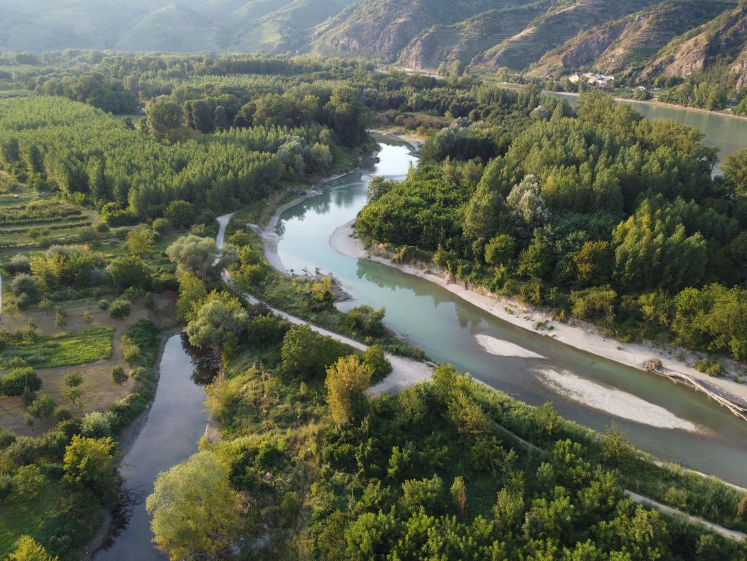
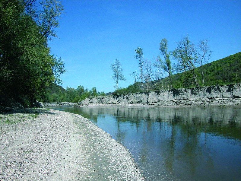
Within an Austrian LIFE Nature project, gravel banks have been established along the Danube in the Wachau, and dried site-arms have been reconnected. The measures aimed at improving biodiversity through providing spawning habitats, as well as controling erosion and run-off. As a particularity, the gravel used in the project stemmed from maintenance works for the shipping channel of the Danube. The project has been initiated and implemented by a local association (Arbeitskreis Wachau), which includes several communities.
All implemented measures of "LIFE Nature Wachau" are still operational and most of them were further optimized by additional projects.
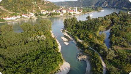
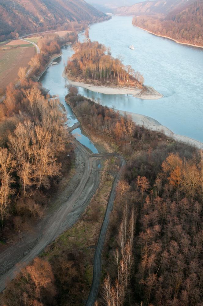
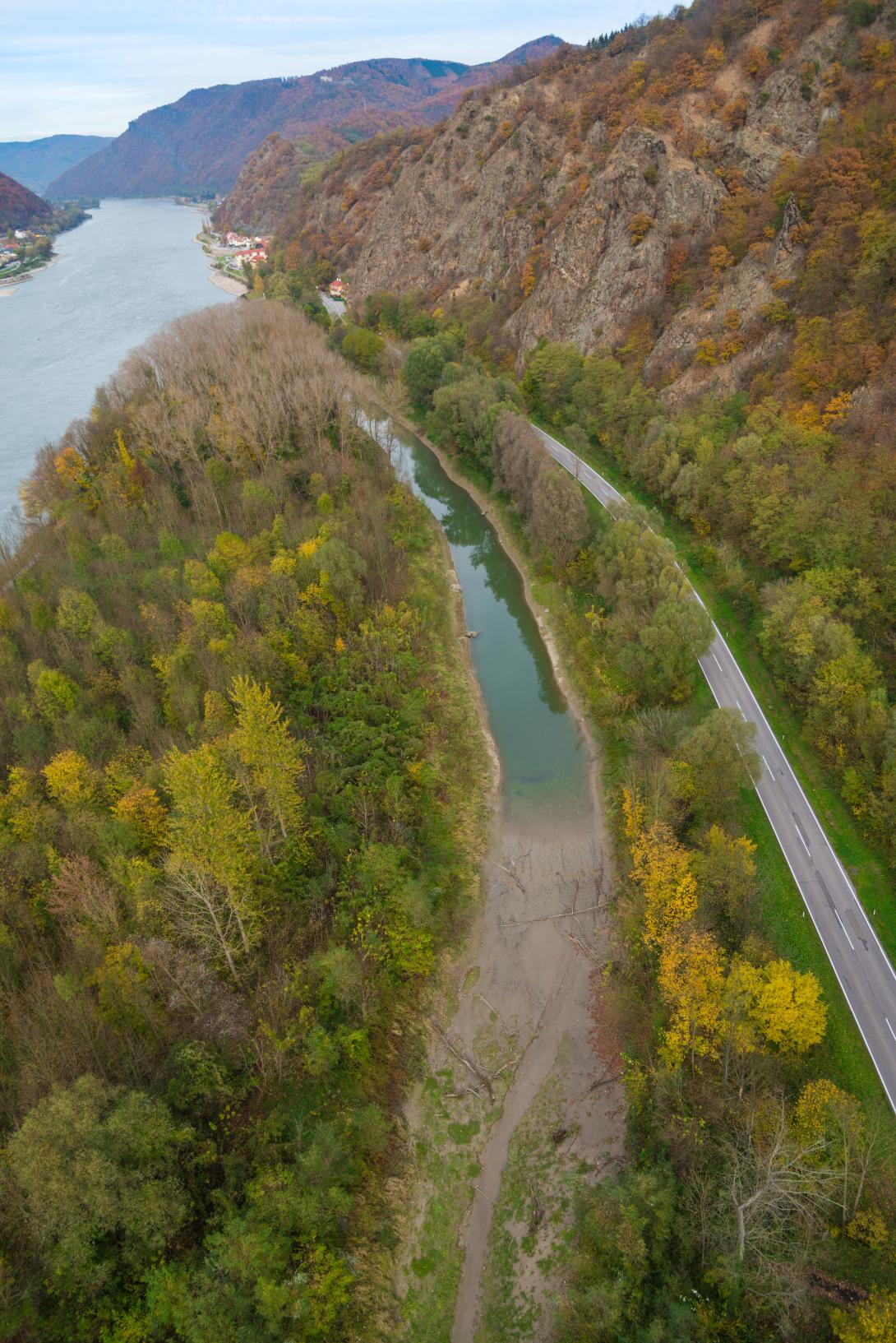
The Sidebranch reconnections of Grimsing and Rührsdorf-Rossatz are still existent and working.
Sidebranch Grimsing was expanded upstream by a new sidebrach Schallemmersdorf and significantly lengthened in 2011 - 2013 as a result of the project LIFE+ Mostviertel Wachau (lead partner: Land NÖ, implementation: viadonau). Now the sidebranch system Schallemmersdorf – Grimsing has a length of more than 4 km in total. The connection to the main stream of Donau is still working at low water level. The sidebranch system now is an important spawning area and habitat for rheopilic fish species which are typical to the Danube. The sidebranch system and the alluvial forest enclosed by it continue to serve as flood area. Further measures to expand the sidebranch system are currently planned by municipality of Emmersdorf (implementation of a new oxbow at sidebranch Grimsing).
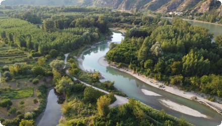
Sidebranch Rührsdorf- Rossatz was expanded downstream by a new sidebranch Schopperstatt and significantly lengthened in 2019 – 2022 as a result of the project LIFE+ Wilderness Wachau (lead partner: viadonau, implementation: viadonau). The new sidebranch system Rührsdorf – Rossatz - Schopperstatt has a length of more than 5 km in total. The connection to the main stream of Donau is still working at low water level. The sidebranch system now is an important spawning area and habitat for rheophilic fish species which are typical to the Danube. The sidebranch system and the alluvial forest enclosed by it continue to serve as flood area.
The Revitalized oxbow Aggsbach has silted up after a few years. Municipality Schönbühel- Aggsbach therefore initiated a new project in 2013/2014 (Strukturierung Altarm Aggsbach) to further expand the oxbow lake and make it available as a spawning habitat for stagnophilous fish species. The funktion as water reservoir has been restored.
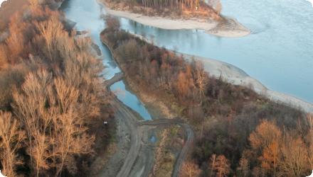
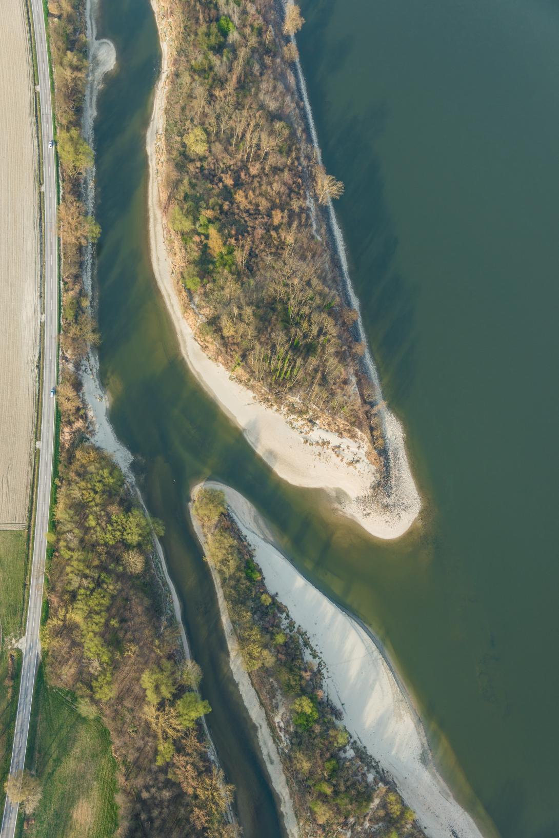
The creation of flat gravel banks and gravel islands as part of the maintenance of the Danube navigation channel has been continued since "LIFE Nature Wachau" was implemented until year 2022 (implementation: viadonau). Currently, new official permits must be obtained in order to be able to continue the work in the future.
Today, the project is still relevant and working; project was (and still is) continuously expanded through follow-up activities. The ecological goals in the Wachau could / can only be achieved through the sum of several implemented projects and ongoing maintenance activities.
All implemented measures of "LIFE Nature Wachau" are still operational and most of them were further optimized by additional projects.
The Sidebranch reconnections of Grimsing and Rührsdorf-Rossatz are still existent and working.
Sidebranch Grimsing was expanded upstream by a new sidebrach Schallemmersdorf and significantly lengthened in 2011 - 2013 as a result of the project LIFE+ Mostviertel Wachau (lead partner: Land NÖ, implementation: viadonau). Now the sidebranch system Schallemmersdorf – Grimsing has a length of more than 4 km in total. The connection to the main stream of Donau is still working at low water level. The sidebranch system now is an important spawning area and habitat for rheopilic fish species which are typical to the Danube. The sidebranch system and the alluvial forest enclosed by it continue to serve as flood area. Further measures to expand the sidebranch system are currently planned by municipality of Emmersdorf (implementation of a new oxbow at sidebranch Grimsing).
Sidebranch Rührsdorf- Rossatz was expanded downstream by a new sidebranch Schopperstatt and significantly lengthened in 2019 – 2022 as a result of the project LIFE+ Wilderness Wachau (lead partner: viadonau, implementation: viadonau). The new sidebranch system Rührsdorf – Rossatz - Schopperstatt has a length of more than 5 km in total. The connection to the main stream of Donau is still working at low water level. The sidebranch system now is an important spawning area and habitat for rheophilic fish species which are typical to the Danube. The sidebranch system and the alluvial forest enclosed by it continue to serve as flood area.
The Revitalized oxbow Aggsbach has silted up after a few years. Municipality Schönbühel- Aggsbach therefore initiated a new project in 2013/2014 (Strukturierung Altarm Aggsbach) to further expand the oxbow lake and make it available as a spawning habitat for stagnophilous fish species. The funktion as water reservoir has been restored.
The creation of flat gravel banks and gravel islands as part of the maintenance of the Danube navigation channel has been continued since "LIFE Nature Wachau" was implemented until year 2022 (implementation: viadonau). Currently, new official permits must be obtained in order to be able to continue the work in the future.
Today, the project is still relevant and working; project was (and still is) continuously expanded through follow-up activities. The ecological goals in the Wachau could / can only be achieved through the sum of several implemented projects and ongoing maintenance activities.
Position
Latitude
48.393333
Longitude
15.455556
Project
NWRM
National Id
Austria_Life_Wachau
Installation date
2008 (LIFE) but continued after until 2022
Implementation Status
RBD code
AT1000
Transboundary
0
Photo gallery

Location of the project
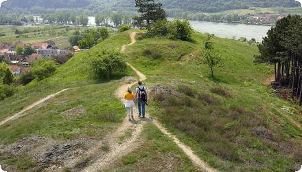
Wachau Valley, along the Danube River in Lower Austria, near Rossatz and Emmersdorf.
NUTS Code
AT12 - Niederösterreich
Project's objectives
• structure the main current of Danube: along 33 km of Danube; using 400,000 m³ of gravel
• reactivate lateral water systems: 9 km of running water biospheres near Grimsing, Rührsdorf, Aggsbach, Rossatzbach
• manage dry grassland: 100 ha regenerated
• maintain and improve wooded stocks which are relevant to the FFH: app. 158 ha
• create a Natural Protection Coordination function in Wachau: Spitz castle
Involved Partners
| Authority type | Authority name | Role | Comments |
|---|---|---|---|
Climate zone
warm temperate dry
Temperature
8.4
Precipitation
633
Annual rainfall range
600 - 900 mm
Runoff
1700
Runoff range
600 - 750 mm
Elevation range
200-210 m
Slope range
0-1%
Groundwater level
gauge Melk: Ø 206,15 – 206,4 müA gauge Emmersdorf: Ø 203,4 – 204,8 müA
Vegetation class
Wachau Valley (along Danube): forest / alluvial forest, agriculture, infrastructure (streets, railway, settlement area)
Surrounding Hills: dry hillside forests, vineyards, dryland grasses, rockfalls, infrastructure (streets etc.)
Surrounding Hills: dry hillside forests, vineyards, dryland grasses, rockfalls, infrastructure (streets etc.)
Water bodies: Ecological Status
Poor
Water bodies: Chemical Status
Failing to achieve good
Project scale
Meso
Project scale specification
Measures were spread over a distance of app. 30 km of Danube
Performance timescale
Immediate
Size
6
Size unit
km
Lifespan
not limited
In terms of aquatic measures, fish habitats should be newly created or optimized, especially:
• New, wave protected sidebranches for rheophilic fish species
• New sidebranches which are connected to the Danube all year round (even low water level)
• Shallow, wave- protected gravel banks for spawning fish and juvenile fish
• Rights of third parties must not be affected (eg. flood protection, navigability of the Danube)
• Ground ownership (if not owned by Republic of Austria)
• Restrictions of flood protection
• Navigability of the Danube
• Restrictions of nature protection (eg. limitation of construction time, compensatory measures)
• Restrictions of forest law (reforestation)
• Restrictions of flood protection
• Navigability of the Danube
• Restrictions of nature protection (eg. limitation of construction time, compensatory measures)
• Restrictions of forest law (reforestation)
Truncated remains of old dristributaries were available for reconnection. Gravel was available from maintenance works for the shipping channel of the Danube.
Total cost
5 200 000
Costs total information
The costs include also works to protect dry grasslands
Financing authorities
Type of funding
EU-funds: LIFE+
Comments
European Union financing through the LIFE Nature fund.
Type of funding
National funds
Type of funding
Sub-national funds
Type of funding
Local funds
Comments
Contribution of the Arbeitskreis Wachau regional development group with communities and LANIUS.
Type of funding
Private funds
Comments
Contribution of the Lower Austrian Fisheries Association and the Austrian Waterways Association via donau.
Policy context
"Although the main river flows free, a dramatic loss of structural diversity has occurred within the past few decades: elimination of gravel banks and other interventions, and the disappearance of the lateral channels due to increasing sedimentation of cut-off river arms during the periodic floods" (Seehofer, 2008). The regulated open Danube offered poor habitat for spawning and survival of young fish. The project goal was to improve habitat by connecting dry oxbows to the Danube and to create 'man-made' gravel banks.
Land ownership
Danube: Republic of Austria (BWV, viadonau) Surrounding area: private, Austrian federal forests (ÖBf), church, municipalities, state of Lower Austria (Land NÖ), Agricultural communities
Community involvment
Yes
Design consultation activity
| Activity stage | Name | Key issues | Comments |
|---|---|---|---|
|
Implementation phase
|
Intensive media work
|
Amongst others, the project has organised the Austrian LIFE-platform in 2005 and was presented at various meetings, conferences and events. The project was also awarded the first prize in the Milestones - "Dr. Erwin Pröll" future prize in the "In Uniso with Nature" category.
|
|
|
Implementation phase
|
Networking activities
|
Networking activities have taken place with experts from Austria, Germany, Switzerland, Japan and Poland.
|
|
|
Implementation phase
|
Visits to target groups
|
37 visits to target groups have been made during the project.
|
Policy target
| Target purpose |
|---|
|
Improved Biodiversity
|
|
Runoff control
|
|
Erosion Control
|
Policy pressure
| Pressure directive | Relevant pressure |
|---|
Policy impact
| Impact directive | Relevant impact |
|---|
Requirement directive
| Requirement directive | Specification |
|---|
Contractual arrangements
0
| Arrangement type | Responsibility | Role | Name | Comments |
|---|
Part of wider plan
1
Wider plan type
| Wider plan type | Wider plan focus | Name | Comments |
|---|---|---|---|
|
Catchment-based
|
Environment & Biodiversity
|
ecological renaturation potential on the Austrian Danube
|
Project of ezb - TB Zauner, commissioned by viadonau & government of Lower Austria (Land NÖ); Commissioned by viadonau & government of Lower Austria (Land NÖ);
|
Fish monitoring of LIFE Nature Wachau was finished 2008. viadonau continued fish monitoring in relation to further LIFE projects and ongoing maintenance works on gravelbanks / gravel islands
The development of bird and fish species has been monitored.
Methods:
• Electro fishing by boat
• Pole fishing
• Point Abundance
• Electric bottom trawl (partly)
• Longline
• Gill net / net fishing
Monitoring of ecological status in relation to WFD is ongoing by BMLUK
Methods:
• Electro fishing by boat
• Pole fishing
• Point Abundance
• Electric bottom trawl (partly)
• Longline
• Gill net / net fishing
Monitoring of ecological status in relation to WFD is ongoing by BMLUK
Maintenance
Gravelbanks / gravel islands at the Danube is done by viadonau. Sidebranch reconnections & oxbow is regulated differently: partly done by viadonau, municipalities, federal forests of Austria (ÖBf)
Maintenance baseflow
0
Information on Maintenance baseflow
Decrease of water level & deepening of Danube river bed in the Wachau section is ongoing
Restoring hydraulic connections
6000
Restoring hydraulic connections unit
meters
Information on Restoring hydraulic connections
6 km of former side-arms have been reconnected to the Danube.
Ecosystem erosion control
1
Information on Ecosystem erosion control
One of the aims of the project is to counteract the excavation of the shipping channel.
Water quality overall improvements
N/A info
Soil quality overall soil improvements
N/A info
1
One of the target species of the project has been the huchen (Hucho hucho). In general terms, spawning grounds for fishes and resting areas for birds have been improved. Significant improvement in fish biomass and ecological status (WFD) in long-term monitoring.
Ecosystem impact climate regulation
Not relevant for the specific application
Key lessons
Within the LIFE Nature Project, different sub-projects have been successfully implemented in the Wachau. This included the establishment of gravel banks, and the reconnection of dried up site-arms. Based on the pilot project experience of reusing gravel dredged from the shipping channels to recreate gravel banks and islets in the Danube, a gravel plan has been set up that foresees that all gravel excavated from the navigation channel between 2005 and 2020 would be brought back into the Danube River. Both gravel structures and reactivated lateral river channels serve as spawning ground for the fish fauna and as resting and breeding sites for aquatic birds.
Success factor(s)
| Success factor type | Success factor role | Comments | Order |
|---|---|---|---|
|
Attitude of relevant stakeholders
|
main factor
|
<p>The commitment of local stakeholders has been crucial for launching and implementing the project.</p>
|
1
|
|
Public participation
|
secondary factor
|
<p>The commitment of the local angling association was important to convince the more than 20 local landowners to make their land available.</p>
|
2
|
Driver
| Driver type | Driver role | Comments | Order |
|---|---|---|---|
|
Organisation committed to it
|
main driver
|
The Arbeitskreis Wachau regional development group and the angling association committed themselves to the project and set initial impulses.
|
1
|
|
Public pressure
|
main driver
|
Interest of local municipalities (fish deaths caused problems with tourism)
Interest of fisheries associations |
|
|
Legal obligations
|
main driver
|
EU Water Framework directive (to gain good ecological status)
Natura 2000 directives (good status for protected species, habitats) |
|
|
Availability of subsidies
|
main driver
|
LIFE Programme of EU
|
Transferability
Trasnferable, important findings on fish ecology and the technical feasibility of measures can be transferred to other areas.
Basin characteristics influence
Touristic significance of Wachau - region which made population / municipalities recognize the importance of ecological aspects and aesthetics of landscape; Wachau has historical background of the fight against hydroelectric power plant near Rossatz.
English