Last update
2025
Summary
In the Xiropotamos River Basin, near the town of Naoussa in Central Macedonia, Greece, a set of natural water retention measures was implemented to address severe erosion, flash flooding, and reduced water availability. The area, affected by deforestation and land degradation, required restoration to stabilize soils and improve hydrological regulation.
The project, initiated in 2004 and approved under national environmental terms in 2013, combined afforestation, riverbed reshaping, and small-scale retention structures. Around 70 hectares of degraded land were reforested with native tree species to reduce runoff and increase infiltration. In parallel, a 2 km stretch of the river was reprofiled to reduce its slope, and a series of check-dams and retention basins were constructed to slow water flow and trap sediments.
Implementation was led by the Municipality of Naoussa with the support of a private contractor, and the public development agency AN.KO A.E. contributed to forest technical works in the mountainous upstream areas. The intervention stands out as one of the first in Greece to combine forest hydrological engineering with landscape restoration at basin scale.
The project helped decrease peak flows, reduce sediment transport, and improve local water retention. It also provided environmental co-benefits by restoring vegetation cover and stabilizing the catchment. Its approval under Greek environmental regulations highlights its formal recognition and alignment with national water and forest policy objectives.
Position
Latitude
40.63
Longitude
22.06
Project
NWRM
National Id
Greece_01
Implementation Status
Contact
Maggie Kossida, IACO
RBD code
GR09
Transboundary
0
Photo gallery
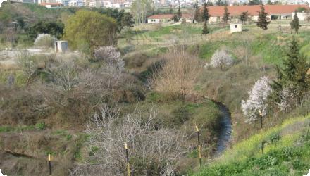
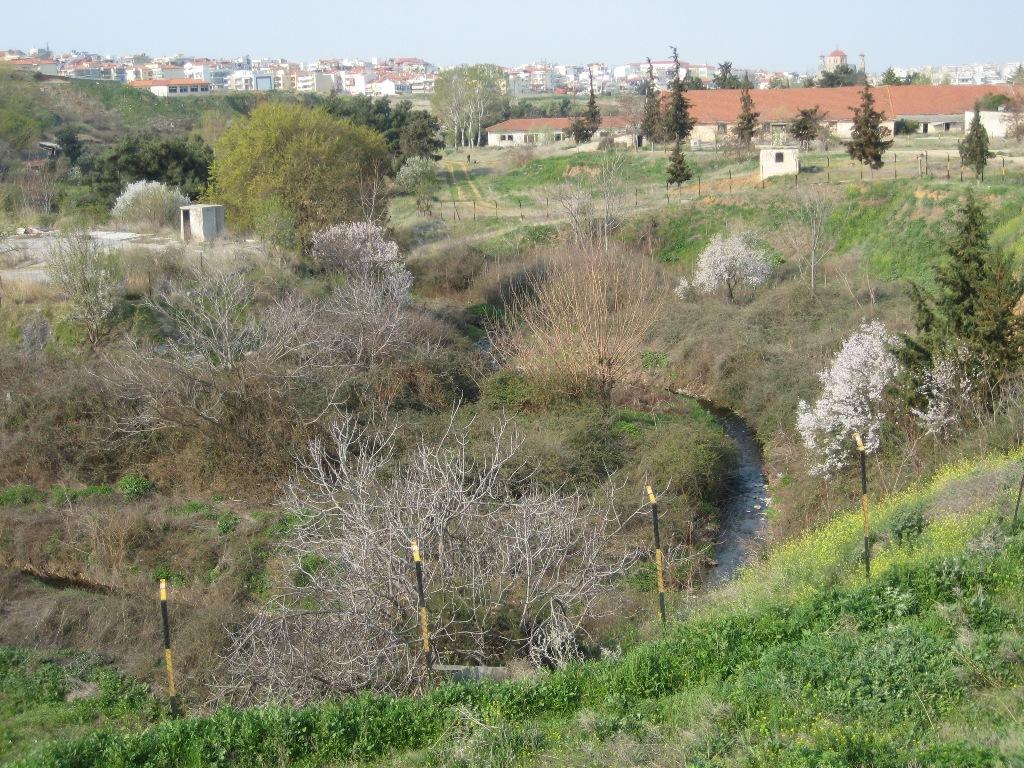
Location of the project
The Xiropotamos River Basin is situated near the town of Naoussa, in Central Macedonia, Greece. The project concerns areas within the mountainous catchment and a 2 km stretch of the river itself.
NUTS Code
EL13 - Δυτική Μακεδονία (Dytiki Makedonia)
Project's objectives
Reduce runoff velocity and peak flows through terrain modifications.
Increase water retention and infiltration via restoration and vegetation.
Mitigate soil loss and improve hydrological regulation at sub‑basin scale.
Increase water retention and infiltration via restoration and vegetation.
Mitigate soil loss and improve hydrological regulation at sub‑basin scale.
Involved Partners
| Authority type | Authority name | Role | Comments |
|---|---|---|---|
Climate zone
warm temperate dry
Temperature
11,6
Precipitation
609,8
Annual rainfall range
600 - 900 mm
Runoff
1,93
Runoff range
600 - 750 mm
Elevation range
375
Vegetation class
The dominant vegetation appears to be forest (native tree cover) rather than grassland.
Water bodies: Ecological Status
Good
Water bodies: Chemical Status
Failing to achieve good
Project scale
Meso
Project scale specification
The intervention was carried out at the river basin level, specifically in the Xiropotamos sub-basin near Naoussa (Central Macedonia, Greece). It involved integrated actions across a 2 km stretch of the river and 70 hectares of the surrounding catchment, including reforestation, riverbed reshaping, and construction of check-dams and retention basins.
Performance timescale
1 - 4 years
Project area
2800
Area subject to Land use change or Management/Practice change (ha)
2800
Lifespan
25
Design capacity description
The retention measures are based on eliminating soil erosion and decreasing the stream gradient, though small scale dams. The maximum volume of runoff water that can be retained is not determined in the study.
The constrains include the implementation of such measures in protected areas and the limitations that are for this reason necessary
The necessary preconditions are the climate conditions and the hydrology of the area.
Total cost
unkown
Costs total information
The measures have not been implemented yet in the area
Costs investment information
The measures have not been implemented yet in the area
Costs operation maintenance information
The measures have not been implemented yet in the area
Policy context
The specific interventions aim at slowing down the stream velocity with retaintion dams and reduction of stream gradient. Additionally the application aimed at reducing soil erosion through afforestation and planting in order to improve the soil properties and mitigate flood risk.
Community involvment
No
Design consultation activity
| Activity stage | Name | Key issues | Comments |
|---|
Policy target
| Target purpose |
|---|
|
Peak-flow reduction
|
|
Erosion Control
|
|
Improved Biodiversity
|
Policy pressure
| Pressure directive | Relevant pressure |
|---|
Policy impact
| Impact directive | Relevant impact |
|---|
Requirement directive
| Requirement directive | Specification |
|---|
Contractual arrangements
0
| Arrangement type | Responsibility | Role | Name | Comments |
|---|
Part of wider plan
0
Wider plan type
| Wider plan type | Wider plan focus | Name | Comments |
|---|
Unknown
Non applicable
The direct benefits include the reduction of the flood risk, the mitigation of soil erosion, the improvement of the micro-environment as well as the aesthetic restoration of the area.
Ancillary benefits include the increase of infiltration / percolation and recharge of aquifers; this water can be used for different purposes (e.g agriculture) as well as for ecosystem services. Also the aesthetic improvement of the area has positive societal impacts
Information on retained water
The volume of retained water was increased due to the small scale dams as well as the improvement in the area vegitation after the afforestation/plantation
Information on increased water storage
The measures slowed down the stream flow and increased the retaining of water for longer period enabling the infiltration/percolation and recharge of aquifers.
Information on runoff reduction
The measures improved the runoff control as the velocity of water volume was reduced leading to decreasing the intensity and frequency of floods.
Information on Water quality overall improvements
Not relevant for this application
Soil quality overall soil improvements
Positive impact-SQ improvement
Information on Soil quality overall soil improvements
The measures have a direct impact on the overall soil quality as afforestation / plantation of the area succeeds in improving the soil properties leading to increased soil storage capacity. Soil erosion have reduced the soil capacity to store and retain water thus an improvement in the soil properties (e.g. soil moisture) can have a positive impact on the soil infiltration capacity.
1
The measures are expected to have positive impact on the biodiversity of the area
Ecosystem impact climate regulation
No information available
Information on Ecosystem impact climate regulation
The micro-climate and micro-environment is expected to be positively affected by the implemented measures; however the degree of impact is not assessed
Information on Ecosystem provisioning services
Not relevant for this application
Key lessons
The Xiropotamos River Basin project demonstrates how a combination of afforestation, riverbed reshaping, and small-scale retention structures can be used to address erosion and flash flooding in a mountainous Mediterranean context. By targeting a degraded sub-basin with limited vegetation cover and a steep gradient, the intervention focused on restoring natural water retention processes through relatively low-tech, nature-based solutions.
One of the key lessons is the importance of integrating forest and hydrological engineering in a basin-scale approach. The coordinated use of reforestation and check-dams allowed for both slope stabilization and a reduction in peak flows. This approach may be replicable in similar environments where erosion control and water retention are priorities.
The project also shows the value of institutional collaboration. It involved local authorities (Municipality of Naoussa), a public development agency (AN.KO A.E.), and national oversight through environmental approval by the decentralised administration. This structure helped align the intervention with regional and national environmental policy.
However, a major limitation is the lack of long-term monitoring data. Without quantifiable evidence of hydrological, ecological, or socio-economic impacts, it is difficult to fully assess the project’s effectiveness or guide adaptive management. This highlights the need for structured follow-up and impact assessment in similar projects.
Finally, the case underscores the potential of pilot-scale, EU-funded initiatives to test nature-based solutions in real-world settings. Yet, it also suggests that such efforts must be accompanied by transparent documentation and accessible evaluation data to inform broader policy and practice.
Success factor(s)
| Success factor type | Success factor role | Comments | Order |
|---|---|---|---|
|
Attitude of decision makers
|
main factor
|
<p>The decision makers approved the relevant environmental impact assessment</p>
|
1
|
Driver
| Driver type | Driver role | Comments | Order |
|---|---|---|---|
|
Other
|
main driver
|
The improved mountainous hydrology of the area.
|
1
|
Transferability
This measure is transferable to other Mediterranean or mountainous regions facing erosion and flash flooding. Its success depends on careful site selection, use of native vegetation, and integration of hydrological and forestry techniques. Attention must be paid to local soil stability, rainfall patterns, and community involvement. Long-term monitoring is essential to assess effectiveness and guide adaptation.
English