Last update
2025
Summary
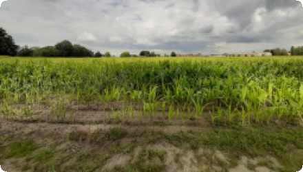
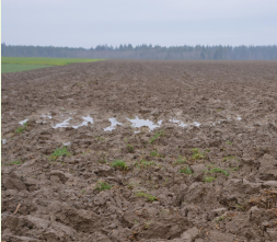
The Wimbe basin is about 112 km2 in size and is classified as a continental bioregion. The basin consists of the water bodies LE8-10. The municipalities within the basin are Daverdisse, Wellin, Beauraing, Gedinne and Rochefort. The basin’s land use is 2% urban, 21% arable, 11% pasture and 66% forest. The region where the stream flows is representative of the Famenne schisteuse and the landscape is open. The region is vulnerable to both floods and low flows. The area is also vulnerable to nitrate concentration in water that is exceeding or is likely to exceed 50 mg/l, may have undergone or likely to undergo eutrophication.
The OPTAIN project will support the case study team with identifying and developing efficient land management strategies and small technical solutions to improve the soils’ infiltration and water holding capacities as well as its capacity to filter, buffer and transform pollutants.
The OPTAIN project will support the case study team with identifying and developing efficient land management strategies and small technical solutions to improve the soils’ infiltration and water holding capacities as well as its capacity to filter, buffer and transform pollutants.
Position
Latitude
50.067272
Longitude
5.226663
Project
OPTAIN
National Id
BE_05
Contact
Ghent University
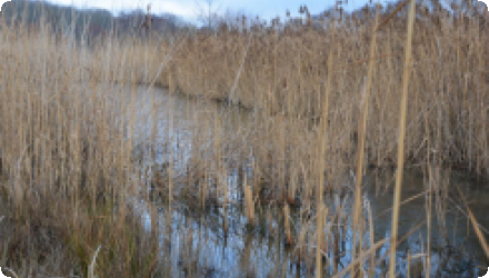
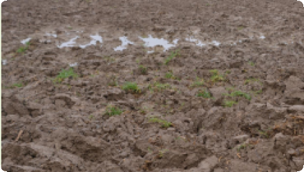
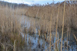
Photo gallery

NUTS Code
BE35 - Prov. Namur
Sponge Measure(s) implemented in the case study
Involved Partners
| Authority type | Authority name | Role | Comments |
|---|---|---|---|
Climate
Climate zone
other
Annual Averages:
Precipitation
844
Temperature
9.8 °C
Evapotranspiration
405 mm/year
Runoff
331 mm
Geography
Slope range
Whole catchment: Max=18.6%, Mean=9.9%, Min=0.01%, stddev=9.2%
Soil type
Cambisol
Groundwater level
35m (deepest)
Vegetation class
The agricultural area (~35%) is mainly cultivated with grasses. Maize and grains are also cultivated aside from the grasses.
Water quality
Water bodies: Ecological Status
Good
Water bodies: Chemical Status
Quality is good if without PBT; but Quality fails to achieve good with PBT
Design land use change
| Land use change type | Comment |
|---|---|
Financing authorities
| Authority name | Type of funding | Financing share | Comments | |
|---|---|---|---|---|
|
EU-funds: Rural development funds
EU-funds: Cohesion and regional development funds
EU-funds: LIFE+
|
EU funds
|
|||
|
Sub-national funds
|
regional funds
|
Policy context
The Wimbe basin is vulnerable to both flooding and low flow events. Agricultural activity within the watershed has impacted the quality of the water, leaving the area vulnerable to nitrate pollution, with concentrations exceeding 50mg/L in certain areas, and instances of eutrophication documented.
The project will be implemented in coordination with the following stakeholders: Contrat de rivière Lesse, Parc Naturel de l’Ardenne Méridoniale, Natagriwal, Fédération Belge du Secteur de l’eau Belgaqua, SPW-GISER Agriculture, Ressources Naturelles et Environnement, Fédération Wallonne de l’Agriculture, Province Namur Cellule Cours d’Eau, Commune de Daverdisse, and local farmers.
The project will be implemented in coordination with the following stakeholders: Contrat de rivière Lesse, Parc Naturel de l’Ardenne Méridoniale, Natagriwal, Fédération Belge du Secteur de l’eau Belgaqua, SPW-GISER Agriculture, Ressources Naturelles et Environnement, Fédération Wallonne de l’Agriculture, Province Namur Cellule Cours d’Eau, Commune de Daverdisse, and local farmers.
Land ownership
around 70% of agricultural land are rented
Wider plan type
| Wider plan type | Wider plan focus | Name | Comments | |
|---|---|---|---|---|
|
Regional
|
Policy target
| Target purpose | |
|---|---|
|
Erosion Control
|
|
|
Pollutants Removal
|
|
|
Peak-flow reduction
|
Policy impact
| Impact directive | Relevant impact |
|---|
Community involvment
No
Policy pressure
| Pressure directive | Relevant pressure | |
|---|---|---|
Requirement directive
| Requirement directive | Specification | |
|---|---|---|
|
Common Agriculture Policy
|
||
|
Nitrate Directive (NiD) 91/676/EEC
|
||
|
European Natura 2000 Network
|
Contractual arrangements
0
Design contractual arrangement
| Arrangement type | Responsibility | Role | Name | Comments |
|---|
Design consultation activity
| Activity stage | Name | Key issues | Comments | |
|---|---|---|---|---|
Policy area
| Policy area type | Policy area focus | Name | Comments | |
|---|---|---|---|---|
|
Primary
|
Common Agricultural Policy
|
|||
|
Primary
|
Environmental Policy
|
Monitoring system
Presence of formal monitoring system
yes
Success factor(s)
| Success factor type | Success factor role | Comments | Order |
|---|---|---|---|
|
Available support tools
|
main factor
|
Incentives |
|
|
Existing staff and consultant knowledge
|
main factor
|
Assistance from non profit organizasation |
|
|
Existing regulations
|
main factor
|
Legislation |
Driver
| Driver type | Driver role | Comments | Order |
|---|---|---|---|
|
Other
|
main driver
|
landowners, land users
|
|
|
Organisation committed to it
|
main driver
|
Policy makers and advice of experts to policymakers
|
Overall impact
only residents can tell