Podravska region/Pesnica/Gačnik
| Authority type | Authority name | Role | Comments |
|---|---|---|---|
Climate
Annual Averages:
Geography
Water quality
The Pesnica River catchment OPTAIN Case Study is located in northeastern Slovenia, within the Pannonian climatic region, classified as cool temperate moist. The area ranges in elevation from 100 to 500 meters above sea level and covers approximately 137 km².
The average annual rainfall ranges from 900 to 1100 mm, with a mean annual temperature of 9.5°C. Hydrologically, the site experiences annual runoff between 300–600 mm, and mean annual evapotranspiration is estimated at 550–650 mm.
The terrain has an average slope of 14%, contributing to surface runoff and erosion in agricultural zones. The dominant soil types are Cambisols and Luvisols, with groundwater levels ranging from 5 to 50 meters deep.
According to WFD Article 4 assessments, the ecological status of the water bodies is rated Poor (2021). The chemical status shows a Bad rating in the biota matrix (including PBT substances) with low confidence, while water and biota assessments excluding PBTs indicate a Good status, with medium confidence.
The landscape is primarily used for arable cropping, with significant areas of permanent grassland and mixed forest vegetation, all of which influence infiltration and water retention dynamics in the catchment.
Scale of the project
Size of the project
Principles
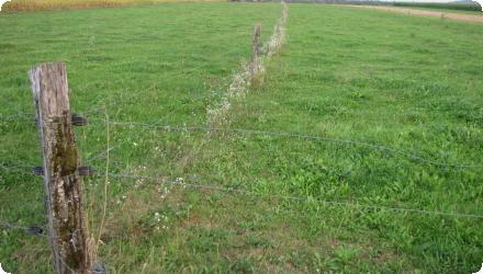
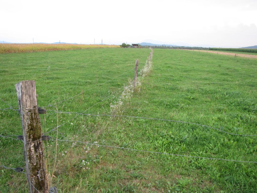
Cropland area was converted to permanent grassland or pasture land by sowing of grass and by a fence as protection. Grazing is organized in a rotation system between suckler cow's pasture and paddocks.
The purpose of the technology is to use the natural potential of the soils. As soils are shallow with low water holding capacity permanent grassland is much more resilient and adapted to the drought; permanent grassland needs not only less water, but as well less nutrients. Grass has the capacity to grow well after any rainfall event at any time of the growing period. During drought when, maize fields get dry, grasslands subsist and just wait until the rain falls. While maize yield is lost in drought years, grassland can sustain and nurrish animals until mid-autumn. Another advantage of grassland is its building up of organic matter in the soils.
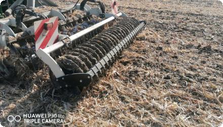
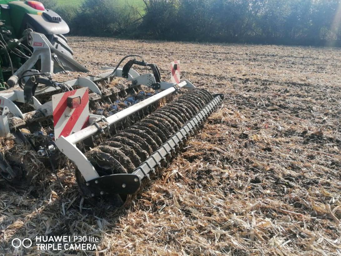
Mulch-till: (also called “conservation agriculture” or “minimum tillage”) is a method of land management with modified, less intensive tillage, where land is covered with plant residues year-round (at least 30% cover) or grass, energy consumption is reduced, and there is less trampling/ compaction of the soil because of fewer machine passes and the protected surface. Under mulch-till, special agricultural machinery and attachments are required. Disc harrows and chisel ploughs are used to loosen the soil, and direct drills are employed for seeding.
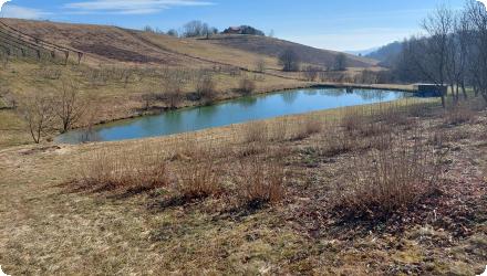
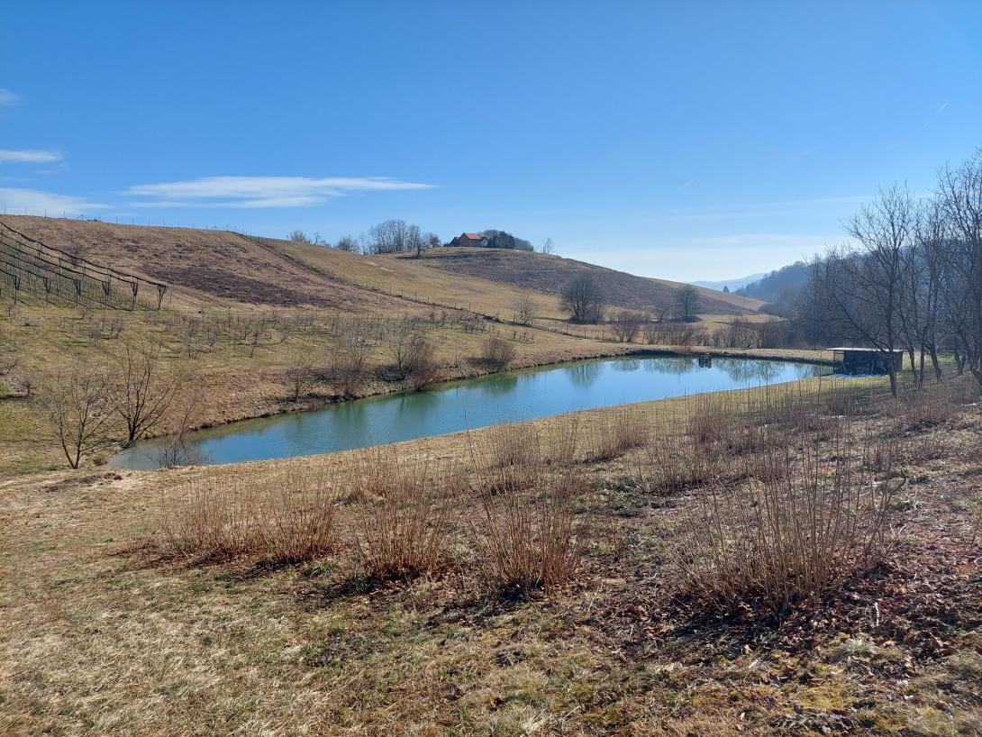
Retention ponds: “Retention ponds” comprise both simple, small ponds (up to 2000 m3, up to 4 m deep) and larger, more complex reservoirs (greater than 2000 m3). Retention ponds are designed to provide storage capacity to attenuate surface runoff during rainfall events. Each consists of a permanent ponded area with landscaped banks. Retention ponds achieve both storm water attenuation and water quality treatment through supplementary storage capacity of runoff. Water is then released at a controlled rate once the risk of flooding has passed. The technology can be applied in a natural or human environment. Before construction of a pond it is essential to follow legislation, which covers conditions and restrictions for the given location. Once a site is selected, technical documentation is prepared: first the conceptual design, then documentation for obtaining opinion, consent and a building permit. Later there is also project documentation for implementation. If the water is to be used for other purposes as well (e.g. for irrigation), it is necessary to plan for usage and environmental impact. Retention and still water promotes pollutant removal through sedimentation, while aquatic vegetation and biological uptake mechanisms offer additional treatment. Retention ponds are effective in removing urban pollutants and improving water quality.
| Land use change type | Comment |
|---|---|
|
No major land use change occurred. Measures were integrated within existing agricultural land uses. Some spatial adaptation was required for buffer strips and hedges, and retention ponds were located on marginal or less-productive land. |
Five NSWRMs were selected and implemented: Low till agriculture, Retention ponds, Green cover, Crop rotation, Buffer strips and hedges. The design relied on local knowledge and was adapted to field conditions, using funding instruments already available to Slovenian farmers. Implementation was simple, cost-effective, and aimed at improving soil protection, water retention, and farm resilience with minimal disruption to existing land use.
Details of the costs
Mulch till : equipment procurement : 63 500 EUR
Retention pond: Document preparation, planning permission, construction of pond: 73 600 EUR
Riparian Buffer Strips and Hedges: Periodic mulching, mowing, or manual cutting (chainsaw work); removal of invasive species; occasional replanting or gap filling.
Green Cover / Cover Crops: Annual seed purchase and sowing; field preparation; potential herbicide or mowing costs for cover termination. These are recurring agronomic costs, varying by crop type and seasonal conditions.
Low Till Agriculture: Ongoing costs are related to specific machinery operations (e.g. disc harrows, no-till seeders). Costs depend on field size, soil condition, machine maintanance and fuel/labor inputs.
Crop Rotation:
No direct maintenance costs, but crop selection and planning must consider nutrient needs, pest cycles, and market viability. Minor administrative or advisory costs may apply.
Crop Rotation: Ongoing costs depend on the specific crop grown in each rotation year. These include variable production costs such as seeds, fertilizers, plant protection products, labor, and machinery use — all considered standard farm operational expenses.
Riparian Buffer Strips and Hedges: Regular inspection; vegetation control through mulching; selective cutting and trimming with chainsaw; removal of invasive species.
Green Cover: Monitoring of cover crop establishment; re-sowing if cover is insufficient; control of unwanted species; soil condition checks.
Low Till Agriculture: Annual review of soil structure and compaction; equipment maintenance; occasional weed pressure monitoring (especially where herbicide use is reduced).
Crop Rotation: Planning and documentation of rotation cycles; monitoring nutrient balance and soil health; adjusting rotation based on market and ecological feedback.
| Authority name | Type of funding | Financing share | Comments | |
|---|---|---|---|---|
|
National funds
|
Provides funding through agricultural subsidies and non-refundable investment support under national and EU rural development programs.
|
|||
|
Sub-national funds
|
Offers returnable financial instruments such as soft loans and guarantees to co-finance sustainable rural and environmental investment projects.
|
|||
|
Other
|
For agronomic measures (e.g. low till, green cover, buffer strips), annual maintenance is supported through CAP subsidies
|
The implementation of NSWRMs was guided by a combination of farmer involvement, national advisory services, and legal requirements, particularly in cases involving construction works like retention ponds. Public agricultural consultants supported planning and decision-making, while regulatory frameworks ensured technical compliance.
The implemented NSWRMs primarily address the following policy targets, flood control. drought mitigation and nutrient runoff. These governance arrangements and design choices help align local actions with broader EU directives and policy goals.
| Wider plan type | Wider plan focus | Name | Comments | |
|---|---|---|---|---|
| Target purpose | |
|---|---|
|
Runoff control
|
|
|
Peak-flow reduction
|
|
|
Groundwater Recharge
|
|
|
Increase Water Storage
|
|
|
Pollutants Removal
|
| Impact directive | Relevant impact | |
|---|---|---|
| Pressure directive | Relevant pressure | |
|---|---|---|
| Requirement directive | Specification | |
|---|---|---|
|
Water Framework Directive (WFD) 2000/60/EC
|
||
|
Nitrate Directive (NiD) 91/676/EEC
|
| Arrangement type | Responsibility | Role | Name | Comments | |
|---|---|---|---|---|---|
| Activity stage | Name | Key issues | Comments | |
|---|---|---|---|---|
| Policy area type | Policy area focus | Name | Comments | |
|---|---|---|---|---|
Most maintenance activities in the Kobiljski potok case study are based on practical experience and consultations with farmers rather than formal long-term testing. Regular tasks include vegetation management around buffer strips, pond inspection, and occasional desilting. Agronomic measures such as green cover and crop rotation are maintained through routine farming operations. While no dedicated long-term monitoring system is in place, observations and performance evaluations were carried out during field visits and stakeholder engagement sessions.
Impact assessement methodology
The application of mulch-till on farm plots has had significant ecological impact, decreasing surface run-off and evapotranspiration. Soil moisture and cover has also been improved while reducing soil compaction, soil loss and crusting. Finally, it is thought to have a beneficial impact in decreasing the impact of droughts.
The installation of retention ponds in the agricultural landscape has resulted in both socio-economic and ecological impacts. In socio-economic terms, their presence increases crop production and reduces the risk of crop production failure. It is also thought to contribute to improving irrigation water quality. In ecological terms, retention ponds increase water quantity by harvesting and collecting water and surface run-off. It is also anticipated that they will reduce climate change risks associated with flooding and drought events,
| Success factor type | Success factor role | Comments | Order |
|---|---|---|---|
|
Other
|
main factor
|
Low-impact requirements |
|
|
Available support tools
|
main factor
|
Simple design, minimal land use change |
|
|
Attitude of relevant stakeholders
|
Awareness of local water and soil management challenges |
| Driver type | Driver role | Comments | Order |
|---|---|---|---|
|
Public pressure
|
main driver
|
Visibility of local hydrological issues
|
|
|
Public pressure
|
main driver
|
Eutrophication of Lake Pernica
|
|
|
Other
|
main driver
|
Soil erosion control
Climate resilience Soil conservation Water retention in the landscape Biodiversity improvement |
The implementation of NSWRMs revealed significant variability in costs, largely influenced by site-specific conditions and farm-specific factors. While some practices, such as riparian buffer strips and cover crops, could involve relatively moderate investments, others—like mulch-till or retention ponds—require substantial upfront costs. All measures demonstrated strong potential to deliver multiple ecosystem services, these include improved water retention, reduced runoff and erosion, enhanced soil health, and increased biodiversity.