Last update
2025
Summary
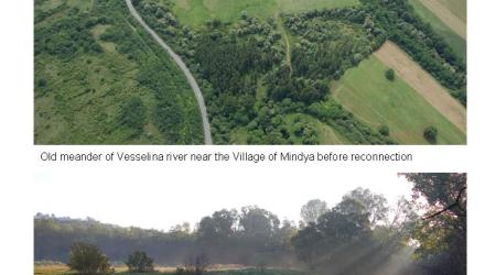
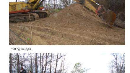
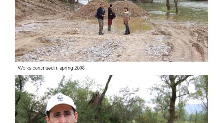
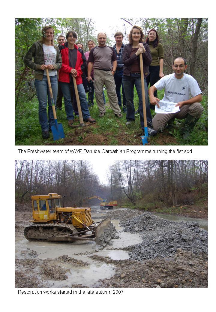
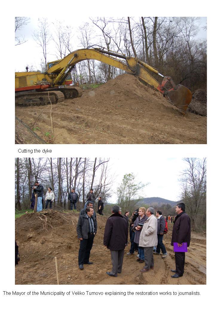
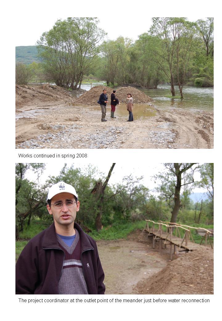
WWF’s Danube-Carpathian Programme, together with residents of Mindya (Veliko Tarnovo), reconnected the Veselina River to a former meander near the village. When the bend was cut off in the past the channel incised by ~150 cm, so a low sill was built (works 2007–2008) to raise water levels and route flow back into the old course.
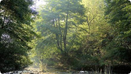
The reconnection now creates slower, warmer waters that support breeding habitat for fish and birds and add retention during high flows.
Project timeline: initiated 2005, works completed April 2008; total cost ≈ €76 k funded by WWF and the DOEN Foundation. The reach lies on WFD water body BG1YN130R029, classified as HMWB.
In May 2012 the site was legally designated the “River Veselina” Protected Area, announced by the Ministry of Environment and Water on the International Day for Biological Diversity; the designation explicitly includes the restored meander. The protected area covers about 98.6 ha between Kapinovo and Mindya.
Since designation, local biodiversity work has documented amphibian and reptile assemblages within the protected area, adding evidence of habitat value.
Position
Latitude
43.03027
Longitude
25.8261
Project
NWRM
National Id
Bulgaria_02
Installation date
2008-09
Implementation Status
Contact
Jovanka Ignjatovic
RBD code
BG1000
Transboundary
0
Photo gallery
Location of the project
Between the villages of Kapinovo and Mindya (Veliko Tarnovo Municipality). The protected site is explicitly listed by the municipality as “Reka Veselina – Kapinovo & Mindya.”
NUTS Code
BG32 - Северен централен (Severen tsentralen)
Project's objectives
Restore ecosystem functions of the Veselina near Mindya
(i) conserving/restoring biodiversity in the old riverbed;
(ii) creating conditions for recreation/tourism;
(iii) reducing flood risk;
(iv) optimizing groundwater level and reducing drought/flood impacts on terrace agriculture;
(v) reducing erosion;
(vi) increasing self-purification capacity of waters. (No numerical targets stated in the sources.)
Involved Partners
| Authority type | Authority name | Role | Comments |
|---|---|---|---|
Climate zone
warm temperate dry
Temperature
11,5
Precipitation
500
Annual rainfall range
300 - 600 mm
Runoff
2,4
Runoff coefficient
0,14
Imperviousness
30
Elevation range
103 m
Slope range
10 %
Vegetation class
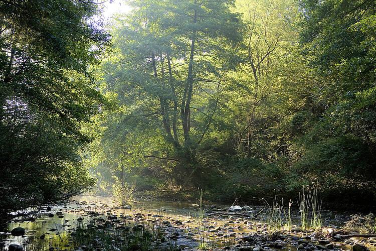
Riparian woodland (alder–willow–poplar–oak) with a mosaic of meadows/pastures and wetlands along the river corridor; land cover around the site is classified as Woodland + presence documented of a permanent marsh presumed to be groundwater-fed
Water bodies: Ecological Status
Good
Water bodies: Chemical Status
Good
Water quality status
Domestic sewage discharges were signaled to the authorities on the Veselina at Kapinovo.
Project scale
Micro
Project scale specification
This is a site-specific hydromorphological intervention on a short river reach near the village of Mindya (Veliko Tarnovo), reconnecting one former meander of the Veselina via a small sill/threshold; it does not span a basin or region. Works were carried out in 2007–2008 and the meander site later fell within the “River Veselina” Protected Area (designated 2012).
Performance timescale
1 - 4 years
Project area
700000
Area subject to Land use change or Management/Practice change (ha)
18
Size
1300
Size unit
m
Lifespan
50
Design capacity description
N/A info
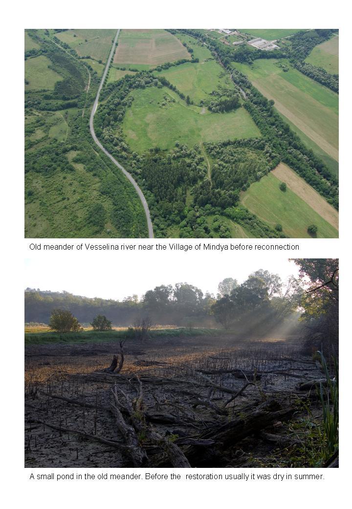
The river meander was cut off back in time, thus the river dug nearly 150 cm deeper into its bed.
Natural riparian vegetation preserved.
Total cost
€76,000
Costs total information
Investigation/design 10–50 k€; stakeholder engagement 1–10 k€; works & supervision 1–10 k€; post-project maintenance < 1 k€; monitoring < 1 k€.
Costs maintenance information
Less than 1000 for Post-project management and maintenance
Financing authorities
Type of funding
Private funds
Type of funding
Private funds
Compensations
0
Policy context
River bed trained and many old meanders are isolated and drying; Decline and fragmentation ofatural riparian habitats.
Land ownership
Strictly public water bodies, and mostly public land.
Community involvment
Yes
Design consultation activity
| Activity stage | Name | Key issues | Comments |
|---|---|---|---|
|
Pressconference
|
|||
|
Booklet
|
|||
|
Public awareness campaign
|
Policy target
| Target purpose |
|---|
|
Improved Biodiversity
|
|
Peak-flow reduction
|
|
Increase Water Storage
|
Target Remarks
Works targeted a WFD-listed water body (BG1YN130R029, classed HMWB), with explicit aims to improve hydromorphology and fish community composition.
Ecological continuity
Landscape enhancement
Ecological continuity
Landscape enhancement
Policy pressure
| Pressure directive | Relevant pressure |
|---|
Pressures remarks
Channel straightening
Artificially regulated hydrology
Former meander cut-off and resulting ~150 cm incision in the active channel
Riparian development
Degraded fish assemblage
Artificially regulated hydrology
Former meander cut-off and resulting ~150 cm incision in the active channel
Riparian development
Degraded fish assemblage
Policy impact
| Impact directive | Relevant impact |
|---|
Requirement directive
| Requirement directive | Specification |
|---|
Contractual arrangements
0
| Arrangement type | Responsibility | Role | Name | Comments |
|---|
Part of wider plan
0
Wider plan type
| Wider plan type | Wider plan focus | Name | Comments |
|---|
Ongoing needs are regulatory inspections by RIOSV/Basin Directorate plus periodic biodiversity checks like the 2019 herpetofaunal survey.
Macrozoobentos, macrophytes and phytobenthos
BG1YN06295MS180
BG1YN86291MS189
Maintenance
Routine site maintenance is municipal (protected-area managers), with only minor post-project maintenance reported in the RESTORE record.
Catchment outlet
Monitoring of the natural riparian habitats
Flood-risk & drought resilience (qualitative): WWF reports the reconnection reduced flood risks and soil erosion at Mindya, and that such restorations benefit local communities by reducing the impacts of floods and droughts and improving water self-purification.
Favorable conditions for development of recreation and tourism in the region
Information on increased water storage
Optimization of groundwater level, but no monitoring results comfirm it yet.
Information on Restoring hydraulic connections
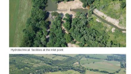
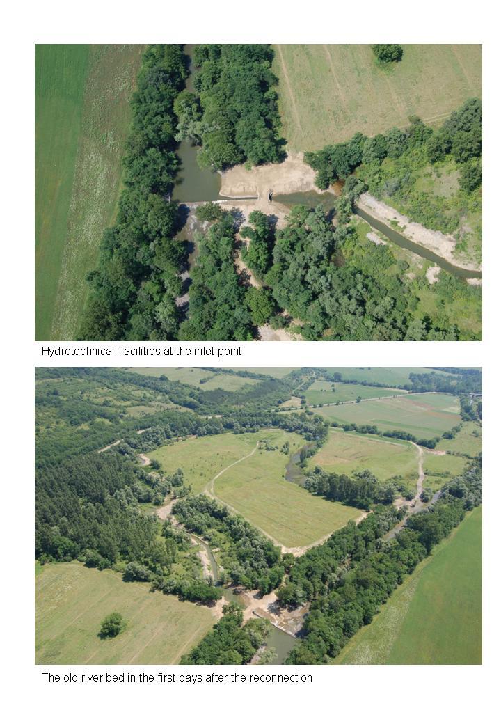
Former meander reconnected (~1,000 m); a low sill was built after ~150 cm incision so flow could return to the old bed. Reported effects: slower waters, added flood protection, less bank erosion.
Hydraulic annex created/restored: the old meander itself (site-scale annex).
Hydraulic annex created/restored: the old meander itself (site-scale annex).
Ecosystem erosion control
1
Information on Ecosystem erosion control
Decreased bottom erosion in main river bed
Information on Water quality overall improvements
increase in self-purification capacity
1
Fish: case record notes “improvement in species composition” (qualitative post-works result). Continuity for organisms: “no change.”
Amphibians & reptiles (2019 survey within the protected site): 12 species recorded over 10 field days; e.g., Marsh frog (303 adults), European pond turtle (38); high use of a ~1.28-acre (≈0.52 ha) permanent marsh (likely groundwater-fed). This confirms good habitat status in/around the restored reach, though it’s not a before–after study.
Amphibians & reptiles (2019 survey within the protected site): 12 species recorded over 10 field days; e.g., Marsh frog (303 adults), European pond turtle (38); high use of a ~1.28-acre (≈0.52 ha) permanent marsh (likely groundwater-fed). This confirms good habitat status in/around the restored reach, though it’s not a before–after study.
Ecosystem impact climate regulation
No specific impact
Key lessons
Small, site-specific works can unlock wide benefits. Reconnecting ~1 km of former meander (2007–2008) with a low sill to overcome ~150 cm incision restored slow-water habitat and reduced local erosion/flood risk, and it helped trigger the 2012 designation of the “River Veselina” Protected Area that includes the site.
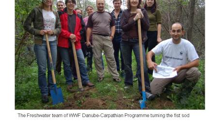
Community leadership is pivotal. The idea and early mobilization came from local groups in Mindya, with WWF and the DOEN Foundation financing the works; afterward, municipal mayors were assigned to manage the protected area, showing how civic initiative plus NGO support can translate into formal stewardship.
Design must address root causes of degradation. Because the channel had incised, the sill was essential to re-water the old bed and reconnect floodplain hydraulics; simply opening the cutoff would not have worked.
Ecological gains can be real yet uneven. The case reports improved fish species composition and richer lentic habitats, while “continuity for organisms” remained unchanged ; reminding us that meander reconnection alone may not fix longitudinal passage.
Monitoring gaps limit evidence. Objectives included groundwater optimization and self-purification, but no site-level hydrologic or water-quality time series were published. Later biodiversity fieldwork (2019) documented 12 amphibian/reptile species and a permanent marsh, yet it wasn’t a before–after study, underscoring the need to embed quantitative monitoring from the start.
Protection is not the end of pressure. Despite the protected status, recent records note sewage issues and attempted irrigation abstractions nearby, requiring ongoing oversight by RIOSV and the Basin Directorate. Legal protection helps, but enforcement and water-use governance remain critical.
Success factor(s)
| Success factor type | Success factor role | Comments | Order |
|---|---|---|---|
|
Financing possibilities
|
secondary factor
|
<p>Relatively small budget was required for implementation</p>
|
1
|
|
Existing staff and consultant knowledge
|
main factor
|
2
|
|
|
Attitude of relevant stakeholders
|
secondary factor
|
3
|
Driver
| Driver type | Driver role | Comments | Order |
|---|---|---|---|
|
Organisation committed to it
|
main driver
|
WWF Bulgaria
|
1
|
Transferability
Highly transferable to small, straightened river reaches with cut-off meanders. Check incision and, if needed, include a level-raising sill; secure base flows/water rights to keep the meander wet; confirm land tenure and protected-area rules; plan enforcement against abstractions/sewage; embed hydrology-and-biodiversity monitoring; and build strong local stewardship, as in Mindya.
English