Last update
2025
Summary
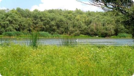
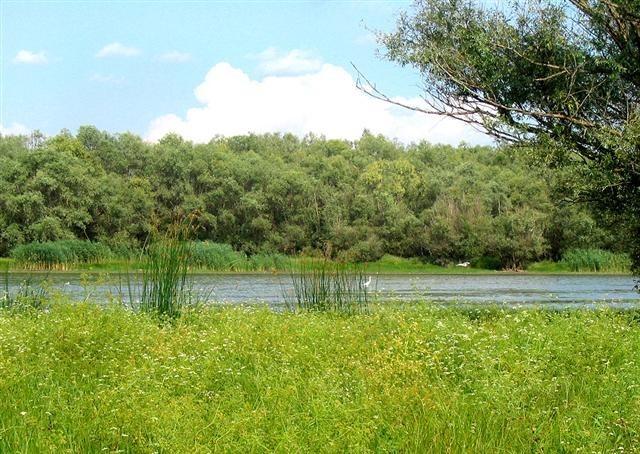
The project’s objective was to improve the conservation status of aquatic bird species in Lower Prut Floodplain Natural Park (Galați County, RO) through scientific inventory, monitoring, site restoration, awareness-raising, implementation of the park management plan, and the designation of Natura 2000 SPAs. Partners were the University of Bucharest, the Romanian Ornithological Society and Romsilva – Galați Forestry.
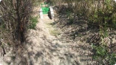
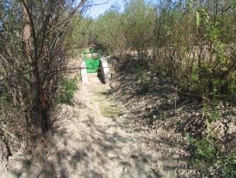
At Pochina, two Prut–lake channels were cleaned and re-profiled (supply L = 362 m; evacuation L = 235 m), with small dykes/footbridges to maintain levels and enable gravitational flushing of sediments; a birdwatching tower was installed. Pochina is a national natural reserve (RONPA0432, 74.8 ha) located near Rogojeni (Suceveni Commune) and lies within the park’s Natura 2000 framework.
At Pochina, two Prut–lake channels were cleaned and re-profiled (supply L = 362 m; evacuation L = 235 m), with small dykes/footbridges to maintain levels and enable gravitational flushing of sediments; a birdwatching tower was installed. Pochina is a national natural reserve (RONPA0432, 74.8 ha) located near Rogojeni (Suceveni Commune) and lies within the park’s Natura 2000 framework.
Position
Latitude
45.991667
Longitude
28.096111
Project
NWRM
National Id
Romania_ 07
Installation date
2010-10
Implementation Status
Contact
Barbu Constantin, RECImola Koszta, REC
RBD code
RO1000
Transboundary
0
Photo gallery
Location of the project
In Rogojeni village (Suceveni commune); access on DJ242D Suceveni–Rogojeni; the park boundary intersects DN26 near Rogojeni.
NUTS Code
RO22 - Sud-Est
Project's objectives
Improve the conservation status of 13 priority and 50+ other Birds Directive species present in the Lower Prut Floodplain Natural Park.
Re-establish the ecological balance of lakes by fixing degraded hydrological structures and improving/maintaining water levels.
Designate four SPAs (Romanian Natura 2000) and prepare/approve an integrated park management plan and administration.
Carry out inventories and monitoring, plus public engagement (village consultations, picture books, nature trails, six annual environment days, bird-watching towers).
Clean and re-profile two Prut–lake channels: supply 362 m, evacuation 235 m; build small dykes/footbridges to maintain levels and allow gravitational flushing.
Involved Partners
| Authority type | Authority name | Role | Comments |
|---|---|---|---|
Climate zone
cool temperate dry
Temperature
11
Precipitation
500
Elevation range
2
Groundwater level
~9–32 m depth; flow toward the Lower Prut floodplain
Vegetation class
Aquatic & palustrine vegetation.
Water bodies: Ecological Status
Moderate
Water bodies: Chemical Status
Good
Water quality status
Organic loading and high mineralization; risks from agricultural pesticides and transboundary accidental discharges
Project scale
Micro
Project scale specification
Site-level hydromorphology within a meso-scale park project.
Project area
74,8
Area subject to Land use change or Management/Practice change (ha)
41,7999992370605
Wetlands belong to the category of ecologically fragile areas, their dynamic being influenced mainly by the qualitative and quantitative characteristic of the water in the hydrographical basin in which they extend. For this reason, the conservation measures promoted in these spaces must be doubled by a strict control of the anthropic activities / arrangements using water for different purposes or as a medium of discharging some wastes.
Total cost
€ 824,710
Financing authorities
Type of funding
EU-funds: LIFE+
Comments
412,355 €
Type of funding
National funds
Comments
412,355 € with all non-EU sources
Type of funding
Local funds
Comments
412,355 € with all non-EU sources
Compensations
0
Policy context
The ecological reconstruction works carried out within the project ensure, by gravitational transfer, a water volume, enough to contribute to the conservation of this special conservation area, declared SPA.
Also, this water transfer from the Prut into Pochina Lake will allow for the cleaning of the bottom of the lake in the future, together with the excess of water being evacuated the extra alluvial deposits, too.
With a view to maintain the water level, dykes were built on the channels as well as footbridges for the free circulation.
Land ownership
State public domain (lake basin).
Community involvment
Yes
Design consultation activity
| Activity stage | Name | Key issues | Comments |
|---|---|---|---|
|
Implementation phase
|
Awareness raising activities
|
These include information dissemination, consultation of every village in the area, and active participation and education with local educational material to be produced. The project takes into account that there is a relatively high illiteracy in the area and will address stakeholders in wide variety of ways, including picture books, nature trails, six annual environment days with expeditions into the area, children's exhibitions, and bird watching towers
|
Policy target
| Target purpose |
|---|
|
Increase Water Storage
|
|
Improved Biodiversity
|
|
Groundwater Recharge
|
Policy pressure
| Pressure directive | Relevant pressure |
|---|
Policy impact
| Impact directive | Relevant impact |
|---|
Requirement directive
| Requirement directive | Specification |
|---|
Contractual arrangements
0
| Arrangement type | Responsibility | Role | Name | Comments |
|---|
Part of wider plan
1
Wider plan type
| Wider plan type | Wider plan focus | Name | Comments |
|---|---|---|---|
|
National
|
Environment & Biodiversity
|
Lower Danube Green Corridor programme
|
Monitoring is carried out under the park management plan, with Romanian Ornithological Society (SOR) listed as a monitoring actor for Pochina and LIFE requiring continued checks of birds and water quality/quantity.
As in the project framework, the site tracks bird population status and organochlorine pesticide bioaccumulation in birds, alongside water quality and quantity.
Maintenance
The two Prut–Pochina channels are kept functional with dykes/footbridges to hold levels, and gravitational flushing is used to clear sediments after the initial dredging and re-profiling done in 2009.
Better conditions for the birds population; increasing the number for aquatic bird species (especially those listed in Annex I of Birds Directive, Bern Convention and in ORNIS lists); improve the trophic state and saprobity of the target aquatic systems; allowing the water oxygenation of the lakes through the input of the fresh water from the Prut River; including the monitoring birds protocols in the adaptive Management Plan of Lower Prut Floodplain Natural Park;
Channel works and a bird tower underpin eco-tourism/education and fisheries potential.
Channel works and a bird tower underpin eco-tourism/education and fisheries potential.
Supply the potential of fisheries resources; using the potential of providing services for tourism and recreation;
Hydrological effects
Increased water storage and maintained levels
Water quality overall improvements
Positive impact-WQ improvement
Information on Water quality overall improvements
Improved trophic state and saprobity and oxygenation of the lakes by fresh Prut inflows.
Sediment removal/dredging was undertaken at the inlet.
Sediment removal/dredging was undertaken at the inlet.
1
Restoration of aquatic birds sites in the natural protected area located in Lower Prut Floodplain Natural Patk - Pochina Lake
Key lessons
The works at works of Pochina Lake assures, by gravitational transfer a sufficient water volum to contribute to the conservation of this special area, designated Special Protected Area (SPA).
A gravity-based reconnection (cleaning/re-profiling two Prut–lake channels) reliably secures sufficient water volume for SPA conservation and helps flush alluvial deposits; holding works (dykes/footbridges) keep levels steady while allowing circulation.
A gravity-based reconnection (cleaning/re-profiling two Prut–lake channels) reliably secures sufficient water volume for SPA conservation and helps flush alluvial deposits; holding works (dykes/footbridges) keep levels steady while allowing circulation.
Success factor(s)
| Success factor type | Success factor role | Comments | Order |
|---|---|---|---|
|
Attitude of decision makers
|
main factor
|
1
|
|
|
Financing possibilities
|
main factor
|
Financing mix: EU LIFE+, national, county. |
|
|
Communication activities
|
secondary factor
|
Extensive stakeholder outreach and education during implementation. |
Driver
| Driver type | Driver role | Comments | Order |
|---|---|---|---|
|
Organisation committed to it
|
main driver
|
1
|
Transferability
Highly transferable to low-gradient river–floodplain lakes: modest channel dredging plus small sluices and dyke repairs can restore levels and habitat. Success hinges on sediment load and long-term maintenance, available inflows, protected-area rules and stakeholder alignment. Watch for rapid re-siltation, drought-driven low flows and fish-farm constraints; embed monitoring of birds and water quality.
English