Saxony/Oberlausitz/Reichenbach OL
| Authority type | Authority name | Role | Comments |
|---|---|---|---|
Climate
Annual Averages:
Geography
Water quality
There are 302 potential sites considered for implementing NSWRM in this case study. All are on arable land. Slope and soils vary across the potential sites of the NSWRMs.
Scale of the project
Size of the project
| Land use change type | Comment |
|---|---|
|
Other
|
| Authority name | Type of funding | Financing share | Comments |
|---|
All NSWRM modelled in this case studies are addressing different policies from regional to EU level, mainly in the field of water management, agriculture, and nature conservation. Nevertheless, only the 'greening' measure (e.g. grassed riparian buffers and grassed waterways) are currently (year 2025) supported with subsidies by CAP and regional agricultural policies.
The project will be implemented with a variety of stakeholders including: Saxon State Office for Environment, Agriculture and Geology, the State Reservoir Administration of Saxony, the Saxon Farmers’ Association, as well as local farmers and stakeholders implicated in landscape management and conservation.
| Wider plan type | Wider plan focus | Name | Comments | |
|---|---|---|---|---|
|
Agriculture
|
Common Agricultural Policy
|
The Common Agricultural Policy provides funding for grassed riparian buffers and grassed waterways under Ecoscheme 1a (“non-productive land”). The establishment of hedges is supported by the Free State of Saxony’s regional policy, the Natural Heritage Funding Guideline, although this program is currently inactive. Other measures receive no support or are funded only under specific conditions.
|
| Target purpose | |
|---|---|
|
Runoff control
|
|
|
Peak-flow reduction
|
|
|
Pollutants Removal
|
|
|
Erosion Control
|
|
| Impact directive | Relevant impact |
|---|
| Pressure directive | Relevant pressure | |
|---|---|---|
|
WFD identified pressure
|
| Requirement directive | Specification | |
|---|---|---|
|
Nitrate Directive (NiD) 91/676/EEC
|
Nitrates Directive – 91/676/EEC
|
|
|
The Birds and Habitat Directives
|
||
|
Other EU
|
Sustainable Use of Pesticides Directive – 2009/128/EC
|
|
|
Water Framework Directive (WFD) 2000/60/EC
|
||
|
European Natura 2000 Network
|
||
|
Common Agriculture Policy
|
| Arrangement type | Responsibility | Role | Name | Comments |
|---|
| Activity stage | Name | Key issues | Comments | |
|---|---|---|---|---|
| Policy area type | Policy area focus | Name | Comments | |
|---|---|---|---|---|
|
Primary
|
Common Agricultural Policy
|
|||
|
Primary
|
Water Framework Directive
|
|||
|
Primary
|
Water Policy - Floods Directive
|
|||
|
Primary
|
Nitrate Directive
|
|||
|
Primary
|
Environmental Policy
|
|||
|
Primary
|
Climate change adaptation policy
|
Not applicable (OPTAIN is a modelling study, => no single measure has been implemented)
| Success factor type | Success factor role | Comments | Order |
|---|---|---|---|
|
<p>Not applicable (OPTAIN is a modelling study, => no single measure has been implemented)</p>
|
| Driver type | Driver role | Comments | Order |
|---|---|---|---|
|
Not applicable (OPTAIN is a modelling study, => no single measure has been implemented)
|
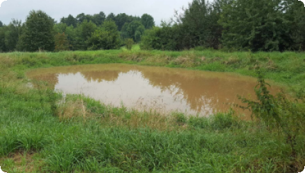
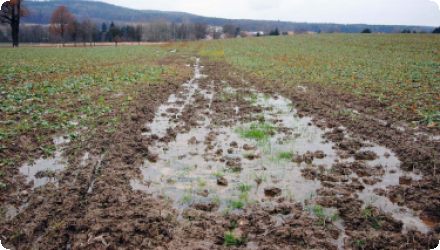
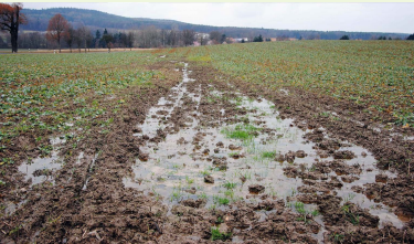
OPTAIN assessed the potential effects of implementing the NSWRM via process-based, numeric watershed modelling. The simulated effectiveness of the NSWRM on water and nutrient retention indicators varied considerably. Of all the NSWRMs, low tillage combined with cover crops implemented on all cropland was the only one with a significant effect on the water balance. This measure increased average soil moisture by 5–10% and reduced river peak flows at the catchment outlet by 10–15%, compared to the status quo (the current situation assuming no NSWRM are implemented). This measure was also the most effective at reducing soil erosion (by 60–65%) and river P loads (by 15–20%), followed by grassed waterways, which reduced river P loads by 10%. The other measures (grassed riparian buffers, hedges and detention ponds) had a rather localised effect on selected sites within the catchment area.
Although OPTAIN did not implement any NSWRMs, hopefully the project will stimulate the smart, targeted implementation of NSWRMs within the case study area (i.e. the right measures in the right locations).
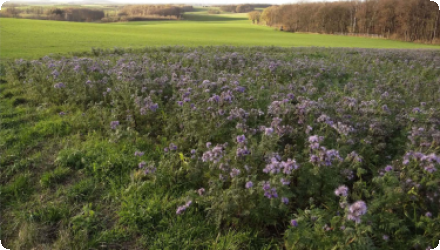
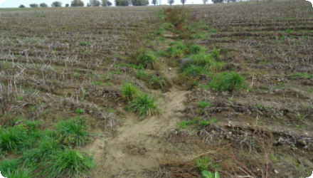
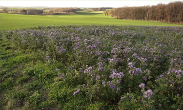
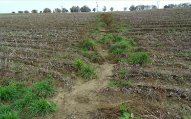
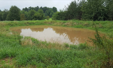
There are 5 different types of potential (modelled) NSWRM in CS1. All are on arable land. In the model, the vegetation cover changes depending on the type of NSWRM. It changes to permant grassland in case of grassed riparian buffer and grassed waterways, it changes to grass/shrubs/deciduous trees in case of hedges, while for low tillage combined with cover crops there is only a change in crop and soil management (the status quo crop rotation remains the same, but also includes cover crops before corn, spring barley and sugar beet). In case a pond is implemented, arable land changes to a pond.