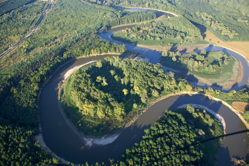
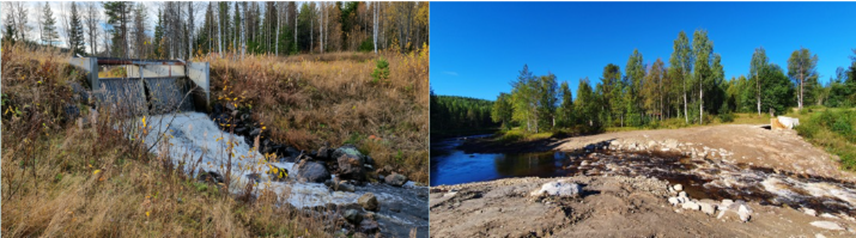
BP12 - Create aquatic habitat

Code
SF02
Sector
Forest
Year of Issue
2025
Summary

Headwater catchments are the source areas of rivers and streams and are critical for maintaining the structure, function, productivity and complexity of downstream ecosystems. They are vital to hydrologic cycle as they are one of the main areas where precipitation contributes to surface and groundwater. Headwaters are typically...
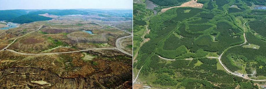
Before and after afforestation (TU)

Source: Kutorman 2012
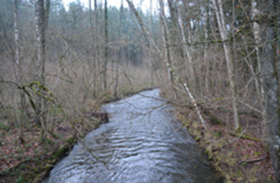
Forest cover in upstream headwaters (BE)

Source: OPTAIN project

Possible benefits with level
Benefits Level
BP1 - Store runoff
High
BP2 - Slow runoff
High
BP5 - Increase evapotranspiration
High
BP6 - Increase infiltration and/or groundwater recharge
High
BP7 - Increase soil water retention
High
BP8 - Reduce pollutant sources
High
BP9 - Intercept pollution pathways
High
BP10 - Reduce erosion and/or sediment delivery
High
BP11 - Improve soils
Medium
BP12 - Create aquatic habitat
Medium
BP13 - Create riparian habitat
Medium
BP14 - Create terrestrial habitats
High
BP15 - Enhance precipitation
Low
BP16 - Reduce peak temperature
Medium
BP17 - Absorb and/or retain CO2
High
ES1 - Water storage
High
ES2 - Fish stocks and recruiting
Low
ES3 - Natural biomass production
High
ES4 - Biodiversity preservation
Medium
ES5 - Climate change adaptation and mitigation
High
ES6 - Groundwater/aquifer recharge
High
ES7 - Flood risk reduction
High
ES8 - Erosion/sediment control
High
ES9 - Filtration of pollutants
High
ES10 - Recreational opportunities
High
ES11 - Aesthetic/cultural value
High
PO1 - Improving status of biology quality elements
Low
PO2 - Improving status of physico-chemical quality elements
Low
PO3 - Improving status of hydromorphology quality elements
Low
PO4 - Improving chemical status and priority substances
Low
PO5 - Improving quantitative status
Medium
PO6 - Improving chemical status
Medium
PO7 - Prevent surface water status deterioration
Medium
PO8 - Prevent groundwater status deterioration
High
PO9 - Take adequate and co-ordinated measures to reduce flood risks
High
PO10 - Protection of important habitats
High
PO11 - Better protection for ecosystems and more use of Green Infrastructure
High
PO12 - More sustainable agriculture and forestry
Medium
PO13 - Better management of fish stocks
Medium
PO14 - Prevention of biodiversity loss
High
Code
SF05
Sector
Forest
Year of Issue
2025
Other sector(s)
Hydro Morphology
Summary

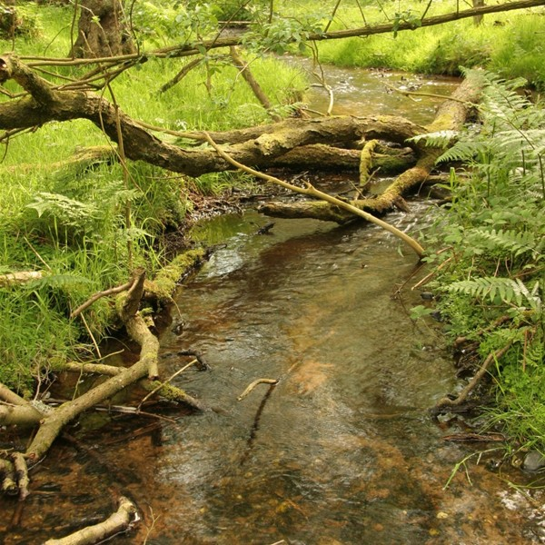
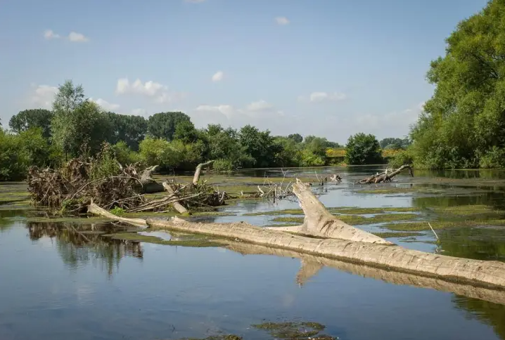
Coarse woody debris (also known as Large Woody Debris - LWD) in stream channels has multiple ecological and hydrologic benefits. Coarse woody debris consists of large sections of deadfall: tree stems or stumps that either fall into or are deliberately placed in streams. Coarse woody debris can be used with varying degrees of naturalness. 

...

River with coarse woody debris (UK)

River with coarse woody debris (UK)

Source: SITA Trust 

Large woody debris (DE)

Large woody debris (DE)

Source: Benjamin Kupilas | REFORM

Possible benefits with level
Benefits Level
BP3 - Store river water
Low
BP4 - Slow river water
High
BP10 - Reduce erosion and/or sediment delivery
Low
BP12 - Create aquatic habitat
High
BP13 - Create riparian habitat
Medium
ES2 - Fish stocks and recruiting
High
ES4 - Biodiversity preservation
High
ES7 - Flood risk reduction
Medium
ES8 - Erosion/sediment control
Low
ES10 - Recreational opportunities
Medium
PO1 - Improving status of biology quality elements
Medium
PO9 - Take adequate and co-ordinated measures to reduce flood risks
Medium
PO10 - Protection of important habitats
Medium
PO11 - Better protection for ecosystems and more use of Green Infrastructure
Medium
PO13 - Better management of fish stocks
Medium
PO14 - Prevention of biodiversity loss
Medium
Code
SF04
Sector
Forest
Year of Issue
2025
Other sector(s)
Hydro Morphology
The complete description of the NWRM
Summary

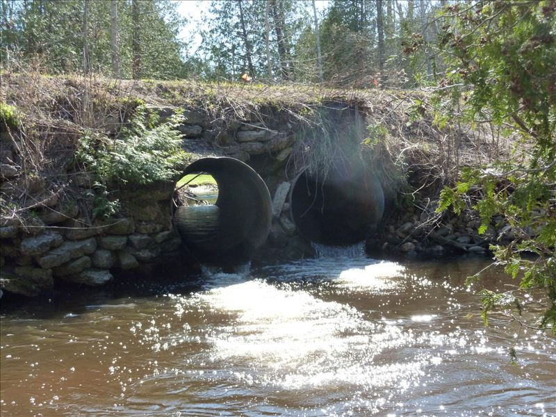
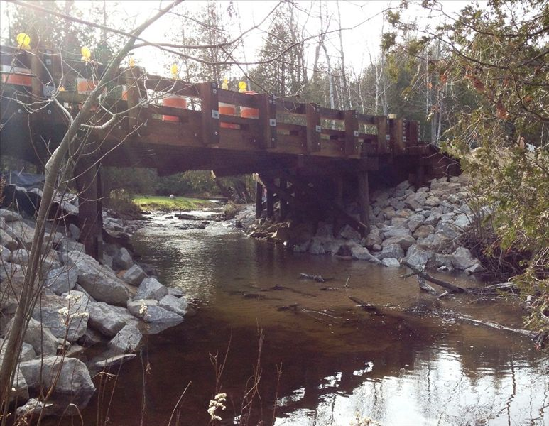
Forest access roads and other roads in rural areas often cross streams and other small watercourses. The design and material used in forest road building may have strong impact on erosion risk and water quality in streams. Bridges or culverts used at stream crossings must be properly designed to...

River with inappropriate design

River after designing a proper crossing

Source: http://www.huronpines.org/projectinfo.asp?pjt=pv&pid=37

Possible benefits with level
Benefits Level
BP2 - Slow runoff
Medium
BP1 - Store runoff
Medium
BP3 - Store river water
Medium
BP4 - Slow river water
Medium
BP8 - Reduce pollutant sources
Medium
BP10 - Reduce erosion and/or sediment delivery
High
BP12 - Create aquatic habitat
High
ES1 - Water storage
Low
ES2 - Fish stocks and recruiting
High
ES4 - Biodiversity preservation
High
ES7 - Flood risk reduction
Low
ES8 - Erosion/sediment control
High
ES9 - Filtration of pollutants
Low
ES11 - Aesthetic/cultural value
Medium
ES12 - Navigation
Low
PO1 - Improving status of biology quality elements
Medium
PO2 - Improving status of physico-chemical quality elements
Low
PO3 - Improving status of hydromorphology quality elements
Medium
PO7 - Prevent surface water status deterioration
High
PO9 - Take adequate and co-ordinated measures to reduce flood risks
Medium
PO10 - Protection of important habitats
Medium
PO11 - Better protection for ecosystems and more use of Green Infrastructure
Low
PO12 - More sustainable agriculture and forestry
Low
PO13 - Better management of fish stocks
Medium
PO14 - Prevention of biodiversity loss
Medium
Code
F09
Sector
Forest
Year of Issue
none
Other sector(s)
Agriculture
Urban
Hydro Morphology
The complete description of the NWRM
Summary

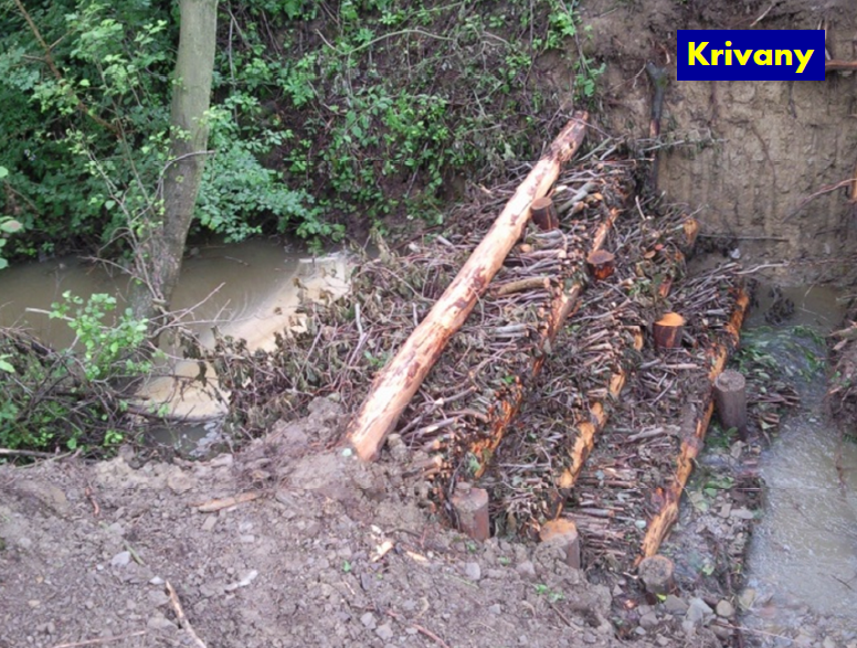
Sediment capture ponds are engineered ponds placed in networks of forest ditches to slow the velocity of water and cause the deposition of suspended materials. Sediment capture ponds are most useful for managing the effects of ditch construction and maintenance, road work and final feeling. While used primarily in forests, sediment capture ponds may be a useful temporary measure for preserving water quality in and around construction sites or...

Sediment capture pond, Slovakia

Source: Michal Kravcík’s presentation, NWRM Workshop 1 (Slovakia)


Possible benefits with level
Benefits Level
BP1 - Store runoff
Medium
BP2 - Slow runoff
Medium
BP3 - Store river water
Low
BP4 - Slow river water
Low
BP6 - Increase infiltration and/or groundwater recharge
Low
BP7 - Increase soil water retention
Low
BP8 - Reduce pollutant sources
High
BP9 - Intercept pollution pathways
High
BP10 - Reduce erosion and/or sediment delivery
High
BP12 - Create aquatic habitat
Low
ES1 - Water storage
Medium
ES2 - Fish stocks and recruiting
High
ES4 - Biodiversity preservation
High
ES5 - Climate change adaptation and mitigation
Low
ES6 - Groundwater/aquifer recharge
Low
ES7 - Flood risk reduction
Medium
ES8 - Erosion/sediment control
High
ES9 - Filtration of pollutants
High
PO1 - Improving status of biology quality elements
Low
PO2 - Improving status of physico-chemical quality elements
Low
PO3 - Improving status of hydromorphology quality elements
Low
PO4 - Improving chemical status and priority substances
Low
PO7 - Prevent surface water status deterioration
High
PO9 - Take adequate and co-ordinated measures to reduce flood risks
Low
PO10 - Protection of important habitats
Low
PO11 - Better protection for ecosystems and more use of Green Infrastructure
Medium
PO12 - More sustainable agriculture and forestry
High
PO13 - Better management of fish stocks
Medium
PO14 - Prevention of biodiversity loss
Medium
Code
U11
Sector
Urban
Year of Issue
none
Other sector(s)
Agriculture
Forest
Hydro Morphology
The complete description of the NWRM
Summary

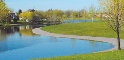
Retention ponds are ponds or pools designed with additional storage capacity to attenuate surface runoff during rainfall events.  They consist of a permanent pond area with landscaped banks and surroundings to provide additional storage capacity during rainfall events.  They are created by using an existing natural depression, by excavating a new depression, or by constructing embankments.  Existing natural...

Possible benefits with level
Benefits Level
ES1 - Water storage
Medium
ES3 - Natural biomass production
Medium
ES4 - Biodiversity preservation
High
ES5 - Climate change adaptation and mitigation
Medium
ES7 - Flood risk reduction
High
ES8 - Erosion/sediment control
Medium
ES9 - Filtration of pollutants
High
ES10 - Recreational opportunities
Medium
ES11 - Aesthetic/cultural value
High
PO2 - Improving status of physico-chemical quality elements
Low
PO4 - Improving chemical status and priority substances
Low
PO7 - Prevent surface water status deterioration
Medium
PO9 - Take adequate and co-ordinated measures to reduce flood risks
High
PO11 - Better protection for ecosystems and more use of Green Infrastructure
High
PO12 - More sustainable agriculture and forestry
Low
PO14 - Prevention of biodiversity loss
High
BP1 - Store runoff
High
BP2 - Slow runoff
High
BP5 - Increase evapotranspiration
Medium
BP8 - Reduce pollutant sources
Low
BP9 - Intercept pollution pathways
High
BP10 - Reduce erosion and/or sediment delivery
High
BP12 - Create aquatic habitat
High
BP13 - Create riparian habitat
Medium
BP14 - Create terrestrial habitats
Low
BP15 - Enhance precipitation
Low
BP16 - Reduce peak temperature
Low
Code
N11
Sector
Hydro Morphology
Other sector(s)
Urban
The complete description of the NWRM
Summary

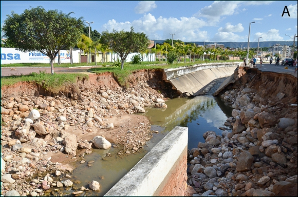
A riverbank protection is an inert or living construction providing bank fixation but also an obstacle for the lateral connection of the river. Eliminating it consists in removing some parts of the bank protection, especially the inert one, in order to enhance lateral connections of the river, diversify flows (depth, substrate, and speed) and habitats, but also cap floods in the mainstream. It is a prerequisite for many other measures like re...

Destroyed artificial riverbank, (Brasil)

Source: http://echogeo.revues.org/13596?lang=en


Possible benefits with level
Benefits Level
PO1 - Improving status of biology quality elements
Medium
PO2 - Improving status of physico-chemical quality elements
Medium
PO3 - Improving status of hydromorphology quality elements
Medium
PO4 - Improving chemical status and priority substances
Medium
PO5 - Improving quantitative status
Low
PO6 - Improving chemical status
Low
PO7 - Prevent surface water status deterioration
Medium
PO8 - Prevent groundwater status deterioration
Low
PO9 - Take adequate and co-ordinated measures to reduce flood risks
Medium
PO10 - Protection of important habitats
High
PO11 - Better protection for ecosystems and more use of Green Infrastructure
High
PO12 - More sustainable agriculture and forestry
High
PO13 - Better management of fish stocks
High
PO14 - Prevention of biodiversity loss
High
ES1 - Water storage
Medium
ES2 - Fish stocks and recruiting
Medium
ES3 - Natural biomass production
Medium
ES4 - Biodiversity preservation
Medium
ES6 - Groundwater/aquifer recharge
Low
ES7 - Flood risk reduction
High
ES8 - Erosion/sediment control
Medium
ES9 - Filtration of pollutants
Medium
ES10 - Recreational opportunities
Medium
ES11 - Aesthetic/cultural value
Medium
BP1 - Store runoff
Low
BP2 - Slow runoff
Low
BP3 - Store river water
High
BP4 - Slow river water
High
BP5 - Increase evapotranspiration
Low
BP6 - Increase infiltration and/or groundwater recharge
Low
BP7 - Increase soil water retention
Low
BP9 - Intercept pollution pathways
Medium
BP10 - Reduce erosion and/or sediment delivery
Medium
BP12 - Create aquatic habitat
Medium
BP13 - Create riparian habitat
Medium
BP17 - Absorb and/or retain CO2
Low
Code
SN04
Sector
Hydro Morphology
Year of Issue
2025
The complete description of the NWRM
Summary

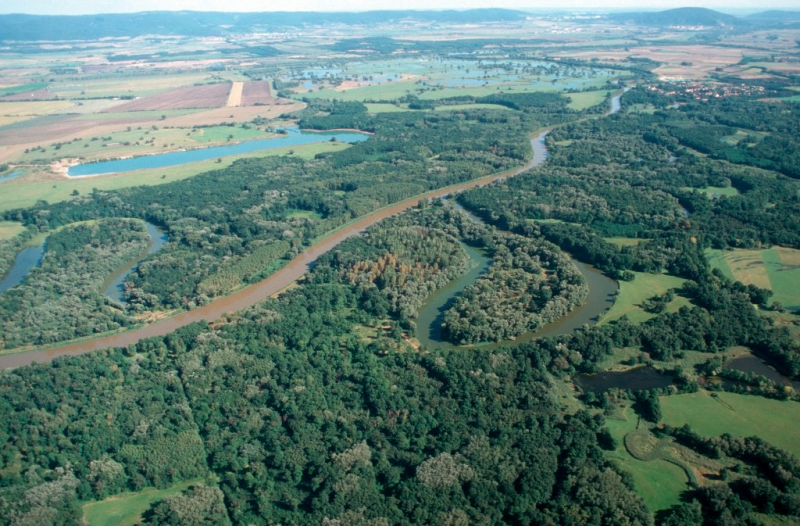
A river meander is a U-form taken by the river, allowing it to decrease water velocity. In the past, rivers have been straightened by cutting off meanders. Many rivers in northern and Western Europe have been straightened and channelized to, for example, facilitate log floating and/or speed up the drainage of water and control/limit the river bed movements. Channelizing was also a way to gain land for cultivation. River re-meandering consists...

River before re-meandering

River after re-meandering

Source: http://riverwatch.eu/en/the-morava-anniversary-project-2014

Possible benefits with level
Benefits Level
PO1 - Improving status of biology quality elements
High
PO2 - Improving status of physico-chemical quality elements
High
PO3 - Improving status of hydromorphology quality elements
High
PO4 - Improving chemical status and priority substances
Medium
PO5 - Improving quantitative status
Medium
PO6 - Improving chemical status
Medium
PO7 - Prevent surface water status deterioration
High
PO8 - Prevent groundwater status deterioration
Medium
PO9 - Take adequate and co-ordinated measures to reduce flood risks
High
PO10 - Protection of important habitats
High
PO11 - Better protection for ecosystems and more use of Green Infrastructure
High
PO12 - More sustainable agriculture and forestry
High
PO13 - Better management of fish stocks
High
PO14 - Prevention of biodiversity loss
High
ES1 - Water storage
Medium
ES2 - Fish stocks and recruiting
Medium
ES3 - Natural biomass production
High
ES4 - Biodiversity preservation
High
ES5 - Climate change adaptation and mitigation
Medium
ES6 - Groundwater/aquifer recharge
High
ES7 - Flood risk reduction
High
ES8 - Erosion/sediment control
High
ES9 - Filtration of pollutants
Medium
ES10 - Recreational opportunities
High
ES11 - Aesthetic/cultural value
High
BP1 - Store runoff
Medium
BP2 - Slow runoff
Medium
BP3 - Store river water
Medium
BP4 - Slow river water
High
BP5 - Increase evapotranspiration
Low
BP6 - Increase infiltration and/or groundwater recharge
Medium
BP7 - Increase soil water retention
Medium
BP8 - Reduce pollutant sources
Low
BP9 - Intercept pollution pathways
High
BP10 - Reduce erosion and/or sediment delivery
High
BP11 - Improve soils
Medium
BP12 - Create aquatic habitat
High
BP13 - Create riparian habitat
High
BP14 - Create terrestrial habitats
Medium
BP16 - Reduce peak temperature
Medium
BP17 - Absorb and/or retain CO2
Low
Code
SN09
Sector
Hydro Morphology
Year of Issue
2025
Summary

Dams and other transversal barriers are obstacles crossing the river section and causing discontinuities for sediment and fauna. Removing them consists in destroying all the obstacles, restoring the slope and the longitudinal profile of the river, therefore allowing re-establishment of fluvial dynamics, as well as sedimentary and ecological...

Hydropower dam removed. Before and after

Source: Dam Removal Europe 


Possible benefits with level
Benefits Level
BP8 - Reduce pollutant sources
Low
BP10 - Reduce erosion and/or sediment delivery
Medium
BP12 - Create aquatic habitat
High
ES2 - Fish stocks and recruiting
High
ES4 - Biodiversity preservation
High
ES7 - Flood risk reduction
Low
ES8 - Erosion/sediment control
Medium
ES12 - Navigation
Medium
ES14 - Energy production
Medium
PO1 - Improving status of biology quality elements
High
PO2 - Improving status of physico-chemical quality elements
Low
PO3 - Improving status of hydromorphology quality elements
High
PO7 - Prevent surface water status deterioration
Low
PO9 - Take adequate and co-ordinated measures to reduce flood risks
Low
PO10 - Protection of important habitats
High
PO11 - Better protection for ecosystems and more use of Green Infrastructure
High
PO13 - Better management of fish stocks
High
PO14 - Prevention of biodiversity loss
High
Code
SN07
Sector
Hydro Morphology
Year of Issue
2025
Summary

An oxbow lake is an ancient meander that was cut off from the river, thus creating a small lake with a U form. Reconnecting it with the river consists in removing terrestrial lands between both water bodies, therefore favouring the overall functioning of the river by restoring lateral connectivity, diversifying flows and cleaning the river section of the present oxbow for a better water retention during floods. 

Recent literature...

Possible benefits with level
Benefits Level
BP1 - Store runoff
High
BP2 - Slow runoff
High
BP3 - Store river water
High
BP4 - Slow river water
High
BP5 - Increase evapotranspiration
Low
BP6 - Increase infiltration and/or groundwater recharge
High
BP7 - Increase soil water retention
Medium
BP8 - Reduce pollutant sources
Low
BP9 - Intercept pollution pathways
Medium
BP10 - Reduce erosion and/or sediment delivery
High
BP11 - Improve soils
Low
BP12 - Create aquatic habitat
High
ES1 - Water storage
Medium
ES2 - Fish stocks and recruiting
Medium
ES3 - Natural biomass production
Low
ES4 - Biodiversity preservation
High
ES5 - Climate change adaptation and mitigation
Medium
ES6 - Groundwater/aquifer recharge
Medium
ES7 - Flood risk reduction
Medium
ES8 - Erosion/sediment control
High
ES9 - Filtration of pollutants
Medium
ES10 - Recreational opportunities
Low
ES11 - Aesthetic/cultural value
Medium
PO1 - Improving status of biology quality elements
Low
PO2 - Improving status of physico-chemical quality elements
Low
PO3 - Improving status of hydromorphology quality elements
High
PO4 - Improving chemical status and priority substances
Medium
PO5 - Improving quantitative status
Medium
PO6 - Improving chemical status
Medium
PO7 - Prevent surface water status deterioration
Medium
PO8 - Prevent groundwater status deterioration
Low
PO9 - Take adequate and co-ordinated measures to reduce flood risks
High
PO10 - Protection of important habitats
High
PO11 - Better protection for ecosystems and more use of Green Infrastructure
High
PO12 - More sustainable agriculture and forestry
Low
PO13 - Better management of fish stocks
Medium
PO14 - Prevention of biodiversity loss
High
Code
SN05
Sector
Hydro Morphology
Year of Issue
2025
Summary

Streambed (or riverbed) represents the bottom of the river, including each bank. In the past, riverbeds have been artificially modified with concrete or big boulders, altering flows and reducing habitat for wildlife and vegetation diversity. The changes were aimed at preventing flood or supporting changes of agricultural practices for example. This has led to more...

Possible benefits with level
Benefits Level
BP3 - Store river water
High
BP4 - Slow river water
High
BP5 - Increase evapotranspiration
Low
BP6 - Increase infiltration and/or groundwater recharge
High
BP7 - Increase soil water retention
Low
BP9 - Intercept pollution pathways
Medium
BP10 - Reduce erosion and/or sediment delivery
High
BP11 - Improve soils
Medium
BP12 - Create aquatic habitat
High
BP13 - Create riparian habitat
High
BP14 - Create terrestrial habitats
Low
BP16 - Reduce peak temperature
Medium
BP17 - Absorb and/or retain CO2
Low
ES1 - Water storage
Low
ES2 - Fish stocks and recruiting
Low
ES3 - Natural biomass production
Medium
ES4 - Biodiversity preservation
High
ES6 - Groundwater/aquifer recharge
Low
ES7 - Flood risk reduction
Medium
ES8 - Erosion/sediment control
High
ES9 - Filtration of pollutants
Medium
ES10 - Recreational opportunities
Medium
ES11 - Aesthetic/cultural value
Medium
PO1 - Improving status of biology quality elements
High
PO2 - Improving status of physico-chemical quality elements
Low
PO3 - Improving status of hydromorphology quality elements
Medium
PO4 - Improving chemical status and priority substances
Medium
PO5 - Improving quantitative status
Low
PO7 - Prevent surface water status deterioration
Medium
PO8 - Prevent groundwater status deterioration
Medium
PO9 - Take adequate and co-ordinated measures to reduce flood risks
Medium
PO10 - Protection of important habitats
High
PO11 - Better protection for ecosystems and more use of Green Infrastructure
High
PO13 - Better management of fish stocks
High
PO14 - Prevention of biodiversity loss
High