
BP14 - Create terrestrial habitats

Code
SU04
Sector
Urban
Year of Issue
2025
Other sector(s)
Agriculture
Summary

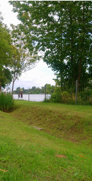
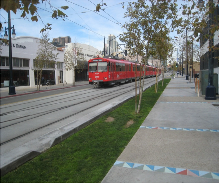
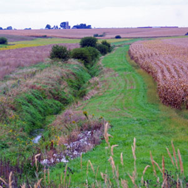
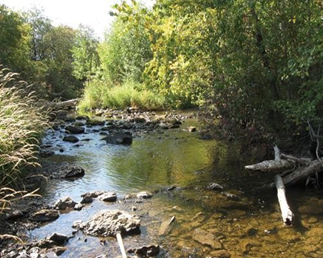
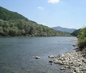
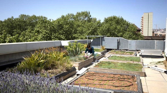
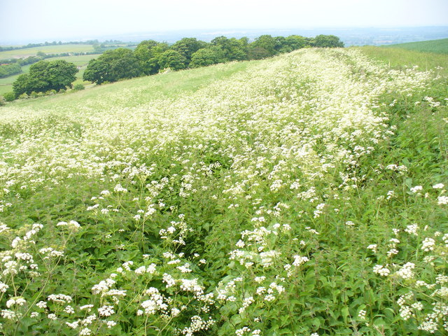
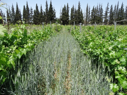
Swales are broad, shallow, linear vegetated channels which can store or convey surface water (reducing the rate and volume of runoff) and remove pollutants. They can be used as conveyance features to pass the runoff to the next stage of the SuDS treatment train and can be designed to promote infiltration where soil and groundwater conditions...

Bioswale in Gartz (DE)

Source: UNalab project


Possible benefits with level
Benefits Level
ES1 - Water storage
Low
ES3 - Natural biomass production
Low
ES4 - Biodiversity preservation
Medium
ES5 - Climate change adaptation and mitigation
Medium
ES6 - Groundwater/aquifer recharge
Medium
ES7 - Flood risk reduction
Medium
ES8 - Erosion/sediment control
Low
ES9 - Filtration of pollutants
Medium
ES11 - Aesthetic/cultural value
Medium
PO2 - Improving status of physico-chemical quality elements
Low
PO4 - Improving chemical status and priority substances
Low
PO5 - Improving quantitative status
Low
PO7 - Prevent surface water status deterioration
Medium
PO8 - Prevent groundwater status deterioration
Low
PO9 - Take adequate and co-ordinated measures to reduce flood risks
High
PO11 - Better protection for ecosystems and more use of Green Infrastructure
Medium
PO12 - More sustainable agriculture and forestry
Low
PO14 - Prevention of biodiversity loss
Medium
BP1 - Store runoff
Medium
BP2 - Slow runoff
High
BP5 - Increase evapotranspiration
Medium
BP6 - Increase infiltration and/or groundwater recharge
Medium
BP7 - Increase soil water retention
Low
BP8 - Reduce pollutant sources
Low
BP9 - Intercept pollution pathways
Medium
BP10 - Reduce erosion and/or sediment delivery
Medium
BP13 - Create riparian habitat
Low
BP14 - Create terrestrial habitats
Low
BP16 - Reduce peak temperature
Low
BP17 - Absorb and/or retain CO2
Low
Code
SU06
Sector
Urban
Year of Issue
2025
Other sector(s)
Agriculture
Summary

Filter strips are uniformly graded, gently sloping, vegetated strips of land that provide opportunities for slow conveyance and (commonly) infiltration. They are designed to accept runoff as overland sheet flow from upstream development and often lie between a hard-surfaced area and a receiving stream, surface water collection, treatment or disposal system. 

Filter strips are generally planted with grass or other dense vegetation...

Small filter strip in urban area

Source: Andras Kis’ presentation, NWRM Workshop 1 

Filter strip in agriculture area

Source: 4R Plus

Possible benefits with level
Benefits Level
ES3 - Natural biomass production
Low
ES4 - Biodiversity preservation
Medium
ES5 - Climate change adaptation and mitigation
Low
ES6 - Groundwater/aquifer recharge
Low
ES7 - Flood risk reduction
Low
ES8 - Erosion/sediment control
Medium
ES9 - Filtration of pollutants
High
ES11 - Aesthetic/cultural value
Medium
PO2 - Improving status of physico-chemical quality elements
Low
PO4 - Improving chemical status and priority substances
Low
PO7 - Prevent surface water status deterioration
Medium
PO9 - Take adequate and co-ordinated measures to reduce flood risks
Low
PO11 - Better protection for ecosystems and more use of Green Infrastructure
Medium
PO12 - More sustainable agriculture and forestry
Low
PO14 - Prevention of biodiversity loss
Medium
BP2 - Slow runoff
Low
BP6 - Increase infiltration and/or groundwater recharge
Low
BP7 - Increase soil water retention
Low
BP9 - Intercept pollution pathways
High
BP10 - Reduce erosion and/or sediment delivery
High
BP14 - Create terrestrial habitats
Medium
BP16 - Reduce peak temperature
Low
BP17 - Absorb and/or retain CO2
Low
Code
SF01
Sector
Forest
Year of Issue
2025
Other sector(s)
Agriculture
Urban
Hydro Morphology
Summary

Riparian buffers are areas of land, predominantly covered with trees, shrubs, and sometimes grasses, along, and often up-gradient from, streams, watercourses, or water bodies. These natural or restored buffers serve multiple purposes. By maintaining a relatively undisturbed zone adjacent to open water, they play an important role in water quality and flow...

llustration 21: Riparian Forest buffer

Source: Amy Chadwick, Watershed Consulting

Illustration 22: Riparian buffer of white willow and white poplar (BU)

Source: WWF Bulgaria

Possible benefits with level
Benefits Level
BP1 - Store runoff
Medium
BP2 - Slow runoff
Medium
BP4 - Slow river water
Low
BP5 - Increase evapotranspiration
Low
BP6 - Increase infiltration and/or groundwater recharge
Low
BP7 - Increase soil water retention
Low
BP8 - Reduce pollutant sources
Medium
BP9 - Intercept pollution pathways
Medium
BP10 - Reduce erosion and/or sediment delivery
High
BP11 - Improve soils
Low
BP12 - Create aquatic habitat
Medium
BP13 - Create riparian habitat
High
BP14 - Create terrestrial habitats
Low
BP16 - Reduce peak temperature
Medium
BP17 - Absorb and/or retain CO2
Low
ES1 - Water storage
Low
ES2 - Fish stocks and recruiting
Medium
ES3 - Natural biomass production
Low
ES4 - Biodiversity preservation
High
ES6 - Groundwater/aquifer recharge
Low
ES7 - Flood risk reduction
Low
ES8 - Erosion/sediment control
High
ES9 - Filtration of pollutants
Medium
ES10 - Recreational opportunities
Low
ES11 - Aesthetic/cultural value
Low
ES12 - Navigation
Low
PO1 - Improving status of biology quality elements
Medium
PO2 - Improving status of physico-chemical quality elements
Medium
PO3 - Improving status of hydromorphology quality elements
Medium
PO4 - Improving chemical status and priority substances
Low
PO6 - Improving chemical status
Low
PO7 - Prevent surface water status deterioration
Medium
PO8 - Prevent groundwater status deterioration
Low
PO9 - Take adequate and co-ordinated measures to reduce flood risks
Low
PO10 - Protection of important habitats
Medium
PO11 - Better protection for ecosystems and more use of Green Infrastructure
High
PO12 - More sustainable agriculture and forestry
Medium
PO13 - Better management of fish stocks
Medium
PO14 - Prevention of biodiversity loss
Medium
Code
SU01
Sector
Urban
Year of Issue
2025
Other sector(s)
Forest
Summary

Green roofs are multi-layered systems that cover the roof of a building with vegetation and/or green landscaping over a drainage layer. There are two types of green roof: 

  • Extensive green roofs cover...

Green roof in Barcelona (ES)

Source: Green Roofs 

Extensive vs intensive green roof

Source: European Federation Green Roofs  and Walls

Possible benefits with level
Benefits Level
ES3 - Natural biomass production
Low
ES4 - Biodiversity preservation
Low
ES5 - Climate change adaptation and mitigation
Medium
ES7 - Flood risk reduction
Medium
ES9 - Filtration of pollutants
Low
ES10 - Recreational opportunities
Low
ES11 - Aesthetic/cultural value
Medium
PO2 - Improving status of physico-chemical quality elements
Low
PO4 - Improving chemical status and priority substances
Low
PO7 - Prevent surface water status deterioration
Low
PO9 - Take adequate and co-ordinated measures to reduce flood risks
Medium
PO11 - Better protection for ecosystems and more use of Green Infrastructure
Medium
PO14 - Prevention of biodiversity loss
Low
BP1 - Store runoff
Medium
BP2 - Slow runoff
Medium
BP5 - Increase evapotranspiration
High
BP8 - Reduce pollutant sources
Low
BP9 - Intercept pollution pathways
Low
BP14 - Create terrestrial habitats
Low
BP16 - Reduce peak temperature
Low
BP17 - Absorb and/or retain CO2
Low
Code
N11
Sector
Hydro Morphology
Other sector(s)
Urban
The complete description of the NWRM
Summary

A riverbank protection is an inert or living construction providing bank fixation but also an obstacle for the lateral connection of the river. Eliminating it consists in removing some parts of the bank protection, especially the inert one, in order to enhance lateral connections of the river, diversify flows (depth, substrate, and speed) and habitats, but also cap floods in the mainstream. It is a prerequisite for many other measures like re...

Destroyed artificial riverbank, (Brasil)

Source: http://echogeo.revues.org/13596?lang=en


Possible benefits with level
Benefits Level
PO1 - Improving status of biology quality elements
Medium
PO2 - Improving status of physico-chemical quality elements
Medium
PO3 - Improving status of hydromorphology quality elements
Medium
PO4 - Improving chemical status and priority substances
Medium
PO5 - Improving quantitative status
Low
PO6 - Improving chemical status
Low
PO7 - Prevent surface water status deterioration
Medium
PO8 - Prevent groundwater status deterioration
Low
PO9 - Take adequate and co-ordinated measures to reduce flood risks
Medium
PO10 - Protection of important habitats
High
PO11 - Better protection for ecosystems and more use of Green Infrastructure
High
PO12 - More sustainable agriculture and forestry
High
PO13 - Better management of fish stocks
High
PO14 - Prevention of biodiversity loss
High
ES1 - Water storage
Medium
ES2 - Fish stocks and recruiting
Medium
ES3 - Natural biomass production
Medium
ES4 - Biodiversity preservation
Medium
ES6 - Groundwater/aquifer recharge
Low
ES7 - Flood risk reduction
High
ES8 - Erosion/sediment control
Medium
ES9 - Filtration of pollutants
Medium
ES10 - Recreational opportunities
Medium
ES11 - Aesthetic/cultural value
Medium
BP1 - Store runoff
Low
BP2 - Slow runoff
Low
BP3 - Store river water
High
BP4 - Slow river water
High
BP5 - Increase evapotranspiration
Low
BP6 - Increase infiltration and/or groundwater recharge
Low
BP7 - Increase soil water retention
Low
BP9 - Intercept pollution pathways
Medium
BP10 - Reduce erosion and/or sediment delivery
Medium
BP12 - Create aquatic habitat
Medium
BP13 - Create riparian habitat
Medium
BP17 - Absorb and/or retain CO2
Low
Code
SN04
Sector
Hydro Morphology
Year of Issue
2025
The complete description of the NWRM
Summary

A river meander is a U-form taken by the river, allowing it to decrease water velocity. In the past, rivers have been straightened by cutting off meanders. Many rivers in northern and Western Europe have been straightened and channelized to, for example, facilitate log floating and/or speed up the drainage of water and control/limit the river bed movements. Channelizing was also a way to gain land for cultivation. River re-meandering consists...

River before re-meandering

River after re-meandering

Source: http://riverwatch.eu/en/the-morava-anniversary-project-2014

Possible benefits with level
Benefits Level
PO1 - Improving status of biology quality elements
High
PO2 - Improving status of physico-chemical quality elements
High
PO3 - Improving status of hydromorphology quality elements
High
PO4 - Improving chemical status and priority substances
Medium
PO5 - Improving quantitative status
Medium
PO6 - Improving chemical status
Medium
PO7 - Prevent surface water status deterioration
High
PO8 - Prevent groundwater status deterioration
Medium
PO9 - Take adequate and co-ordinated measures to reduce flood risks
High
PO10 - Protection of important habitats
High
PO11 - Better protection for ecosystems and more use of Green Infrastructure
High
PO12 - More sustainable agriculture and forestry
High
PO13 - Better management of fish stocks
High
PO14 - Prevention of biodiversity loss
High
ES1 - Water storage
Medium
ES2 - Fish stocks and recruiting
Medium
ES3 - Natural biomass production
High
ES4 - Biodiversity preservation
High
ES5 - Climate change adaptation and mitigation
Medium
ES6 - Groundwater/aquifer recharge
High
ES7 - Flood risk reduction
High
ES8 - Erosion/sediment control
High
ES9 - Filtration of pollutants
Medium
ES10 - Recreational opportunities
High
ES11 - Aesthetic/cultural value
High
BP1 - Store runoff
Medium
BP2 - Slow runoff
Medium
BP3 - Store river water
Medium
BP4 - Slow river water
High
BP5 - Increase evapotranspiration
Low
BP6 - Increase infiltration and/or groundwater recharge
Medium
BP7 - Increase soil water retention
Medium
BP8 - Reduce pollutant sources
Low
BP9 - Intercept pollution pathways
High
BP10 - Reduce erosion and/or sediment delivery
High
BP11 - Improve soils
Medium
BP12 - Create aquatic habitat
High
BP13 - Create riparian habitat
High
BP14 - Create terrestrial habitats
Medium
BP16 - Reduce peak temperature
Medium
BP17 - Absorb and/or retain CO2
Low
Code
SN05
Sector
Hydro Morphology
Year of Issue
2025
Summary

Streambed (or riverbed) represents the bottom of the river, including each bank. In the past, riverbeds have been artificially modified with concrete or big boulders, altering flows and reducing habitat for wildlife and vegetation diversity. The changes were aimed at preventing flood or supporting changes of agricultural practices for example. This has led to more...

Possible benefits with level
Benefits Level
BP3 - Store river water
High
BP4 - Slow river water
High
BP5 - Increase evapotranspiration
Low
BP6 - Increase infiltration and/or groundwater recharge
High
BP7 - Increase soil water retention
Low
BP9 - Intercept pollution pathways
Medium
BP10 - Reduce erosion and/or sediment delivery
High
BP11 - Improve soils
Medium
BP12 - Create aquatic habitat
High
BP13 - Create riparian habitat
High
BP14 - Create terrestrial habitats
Low
BP16 - Reduce peak temperature
Medium
BP17 - Absorb and/or retain CO2
Low
ES1 - Water storage
Low
ES2 - Fish stocks and recruiting
Low
ES3 - Natural biomass production
Medium
ES4 - Biodiversity preservation
High
ES6 - Groundwater/aquifer recharge
Low
ES7 - Flood risk reduction
Medium
ES8 - Erosion/sediment control
High
ES9 - Filtration of pollutants
Medium
ES10 - Recreational opportunities
Medium
ES11 - Aesthetic/cultural value
Medium
PO1 - Improving status of biology quality elements
High
PO2 - Improving status of physico-chemical quality elements
Low
PO3 - Improving status of hydromorphology quality elements
Medium
PO4 - Improving chemical status and priority substances
Medium
PO5 - Improving quantitative status
Low
PO7 - Prevent surface water status deterioration
Medium
PO8 - Prevent groundwater status deterioration
Medium
PO9 - Take adequate and co-ordinated measures to reduce flood risks
Medium
PO10 - Protection of important habitats
High
PO11 - Better protection for ecosystems and more use of Green Infrastructure
High
PO13 - Better management of fish stocks
High
PO14 - Prevention of biodiversity loss
High
Code
SN02
Sector
Hydro Morphology
Year of Issue
2025
Other sector(s)
Agriculture
Urban
Forest
Summary

According to the Convention on Wetlands (1971), a wetland is an area of marsh, fen, peatland or water, whether natural or artificial, permanent or temporary, with water that is static or flowing, fresh, brackish or salt, including areas of marine water the depth of which at low tide does not exceed six metres. 

Wetlands play a crucial role in regulating the global climate and are natural biofilters for pollutant removal, nutrient...

Possible benefits with level
Benefits Level
BP1 - Store runoff
High
BP2 - Slow runoff
High
BP3 - Store river water
Medium
BP4 - Slow river water
Medium
BP6 - Increase infiltration and/or groundwater recharge
Medium
BP7 - Increase soil water retention
Medium
BP9 - Intercept pollution pathways
Medium
BP10 - Reduce erosion and/or sediment delivery
Low
BP11 - Improve soils
Low
BP12 - Create aquatic habitat
High
BP13 - Create riparian habitat
High
BP14 - Create terrestrial habitats
Low
BP17 - Absorb and/or retain CO2
High
PO1 - Improving status of biology quality elements
High
PO2 - Improving status of physico-chemical quality elements
Medium
PO3 - Improving status of hydromorphology quality elements
Low
PO5 - Improving quantitative status
Medium
PO7 - Prevent surface water status deterioration
Medium
PO8 - Prevent groundwater status deterioration
Medium
PO9 - Take adequate and co-ordinated measures to reduce flood risks
Medium
PO10 - Protection of important habitats
High
PO11 - Better protection for ecosystems and more use of Green Infrastructure
High
PO12 - More sustainable agriculture and forestry
Low
PO13 - Better management of fish stocks
High
PO14 - Prevention of biodiversity loss
High
ES1 - Water storage
Medium
ES2 - Fish stocks and recruiting
High
ES3 - Natural biomass production
Medium
ES4 - Biodiversity preservation
High
ES5 - Climate change adaptation and mitigation
Medium
ES6 - Groundwater/aquifer recharge
Medium
ES7 - Flood risk reduction
Medium
ES8 - Erosion/sediment control
Low
ES9 - Filtration of pollutants
Medium
ES10 - Recreational opportunities
Medium
ES11 - Aesthetic/cultural value
Medium
Case study(ies)
Code
SA02
Sector
Agriculture
Year of Issue
2025
Other sector(s)
Forest
Hydro Morphology
Summary

Buffer strips and hedges are natural or semi-natural vegetated features integrated into agricultural and semi-urban landscapes to enhance ecological and hydrological functions.

Buffer strips are areas of natural vegetation cover (grass, bushes or trees) at the margin of fields, arable land, transport infrastructures and water courses. They can feature various combinations of vegetation, from simple grass to mixtures of grass, trees,...

Possible benefits with level
Benefits Level
BP2 - Slow runoff
High
BP5 - Increase evapotranspiration
Medium
BP6 - Increase infiltration and/or groundwater recharge
Low
BP7 - Increase soil water retention
Medium
BP9 - Intercept pollution pathways
Medium
BP10 - Reduce erosion and/or sediment delivery
High
BP11 - Improve soils
Low
BP14 - Create terrestrial habitats
Medium
BP17 - Absorb and/or retain CO2
Medium
ES3 - Natural biomass production
Low
ES4 - Biodiversity preservation
Low
ES5 - Climate change adaptation and mitigation
Medium
ES6 - Groundwater/aquifer recharge
Medium
ES7 - Flood risk reduction
High
ES8 - Erosion/sediment control
High
ES9 - Filtration of pollutants
High
PO1 - Improving status of biology quality elements
Low
PO2 - Improving status of physico-chemical quality elements
Low
PO3 - Improving status of hydromorphology quality elements
Medium
PO4 - Improving chemical status and priority substances
Low
PO5 - Improving quantitative status
Low
PO6 - Improving chemical status
Low
PO7 - Prevent surface water status deterioration
High
PO8 - Prevent groundwater status deterioration
Medium
PO9 - Take adequate and co-ordinated measures to reduce flood risks
High
PO10 - Protection of important habitats
Low
PO11 - Better protection for ecosystems and more use of Green Infrastructure
High
PO12 - More sustainable agriculture and forestry
High
PO13 - Better management of fish stocks
Low
PO14 - Prevention of biodiversity loss
High
Code
SA08
Sector
Agriculture
Year of Issue
2025
Summary

Green cover, cover crops or catch crops refers to crops planted in late summer or autumn, usually on arable land, to protect the soil, which would otherwise lie bare during the winter, against wind and water erosion.  Green cover crops also improve the structure of the soil, diversify the cropping system, and mitigate the loss of soluble nutrients. Green cover crops are good...


Vineyard with green cover (GR)

Source: Biodiversify project

Possible benefits with level
Benefits Level
BP2 - Slow runoff
High
BP5 - Increase evapotranspiration
Medium
BP6 - Increase infiltration and/or groundwater recharge
Medium
BP7 - Increase soil water retention
Medium
BP8 - Reduce pollutant sources
Low
BP9 - Intercept pollution pathways
High
BP10 - Reduce erosion and/or sediment delivery
High
BP11 - Improve soils
Medium
BP14 - Create terrestrial habitats
Low
BP17 - Absorb and/or retain CO2
Medium
ES3 - Natural biomass production
Low
ES4 - Biodiversity preservation
Low
ES5 - Climate change adaptation and mitigation
Medium
ES6 - Groundwater/aquifer recharge
Medium
ES7 - Flood risk reduction
High
ES8 - Erosion/sediment control
High
ES9 - Filtration of pollutants
High
PO2 - Improving status of physico-chemical quality elements
Low
PO3 - Improving status of hydromorphology quality elements
Medium
PO4 - Improving chemical status and priority substances
Low
PO5 - Improving quantitative status
Low
PO6 - Improving chemical status
Low
PO7 - Prevent surface water status deterioration
High
PO8 - Prevent groundwater status deterioration
Medium
PO9 - Take adequate and co-ordinated measures to reduce flood risks
High
PO10 - Protection of important habitats
Low
PO11 - Better protection for ecosystems and more use of Green Infrastructure
High
PO12 - More sustainable agriculture and forestry
High
PO14 - Prevention of biodiversity loss
High