Last update
2025
Summary
On the Lower Danube between Silistra and Brăila, the LIFE project RESTOREWETLANDS (LIFE06 NAT/RO/000172) ran from 2006–2011 (eligible budget €1,017,396; EU contribution €489,209) to preserve, restore and sustainably manage the Small Islands of Brăila. Targets covered ~2,949 ha: planting alluvial forest on 449 ha, removing Amorpha fruticosa (planned 212 ha; achieved 237 ha), and restoring the natural hydrological regime on ~2,500 ha (incl. 1,366 ha of lakes). Forest and invasive-species actions met goals; however, prolonged floods limited lake works—Fundu Mare was only partial and the Navodari action failed.
The hydrological concept envisaged keeping permanent water via sluices in two zones (Egreta, Fundu Mare) and de-silting in a third (Navodari), with later expansion to other lakes; the plan also set out monitoring of siltation, banks and habitats.
Post-project reviews note that dredged channels re-closed where maintenance lapsed, reducing connectivity—an unexpected negative outcome.
Follow-up at Fundu Mare under EEA/SEE funding installed two sluices and channel works serving four lakes (~837 ha of open water); the park also maintains two educational water routes through light de-silting and removal of floating invasive vegetation.
Governance and planning have been updated with a Management Plan published by the park administration in 2024.
Position
Latitude
44.9624
Longitude
28.0023
Project
NWRM
National Id
Romania_08
Installation date
2011-03
Implementation Status
Contact
Bogdan Barbu, REC ROImola Koszta, REC
RBD code
RO1000
Transboundary
0
Photo gallery
Location of the project
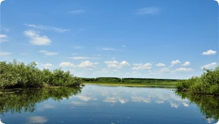
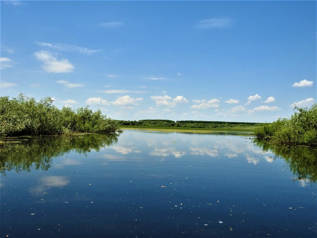
On the Lower Danube floodplain of Brăila County, between the Giurgeni–Vadu Oii Bridge (river km ~237–238 on DN2A) and the city of Brăila (river km ~175).
NUTS Code
RO22 - Sud-Est
Project's objectives
Overall aim: ensure long-term conservation of priority habitats and species in the Small Island of Brăila Natural Park, with restoration actions across ~2,949 ha of key habitats. Restore former floodplain forest on 449 ha; restore the natural hydrological regime on almost 2,500 ha (including 1,366 ha of lakes) affected by siltation; remove the invasive Amorpha fruticosa from 212 ha; and manage the area as a pilot site to build management experience. A communication campaign with locals and visitors was also foreseen.
Involved Partners
| Authority type | Authority name | Role | Comments |
|---|---|---|---|
Climate zone
warm temperate moist
Temperature
12.5 °C
Precipitation
523
Annual rainfall range
300 - 600 mm
Elevation range
2
Slope range
Relief is very low: min–max elevation ~1–8.2 m; micro-relief amplitude on islands ~4–6 m
Vegetation class
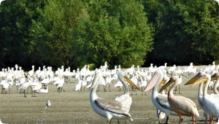
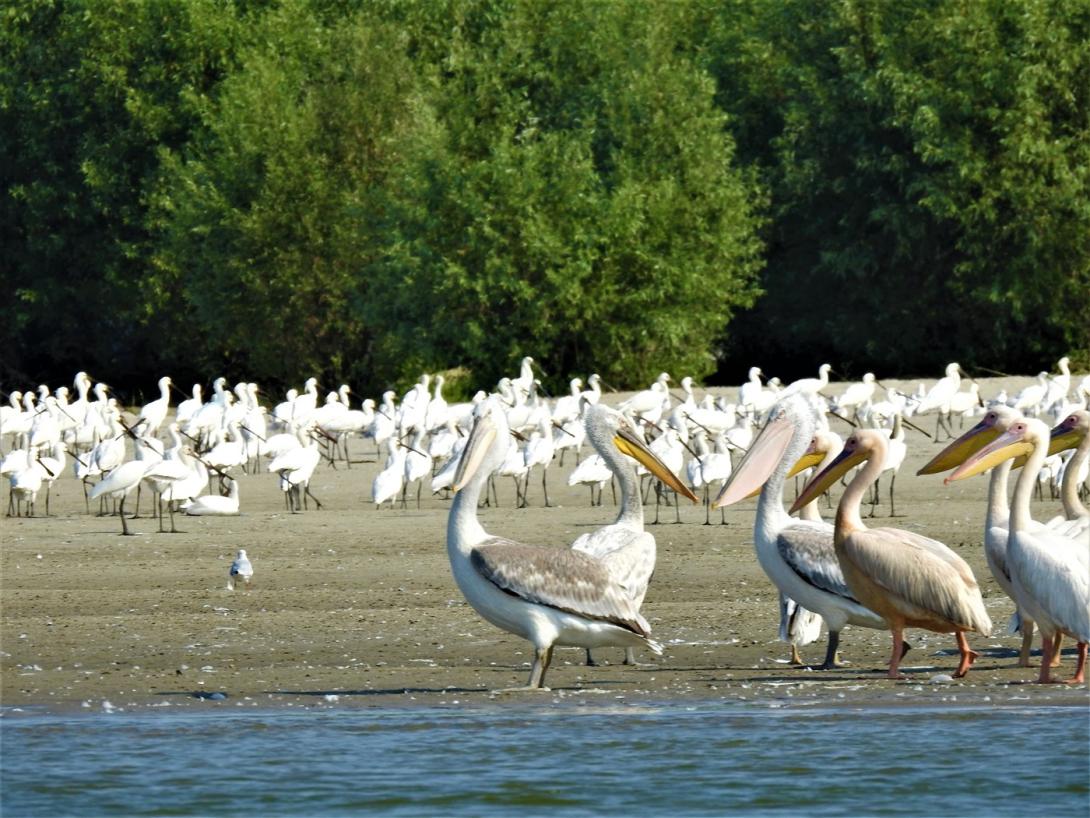
Floodplain reedbeds and marshes (Phragmites, Typha) and softwood gallery forests dominated by willow and poplar; also wet meadows.
Water bodies: Ecological Status
Moderate
Water bodies: Chemical Status
Failing to achieve good
Water quality status
Long-term eutrophication symptoms in the Lower Danube Wetlands affecting the site (nutrient load increases in the 1980s; DIN:TRP ratio decline; frequent algal blooms; Secchi depth 15–30 cm; DO swings; occasional metal hotspots in the wider Lower Danube.
Project scale
Micro
Project scale specification
This is a site-specific restoration within the Small Islands of Brăila (not a whole basin/country): the NWRM record itself tags the case as “Field scale” with a footprint ~2,949 ha; follow-up works concentrated on the Fundu Mare island complex with two sluices and channel reconnections restoring/opening ~837 ha of floodplain lakes; the park’s management plan also lists hydrological rehabilitation at Fundu Mare as an action i.e., localised hydromorphological interventions rather than regional river-basin management.
Project area
2949
Total cost
€2,717,396
Costs total information
LIFE06 NAT/RO/000172 – “RESTOREWETLANDS.” : Total budget: €1,017,396 eligible
RE-F.MARE (Fundu Mare island; 2015–2017) — EEA/SEE GrantsTotal value: €1,700,000 (7,503,630 lei).
RE-F.MARE (Fundu Mare island; 2015–2017) — EEA/SEE GrantsTotal value: €1,700,000 (7,503,630 lei).
Financing authorities
Type of funding
EU-funds: LIFE+
Comments
LIFE06 NAT/RO/000172 – “RESTOREWETLANDS.”
€489,209.
€489,209.
Type of funding
National funds
Type of funding
Private funds
Type of funding
Private funds
Compensations
0
Land ownership
Inside Small Islands of Brăila protected area, parts of the terrestrial zone are state public property (national forest fund) and parts are privately owned parcels. RNP Romsilva manage most state forest and the protected area.
Community involvment
No
Design consultation activity
| Activity stage | Name | Key issues | Comments |
|---|
Policy target
| Target purpose |
|---|
|
Improved Biodiversity
|
Policy pressure
| Pressure directive | Relevant pressure |
|---|
Policy impact
| Impact directive | Relevant impact |
|---|
Requirement directive
| Requirement directive | Specification |
|---|
Contractual arrangements
0
| Arrangement type | Responsibility | Role | Name | Comments |
|---|
Part of wider plan
0
Wider plan type
| Wider plan type | Wider plan focus | Name | Comments |
|---|
Monitoring is ongoing for birds, habitats and pressures under the integrated plan, but full fish monitoring requires dedicated gear and permits that the admin currently lacks.
he park records species presence and population sizes for priority waterbirds via transects and fixed points (with colony counts at known rookeries), evaluates habitat extent and structure/functions for key lake habitat types, and notes hydrological functioning (e.g., adequate lake levels linked to Danube stages and working sluices). Fish are assessed indirectly from catch size/health data until scientific sampling is possible; ranger patrols document pressures (navigation, poaching, etc.) and compliance with conservation measures.
Maintenance
Light but regular maintenance is performed by the park—de-silting channels, removing invasive vegetation, and operating sluices to keep Fundu Mare routes and lakes functional
The LIFE project developed an eco-tourism strategy, marked 15 tourist trails, built visitor infrastructure, and promoted agro-tourism. Later projects added observation towers, floating hides, and maintained two water routes to support visitor access. In 2023, around 2,150 visitors were recorded, including ecotourists, sport fishers, and students. The park runs regular education programmes, events, and community outreach, and its regulations link biodiversity protection with the sustainable development of surrounding communities.
Information on retained water
Long-lasting floods hampered works; some measures were completed, Fundu Mare actions were only partial, and Navodari failed.
Without upkeep, dredged channels closed again (loss of connectivity) - an unexpected negative outcome noted post-project.
Without upkeep, dredged channels closed again (loss of connectivity) - an unexpected negative outcome noted post-project.
1
Alluvial forest restored: 449 ha planted with native species (target met).
Invasive removal: Amorpha fruticosa cleared from 237 ha (exceeding the 212 ha target).
Invasive removal: Amorpha fruticosa cleared from 237 ha (exceeding the 212 ha target).
Key lessons
Hydrological gains in a dynamic Danube floodplain are fragile without continuous maintenance. Where dredged channels were not kept open and sluices not actively managed, connectivity and water-level control declined.
Ambitious hydraulic targets need realistic phasing and access windows. Prolonged high waters during 2006–2011 curtailed works, with Fundu Mare only partially delivered and Navodari not achieved—contingencies for extreme hydrology are essential.
Ecological actions that are technically straightforward scale well. Alluvial forest planting (~449 ha) and Amorpha fruticosa removal (>212 ha) were completed as planned, in contrast to basin-wide hydrologic restoration.
Model-guided pilots help de-risk restoration. The Fundu Mare follow-up used hydrodynamic modelling and targeted sluices to stabilise open-water habitats, showing the value of adaptive, evidence-based design.
Governance continuity underpins outcomes. Updating the management plan and maintaining education/tourism use supports stewardship, but monitoring capacity (e.g., fish) still depends on equipment, permits, and staffing.
Success factor(s)
| Success factor type | Success factor role | Comments | Order |
|---|---|---|---|
|
Attitude of decision makers
|
main factor
|
Continuous governance and a current management plan. |
|
|
Financing possibilities
|
main factor
|
Sequential funding (LIFE → EEA/Norway Grants → POPAM/POIM). |
|
|
Conducted assessments (incl. economic)
|
main factor
|
Hydrodynamic modelling guiding targeted hydraulic works. |
|
|
Conducted assessments (incl. economic)
|
secondary factor
|
Technically tractable habitat measures (forest planting, invasive control). |
|
|
Public participation
|
secondary factor
|
Active outreach and ecotourism that build local support. |
Driver
| Driver type | Driver role | Comments | Order |
|---|
Transferability
Highly transferable to large lowland floodplains with embanked islands: invasive control and floodplain forest planting scale well; hydrological reconnection via sluices/channels is site-specific. Key cautions: extreme water-level variability, sedimentation rates, long-term O&M needs, permits across water/forestry/PA authorities, monitoring capacity (esp. fish), and community access/tourism trade-offs.
English