Last update
2015
Summary
The intensive urban development of the Bezannes joint development zone (ZAC), near Reims, has led to the artificialization of 172 hectares of land, along with a growing need for stormwater management. Vegetated swales were implemented in the southern part of the area, while in the north, stormwater is collected and directed to a facility that includes an artificial wetland, an artificial lagoon, and a reed bed filter.
The construction of this facility, initiated by the Greater Reims Urban Community (project owner) and Sinbio (project manager), aimed to incorporate a nature-based solution to manage stormwater inflows upstream of the Muire River, improve the quality of discharged water, and create a 5-hectare natural space that would benefit both local residents and biodiversity called Parc de la Roselière.
This project illustrates a shift from traditional civil engineering to ecological engineering, combining water regulation, pollution control, biodiversity enhancement, and public amenities.
Position
Latitude
49.222
Longitude
3.989
Project
NWRM
National Id
France_02
Installation date
2009-2010, public opening in 2013
Implementation Status
Contact
Elia Desmot, OIEau
RBD code
FRH
Transboundary
0
Photo gallery
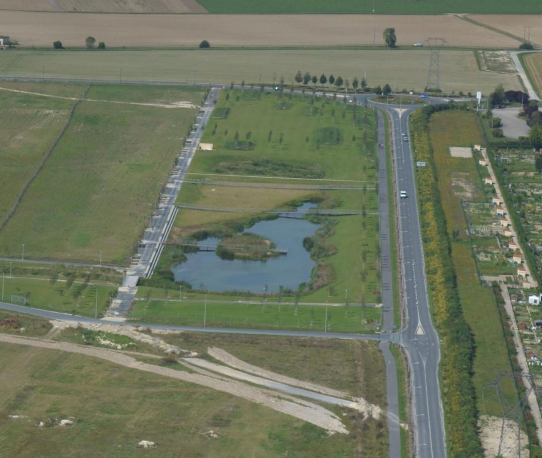

Location of the project
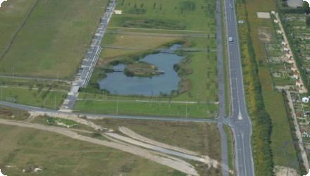
This project is located at the northern boundary of the commune of Bezannes, adjacent to the city of Reims. It is an area that has become highly urbanized, as fields have given way to residential developments and a joint development zone (ZAC) since the 2000s. The project is located within the catchment area of the Muire River, which flows downstream into the Vesle River, in a densely urbanized area.
NUTS Code
FR21 - Champagne-Ardenne
Project's objectives
Regulate runoff from 34.9 ha of impervious surfaces
Prevent downstream flooding and pollution (Muire stream and Vesle river)
Improve stormwater quality through natural filtration
Enhance biodiversity and landscape integration
Provide recreational and educational value via public access
Prevent downstream flooding and pollution (Muire stream and Vesle river)
Improve stormwater quality through natural filtration
Enhance biodiversity and landscape integration
Provide recreational and educational value via public access
Involved Partners
| Authority type | Authority name | Role | Comments |
|---|---|---|---|
Climate zone
cool temperate moist
Temperature
11.5
Precipitation
596
Annual rainfall range
300 - 600 mm
Evapotranspiration
present, but not quantified
Remarks runoff imperviousness
No exact value, but area is part of an urban development zone with high imperviousness
Elevation range
81.7 m
Depth groundwater
The water table is very close to the surface in this area, even overflowing sometimes.
Vegetation class
species of wetlands and aquatic environments, great diversity: 26 varieties
Water bodies: Ecological Status
Moderate
Water bodies: Chemical Status
Failing to achieve good
Water quality status
Chronic rainwater pollution, road runoff. Nitrate-sensitive groundwater.
Project scale
Micro
Project scale specification
Urban site-level intervention (stormwater management for 34.9 ha)
Located in the downstream section of the 172 ha ZAC de Bezannes
Located in the downstream section of the 172 ha ZAC de Bezannes
Performance timescale
< 1 year
Project area
35
Area specifications
Northern part of the 174-hectare joint development zone of Bezannes. Approx. 35 ha of drainage area.
Lagoon and filter: ~1.2 ha
Total landscaped park: >1 ha
Lagoon and filter: ~1.2 ha
Total landscaped park: >1 ha
Size
4.7
Size unit
ha
Transition from technical to ecological solution
Passive, gravity-based water routing (no pumping)
Multi-functionality: hydraulic retention, filtration, biodiversity, recreation
Design for 1-year to 100-year stormsIntegration of various depths and habitats (open water, wetlands, dry areas)
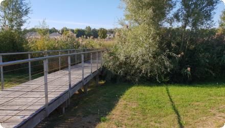
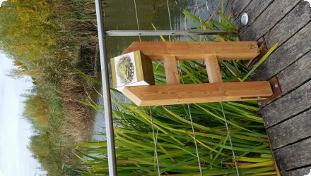
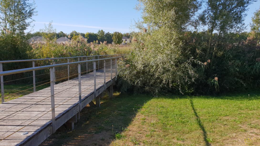
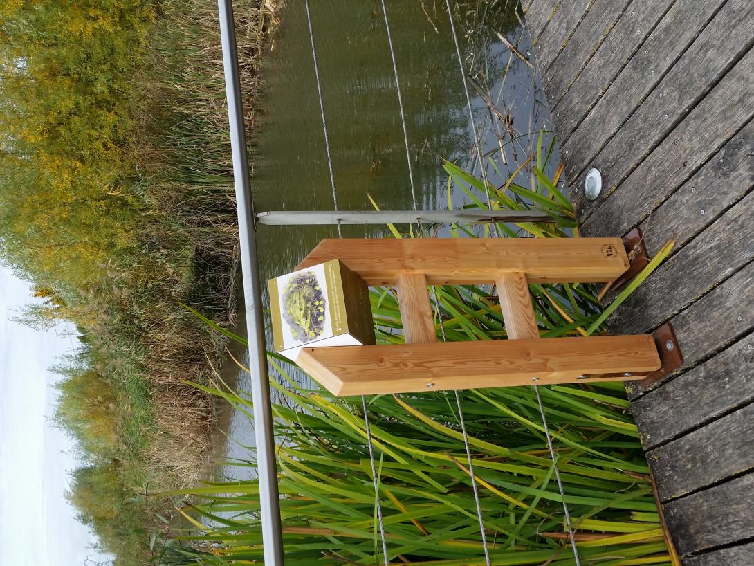
Public access with wooden footbridges and interpretive panels
Passive, gravity-based water routing (no pumping)
Multi-functionality: hydraulic retention, filtration, biodiversity, recreation
Design for 1-year to 100-year stormsIntegration of various depths and habitats (open water, wetlands, dry areas)
Public access with wooden footbridges and interpretive panels
15000 m3
Design capacity description
Extension of the stormwater collector culvert by an artificial river.
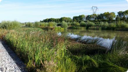
Creation of 8,000 m² of water bodies (lagoon overflowing into a planted filter).
Development of 3,500 m² of reed-planted filters for water treatment.
Development of 1,600 m² of wetland for biodiversity (and reception of another catchment area).
Landscape integration through structures that contribute to the site's landscaping.
Implementation of a gravity-fed discharge into the natural environment: Discharge into the Muire River limited to 80 L/s.
1.5-hectare playground nearby.
Very high groundwater table, no infiltration possible.
Need to avoid adding pressure to downstream sewer network (limited to 85 L/s).
Need to avoid adding pressure to downstream sewer network (limited to 85 L/s).
The idea to change from concrete to natural water retention was supported by WFD conditions and the city management. Large available space. Landscape integration supported by the urban project vision
Total cost
€ 5,480,000
Costs total information
Basin works: 4,310,000 €
Park works: 520,000 €
Fence: 370,000 €
Project management : 280,000 €
All values are without VAT.
Park works: 520,000 €
Fence: 370,000 €
Project management : 280,000 €
All values are without VAT.
Financing authorities
Type of funding
Sub-national funds
Comments
709,815.26 €
Type of funding
Local funds
Comments
Additional budget dedicated to the joint development zone.
Type of funding
Sub-national funds
Comments
139,332.00 €
Compensations
0
Policy context
The creation of a 174-hectare joint development zone (ZAC) in the commune of Bezannes led to the need for stormwater management. The Greater Reims Urban Community sought to minimize reliance on civil engineering solutions for managing these waters. To protect the downstream urban areas, it is essential to store and infiltrate the water as much as possible, especially as the water table is shallow in the area. To maintain water quality, the use of the biological purification functions of wetlands and reed bed filters was chosen.
Land ownership
Public – Owned by Communauté Urbaine du Grand Reims (Project owner and operator)
Community involvment
Yes
Design consultation activity
| Activity stage | Name | Key issues | Comments |
|---|---|---|---|
|
Other
|
Informative signage & bird panels
|
Explains system & biodiversity
|
Policy target
| Target purpose |
|---|
|
Increase Water Storage
|
|
Runoff control
|
|
Improved Biodiversity
|
|
Oher Societal Benefits
|
Target Remarks
Manage runoff from 34.9 ha of urban surfaces
Limit discharge to 85 L/s
Prevent flooding and protect groundwaterImprove water quality and create a recreational space
Limit discharge to 85 L/s
Prevent flooding and protect groundwaterImprove water quality and create a recreational space
Policy pressure
| Pressure directive | Relevant pressure |
|---|
Pressures remarks
Sealed soils and urbanization
High groundwater level
Downstream flood risk (Muire & Vesle)
Chronic urban water pollution (hydrocarbons, heavy metals, road runoff)
High groundwater level
Downstream flood risk (Muire & Vesle)
Chronic urban water pollution (hydrocarbons, heavy metals, road runoff)
Policy impact
| Impact directive | Relevant impact |
|---|
Impact remarks
Hydrological regulation
Reduction of pollutants via reed bed filtration
Public access and landscape integration
Biodiversity creation and spontaneous species colonisation
Reduction of pollutants via reed bed filtration
Public access and landscape integration
Biodiversity creation and spontaneous species colonisation
Requirement directive
| Requirement directive | Specification |
|---|
Requirement directive remarks
Regulatory authorisation under the Loi sur l’Eau (2006)
Strict pollutant discharge thresholds (e.g. 25 mg/L MES, 5 mg/L hydrocarbons)
Strict pollutant discharge thresholds (e.g. 25 mg/L MES, 5 mg/L hydrocarbons)
Policy challenges requirements
Limit algae growth and the need for dredging operations.
Landscaping includes three wooden footbridges and a path along the embankment, allowing for a walk around the basin.
Landscaping includes three wooden footbridges and a path along the embankment, allowing for a walk around the basin.
Contractual arrangements
0
| Arrangement type | Responsibility | Role | Name | Comments |
|---|
Part of wider plan
0
Wider plan type
| Wider plan type | Wider plan focus | Name | Comments |
|---|
No formal long-term ecological or hydrological monitoring in place
Maintenance
Includes green space maintenance, reed cutting, decantation chamber cleaning. Footbridge repairs handled separately. Some early issues due to insufficient maintenance.
Unknown
Integrated into a public park frequented by local residents (recreation, education)
Increased land value and public satisfaction.
Increased land value and public satisfaction.
Earlier estimate for conventional concrete basin was 8,000,000 €. The natural alternative saved ~3.2 M€
Information on retained water
Storage of up to 15,000 m³ for 100-year storms
Discharge regulated at 85 L/s
Passive gravity-based outflow prevents downstream network saturation
Early limitation: underperformance at start due to incomplete roadworks and insufficient inflow
Discharge regulated at 85 L/s
Passive gravity-based outflow prevents downstream network saturation
Early limitation: underperformance at start due to incomplete roadworks and insufficient inflow
Water quality overall improvements
Positive impact-WQ improvement
Information on Water quality overall improvements
Filtration of stormwater via reed bed filter
Treatment of suspended solids, hydrocarbons, and metals
Pollution control compliant with thresholds (e.g. MES < 25 mg/L)
Occasional pollution episodes observed (e.g. sewage backflow, dewatering discharge)
Treatment of suspended solids, hydrocarbons, and metals
Pollution control compliant with thresholds (e.g. MES < 25 mg/L)
Occasional pollution episodes observed (e.g. sewage backflow, dewatering discharge)
Soil quality overall soil improvements
N/A info
1
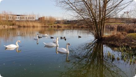
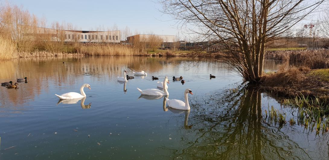
Development of a diversified wetland habitat. The site functions as an attractive refuge and offers a variety of habitats.
Spontaneous colonisation by frogs, fish, and unexpected willow species. Notably, the house martin and the common kestrel - both species in significant decline in recent years - have been observed. Bats (common pipistrelle and the serotine bat), odonates (such as hawker dragonflies and damselflies), orthopterans including the ebony black grasshopper - listed as a regional red list species - and common butterflies like the common blue, marbled white, and cabbage white.
Plantation of 26 wetland plant varieties
Artificial river section: This area hosts the richest biodiversity on the site.
Lagoon section: Ecological diversity and richness are satisfactory, but the planted species are underrepresented. The presence of filamentous algae suggests a meso-eutrophic environment, water renewal is lower than expected.
Reed bed filter section: The plants appear stunted due to insufficient water and nutrients. Eight additional species have colonized the area spontaneously, requiring differentiated mowing management.
Wetland section: Water levels are too low; the planted species are in the minority and have been replaced by plants not typical of wetland environments.
Ecosystem impact climate regulation
No specific impact
Information on Ecosystem impact climate regulation
Not mentioned
Ecosystem provisioning services
1
Information on Ecosystem provisioning services
Amenity space, improvement of water quality, increased water storage
Key lessons
This project demonstrates how a purely technical stormwater management facility can be transformed into a project that delivers significant ecological and landscape value, particularly as it is located along one of the identified ecological corridors of the urban area.
Passive, nature-based solutions can replace costly engineered alternatives
Early stakeholder engagement (e.g. landscape architects, ecologists) improves project outcomes
Public accessibility increases acceptance, but requires robust infrastructure
Design flexibility is key to adapting to site constraints (e.g. groundwater)
Anticipating inflow timing and maintenance needs is essential for early functionality
Success factor(s)
| Success factor type | Success factor role | Comments | Order |
|---|---|---|---|
|
Other
|
main factor
|
Large space available enabled ecological and public integration |
|
|
Existing staff and consultant knowledge
|
main factor
|
Interdisciplinary design team. Combined hydrology, landscape, ecology, and urban design |
|
|
Other
|
secondary factor
|
Public ownership and long-term vision. Enabled consistent management and public park development. |
Driver
| Driver type | Driver role | Comments | Order |
|---|---|---|---|
|
Organisation committed to it
|
main driver
|
Project director to replace a concrete basin with a natural solution
|
|
|
Other
|
main driver
|
Need to manage runoff from a large new urban zone.
|
|
|
Legal obligations
|
secondary driver
|
Sustainability ambition embedded in Reims Métropole’s planning policies
|
Cost effectiveness
The initial solution cost of €8 million. The sustainable development approach reduced to €4.8 million, representing a saving of €3.2 million.
Source(s)
English