Last update
2025
Summary
Gerai (Balta Geraiului), a Danube floodplain between Gârcov and Islaz, was restored under the LIFE+ “Green Borders” project. Works completed in 2011 reinstated the hydrological regime on about 1,000 ha to secure breeding water levels and open-water patches for Ferruginous Duck (Aythya nyroca) and Pygmy Cormorant (Microcarbo pygmaeus). Since then, the area has gained stronger protection and outreach: on 13 June 2012 it was designated as part of the Olt–Danube Confluence Ramsar Site (46,623 ha), and in June 2013 WWF, APM Olt and local communities opened a visitor observation point at Gerai. Governance has also been updated: in May 2023 Romania approved the official management plan for the Natura 2000 sites ROSPA0024 “Olt–Danube Confluence” and ROSCI0044 “Corabia–Turnu Măgurele”, which cover the Gerai area. Recent pressures include recurring reed/grass fires; in August 2022, over 600 ha around Islaz in the “Teleorman Delta”, including Balta Geraiului, burned. Overall, the project’s hydrological reconnection and bird-habitat aims remain relevant, now framed by Ramsar and Natura 2000 planning, while fire management is an ongoing challenge.
Position
Latitude
43.73428
Longitude
24.671109
Project
NWRM
National Id
Romania_05
Installation date
2011
Implementation Status
Contact
Koszta Imola, REC
RBD code
AT1000
Transboundary
0
Photo gallery
Location of the project
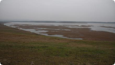
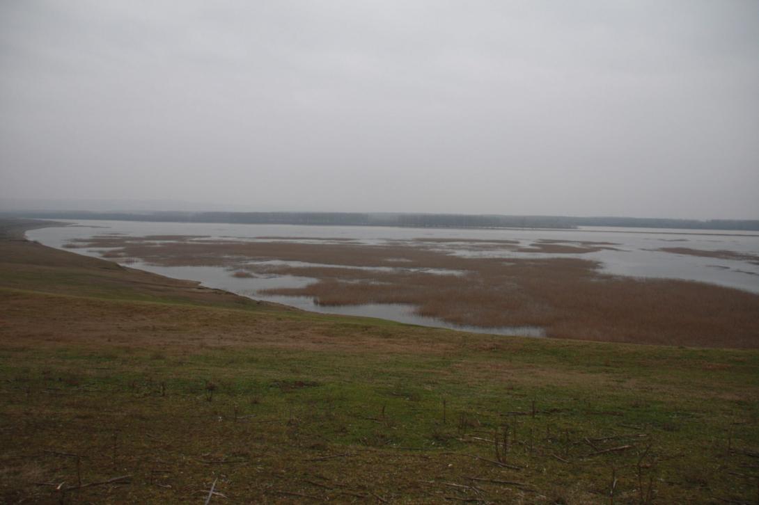
Danube floodplain between the villages of Gârcov (west) and Islaz (east), at the Olt–Danube confluence. The site lies near national road DN54 (Turnu Măgurele–Islaz–Corabia) that connects the two villages.
NUTS Code
RO31 - Sud - Muntenia
Project's objectives
Restore hydrology at Gerai to facilitate water circulation and maintain water levels required by aquatic birds during the breeding/rearing season; improve hydrological conditions on ~900 ha of the floodplain.
Ensure favourable living conditions for Ferruginous Duck (Aythya nyroca) and Pygmy Cormorant (Microcarbo pygmaeus) by reconstructing nesting/feeding areas, applying best practices in fisheries/reed/forest management, reducing accidental/deliberate killing, informing local communities, and mobilising funding.
Implement a hydrological reconnection able to store up to ~4.2 million m³ during floods on a site of ~950 ha, via three control structures on drainage canals and a ~900 m feeder canal.
Involved Partners
| Authority type | Authority name | Role | Comments |
|---|---|---|---|
Climate zone
warm temperate moist
Temperature
11,5
Precipitation
450
Runoff
65,9
Runoff coefficient
0,150000005960464
Runoff range
450 - 600 mm
Elevation range
23
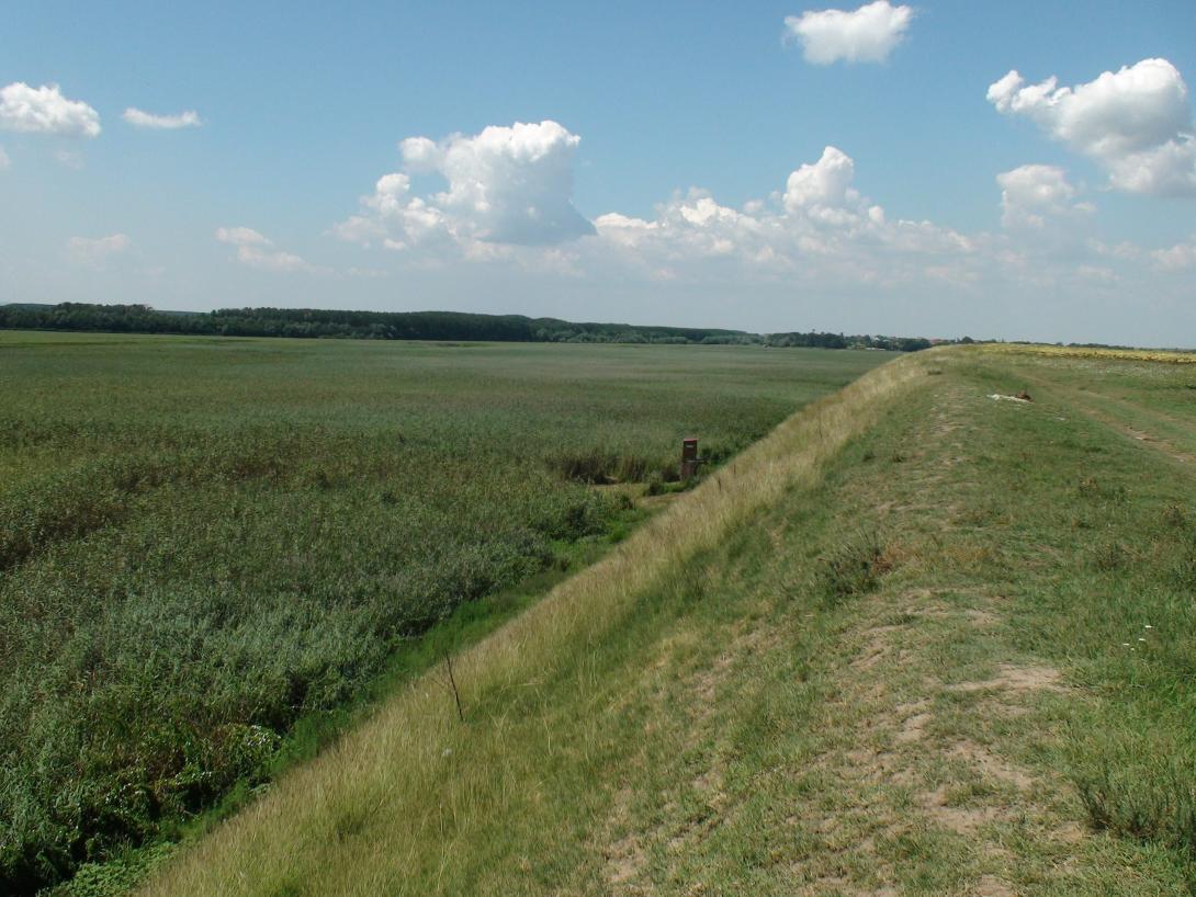
Slope range
0-1% (flat, flood plain lookalike, butshowing small bumps (type of sand dunes) that don't exceed a few meters. The height in the area of Gerai Pond ranges between 22 and 24 meters, the location being almost horizontal. Only in the North area of the pond the heights increase somewhere around 40 to 45 m locally and in some cases reaches 50 m)
Groundwater level
Phreatic waters are stored in terrace deposits at 15–20 m depth; floodplain deposits are closely linked to Danube flows.
Vegetation class
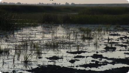
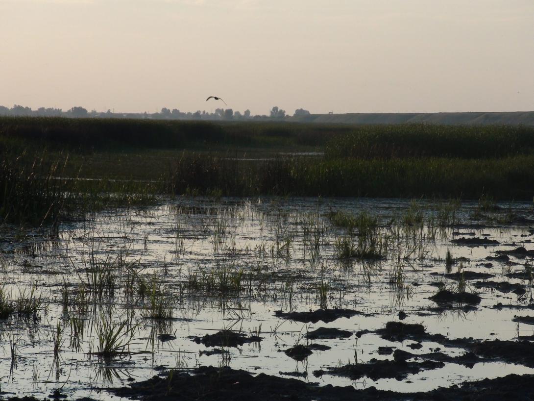
Emergent wetland vegetation and reedbeds, with a mosaic of open water and pastures/grasslands. Reported hydrophilic plants include rushes/club-rush, bulrush, iris and arrowhead - typical marsh/helophyte communities.
Water bodies: Ecological Status
Moderate
Water bodies: Chemical Status
Failing to achieve good
Water quality status
A recent pressure on wetland habitats is recurrent reed/grass fires
Project scale
Micro
Project scale specification
This is a site-specific floodplain/wetland restoration at Balta Geraiului between Gârcov and Islaz, with hydrological reconnection works focused on a single pond/floodplain unit (~950–1,000 ha) rather than a whole river basin or region.
Performance timescale
< 1 year
Project area
950
Area subject to Land use change or Management/Practice change (ha)
950
Lifespan
50
Design capacity description
could store 4.2 million m3 during floods;
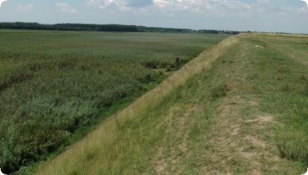
3 dams were build on the 3 drainage canals: one of 110 m, one of 60 and one of 40; new canal of 900 m long and 4 m wide was constructed in order to supply the pond with freshwater.
3 dams were build on the 3 drainage canals: one of 110 m, one of 60 and one of 40; new canal of 900 m long and 4 m wide was constructed in order to supply the pond with freshwater.
Total cost
€1,305,390
Costs total information
Total cost of the LIFE project covering Gerai + other key sites in RO/BG.
Costs capital
65000
Costs capital information
Construction of 3 dams on the drainage canals in order to retain water in the area. Construction of a new canal in order to supply the pond with freshwater
Financing authorities
Type of funding
EU-funds: LIFE+
Comments
€979,042
Compensations
0
Policy context
Ecological restoration of the habitats (nesting and feeding) for hydrophilic species like the red duck (Aythya nyroca) and pygmy cormorant (Phalacrocorax pygmaeus), both being threatened species
Land ownership
A mosaic of ~400 small private landowners from the villages of Islaz and Gârcov hold land on Balta Geraiului (Gerai Pond).
Community involvment
Yes
Design consultation activity
| Activity stage | Name | Key issues | Comments |
|---|---|---|---|
|
Design phase
|
Consultation meeting in Izlaz and Garcov on 29-30 September, 2009
|
There were approximately 400
small landowners from Izlaz and Garcov villages on Balta Geraiului. |
Policy target
| Target purpose |
|---|
|
Improved Biodiversity
|
|
Runoff control
|
|
Oher Societal Benefits
|
Policy pressure
| Pressure directive | Relevant pressure |
|---|
Policy impact
| Impact directive | Relevant impact |
|---|
Requirement directive
| Requirement directive | Specification |
|---|
Contractual arrangements
0
| Arrangement type | Responsibility | Role | Name | Comments |
|---|
Part of wider plan
1
Wider plan type
| Wider plan type | Wider plan focus | Name | Comments |
|---|---|---|---|
|
Lower Danube Green Corridor strategy
|
Monitoring is required/ongoing to track the status of target bird species and habitat condition, carried out by WWF and partners during LIFE+ and framed since 2023 by the approved Natura 2000 management plan.
Avian responses (including Ferruginous Duck and Pygmy Cormorant) and vegetation recovery, insects.
Maintenance
Maintenance consists of applying conservation management of reedbeds/fisheries/forests and keeping the site under a managed regime.
Catchment outlet
Field observation
Livelihoods & local use. The restoration brought ancillary benefits for residents, notably grasslands suitable for grazing; beekeepers from across Romania came for mint, fishing is possible in parts of the area, and eco-tourism increased.
Tourism & education infrastructure. On 26 June 2013, WWF-Romania, with APM Olt and local communities, inaugurated a tourist observation point at Balta Geraiului to enable birdwatching while reducing disturbance; WWF also backed a cycling-route initiative along the Romanian Danube.
Tourism & education infrastructure. On 26 June 2013, WWF-Romania, with APM Olt and local communities, inaugurated a tourist observation point at Balta Geraiului to enable birdwatching while reducing disturbance; WWF also backed a cycling-route initiative along the Romanian Danube.
ancillary benefits for the people living in the area, such as grassland suitable for grazing
Information on retained water
1.5 million m3 retained water
Hydraulic works (connectivity): Three control dams on former drainage canals (≈110 m, 60 m, 40 m) plus a new feeder canal ~900 m long, 4 m wide to bring freshwater to the pond.
Hydraulic works (connectivity): Three control dams on former drainage canals (≈110 m, 60 m, 40 m) plus a new feeder canal ~900 m long, 4 m wide to bring freshwater to the pond.
Information on increased water storage
could store 4.2 million m3 during floods
Water quality overall improvements
N/A info
Information on Water quality overall improvements
N/A info
Soil quality overall soil improvements
Not relevant for this application
Information on Soil quality overall soil improvements
Not relevant for this application
1
Ferruginous Duck (Aythya nyroca) breeding pairs increased from ~20 (pre-project) to ~60 (2013). Return of target birds including Pygmy Cormorant.
Habitat mosaic: WWF describes ~600 ha offering a mix of open-water pools, reedbeds and pastures after works (site description of outcomes).
Habitat mosaic: WWF describes ~600 ha offering a mix of open-water pools, reedbeds and pastures after works (site description of outcomes).
Ecosystem impact climate regulation
Increased permanent biomas
Information on Ecosystem impact climate regulation
During the dry season in 2012 there was a green grassland with a wide diversity of plants (such as mint)
Ecosystem provisioning services
1
Information on Ecosystem provisioning services
Beekeepers from all over the country, came to pick mint,fishing can be practiced in some parts of the area and increased Eco-tourism
Key lessons
A focused, low-cost hydrological reconnection can deliver quick biodiversity gains. At Gerai, three control dams and a ~900 m feeder canal re-established water exchange on ~950–1,000 ha; within two years Ferruginous Duck breeding pairs rose from ~20 to ~60, demonstrating rapid avian response at site scale.
Locking restoration into formal protection and planning sustains outcomes. After works finished (2011), the area was included in the Olt–Danube Confluence Ramsar Site (2012), and an official Natura 2000 management plan for ROSPA0024/ROSCI0044 was approved in May 2023—providing a framework for ongoing management and monitoring.
Transparent local engagement helps when land is fragmented. The case documents consultations with village stakeholders/landowners from Islaz and Gârcov at project start, which supported access and acceptance for interventions on the floodplain.
Plan for maintenance and monitoring from day one. WWF lists “Monitoring” and “Maintenance” as explicit phases at Gerai, and reported that post-works monitoring showed the wetland “coming back to life,” with returning bird and plant communities—useful, concrete indicators for tracking success.
External pressures can erode ecological gains if unmanaged. Recurrent late-summer fires culminated in ~700 ha burned around Islaz in 2022 (including Balta Geraiului), underscoring the need to integrate fire-risk reduction and enforcement into wetland management.
Investing in low-impact visitor infrastructure aligns conservation and local benefits. The 2013 bird-watching observation point formalized access, supporting education and ecotourism while channeling visitors to reduce disturbance.
Success factor(s)
| Success factor type | Success factor role | Comments | Order |
|---|---|---|---|
|
Public participation
|
main factor
|
<p>There were approximately 400 small landowners from Izlaz and Garcov villages on Balta Geraiului.</p>
|
1
|
Driver
| Driver type | Driver role | Comments | Order |
|---|---|---|---|
|
Other
|
main driver
|
The need to create and ensure the protection and conservation of threatened bird species.
|
1
|
Transferability
Highly transferable to disconnected floodplain ponds where modest hydraulic works restore water exchange. At Gerai, three control dams and a ~900 m feeder canal reinstated flows on ~950–1,000 ha with quick bird recovery. Key cautions: secure legal protection/management plan, engage many small private owners, fund maintenance/monitoring, manage reed–grass fire risk, and calibrate water levels to breeding needs.
English