Last update
2025
Summary
The project’s objective was to improve the conservation status of aquatic bird species in Lower Prut Floodplain Natural Park (Galați County, RO) through scientific inventory, monitoring, site restoration, awareness-raising, implementation of the park management plan, and the designation of Natura 2000 SPAs. Partners were the University of Bucharest, the Romanian Ornithological Society and Romsilva – Galați Forestry.
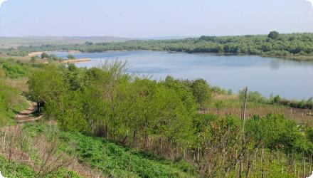
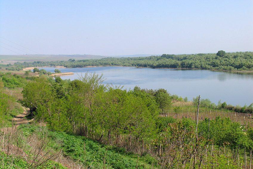
At Vlăscuța, connectivity with the Prut was re-established by de-clogging the access (366 m) and outflow (176 m) channels and installing two sluices to stabilise lake levels; a birdwatching tower was also built here. The site is a national natural reserve (RONPA0433, 41.8 ha) within the Natura 2000 network (park overlaps ROSCI0105 and SPAs including ROSPA0070). Recent management documents confirm these works and facilities.
At Vlăscuța, connectivity with the Prut was re-established by de-clogging the access (366 m) and outflow (176 m) channels and installing two sluices to stabilise lake levels; a birdwatching tower was also built here. The site is a national natural reserve (RONPA0433, 41.8 ha) within the Natura 2000 network (park overlaps ROSCI0105 and SPAs including ROSPA0070). Recent management documents confirm these works and facilities.
Position
Latitude
45.7775
Longitude
28.147222
Project
NWRM
National Id
Romania_ 09
Installation date
2010-10
Implementation Status
Contact
Bogdan Barbu, REC ROImola Koszta, REC
RBD code
RO1000
Transboundary
0
Photo gallery
Location of the project
In Măstăcani commune (Drăculești village), inside the Prut embanked area; access from DN26 Galați–Cavadinești and the local road DC “Șoseaua Rusului” to the Prut dyke.
NUTS Code
RO22 - Sud-Est
Project's objectives
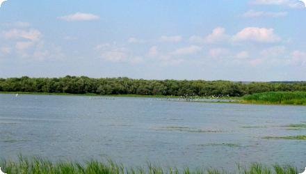
Improve the conservation status of 13 priority and 50+ other Birds Directive species present in the Lower Prut Floodplain Natural Park.
Re-establish the ecological balance of lakes by fixing degraded hydrological structures and improving/maintaining water levels.
Designate four SPAs (Romanian Natura 2000) and prepare/approve an integrated park management plan and administration.
Carry out inventories and monitoring, plus public engagement (village consultations, picture books, nature trails, six annual environment days, bird-watching towers).
De-clog access canal 366 m and evacuation canal 176 m; install two dams/sluices (with a small footbridge) to control levels.
Involved Partners
| Authority type | Authority name | Role | Comments |
|---|---|---|---|
Climate zone
cool temperate dry
Temperature
11
Precipitation
500
Annual rainfall range
300 - 600 mm
Elevation range
6
Groundwater level
~9–32 m depth; flow toward the Lower Prut floodplain
Vegetation class
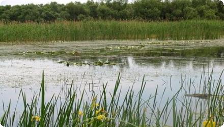
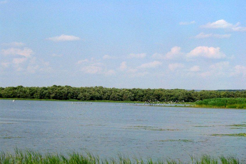
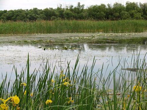
The specific vegetation for the area of Vlascuta Lake is represented by the water flora itself made up by: reed, mace reed, sedge, shave rush, duckweed, water milfoil, white water lilies and many other characteristic species.
Water bodies: Ecological Status
Moderate
Water bodies: Chemical Status
Good
Water quality status
Organic loading and high mineralization; risks from agricultural pesticides and transboundary accidental discharges
Project scale
Micro
Project scale specification
Site-level hydromorphology within a meso-scale park project.
Performance timescale
Immediate
Project area
41,8
Area subject to Land use change or Management/Practice change (ha)
41,7999992370605
Wetlands belong to the category of ecologically fragile areas, their dynamic being influenced mainly by the qualitative and quantitative characteristic of the water in the hydrographical basin in which they extend. For this reason, the conservation measures promoted in these spaces must be doubled by a strict control of the anthropic activities / arrangements using water for different purposes or as a medium of discharging some wastes.
Total cost
€ 824,710
Financing authorities
Type of funding
EU-funds: LIFE+
Comments
412,355 €
Type of funding
National funds
Comments
412,355 € with all non-EU sources
Type of funding
Local funds
Comments
412,355 € with all non-EU sources
Compensations
0
Policy context
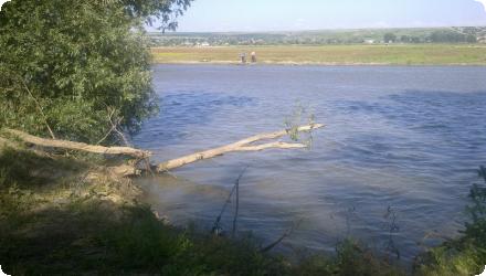
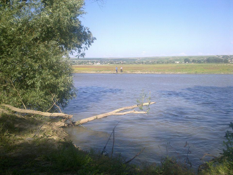
Within the perimeter of the Lower Prut Floodplain Natural Park, it was the area Vlascuta Lake, who needed ecological reconstruction works, because it was situated on a floodable land and the clogging phenomenon is rapid and advanced. All these are also due to the fact that the basin of the Prut River underwent, during the last 70 years, many hydrotechnical and hydrological works. These works consisted in the building of dams and draining on a large surface of the wetland. The Lower Prut Floodplain underwent the most radical alteration by the draining of the main part of Brates Lake. In the case of Vlascuta Lake, the ecological reconstruction works were quite necessary, since the canal for the access of the water from the Prut River was partially clogged, and the water evacuation canal from Vlascuta Lake was almost completely clogged.
Land ownership
State public domain (lake basin).
Community involvment
Yes
Design consultation activity
| Activity stage | Name | Key issues | Comments |
|---|---|---|---|
|
Implementation phase
|
Awareness raising activities
|
These include information dissemination, consultation of every village in the area, and active participation and education with local educational material to be produced. The project takes into account that there is a relatively high illiteracy in the area and will address stakeholders in wide variety of ways, including picture books, nature trails, six annual environment days with expeditions into the area, children's exhibitions, and bird watching towers
|
Policy target
| Target purpose |
|---|
|
Increase Water Storage
|
|
Improved Biodiversity
|
|
Groundwater Recharge
|
Policy pressure
| Pressure directive | Relevant pressure |
|---|
Policy impact
| Impact directive | Relevant impact |
|---|
Requirement directive
| Requirement directive | Specification |
|---|
Contractual arrangements
0
| Arrangement type | Responsibility | Role | Name | Comments |
|---|
Part of wider plan
1
Wider plan type
| Wider plan type | Wider plan focus | Name | Comments |
|---|---|---|---|
|
National
|
Environment & Biodiversity
|
Lower Danube Green Corridor programme
|
The park’s management plan assigns ongoing monitoring to the Lower Prut Floodplain NP Administration, with long-term LIFE monitoring on birds, water quality/quantity, and bioaccumulation of organochlorine pesticides; facilities include a tower at Vlăscuța
Bird population status (with a formal species monitoring programme and watch facilities) and bioaccumulation of organochlorine pesticides in birds; water quality and quantity, land-use and awareness tracking.
Maintenance
Lake levels are controlled by operating two sluices/dams on the inflow and outflow channels; the site also keeps its birdwatching tower operational.
Better conditions for the birds population; increasing the number for aquatic bird species (especially those listed in Annex I of Birds Directive, Bern Convention and in ORNIS lists); improve the trophic state and saprobity of the target aquatic systems; allowing the water oxygenation of the lakes through the input of the fresh water from the Prut River; including the monitoring birds protocols in the adaptive Management Plan of Lower Prut Floodplain Natural Park;
Eco-tourism and fisheries potential supported by restored hydrology and a bird tower; activities framed by park rules for organised tourism.
Eco-tourism and fisheries potential supported by restored hydrology and a bird tower; activities framed by park rules for organised tourism.
Supply the potential of fisheries resources; using the potential of providing services for tourism and recreation
Hydrological effects
Increased water storage and maintained levels
Water quality overall improvements
Positive impact-WQ improvement
Information on Water quality overall improvements
Improved trophic state and saprobity and oxygenation of the lakes by fresh Prut inflows
1
Restoration of aquatic birds sites in the natural protected area located in Lower Prut Floodplain Natural Patk - Vlascuta Lake
Key lessons
Re-opening short inlet/outlet channels and operating two small sluices was enough to stabilise levels so habitats are protected in both droughts and floods—turning Vlăscuța into a showcase for redeveloping and broadening habitats that support Natura 2000 objectives. Strong public outreach embedded in the project helped social acceptance.
Success factor(s)
| Success factor type | Success factor role | Comments | Order |
|---|---|---|---|
|
Attitude of decision makers
|
main factor
|
Clear roles among agencies (REPA Galați, Park Administration, Forestry Dept., University of Bucharest, SOR). |
1
|
|
Financing possibilities
|
secondary factor
|
Blended financing: EU LIFE+, national ministry, Galați County Council. |
|
|
Communication activities
|
main factor
|
Early, targeted awareness work (village consultations, nature trails, events, towers). |
Driver
| Driver type | Driver role | Comments | Order |
|---|---|---|---|
|
Organisation committed to it
|
main driver
|
1
|
Transferability
Highly transferable to low-gradient river–floodplain lakes: modest channel dredging plus small sluices and dyke repairs can restore levels and habitat. Success hinges on sediment load and long-term maintenance, available inflows, protected-area rules and stakeholder alignment. Watch for rapid re-siltation, drought-driven low flows and fish-farm constraints; embed monitoring of birds and water quality.
English