Last update
2025
Summary
The project aims to secure year-round Danube Commission fairway depths of 2.5 m between Călărași and Brăila, including during low flows. Since 2022 it has been reframed as “BALA II,” a combined navigation–environment scheme led by AFDJ Galați that restores and renaturalises the Bala bifurcation area. The solution raises the Bala bottom sill from 0 m to 6.5 m (MNC), re-activates an old bifurcation branch, and foresees complementary works on the Old Danube reach, in order to stabilise low-water hydraulics while limiting ecological impacts. Key permits and approvals have been obtained: water management approval (June 2022) and an environmental agreement from APM Călărași (Sept 2023). In Sept 2024 the Government approved the project’s techno-economic indicators (HG 1079/2024). Procurement for design and works was relaunched in 2025 (estimated value ~743.8 million RON; 96-month duration). As of August 2025, no award notice is publicly available.
Position
Latitude
44.1916
Longitude
27.566
Project
NWRM
National Id
Romania_ 10
Installation date
2011-2016
Implementation Status
Contact
Bogdan Barbu, REC RomaniaImola Koszta, REC
RBD code
RO1000
Transboundary
0
Photo gallery
Location of the project
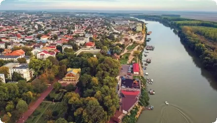
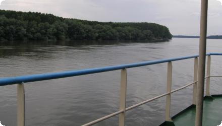
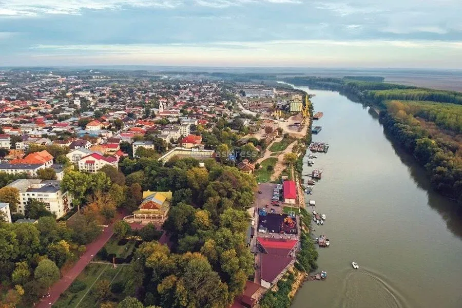
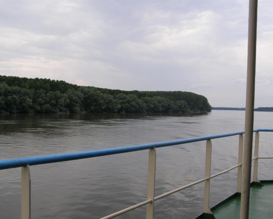
Lower Danube between rkm 375 (Călărași) and rkm 175 (Brăila). Key works are at the Bala–Old Danube bifurcation, with dredging on Old Danube rkm 345.5–343.0 and structures around km 347–343 near Izvoarele village (Lipnița commune, Constanța County).
NUTS Code
RO22 - Sud-Est
Project's objectives
Ensure Danube Commission fairway parameters year-round: keep a minimum depth of 2.5 m along the fairway between rkm 375–175, including during dry season.
Meet fairway width guidance: provide a fairway width ~150–180 m on this sector.
Remove low-water bottlenecks at defined “critical points”: execute targeted river-training works initially at CP01 Bala (km 347–343), CP02 Epurașu (km 342.7–341.8), CP10 Caleia/Ostrovu Lupu (km 197–195) to secure the fairway during low flows.
Operational outcome targeted: avoid the seasonal ~110 km bypass via the Bala–Borcea branch (which affected navigation for ~140–160 days/year) by restoring reliable low-water navigation on the Old Danube.
Involved Partners
| Authority type | Authority name | Role | Comments |
|---|---|---|---|
Climate zone
warm temperate moist
Temperature
13.6°C
Precipitation
560
Annual rainfall range
300 - 600 mm
Elevation range
7 m
Groundwater level
1,4
Vegetation class
Floodplain/riparian vegetation—willow and poplar stands/plantations on islands and banks, with wetland/reedbed and aquatic macrophyte communities (Hydrocharition/Magnopotamion) in backwaters.
Water bodies: Ecological Status
Moderate
Water bodies: Chemical Status
Failing to achieve good
Water quality status
Hydromorphological pressures linked to navigation works (dredging, bottom sill, guiding wall, bank protections) at the Bala bifurcation/Old Danube; the basin plan also flags navigation-related hydromorphology as a pressure class on the Danube.
Project scale
Micro
Project scale specification
Localised hydromorphological works at the Bala bifurcation and a short Old Danube reach: restoration/renaturation of a ~3.4 km branch, raising the Bala bottom sill to 6.5 m (MNC), and ~2.5 km of dredging between rkm 345.5–343
Size
200
Size unit
km
Rebalance discharge during low flows to keep the Old Danube navigable: use a submersed bottom sill on the Bala branch (plus guiding wall, bank protection) to decrease discharge in Bala and increase it on the Old Danube (by up to ~20% at low flows, per the original plan), with interventions designed to act mainly in low-water seasons (reduced environmental impact).
Total cost
€ 38,671,752
Costs other information
Works 2011–2016 (“DANUBE 1”)
Total budget: €49,650,516 (RON 218,611,217, incl. VAT). Funding split: 85% Cohesion Fund / 15% Romanian State. (≈ €42.2 m EU, €7.45 m national).
Environmental monitoring (ROMOMED)
Contract price: €7,197,680; funding: 71.12% ERDF / 28.88% national (≈ €5.12 m EU, €2.08 m national).
Current follow-up project (“BALA II”)
Government-approved total investment: RON 1,020,762,000 (incl. VAT; ~€207.5 m at 1 € = 4.9193 RON). Of this, C+M (construction + installation) is RON 841,369,000 (incl. VAT; ~€171.0 m). Financing source: EU funds via the Transport Program 2021–2027 + Romanian state budget (share not specified in the decision).
Financing authorities
Type of funding
EU-funds: Cohesion and regional development funds
Type of funding
National funds
Compensations
0
Policy context
To solve out the navigation constraints the solution was the restoration and renaturation of a partially dried old branch near Bala branch, 3,400 meters long (aprox. 1,700 meters still navigable) with meanders, 200 meters base width, with created habitats for sturgeons and a projected water speed to attract and sustain sturgeon migration. The all 4 types of habitats will be created on this arm.
Land ownership
Danube riverbed/fairway, which is public property of the Romanian State, navigation infrastructure on these waters is public property administered by AFDJ Galați
Community involvment
Yes
Design consultation activity
| Activity stage | Name | Key issues | Comments |
|---|
Policy target
| Target purpose |
|---|
|
Oher Societal Benefits
|
Target Remarks
- the restored arm will have natural infiltration to the goundwater to suport hyporheic zones (Bencala 1993), buffer strips diversifying the structure of the banks of the restored/renatured arm, planting hydrophilic vegetation to reduce bank erosion, pollution with other substances, nutrients, pesticides, supporting the diversity of habitats;
- the creation of "Oxbow lake" type wetlands zone with positive effects on reducing the risk of flooding by mitigating the effect and ensuring lateral connectivity, improving water storage capacity and diversifying habitats; supporting ecological infrastructure (green and blue);
- as the flow on Old Danube Branch (TEN-T core network) will increase, there will be created the conditions for the ecological flow to be reached (Water Framework Directive) and to restore sturgeon migration on this branch;
- increasing the ecosystems potential of the wetlands in the Natura 2000 Sites - the site of community importance (SCI) – ROSCI0022 and ROSPA0039 Ostroave Danube and increasing the water clarity;
- restoring the natural hydrological regime of the meadow (specific vegetation exists and develops);
- restoring the balance in the sediment regime on the Danube by ensuring a sufficient flow on the Old Danube to entrain and transport sediments from the river bed;
- creating the premises of a speed gradient of the balanced flow regime at the distribution between the arms, the restored one and the Old Danube;
- restoring essential ecosystem services by increasing the area of wetlands by approx. 55.7 ha, which would increase flood, drought and disaster protection, supporting biodiversity and storing (sequestering) more carbon (due to high storage efficiency than any other ecosystem) (35% of wetlands have lost since 1970, at a rate three times higher than that of forests): "the ecosystem services of wetlands are enormous, far exceeding those of terrestrial ecosystems”
- promoting the transport on inland waterways by contributing to the achievement of the objectives of European Green Deal, COM(2019) 640 final with net greenhouse gas emissions target by 2050 and 75% of inland road freight to be transferred to rail and inland waterways;
- reduction of GHG emissions with 62,5 - 55% and increases the area of wetlands that are very important absorbers;
Policy pressure
| Pressure directive | Relevant pressure |
|---|
Policy impact
| Impact directive | Relevant impact |
|---|
Requirement directive
| Requirement directive | Specification |
|---|
Contractual arrangements
0
| Arrangement type | Responsibility | Role | Name | Comments |
|---|
Part of wider plan
0
Wider plan type
| Wider plan type | Wider plan focus | Name | Comments |
|---|
The project has an integrated monitoring program (pre-construction, construction, post-construction) led for AFDJ by an INCDPM-coordinated consortium, covering abiotic and biotic components and reporting regularly to the authority.
Hydromorphology & hydraulics: 2D/3D bathymetry, repeated cross-sections, flow and velocity measurements; continuous water level and turbidity at five automatic stations.
Water & sediments: in-situ physico-chemical field tests, laboratory analyses of water and sediment (including suspended load/turbidity; granulometry).
Biota: phytoplankton, macrophytes, benthic macroinvertebrates, ichthyofauna with a dedicated sturgeon and barbel program (captures/registers, telemetry; tracking migration over the Bala bottom sill), plus avifauna and Natura 2000 site checks.
Maintenance
Fairway maintenance is carried out by AFDJ Galați through routine hydrographic/bathymetric surveys, fairway marking (buoys) and targeted dredging during low-water, with adaptations such as temporarily narrowing the fairway when levels are below LNWL.
Lower transport time and costs between Călărași–Brăila (and implicitly Călărași–Cernavodă), and higher usage of the Danube corridor (more ships and cargo), by stabilising low-water hydraulics on the Old Danube.
Information on retained water
At CP01 Bala, the works increased discharge on the Old Danube by ~17% at Q=2000 m³/s and ~30% at Q=4000 m³/s. Navigation on the Danube main course was reopened after ~20 years at CP10 Caleia; bank erosion decreased on the Caleia branch.
Modelled for BALA II (renaturation + raised sill):
• At low flows (Q=2000–4000 m³/s), Alternative A yields up to +1.05 m water level on the Old Danube and +300 m³/s average flow; depth increase up to ~1.2 m vs. 2011. Effects diminish as discharge rises. Long-term: reduces (but does not stop) Old Danube aggradation.
• Noted sediment effects: scour/deficit at Bala, aggradation in the Old Danube (e.g., Caragheorghe bar) linked to unbalanced liquid/solid splits.
1
When the sill was at 0 m MNC, sturgeon migration was not affected; other literature warns that immersed obstacles (e.g., bottom sills) can disrupt migration—hence the “win-win” redesign in BALA II (renaturation + raised sill with corridors).
Information on Ecosystem impact other GHG
GHG emissions reduction: AFDJ states a 62.5% cut versus the current situation; even with a +20% traffic increase, the reduction would be ~55% (TEN-T alignment / Fit for 55).
Key lessons
River freight is a vital, cost-efficient lifeline. To keep it viable from the Upper Danube to Constanța, sufficient year-round fairway depth is needed. Over decades, natural river dynamics deepened the Bala branch while the Old Danube silted, creating a structural bottleneck that navigation alone could not overcome.
Routine dredging proved insufficient and short-lived on this reach. Studies and operational experience show that persistent morphodynamic imbalance (e.g., several metres’ bed-level difference between Bala and the Old Danube) makes “maintenance-only” approaches ineffective, pointing to the need for structural and morphological solutions.
A step-by-step, evidence-based approach under the Joint Statement greatly improved the project. Works were paused, an extensive monitoring programme (ROMOMED) was put in place, and 2D/3D modelling guided design choices. Early NGO and Commission input shaped requirements and oversight.
“BALA II” shows that navigation and ecology can be combined by renaturing the bifurcation and carefully tuning structures. The concept restores an old branch, raises the Bala sill, and aims to increase water levels on the Old Danube at low flow—while maintaining sturgeon migration conditions.
Stable governance and financing matter. Government approval of techno-economic indicators and EU/national co-funding unlocked the follow-up phase, while procurement and permitting required multiple, sequenced steps.
Success factor(s)
| Success factor type | Success factor role | Comments | Order |
|---|---|---|---|
|
Financing possibilities
|
main factor
|
1
|
|
|
Attitude of decision makers
|
main factor
|
Strong institutional lead (AFDJ) with clear objectives aligned to Danube Commission fairway guidance and TEN-T policy. |
|
|
Conducted assessments (incl. economic)
|
main factor
|
Robust modelling and monitoring (3D/2D models; ROMOMED) to design, check and adapt measures. |
|
|
Attitude of relevant stakeholders
|
secondary factor
|
Joint Statement framework with stakeholder engagement (ICPDR/DC/NGOs) improving environmental safeguards. |
|
|
Other
|
main factor
|
Stepwise redesign toward renaturation (“BALA II”) to balance hydraulics and biodiversity (sturgeons). |
Driver
| Driver type | Driver role | Comments | Order |
|---|
Transferability
Transferable to low-flow bottlenecks on large, multi-branch rivers where navigation and ecology must co-exist. Success hinges on site-specific 2D/3D morphodynamic modelling, stepwise design (e.g., branch renaturation + tuned sill), rigorous pre/during/post monitoring, safeguarding migratory fish, Natura 2000 permitting, and adaptive operations (fairway marking, targeted dredging) within a transparent stakeholder process.
English