Last update
2025
Summary
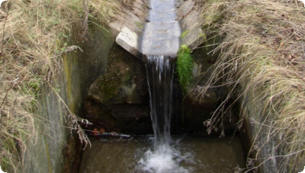
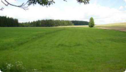
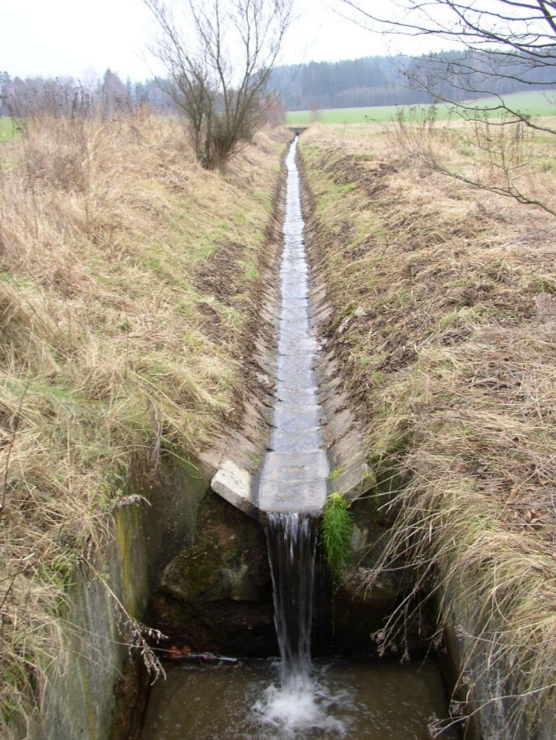
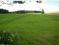
The Cechticky stream catchment case study is located at the Central Bohemian Region of the Czech Republic. The catchment area is about 72 km², most of which is used as agricultural land (69%). Fifty nine percent of which is cropland. Čechtický stream catchment is a part of the Želivka river basin, which includes the Švihov drinking water reservoir. The reservoir is currently facing persistent problems with poor water quality linked to phosphorus, nitrogen and pesticide pollution. The area is also threatened by soil erosion in large fields as well as poor soil quality linked to dehumidification, soil compaction and increasing periods of drought. Tile drainage is common in the area and issues linked to technical failures, unintended runoff and poor quality are increasing.
OPTAIN aims to develop strategies and advanced tools for designing and evaluating the effectiveness of Natural Small Water Retention Measures taking into account the principles of their feasibility in small agricultural river basins in terms of increasing water accumulation and retention and improving water quality. Emphasis will be placed on measures on agricultural drainage systems in terms of possibility of their modernization, regulation, professional elimination.
OPTAIN aims to develop strategies and advanced tools for designing and evaluating the effectiveness of Natural Small Water Retention Measures taking into account the principles of their feasibility in small agricultural river basins in terms of increasing water accumulation and retention and improving water quality. Emphasis will be placed on measures on agricultural drainage systems in terms of possibility of their modernization, regulation, professional elimination.
Position
Latitude
50.51159
Longitude
15.61694
Biogeographical Region
Continental
Project
OPTAIN
National Id
CZ_06
Installation date
2019
Contact
Research Institute for Soil and Water Conservation- Dr. Petr Fučík fucik.petr@vumop.cz
Photo gallery

NUTS Code
CZ06 - Jihovýchod
Sponge Measure(s) implemented in the case study
Involved Partners
| Authority type | Authority name | Role | Comments |
|---|---|---|---|
Climate
Climate zone
cool temperate moist
Annual Averages:
Precipitation
660 - 780
Temperature
9.1°C
Evapotranspiration
519
Runoff
90.7 mm/year
Geography
Slope range
6-12%
Soil type
Cambisol
Groundwater level
1.2-4.6 meters
Vegetation class
Arable land, Grassland, Forest.
Scale of the project
Project scale
Meso
Size of the project
Project area
72 km2
Area subject to Land use change or Management/Practice change (ha)
Land use change takes place in some designed and modelled NSWRMs. I.e. within Grassing of reacharge area and grassed waterways.
Catchment area
72
Design land use change
| Land use change type | Comment |
|---|---|
Financing authorities
| Authority name | Type of funding | Financing share | Comments |
|---|
Community involvment
No
Design consultation activity
| Activity stage | Name | Key issues | Comments | |
|---|---|---|---|---|
Policy target
| Target purpose | |
|---|---|
|
Erosion Control
|
|
|
Pollutants Removal
|
Policy area
| Policy area type | Policy area focus | Name | Comments | |
|---|---|---|---|---|
|
Primary
|
Common Agricultural Policy
|
Common Agricultural Policy
|
Common Agricultural Policy (CAP) Strategic Plan Regulation – 2021/2115 (while not a directive, the CAP provides the funding mechanism and policy framework that supports implementation of all the above practices through Eco-schemes, Agri-environment-climate measures (AECMs), and Good Agricultural and Environmental Condition (GAEC) standards under cross-compliance rules)
|
|
|
Primary
|
Water Framework Directive
|
Water Framework Directive
|
Part of wider plan
0
Wider plan type
| Wider plan type | Wider plan focus | Name | Comments | |
|---|---|---|---|---|
Requirement directive
| Requirement directive | Specification | |
|---|---|---|
|
Water Framework Directive (WFD) 2000/60/EC
|
||
|
Other EU
|
Sustainable Use of Pesticides Directive – 2009/128/EC
|
|
|
Nitrate Directive (NiD) 91/676/EEC
|
Policy and general governance summary
The stream catchment area is facing issues of water pollution and soil degradation due to poor land management and agricultural practices. Soil erosion caused by large agricultural fields is endangering soil quality, resulting in lowered water retention at soil level. Mechanised agricultural practices are also resulting in increased soil compaction. The impacts of soil erosion and poor soil quality are expected to increase with longer periods of drought.
In addition, dense tile drainage systems which ensure draining of agricultural plots are becoming problematic as they increase runoff, poor water quality, and lack of maintenance is increasing failure.
Costs operation maintenance
Under River basin authority and Czech Soil Erosion monitoring programme
WFD ecological status obj quantity
Moderate - to - Poor
Success factor(s)
| Success factor type | Success factor role | Comments | Order |
|---|---|---|---|
Driver
| Driver type | Driver role | Comments | Order |
|---|---|---|---|