Based on model calculations, OPTAIN works to determine the maximum possible water and nutrient retention potential that can be achieved with NSWRMs if they are optimally combined and positioned in the catchment. Although the focus is on the Petite Glâne, the case study extends to the entire Broye catchment when it comes to modelling and stakeholder involvement.
The OPTAIN project supported the case study team with identifying and developing efficient land management strategies and small technical solutions to improve the soils’ infiltration and water holding capacities as well as its capacity to filter, buffer and transform pollutants.
| Authority type | Authority name | Role | Comments |
|---|---|---|---|
Climate
Annual Averages:
Geography
Water quality
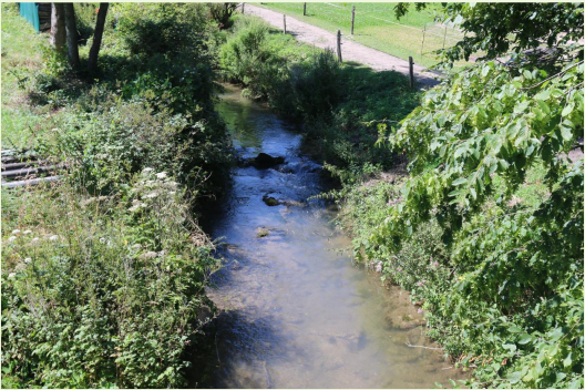
The soil and climate in the Broye catchment are highly suitable for arable production. Nevertheless, the area is experiencing a water shortage. The water availability from the Broye or Petite Glâne streams is often insufficient for irrigation and farmers are considering other options to mitigate increasing drought events. This project investigates the potential of natural small-scale water retention measures to mitigate drought stress in the future. Although the focus is on the Petite Glâne, the case study is extended to the entire Broye catchment for modelling and stakeholder involvement.
Scale of the project
Size of the project
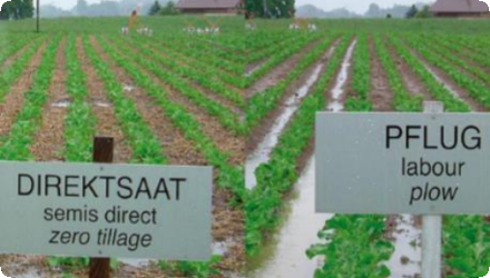
Both structural and agricultural NSWRM play important roles. Structural measures like riparian zone revitalization are costly and implemented in specific locations, but they are publicly funded by the federal government, cantons, and municipalities—not by individual farmers. In contrast, agricultural measures such as direct seeding, intercropping, and drought-resistant crops can be applied across many fields. While they may require upfront investment in machinery, they become cost-effective over time. Their broader applicability makes them a practical option for farmers, depending on local conditions and crop demand. The total cost projected includes: This includes: Slope Division for Erosion Control (scaled from 0.22 ha), Drought Resistant Crops (maintenance + seed), Revitalization of Riparian Zones (per ha cost), Intercropping (labour, equipment, plant material), Direct Seeding (machine + annual inputs), Maize Strip Tillage (machine + annual inputs)
| Authority name | Type of funding | Financing share | Comments |
|---|
Switzerland promotes (some) NSWRM through a mix of regulations, subsidies, and advisory support. Measures like conservation tillage and riparian buffers are tied to eligibility for direct payments under federal ordinances. River revitalisation is mandated by law (prioritisation areas at canotal level) but depends heavily on public funding and local coordination. While structural measures are centrally planned, agricultural ones are more widely applicable but require investment and compliance with ecological standards. Support for drought-tolerant crops remains limited to pilot efforts and advisory programs. Overall, implementation relies on cooperation across federal, cantonal, and local actors.
| Wider plan type | Wider plan focus | Name | Comments | |
|---|---|---|---|---|
| Target purpose | |
|---|---|
|
Improved Biodiversity
|
| Impact directive | Relevant impact |
|---|
| Pressure directive | Relevant pressure | |
|---|---|---|
| Requirement directive | Specification | |
|---|---|---|
| Arrangement type | Responsibility | Role | Name | Comments |
|---|
| Activity stage | Name | Key issues | Comments | |
|---|---|---|---|---|
|
Screening phase
|
MARG workshop
|
The project involves a Multi-Actor Reference Group (MARG) composed of farmers, local and regional authorities, NGOs, and researchers to co-develop realistic solutions tailored to regional challenges. Engagement with local communities and stakeholders.
|
| Policy area type | Policy area focus | Name | Comments | |
|---|---|---|---|---|
|
Common Agricultural Policy
|
||||
|
Primary
|
Water Framework Directive
|
Water management
|
The monitoring and maintenance approach combines model-based simulations with practical field validation (crop / discharge) to ensure both scientific robustness and real-world applicability. Monitoring is primarily conducted through the SWAT+ hydrological model, calibrated using local data.
| Success factor type | Success factor role | Comments | Order |
|---|---|---|---|
| Driver type | Driver role | Comments | Order |
|---|---|---|---|
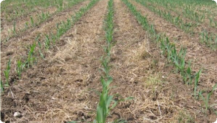
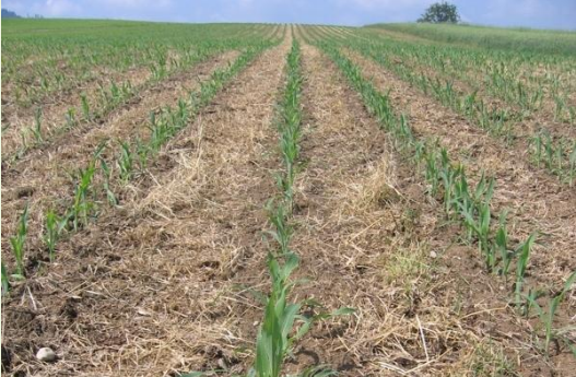
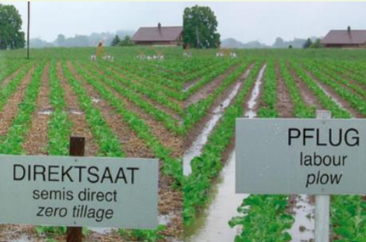
In the upper, more hilly part of the catchment, slope diversions are already in place, though large open fields without erosion control still pose challenges. Agricultural NSWRM such as minimum tillage practices have been introduced, albeit not yet widely adopted. Some farmers have also experimented with drought-resistant crops like sorghum as an alternative to maize, but broader implementation depends on market demand (e.g. suitability for fodder in dairy production).
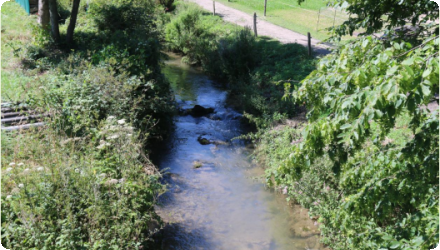
Structural NSWRM, particularly the revitalization of riparian zones, are being implemented through an ongoing cantonal program. According to model results, a combined approach using both structural and agricultural NSWRM yields the most effective outcomes in terms of water retention, erosion control, and nutrient management. However, large-scale adoption is contingent on various enabling factors including policy support, subsidy availability, land-use incentives, and economic viability of alternative crops.