Last update
2025
Summary
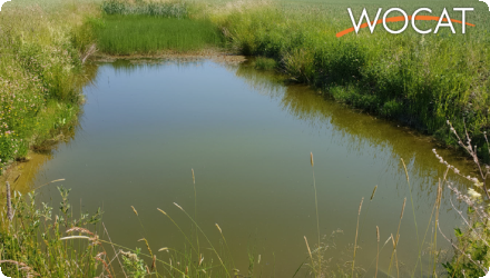
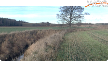
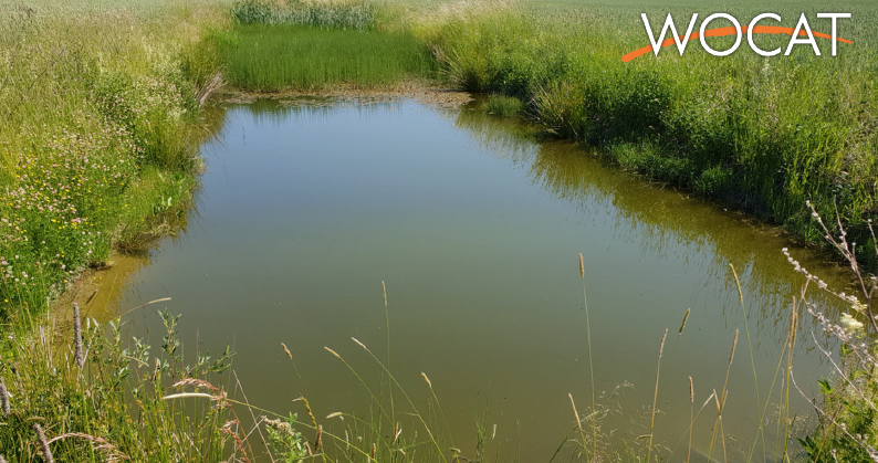
Sävjaån catchment is a lowland mixed land use catchment characteristic of central Sweden. Headwaters in the catchment drain a mixture of forest and agricultural land. Streams draining agricultural land are general deepened and straightened to promote drainage. Localized spring floods are common and summer droughts are increasing. Eutrophication is an issue throughout the catchment.
Position
Latitude
59.83054168118041
Longitude
17.670219687235484
Biogeographical Region
Boreal
Project
OPTAIN
Implementation Status
Modeled
Photo gallery
NUTS Code
SE03 - Östra Mellansverige
Sponge Measure(s) implemented in the case study
Involved Partners
| Authority type | Authority name | Role | Comments |
|---|---|---|---|
Climate
Climate zone
cool temperate moist
Annual Averages:
Precipitation
639 mm/year
Temperature
6°C
Geography
Groundwater level
< 5 m
Vegetation class
Riparian grasses, wetland vegetation, crops in adjacent fields
Water quality
Water bodies: Ecological Status
Good
Water bodies: Chemical Status
Good
Site Information Summary
Small-scale experimental and permanent interventions on agricultural land to reduce diffuse pollution and increase ecological integrity.
Scale of the project
Project scale
Micro
Project scale specification
localised ditches and buffer strips in fields
Size of the project
Project area
Varies; local plots to small sub-catchments (0.5–100 ha)
Area specifications
Rural, cropland, ditch networks
Principles
Principles
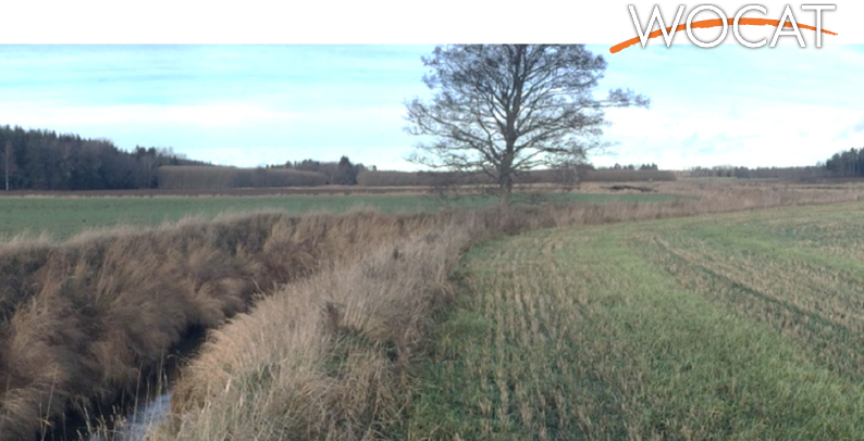
Riparian areas proximal to streams and ditches that are not in agricultural production
can slow the movement of particulate matter and water from fields to receiving
waters, thereby potentially limiting peak flow.
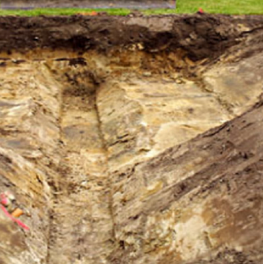
Drainage ditches with a "bench" or floodplain can slow the movement of water and
retain nutrients, benches function as wetlands when wet.
Wetlands/ponds are created to retain nutrients and prevent drought/flooding.
can slow the movement of particulate matter and water from fields to receiving
waters, thereby potentially limiting peak flow.
Drainage ditches with a "bench" or floodplain can slow the movement of water and
retain nutrients, benches function as wetlands when wet.
Wetlands/ponds are created to retain nutrients and prevent drought/flooding.
Design land use change
| Land use change type | Comment |
|---|---|
|
Other
|
Land ownership
Mixed ownership: individual, company, community/ village; cooperative arrangements with farmers
Community involvment
No
Design consultation activity
| Activity stage | Name | Key issues | Comments | |
|---|---|---|---|---|
Policy target
| Target purpose | |
|---|---|
|
Pollutants Removal
|
Policy area
| Policy area type | Policy area focus | Name | Comments | |
|---|---|---|---|---|
|
Primary
|
Environmental Policy
|
|||
|
Primary
|
Common Agricultural Policy
|
Part of wider plan
0
Wider plan type
| Wider plan type | Wider plan focus | Name | Comments | |
|---|---|---|---|---|
|
Regional
|
Water
|
Regional/catchment-based strategy under EU directives
|
Requirement directive
| Requirement directive | Specification | |
|---|---|---|
|
WFD-mitigation of significant pressure
|
Monitoring system
Presence of formal monitoring system
No structured long-term monitoring in place
Success factor(s)
| Success factor type | Success factor role | Comments | Order |
|---|---|---|---|
|
Other
|
main factor
|
<p>simplicity, ecosystem based </p>
|
|
|
Attitude of relevant stakeholders
|
main factor
|
<p>farmers collaboration</p>
|
Driver
| Driver type | Driver role | Comments | Order |
|---|---|---|---|
|
Legal obligations
|
main driver
|
EU Water Policy
|
|
|
Other
|
main driver
|
research-based evidence of effectiveness
|
Overall impact
Significant positive impact on runoff quality, biodiversity, and erosion control
Lessons learned Summary
Simple measures can have strong long-term effects but require maintenance and clear institutional responsibility
Conversion of agricultural edges to buffer zones or retention features