Last update
2025
Summary
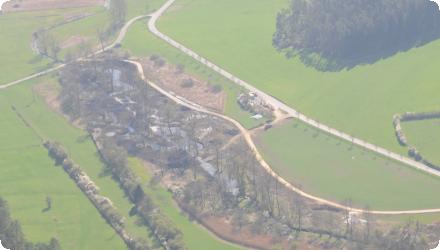
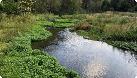
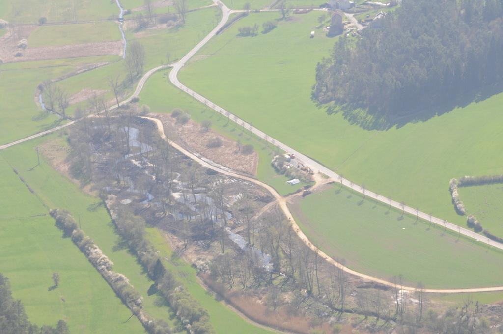
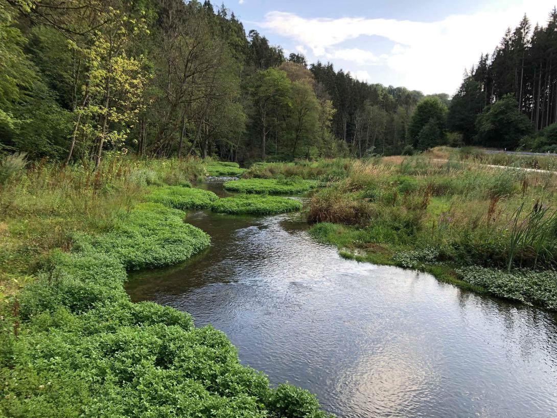
The Ernz Blanche (Luxembourg) river restoration sought to undo channelisation that had uniformised the river and increased downstream flooding. It relocated the watercourse into the thalweg, widened and/or raised the bed, re-meandered the channel, backfilled the former bed, restored adjacent streams, redesigned pipeline connections, and redeveloped areas around hydraulic structures.
After the 2002 feasibility, major works were delivered in 2010–2011 on the Koedange–Supp reach (~5 km), reducing flood peaks at Larochette (–3.8 m³/s; –25 cm) and creating ~110,000 m³ of storage (project cost ≈ €1.52 m). In 2016, longitudinal continuity downstream at Ernzen was restored via a pool-type fish pass at Wehnschelt and a rough ramp at Milleboesch. The project area has also been tied into the PC5 cycle path and Natura 2000 management.
Under Luxembourg’s 2021–2027 Flood Risk Management Plan, additional riverbed restoration and space-for-river measures are listed/advancing on several reaches, incl. 417 m at Larochette; 1,102 m along CR119 at Ernzen (in implementation); 2,739 m at Altlinster; and 629 m at Medernach. Recent 2025 decisions cover local flood-protection works and targeted sediment removal in Larochette, while continuous hydrometric monitoring at station “Larochette / Ernz Blanche” supports ongoing management.
Position
Latitude
49.7837
Longitude
6.2194
Project
NWRM
National Id
Luxembourg_2
Installation date
2002
Implementation Status
Contact
Alexandra Rossi, ACTeon
RBD code
LU RB_000
Transboundary
0
Photo gallery
Location of the project
On the White Ernz between Soup–Koedange–Larochette (Mëllerdall), near CR119/PC5 cycle path; approx.
NUTS Code
LU00 - Luxembourg
Project's objectives
Erase channelisation effects; re-meander & widen/raise bed.
Create ~110,000 m³ flood storage; reduce Q10 peak from 18.8 → 15 m³/s.
Restore adjacent streams & hydraulic structures; improve continuity.
Create ~110,000 m³ flood storage; reduce Q10 peak from 18.8 → 15 m³/s.
Restore adjacent streams & hydraulic structures; improve continuity.
Involved Partners
| Authority type | Authority name | Role | Comments |
|---|---|---|---|
Climate zone
cool temperate moist
Temperature
9,2
Precipitation
853
Annual rainfall range
600 - 900 mm
Elevation range
272 m
Slope range
2-5%
Vegetation class
The Natura 2000 site “Vallée de l’Ernz blanche” is dominated by beech forests (Asperulo-Fagetum 9130 ≈ 682 ha; Luzulo-Fagetum 9110 ≈ 139 ha), with alluvial alder-ash forests (91E0* ≈ 18 ha) and lowland hay meadows (6510).
Water bodies: Ecological Status
Poor
Water bodies: Chemical Status
Failing to achieve good
Water quality status
Historic channelisation/hydromorphological alteration; nutrient pressure evidenced by orthophosphate above “good” threshold at Koedange (2017); multiple fish barriers—several removed/mitigated since 2016–2022.
Project scale
Meso
Project scale specification
The measures span ~10 km of a river reach across several communes (river/sub-basin scale) with basin-level flood retention objectives and multiple sub-projects.
Performance timescale
> 20 years
Project area
6596000
Size
10
Size unit
km
Space-for-river restoration: relocate channel to thalweg, re-meander, widen/raise bed; reconnect floodplain and tributaries; redesign pipes/structures. Retention capacity ≈ 110,000 m³. Designed to lower 10-year peak from ~18.8 to 15 m³/s.
Connectivity: subsequent fish-pass works at barriers (e.g., Hessemillen, Bakesmillen, Neimillen, “am obersten Deich”).
Connectivity: subsequent fish-pass works at barriers (e.g., Hessemillen, Bakesmillen, Neimillen, “am obersten Deich”).
The NWRM was designed to reduce the peak flow for a 10-years storm (from 18.8 m3/s to 15 m3/s).
Design capacity description
NWRM aimed at reducing the maximum peak flow.
Steep Luxembourg Sandstone valleys with narrow floodplains over marl layers; permeable sandstone aquifer sustains baseflow. Valley geometry and prior straightening constrained options; state landownership was a favorable precondition.
Land next to the river is owned by the Grand Duchy of Luxembourg.
Total cost
€2.94 million
Costs investment
€ 2,940,000
Costs investment information
The investment costs cover all the earthworks and structures.
Costs operation maintenance information
The maintenance costs were not assessed in the feasability document. However, we can assume that they are low and that there are no extra maintenance costs compared to a usual river management.
Financing authorities
Type of funding
National funds
Policy context
Larochette is a village located along the Ernz Blanche River. It is regularly flooded, leading to damages on houses and community facilities. Classical flood protection measures (dikes, river banks, etc.) exacerbate the flood risk down stream.
The overall flood risk is due to urbanisation and the river canalisation upstream from Larochette, as well as river realignments.
The overall flood risk is due to urbanisation and the river canalisation upstream from Larochette, as well as river realignments.
Land ownership
State-owned riparian land: parcels along the project reach were owned by the Grand Duchy of Luxembourg, so no land acquisition was needed.
Community involvment
No
Design consultation activity
| Activity stage | Name | Key issues | Comments |
|---|
Policy target
| Target purpose |
|---|
|
Peak-flow reduction
|
|
Increase Water Storage
|
|
Improved Biodiversity
|
Policy pressure
| Pressure directive | Relevant pressure |
|---|
Policy impact
| Impact directive | Relevant impact |
|---|
Requirement directive
| Requirement directive | Specification |
|---|
Contractual arrangements
0
| Arrangement type | Responsibility | Role | Name | Comments |
|---|
Part of wider plan
0
Wider plan type
| Wider plan type | Wider plan focus | Name | Comments |
|---|
Edge of Field/Plot
A hydrological study was realised in order to measure the impact of the NWRM.
The benefits could in theory be assessed based on the costs of avoided damages due to floods in Larochette. This assessment has not been done.
Social benefits
Creation of an active tourism area, with a bike path.
Information on retained water
Creation of ~110,000 m³ retention, floodplain reconnection and channel complexity; design aimed to lower 10-year flood peak and delay flood wave at Larochette.
Peak flow rate reduction
15
Peak flow rate reduction unit
m3/sec
Information on Peak flow rate reduction
Reduction of the peak-flow rate in Larochette by 3.8 m³/s (from 18.8 m³/s to 15 m³/s).
Information on Reducing flood risks, quantity
Lowering of the high water level in Larochette by up to 25 cm
Water quality overall improvements
Positive impact-WQ improvement
Information on Water quality overall improvements
The wetland restoration leads to the improvement of self-purifying properties. This leads to improved overall water quality. Though, no assessment has been realized.
Soil quality overall soil improvements
N/A info
1
Wetland restoration is beneficial for the aquatic biotope.
Ecosystem impact climate regulation
No specific impact
Key lessons
The natural water retention measure was more cost effective than a classical measure. The possibility of building a rainwater retention reservoir was considered but costs amounted to about 10M€. The cost of the wetland restoration project was about 2,9M€.
Success factor(s)
| Success factor type | Success factor role | Comments | Order |
|---|
Driver
| Driver type | Driver role | Comments | Order |
|---|
Transferability
High where land control exists and basin-scale planning guides reach selection; needs hydrologic studies (e.g., flood-risk concepts), coordination with Natura 2000 objectives, and careful management of sediment/nutrient sources.
English