Last update
2025
Summary
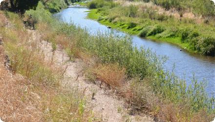
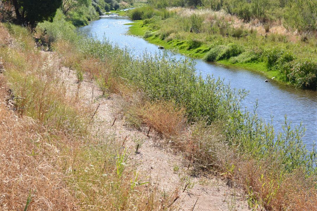
The Odelouca River: Natural bank stabilization and riparian buffer galleries as part of mitigation and compensatory measures and through the use of bio-engineering techniques.
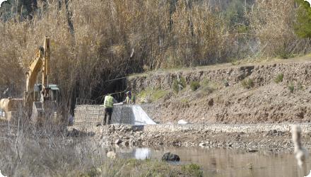
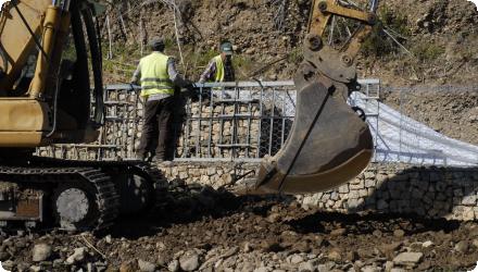
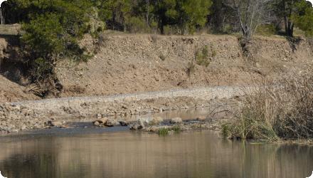
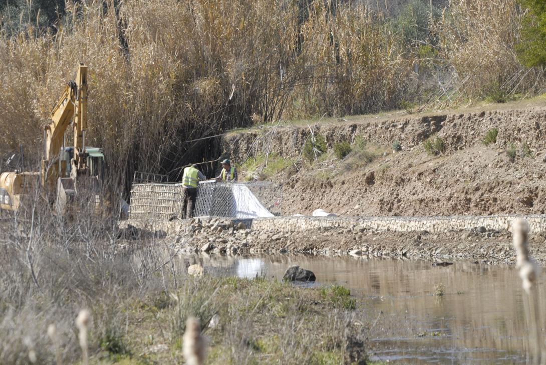
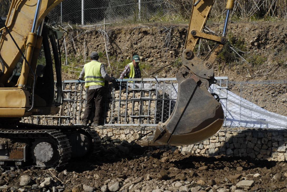
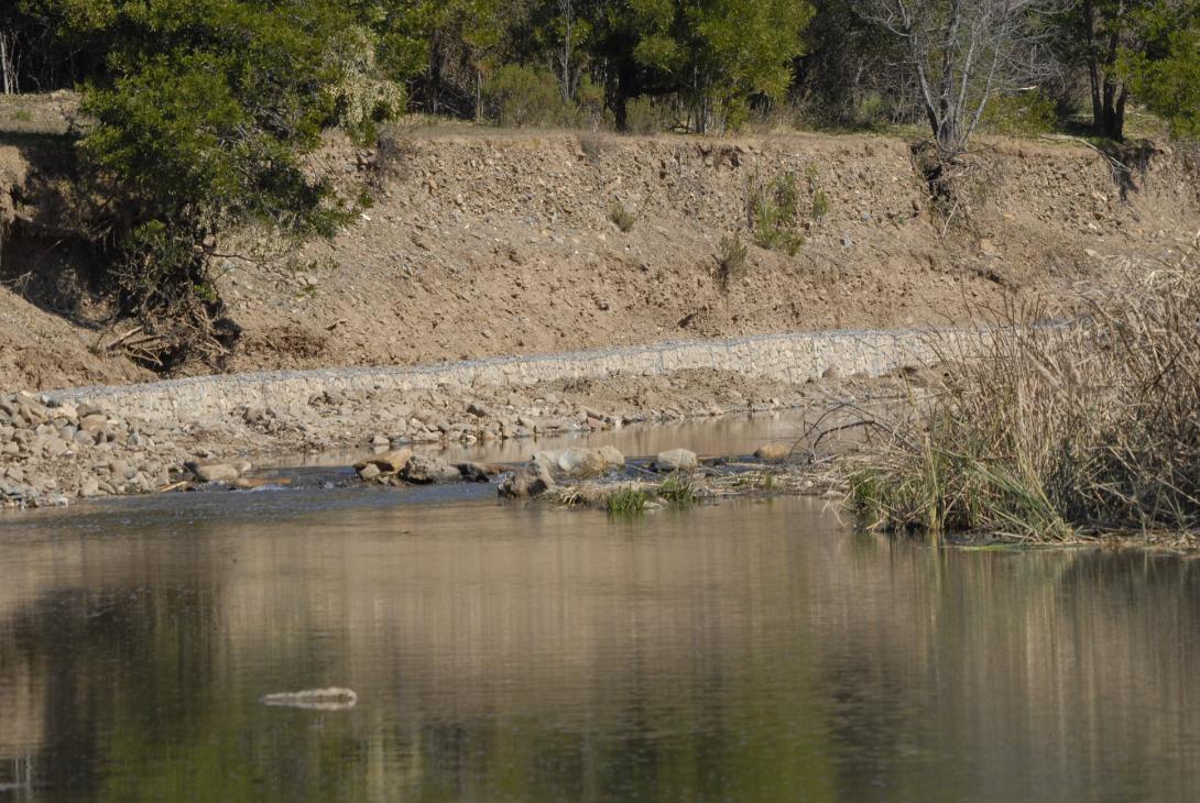
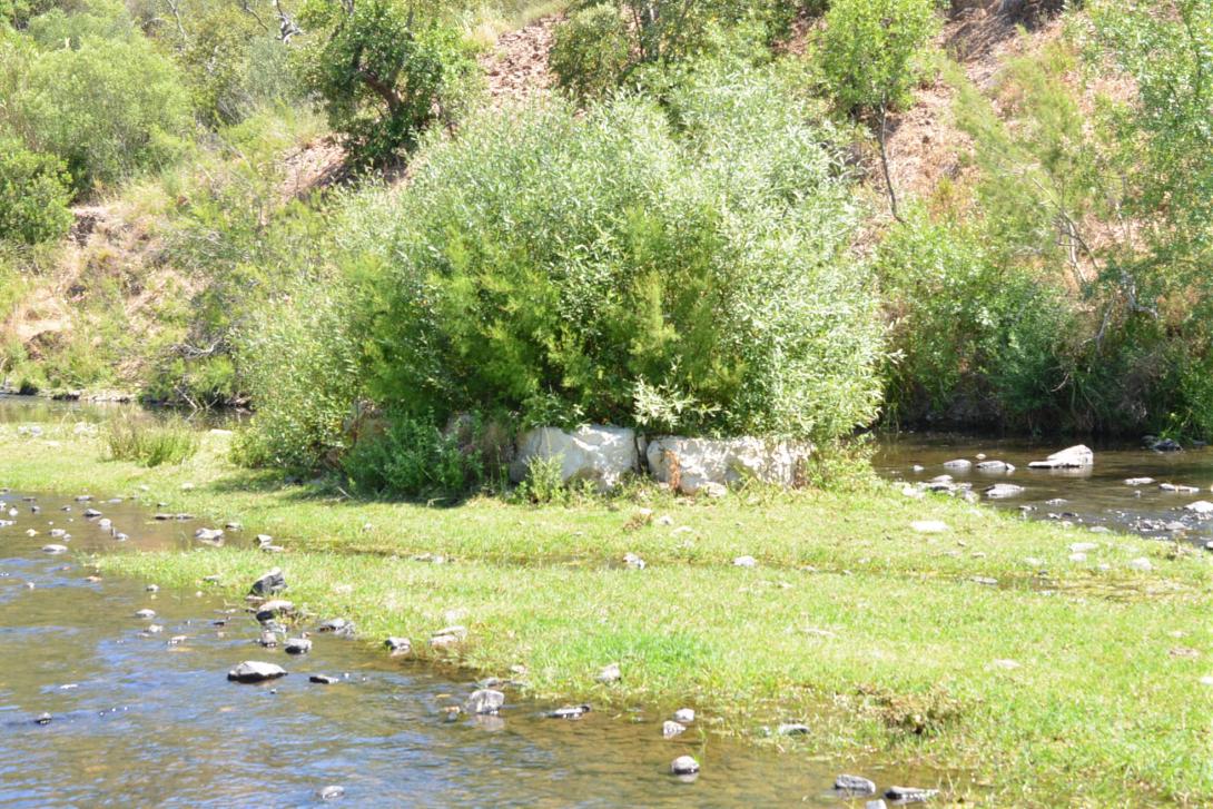
This project carried out in the Odelouca River (sub-catchment of the Arade River Basin, Algarve Region, South of Portugal) entailed the implementation of measures focused on the use of bio-engineering or natural techniques for rehabilitation of riparian buffer zones and river banks (such as river banks resectioning and placement of geotextile; live crib walls and vegetated gabions/rock armour construction and placement; planting of rehabilitated banks with native plant species; construction of artificial islands in the river channel, and clearance of invasive riparian plant species).
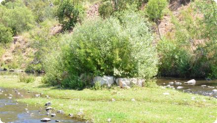
Today it remains a relevant and effective implementation. However it needs restoration, but there is apparently no intention to restart the project to the original goals.
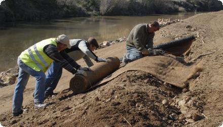
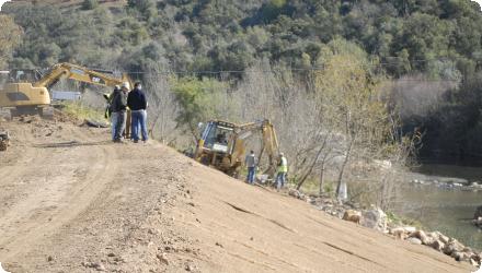
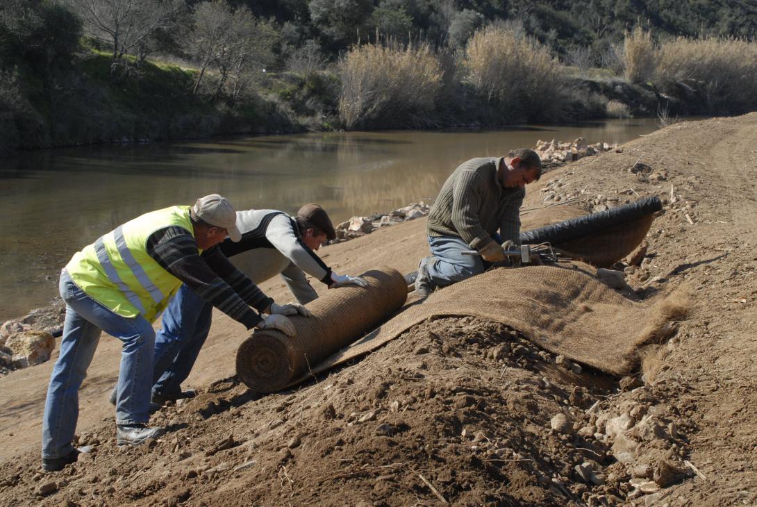
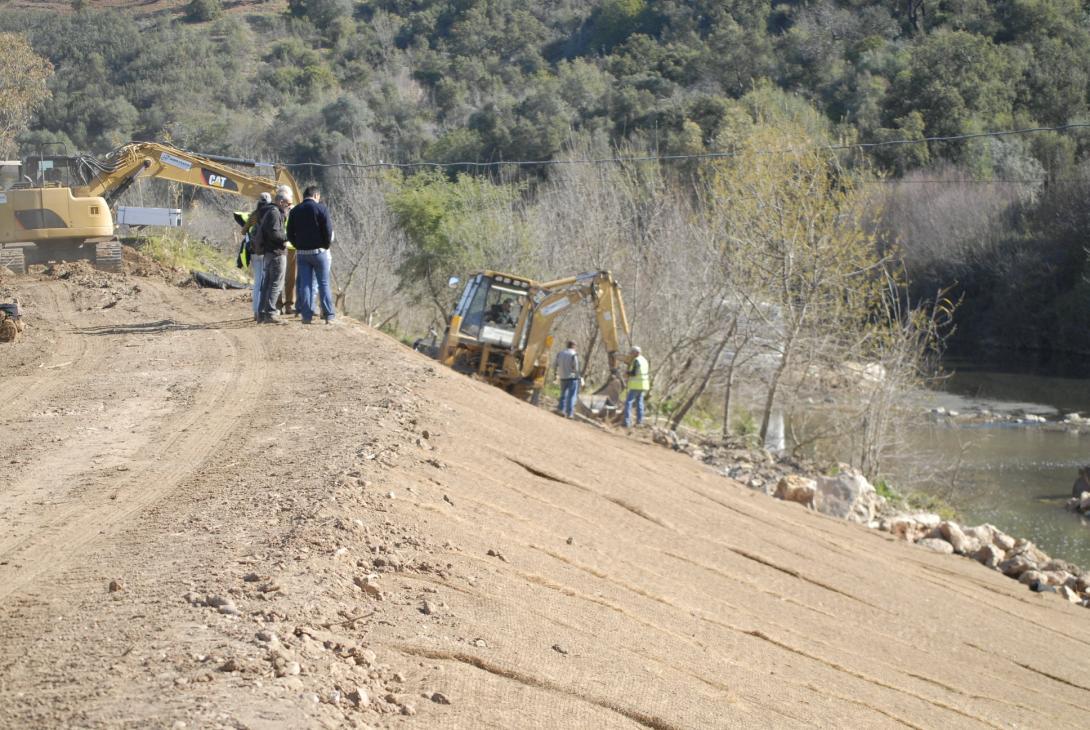
The measures implemented focus on the use of bio-engineering or natural techniques for rehabilitation of riparian buffer zones and river banks such as: i) resectioning of river banks and placement of geotextile to prevent erosion, retain soil moisture, prevent (re) growth of weeds and invasive plants and create favourable conditions for planted native plants (reed bed removal / placement of geotextile; 100% coco fibre with 2 polypropylene nets); ii) construction of a crib wall and placement of stone filled gabions to stabilise river banks (vegetated rock armour, live cribwalls (i.e Krainer wall), and vegetated gabions); iii) planting of rehabilitated banks with native plant species, collected from cuttings and seeds in the area and grown on in local nurseries (e.g. Tamarix, Oleander, buckthorn and ash); iv) construction of artificial islands in the river channel; v) clearance of invasive riparian plant species (Arundo donax and Acacia sp).
This project carried out in the Odelouca River (sub-catchment of the Arade River Basin, Algarve Region, South of Portugal) entailed the implementation of measures focused on the use of bio-engineering or natural techniques for rehabilitation of riparian buffer zones and river banks (such as river banks resectioning and placement of geotextile; live crib walls and vegetated gabions/rock armour construction and placement; planting of rehabilitated banks with native plant species; construction of artificial islands in the river channel, and clearance of invasive riparian plant species).
Today it remains a relevant and effective implementation. However it needs restoration, but there is apparently no intention to restart the project to the original goals.
The measures implemented focus on the use of bio-engineering or natural techniques for rehabilitation of riparian buffer zones and river banks such as: i) resectioning of river banks and placement of geotextile to prevent erosion, retain soil moisture, prevent (re) growth of weeds and invasive plants and create favourable conditions for planted native plants (reed bed removal / placement of geotextile; 100% coco fibre with 2 polypropylene nets); ii) construction of a crib wall and placement of stone filled gabions to stabilise river banks (vegetated rock armour, live cribwalls (i.e Krainer wall), and vegetated gabions); iii) planting of rehabilitated banks with native plant species, collected from cuttings and seeds in the area and grown on in local nurseries (e.g. Tamarix, Oleander, buckthorn and ash); iv) construction of artificial islands in the river channel; v) clearance of invasive riparian plant species (Arundo donax and Acacia sp).
Position
Latitude
37.255
Longitude
-8.496
Project
NWRM
National Id
Portugal_01
Installation date
2011
Implementation Status
Contact
Gonzalo Delacámara and Estefanía Ibáñez (IMDEA Water) in close cooperation with Samantha J. Hughes (UTAD, Portugal).
RBD code
PTRH8
Transboundary
0
Photo gallery
Location of the project
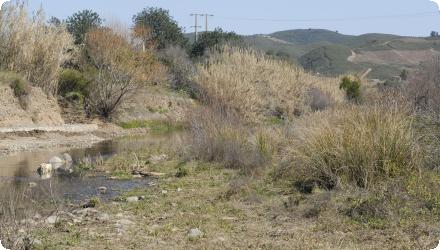
The Odelouca River, a sub-catchment of the Arade basin in south Portugal.
NUTS Code
PT15 - Algarve
Project's objectives
This is an integrated project related to compensation measures in face of dam built upstream, in a Nature 2000 habitat. It was designed to control the extensive fluvial erosion, with the dramatic collapse of the river banks, to control the invasion of giant reed, to establish the ecological flows to be released by the dam (calculated but never implemented) and to enhance the population of two endemic cyprinid fish species, with high conservation status, restricted to this area.
Involved Partners
| Authority type | Authority name | Role | Comments |
|---|---|---|---|
Climate zone
warm temperate dry
Temperature
17,6
Precipitation
934
Annual rainfall range
900 - 1200 mm
Remarks runoff imperviousness
Intermittent river with common floods in autumn.
Elevation range
150 m
Slope range
0-1% (The average slope of the basin is 26%)
Soil type
Luvisols
Vegetation class
Orchards, extensive agriculture, shrubland. Mediterranean riparian vegetation invaded by the exotic giant reed (Arundo donax)
Water bodies: Ecological Status
Moderate
Water bodies: Chemical Status
Good
Water quality status
Casual organic pollution caused by pig farming, no toxic contamination. P and N loads disposed in the river are 20/t/year and 236/t/year. Pig farming is responsible for 39 ton/N/year and 6 ton/P/year. Diffuse sources are for 35% (N) and 18% (P) loads.
Project scale
Large
Project scale specification
Watershed scale
Performance timescale
11 - 20 years
Area specifications
The project took place essentially along the river corridor, in 6 segments, each with an average length of 500-600 m
Size
The project took place essentially along the river corridor, in 6 segments, each with an average length of 500-600 m
Lifespan
15-20 years
The main objectives were to control the fluvial erosion, avoiding grey techniques; at the same time there was an attempt to improve general biodiversity, especially restoring the scarce riparian gallery and improving the habitat for native fish fauna.
To increase acceptability and participation of involved stakeholders (landowners)
The character of biological quality elements was assessed in relation to longitudinal changes in habitat quality, including riparian quality.
It was necessary to foresee a modification of the river channel, as downstream the dam the river flow varies (will be most likely reduced). The study area was divided into groups of physically similar units and then the extent of given pressures within each unit was assessed; habitat and riparian integrity and types of impact were quantified in the study area allowing impact specific rehabilitation measures to be drawn up. This was done using the KT method.
Legal obligations: with the construction of the dam structure and the subsequent flooding of the basin, was mandatory (EC) to implement compensatory measures, which would improve the river functionality, and the habitats linked to it.
The reforestation of riparian areas was done with native plant species, collected from local sites and grown in local nurseries. The design of the measures had to take into account the availability of water, and should mimic when possible the natural distribution of plants.
The reforestation of riparian areas was done with native plant species, collected from local sites and grown in local nurseries. The design of the measures had to take into account the availability of water, and should mimic when possible the natural distribution of plants.
High variability in rainfall patterns and risk of exposure to long drought periods may jeopardize the development of the riparian forest.
Besides, socio-economic aspects are relevant, as the alteration of the ecosystem is closely related to the economic activities being developed in the basin; in this specific context, irrigated agriculture.
The constrains were related to the private owners that accepted the project in their farms (fewer than expected); the favourable aspects were the possibility to collected native plants in the area that was later submersed by the reservoir, to use them for plant nurseries and to introduce them combined with the soil engineering techniques to stabilize the river banks.
Negative influence effectiveness
High variability in rainfall patterns and risk of exposure to long drought periods may jeopardize the development of the riparian forest.
Total cost
€ 5,700,202
Costs total information
This includes the total cost of the initial sub programme of measure (avifauna, fish fauna, riparian galleries and monitoring studies) (5,430,664 €) and the budget of the Project RICOVER for rehabilitation of riparian galleries (267,636 €).
Costs capital information
3,4 - 9,2 €/m2 (median: 4,5 €/m2): Cost range for geotextile application in similar projects carried out in Spain (Mediterranean basins)
20,7 €/m2: Cost of the application of geotextile (coco fibre) plus willow stakes in Spain.
Vegetated rock armour
72,3 €/m2: Live cribwalls (Krainer wall): 5 wood logs [h=2m; x=20cm] plus 30 willow (alive) stakes.
Vegetated gabions
3078 €/ha: Vegetation clearance (this is the average cost of 21 implemented projects in Spain). The range was 428 -7019 €/ha
25203 €/ha: Re-vegetation (this is the average cost of 21 implemented projects in Spain). The range was 1614 - 80249 €/ha
Costs operation maintenance information
The average annual maintenance cost for bioengineering measures (using live material) is 5% of the investment cost. Maintenance was only carried out in the initial 3 year period, thus the total maintenance cost could be estimated as the 15% of the investment cost.
Costs maintenance information
The average annual maintenance cost for bioengineering measures (using alive material) is 5% of the investment cost. It is foreseen that maintenance should be 3 year long, thus the total maintenance cost could be estimated as the 15% of the investment cost
Administrative annual costs
€ 15,902
Financing authorities
Type of funding
National funds
Comments
Main initial funding source was the Instituto Nacional de Agua (INAG), currently Âgencia Portuguesa do Ambiente (APA). (5,430,664 €)
Type of funding
EU-funds: Cohesion and regional development funds
Comments
Additional funding: SUDOE Interreg IV4b (Programme of Territorial Cooperation, via EU ERDF) (267,636 €).
Type of funding
Private funds
Comments
(15,902 €)
Compensations scheme information
It is not specified in the literature of the case that the agreement with landowners required a compensation payment. Landowners had to give their consent to the implementation of the measures affecting their property/land.
Policy context
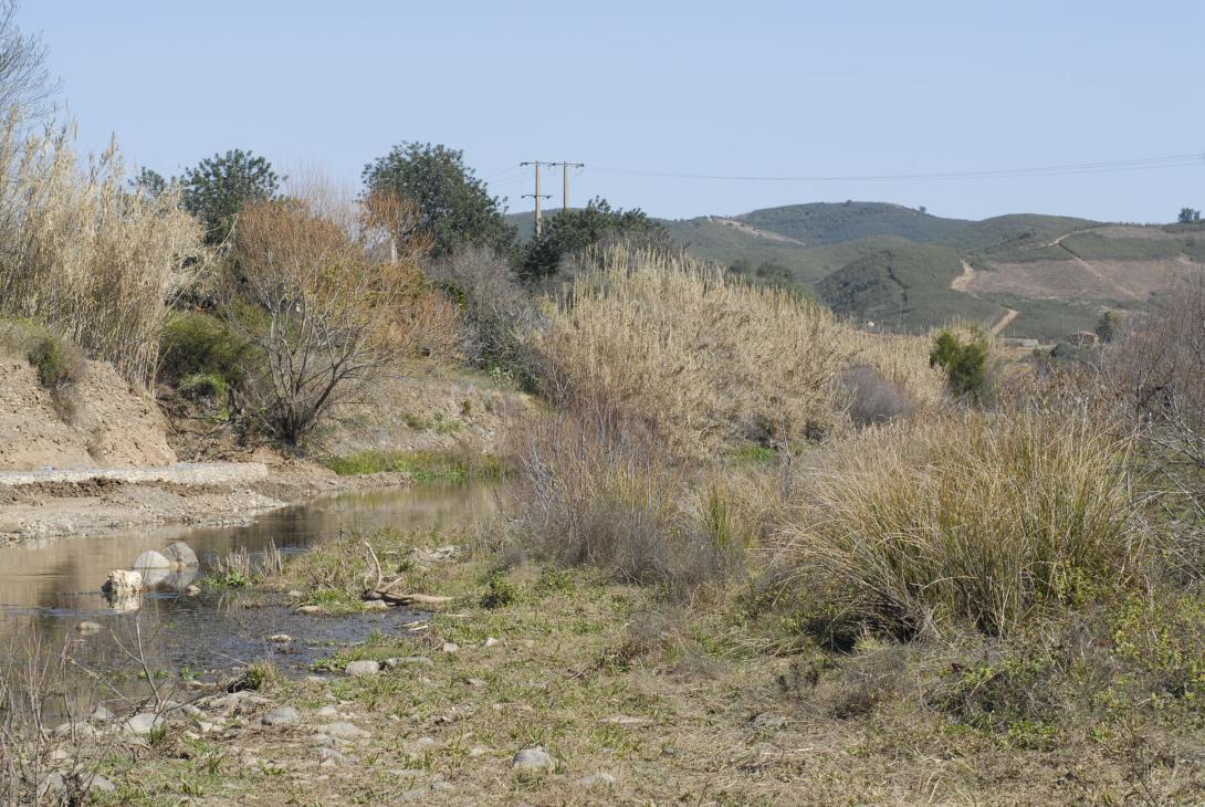
In Mediterranean rivers, main human impacts over the last century have been mainly related to changes in land use and alterations in water and channel management (Hooke, 2006; Aguiar and Ferreira, 2005). The construction of the Odelouca Dam (2010), to increase water supply for the Algarve Region (southern Portugal), implied a major morphological alteration in the middle course of the river Odelouca. Prior to the construction of the dam, upstream and downstream sections of the river had been already modified by human activities (due to agriculture of extensive citrus groves replacing riparian forest), causing disturbance in riverbanks and riparian vegetation. The lower course is the most degraded stretch subject to re-sectioning and canalization in some areas. In many places invasive reed and giant reed beds have also replaced the riparian woody vegetation. The dam construction, and the flooded area, affected the section of the river with better ecologically preserved, which triggered the need of restoring the river functionality, water retention capacity of the system and the ecosystem function.
- WFD identified pressures: 4.2.3 and 4.2.4 Dams, barriers and locks for drinking water and for irrigation; 4.1.2. Physical alteration of channel/bed/riparian area/ shore of water bodie for agriculture
- The Habitat Directive specific pressures: A09: irrigation; A10: Restructuring agricultural land holding (removal of hedges and copses or scrub (A10.01), stone walls and embankments (A10.02); including (temporary) transition from dry to mesic or wet conditions due to irrigation); Diffuse pollution to surface waters due to agricultural and forestry activities (H01.05) and to household sewage and waste waters (H01.08); I01: invasive non-native species; J02.05.04: Modification of hydrographic functioning, general (reservoirs); J02.06.01: Surface water abstractions for agriculture; J03.01: Reduction or loss of specific habitat features; J03.02: Anthropogenic reduction of habitat connectivity
Land ownership
Private owners, small farms.
Community involvment
Yes
Design consultation activity
| Activity stage | Name | Key issues | Comments |
|---|---|---|---|
|
Implementation phase
|
Attempt to inform the community about the project characteristics
|
It took place too late, when the machines were already in the field. It failed in attracting the residents into the project.
|
Policy target
| Target purpose |
|---|
|
Improved Biodiversity
|
|
Erosion Control
|
Target Remarks
Biodiversity and gene-pool conservation in riparia
Mass stabilisation and control of erosion rates
Soil formation and maintenance
Mass stabilisation and control of erosion rates
Soil formation and maintenance
Policy pressure
| Pressure directive | Relevant pressure |
|---|
Policy impact
| Impact directive | Relevant impact |
|---|
Impact remarks
The lower course was the most degraded stretch subject to re-sectioning and canalization in some areas.
Requirement directive
| Requirement directive | Specification |
|---|
Requirement directive remarks
Restoring riparian areas of surface waters via protected vegetated buffer zones goes beyond the concept of a buffer strip to provide a natural fully functional barrier to protect water bodies. This measure provides water purification services and improves river quality by reducing pollution caused by nutrients, pesticides, and suspended solids, flow (mass) regulation services by controlling erosion and sediment transport in addition to leading to runoff control. It contributes to the achievement of GES since it improves both the aquatic and the terrestrial ecosystems as it provides ecological corridors providing habitat services.
In turn, natural bank stabilization also leads to multiple benefits, improving all aspects of GES including improvement/regulation of hydrological regime (regulating river flows, improving the hydrological balance, increasing groundwater recharge and summer low-flow, increasing water exchange between the surface and the subsurface environment, and improving chemical and biological status). The improvement of GES also leads to increasing clean water availability and providing a water provisioning service.
Implemented measures thus contribute to the WFD art. 4, FD art. 7, HD objectives 1 & 2, and BD art. 3.
Policy challenges requirements
Monchique Site Natura 2000 (PTCON0037), ranked by Resolution of the Council of Ministers No. 142/97 of 28 August: preservation and conservation of existing habitats in the area, specifically those listed under the Habitats Directive transposed to national law by Decree-Law n.140/99 of 24 April.
The Liga para a Protecçao da Naturaleza (LPN) presented a complaint to the EC for the violation of the Natura 2000 protected area with the construction of the Odelouca Dam. A ministerial order in 2005 confirmed the continuation of the works, including the conditions stipulated by the EC for its construction.
The Liga para a Protecçao da Naturaleza (LPN) presented a complaint to the EC for the violation of the Natura 2000 protected area with the construction of the Odelouca Dam. A ministerial order in 2005 confirmed the continuation of the works, including the conditions stipulated by the EC for its construction.
Contractual arrangements
1
| Arrangement type | Responsibility | Role | Name | Comments |
|---|---|---|---|---|
|
Contractual agreement
|
Agreements between landowners and project implementators
|
Part of wider plan
1
Wider plan type
| Wider plan type | Wider plan focus | Name | Comments |
|---|---|---|---|
|
Local
|
Water
|
Compensation measures of dam built in this protected area
|
This was part of a wider plan that included another emblematic and successful project (with national projection) in the area: the reintroduction of the lynx population extinct in the region for several decades.
|
The project was monitored the first 3 years after conclusion, but no follow-up was introduced afterwards. This monitorization was conducted by the project team, activity that was included in the contract.
The first 3 years there was a monitorization to assess the success of control of the invasive giant reed and the bank stabilization with bioengineering techniques to stabilize river banks. However, there was not even monitorization of the habitats created to protect 2 endemic fish species after the installation of shelters.
Maintenance
No maintenance took place after the initial period. No watering of plants despite the harsh summer after plantation. Geotextile decomposits in 2 years. Gabions have a lifetime of 25 years. Wooden logs rot, the grown vegetation become stabilizing.
Edge of Field/Plot
For the sampling programme of 2012, the WFD compliant protocols were used: Biological Quality Elements (BQE), and physicochemical and hydromorphological support elements. Additional protocols to assess the quality of riparian habitat (and habitat quality in general) were used along the 7km stretch. The findings were compared with defined control sites located upstream the reservoir, which were considered as spots with a "more natural" riverine condition.
- Improvement of water retention capacity in the system
- Reduction of flood vulnerability due to a better developed riparian forest
- Improvement of water quality
* The economic activity of the region is based on traditional activities, which occupied the riversides of the Odelouca with fruit trees (citrus) annual irrigation crops, vegetables gardens and livestock. Traditionally, landowners use as protection for flood risk ripraps and earth embankment, proving memory on past flood events (causing relevant damages). Despite the initial mistrust in the measures to be implemented, most landowners gave their permission to develop works within their property, which will have direct benefits on flood protection, improved soil composition, water availability, and landscape improvement.
- Water retention in riverbanks and improvements in infiltration capacity will provide better water security (reliability of supply and resilience to drought). Water provision to deliver water services to the economy, in particular to irrigated agriculture
- Flood security and protection (delay on flood peaks)
- Amenities (associated to habitat protection): fish and plants, tourism, recreation, and others
- Sediment retention
- Carbon fixation
- Wildlife habitats and ecological corridors
- Streambanks stabilization
- Providing shade, organic matter, food for streams and their biota
- Filtration of chemicals and other pollutants
Information on runoff reduction
The restored cover of trees and bushes in the riparian gallery will intercept precipitation when it reaches a more mature structure, as currently, not enough time lapse has occurred to perceive these effects. Intercepted precipitation reduces direct runoff and delays the onset of peak flows, and it will become more efficient with a larger and more complex structure of the riparian gallery (i.e. width, different heights/layers of vegetation within the gallery). Some of the measures included the creation of artificial islands in the river channel, which may control the flow regime. Besides, the restoration of riverbanks and the elimination of invasive reed will reduce and diversify stream flow velocity.
Information on Peak flow rate reduction
The Odelouca is a regulated river now where the flow regime downstream is a managed environmental flow that is released from the Odelouca dam.
Information on Increased groundwater level
A developed riparian forest increases the density of roots in the soil and creates coarse substrates. During periods of high-energy flow, plant debris and sediments are conveyed and deposited downstream as the flow decreases, increasing habitat heterogeneity. A more heterogeneous structure of soils and riparian areas improve retention via infiltration of water from the river itself during peaks in flow and from precipitation.
Information on Increased infiltration
A developed riparian forest increases the density of roots in the soil and creates coarse substrates. During periods of high-energy flow, plant debris and sediments are conveyed and deposited downstream as the flow decreases, increase habitat heterogeneity. A more heterogeneous structure of soils and riparian areas improve retention via infiltration of water from the river itself during peaks in flow and from precipitation.
Information on Soil moisture
A well-developed riparian gallery provides organic matter to the soil through falling leaves and decomposition of senescent plants, which contributes to the creation of natural mulch. The result is an increase of organic content of the soil, which enhances its moisture content and fertility. Other side benefits of a developed riparian forest are the increase of shade areas, lowering local surface and air temperatures, thereby reducing rates of evapotranspiration.
Information on Reducing flood risks, quantity
Bank storage of water has been enhanced with the implemented measures and thus its important role in reducing flood intensity and sustaining stream flow decreases. Measures have effect on the slope, rugosity, complexity and state of the riverbank, which are important factors in water storage capacity and retention.
Information on Restoring hydraulic connections
The restoration of riverbanks improves lateral connectivity of the river (interaction of the river with the valley) and vertical interaction with groundwater.
Information on Ecosystem flood control volume
Bank storage of water has been enhanced with the implemented measures and thus its important role in reducing flood intensity and sustaining stream flow decreases. Measures have effect on the slope, rugosity, complexity and state of the riverbank, which are important factors in water storage capacity and retention.
Information on Ecosystem erosion control
vegetated riverbanks help to reduce erosion and thus the amount of sediments in the river flow. Vegetation in riverbanks enhances drainage of soils close to the water level preventing them from collapse, supporting adjacent terrain weight. A study (Beeson & Doyle, 1995) in 748-curve river stretches, 67% of non-vegetated areas suffered erosion during a storm event, while 14% of vegetated areas did under same conditions.
Information on Water quality overall improvements
There is not measured evidence yet, but a well-developed riparian forest will also help retain pollutants (i.e excess nutrients from agriculture) by "defiltering" water as it moves to the groundwater helping to prevent contamination of aquifers.
Information on Soil quality overall soil improvements
Increase in organic matter in soil and the development of roots enhances its structure and improves its functionality.
Information on WFD ecological status obj quantity
In 2012, the sampling programme revealed that the overall ecological status of Odelouca river and its tributaries is “excellent” and “good”, despite some spots, which remain heavily organically polluted. However, in the 3rd River Basin management plan (WFD2022 Ecological Status), it was "Moderate" ecological status.
1
The Odelouca River is part of the Natura 2000 Network, as it is the habitat of two endemic fish species and the Iberian Lynx. By recovering the river functions, and retaining water, a proper functioning of ecosystems to support the habitat of these species is possible.
Ecosystem impact climate regulation
No information available
Ecosystem provisioning services
0
Key lessons
- Artificial water retention measures (i.e. dam) do induce significant hydromorphological pressures on streams, thus hindering, among other things, natural water retention capacity downstream.
- Forested riparian zones deliver a number of ecosystem functions and services such as storing and fixing carbon; serving as wildlife habitats and ecological corridors; stabilizing riverbanks; providing shade, organic matter, and food for streams and their biota; retaining sediments and filtering chemicals (fertilizers and pesticides). Therefore, further to their effect on water yield, they contribute to a wide range of benefits for society.
- Riparian afforestation is by no means just about planting trees but also about introducing other vegetation types such as scrub, mostly through laterally recovering space for the river. Afforestation is compatible (and there are synergies indeed) with riparian clearing (in this case of invasive species).
- Although there is still no evidence available for the Odelouca sub-catchment, it all suggests that nitrogen levels can be reduced in rivers (by plants or microbial denitrification) through forcing water to circulate through afforested riparian buffers.
- The Odelouca case study is a good example about the characterization and assessment of intermittent Mediterranean river systems for restoration and requalification measures, including bioengineering techniques, closely related to green infrastructures.
- Monitoring is critical. River Habitat Survey (RHS) is a good way of assessing habitat quality including riparian complexity, diversity of hydromorphological features and artificialisation of aquatic habitats (features that may affect facets of the local water cycle).
- Riparian vegetation is central to the physical, chemical, and trophic health of streams. However, riparian restoration is still its formative stage and can be a complex process.
- Further efforts on the ex-post assessment of the impacts of vegetation changes on seasonal water yield and flow regime would be required.
Success factor(s)
| Success factor type | Success factor role | Comments | Order |
|---|---|---|---|
|
Successful coordination between authorities
|
main factor
|
<p>Cooperation between Aguas do Algarve, the promoter company of the Odelouca dam, and the rest of stakeholders enables the implementation of the measures relevant for the restoration of damage sections of the river.</p>
|
1
|
|
Attitude of relevant stakeholders
|
main factor
|
<p>Despite the already mentioned initial resistence, the initiative managed to get most of the needed permissions from landowners in order to start the works. 25 landowners accepted. Out of 32 identified private plots, 22 agreed to participate</p>
|
2
|
|
Existing staff and consultant knowledge
|
The bioengineering techniques were successful and appropriated to mitigate the impact of the frequent floods during the fall period. They were adapted to the characteristics of each river reach and this explain the success. |
5
|
Driver
| Driver type | Driver role | Comments | Order |
|---|---|---|---|
|
Legal obligations
|
main driver
|
The project advanced and was financed as a consequence of construction of a dam (for water supply to populations in the Algarve) in a Nature 2000 habitat. EU authorities demanded inherent compensation measures in order to accept the dam.
|
1
|
Flexibility adaptability
The initial report of the intervention (definition of the river sections affected by the programme, and the bio-engineering and traditional measures to be applied) was modified regarding:
- The actual physical conditions of the sections
- Suggestions and demands of landowners in order to accept the intervention - Alteration in the erosion processes, which were verified regarding the fragility of marginal habitats and the expansion of the reed.
- The actual physical conditions of the sections
- Suggestions and demands of landowners in order to accept the intervention - Alteration in the erosion processes, which were verified regarding the fragility of marginal habitats and the expansion of the reed.
Transferability
Easily transferable, in terms of the techniques (and plants) to be used in the restoration of a typical Mediterranean river, which is much more challenging than permanent streams.
English