The study site is sensitive to nutrient and nitrate loss. Extreme weather events, the presence of loose parent material and a lack of best management practices in some part of the study site increase soil degradation, especially gully erosion. The water and nutrient management of this small catchment affects water quantity and quality of Lake Balaton. Extreme weather events will increase the environmental and social conflicts in the region.
The most pressing issues recognized in the study site are: revise the aspects considered for the delineation of soil erosion prone areas, wider application of measures that efficiently decrease soil erosion and nutrient load, and implementation of integrated water resources conservation.
OPTAIN project aims to identify effective combination of the NSWRMs and optimize their allocation, in order to improve water and nutrient retention in the soil and the catchments. Emphasis will be put on suitable options to foster the resilience of agricultural production to climate change.
| Authority type | Authority name | Role | Comments |
|---|---|---|---|
Climate
Annual Averages:
Water quality
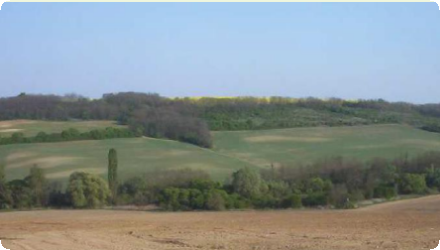
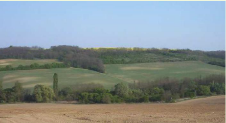
The case study belongs to the catchment of Lake Balaton. Its climate is moderately warm and moderately humid. For the study period, the average annual temperature is 11.2 °C, and the average annual precipitation is 689 mm. The catchment is an erosional hilly area with elevations ranging from 124 m to 300 m. Its dominant soil types are Cambisols, Luvisols, Regosols and Gleysols. The study area consists of 52 % forest, 31 % arable land, 3 % orchard, 5 % grassland and 4 % urban areas.
Scale of the project
Size of the project
| Land use change type | Comment |
|---|---|
| Authority name | Type of funding | Financing share | Comments |
|---|
Hungary's Common Agricultural Policy (CAP) Strategic Plan for 2023-2027 emphasizes sustainable water management through various water retention measures aimed at enhancing environmental sustainability and climate resilience. Key initiatives include financial support for non-productive water protection investments and implementation of NSWRMs. For the 2025–2029 period, the payment system supports soil-improving managements on arable land.
In order to change land management practices on landscapes within the watershed the following stakeholders will be involved in the development and implementation of the project: General Directorate of Water Management, Local farmers, Balaton Limnological Institute, Lake Balaton Development Council, Hungarian Young Farmers Association (AGRYA), Hungarian Chamber of Agriculture (NAK), AGRO PROFI, and WWF Hungary.
| Wider plan type | Wider plan focus | Name | Comments | |
|---|---|---|---|---|
| Target purpose | |
|---|---|
|
Runoff control
|
|
|
Pollutants Removal
|
|
|
Erosion Control
|
|
|
Oher Societal Benefits
|
| Impact directive | Relevant impact |
|---|
| Pressure directive | Relevant pressure | |
|---|---|---|
| Requirement directive | Specification | |
|---|---|---|
| Arrangement type | Responsibility | Role | Name | Comments |
|---|
| Activity stage | Name | Key issues | Comments | |
|---|---|---|---|---|
| Policy area type | Policy area focus | Name | Comments | |
|---|---|---|---|---|
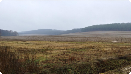
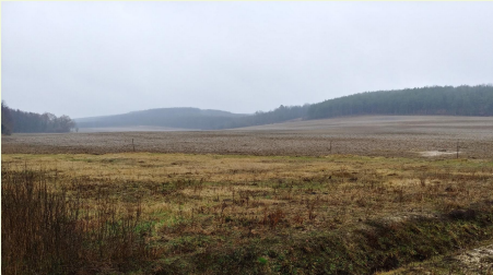
Hydrometeorological monitoring of the Tetves Stream is performed by the South-Transdanubian Water Directorate.
The maintenance cost for forested riparian buffers is 335 €/ha. Shrub-grass riparian buffers have a maintenance cost of 248 €/ha, while grassed riparian buffers cost 196 €/ha to maintain. Forested erosion control strips also require 335 €/ha in maintenance, and shrub-grass erosion control strips cost 248 €/ha. Grassed erosion control strips have a maintenance cost of 196 €/ha. For no-till with cover crops, there is a reduction in maintenance costs of 2 €/ha due to lower fuel consumption. Similarly, min-till results in a maintenance cost reduction of 55 €/ha, thanks to fewer field operations. Lastly, the conversion of arable land to grassland has a high maintenance cost of 787 €/ha.
| Success factor type | Success factor role | Comments | Order |
|---|
| Driver type | Driver role | Comments | Order |
|---|
Mintill management has high projected favourable impact on posphorus loss and sediment loss and expected to increase percolation and soil moisture content of the profile. Its efficiency is related to the area covered as well, which was 100% of the cropland in our study.
Cropland-to-grassland uses more water than cropland which results in lower soil moiture content and maximum flows in the simulation. It is expected to significantly decrease sediment loss. Among the analysed NSWRMs, this one is projected to reduce soil erosion the most.
Riparian buffers are projected to be effective in improving water quality - decreasing phosphorus load and sediment load in the stream - , but have low influence on water retention. Erosion control strips are expected to reduce sediment loss. These linear landscape elements cover small areas, however, they are converted into non-productive land.