Last update
2025
Summary
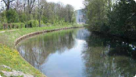
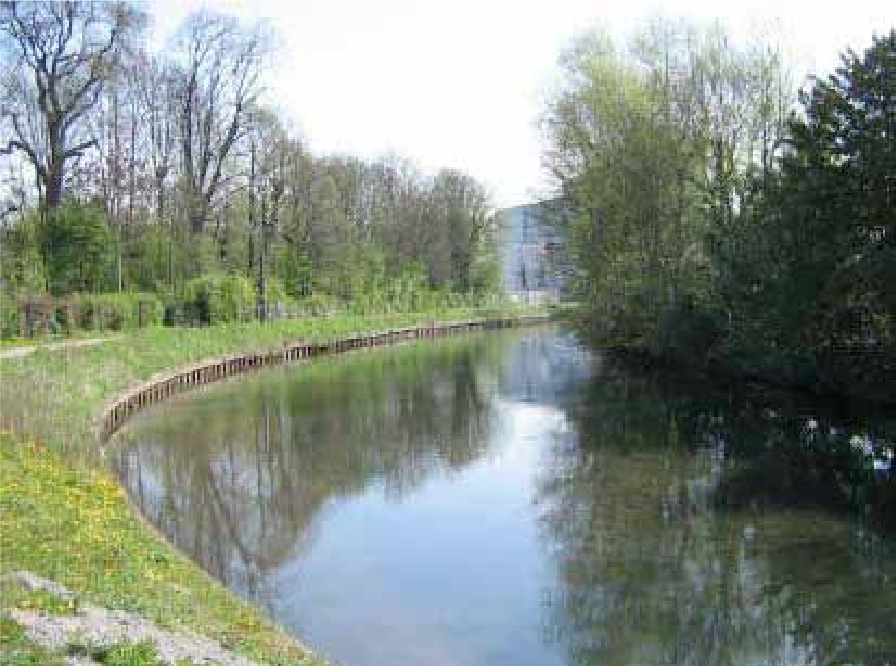
The Scarpe in Arras (long canalised) was renatured (2009–2012) to balance navigation, recreation and ecology. Actions included removal of sheet piling, gentle bank reprofiling, mixed bio-engineering (hemp bundles, vegetated geonets, gabion mattresses where needed), riparian restoration (invasives removal, seeding, pollarded white willows), controlled access, and creation of a lagoon.
The project treated 1,760 m of banks and built two reedbeds (≈1,000 m² and 1,450 m²). In the same programme, a 1.4 ha pike spawning area at Fampoux was re-opened and reconnected to the Scarpe. Governance shifted in 2012 via a VNF→Arras Urban Community (CUA) convention; FDAAPPMA 62 manages the spawning sites. Baseline surveys were done in 2010 with a five-year follow-up planned.
Total cost €1,321,310 (studies €132,277; works €1,189,032), co-funded by Artois-Picardie Water Agency 51%, ERDF 48%, CUA 1%.
The reach remains actively managed. In 2022 the environmental authority (MRAe) reviewed a 10-year dredging plan (~180,000 m³) to secure a 1.65 m navigation draft, notably around the Saint-Laurent-Blangy water-sports base, and requested stronger WFD compliance, better fish/European eel assessment, and a catchment-scale response to upstream sediment inputs. Together, the restoration and ongoing management aim to diversify habitats while keeping the canal’s socio-economic uses.
Position
Latitude
50.293
Longitude
2.7818
Project
NWRM
National Id
France_03
Installation date
2012
Implementation Status
Contact
Elia Desmot, OIEau
RBD code
FRA
Water body code
AR48
Transboundary
0
Photo gallery
Location of the project
The Upper Scarpe Canal, which flows for 23 km, connects Arras to Corbehem via navigation through nine locks.
NUTS Code
FR30 - Nord - Pas-de-Calais
Project's objectives
Improve biological & chemical quality; recreate reproduction habitats. Targets: maintain burdock, pike & eel populations; establish ≥1 amphibian species; double the number of bird and insect species vs 2010 baseline.
Involved Partners
| Authority type | Authority name | Role | Comments |
|---|---|---|---|
Climate zone
cool temperate moist
Temperature
10.8 °C
Precipitation
618
Annual rainfall range
600 - 900 mm
Elevation range
75 m
Vegetation class
Reedbeds (Phragmites) from two constructed roselières (≈1,000 m² & 1,450 m²), helophyte fringes, and riparian white willow (Salix alba) pollarded; hydrophilous bank flora.
Water bodies: Ecological Status
Poor
Water bodies: Chemical Status
Failing to achieve good
Water quality status
Heavily modified canal reach: past sheet-piling, limited habitats; sediment infill from upstream; runoff of agricultural inputs in marshes; invasive plants; leisure & geese pressure; WFD compliance issues flagged for dredging.
Project scale
Micro
Project scale specification
Works on ~1.76 km of banks within a specific urban reach, plus a single oxbow-type lagoon and one 1.4 ha pike spawning area—localised hydromorphology and habitat measures.
Performance timescale
< 1 year
Size
1,760
Size unit
m
Lifespan
100
Multi-functionality: reconcile navigation/recreation with ecological restoration. Strategies: remove sheet-piling; gentle re-grading; bio-engineering (gabion mattresses + vegetated geonets; helophyte bundles); riparian restoration; controlled access; create alluvial annex/lagoon. Capacities (not storm-event-based): 1,760 m banks treated; reedbeds ~2,450 m² total; pike spawning area ~1.4 ha; dredging plan targets 1.65 m draft (separate O&M).
Low-slope canalised river with historic sheet-piling; access constraints required working from water; strong leisure use and geese grazing; need to maintain navigation; presence of valuable but fragmented wetland habitats; prior dragage needed to mobilise equipment.
River banks protected by grey infrastructure
Population favourable to the change
Total cost
€1,321,310
Costs total information
Preliminary studies : € 132,277
Works and developments : € 1,189,032
Works and developments : € 1,189,032
Financing authorities
Type of funding
Sub-national funds
Type of funding
EU-funds: Cohesion and regional development funds
Type of funding
Local funds
Compensations
0
Policy context
Protection of riverbanks. Current dredging PGPOD (10 yrs, ~180,000 m³) reviewed by the environmental authority, which requested stronger WFD alignment and fish/eel assessments and urged basin-scale sediment management.
Land ownership
Public river domain (State/VNF). Day-to-day management of the canalised reach was delegated to the Arras Urban Community (CUA) from 1 Jan 2012. Spawning sites managed with the Pas-de-Calais anglers’ federation.
Community involvment
No
Design consultation activity
| Activity stage | Name | Key issues | Comments |
|---|
Policy target
| Target purpose |
|---|
|
Improved Biodiversity
|
|
Peak-flow reduction
|
|
Pollutants Removal
|
|
Oher Societal Benefits
|
Target Remarks
Improve biological and chemical water quality in the Scarpe river
Recreate breeding habitats for species
Recreate breeding habitats for species
Policy pressure
| Pressure directive | Relevant pressure |
|---|
Policy impact
| Impact directive | Relevant impact |
|---|
Requirement directive
| Requirement directive | Specification |
|---|---|
|
WFD-achievement of good ecological status
|
|
|
WFD-restoring a HMWB
|
Contractual arrangements
0
| Arrangement type | Responsibility | Role | Name | Comments |
|---|
Part of wider plan
1
Wider plan type
| Wider plan type | Wider plan focus | Name | Comments |
|---|
Checking of vegetation's health
Unknown
Information on retained water
Improved lateral connectivity via annex lagoon; diversification of marginal habitats; replacement of hard banks with low-slope vegetated margins; expected gains in habitat complexity. No quantified water-retention volume reported.
Water quality overall improvements
N/A info
Information on Water quality overall improvements
The riparian area associated to the river has been improved and therefore the pollution is better managed
Soil quality overall soil improvements
N/A info
Information on Soil quality overall soil improvements
Biodiversity enhanced
1
New fish species and vegetation development observed.
Ecosystem impact climate regulation
No specific impact
Information on Ecosystem impact climate regulation
Not mentioned
Ecosystem provisioning services
1
Information on Ecosystem provisioning services
Amenity space, improvement of water quality
Key lessons
The revitalisation of the Scarpe River led to an improvement and a diversification of its related aquatic and terrestrial habitats. Therefore, this project participated in enhancing the ecological status of the river, expected to be good by 2021. The perception of the population was very positive thanks to the amenity space provided. However, the fact that the work took place from the river made its realisation difficult and a population of gooses is now disturbing the growth of the planted vegetation.
The various developments carried out allow for the reconciliation of both the ecological value of the site and the use of the waterway, namely commercial navigation, recreational boating, and associated leisure activities. As a result, the site's landscape value is enhanced, with a positive impact on tourism or recreational boating, as well as on leisure activities (such as walks...).
The various developments carried out allow for the reconciliation of both the ecological value of the site and the use of the waterway, namely commercial navigation, recreational boating, and associated leisure activities. As a result, the site's landscape value is enhanced, with a positive impact on tourism or recreational boating, as well as on leisure activities (such as walks...).
Success factor(s)
| Success factor type | Success factor role | Comments | Order |
|---|---|---|---|
|
Attitude of relevant stakeholders
|
1
|
Driver
| Driver type | Driver role | Comments | Order |
|---|---|---|---|
|
Organisation committed to it
|
1
|
Transferability
Applicable to canalised urban rivers. Key cautions: geotechnical stability of regraded banks; invasive-species control; balancing navigation with habitat goals; address catchment sediment sources or dredging benefits won’t persist; document WFD non-deterioration.
English