
Completed

Summary
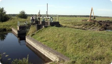
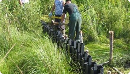
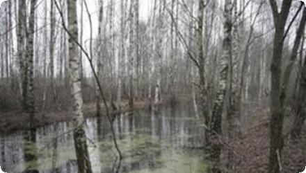
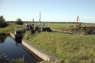
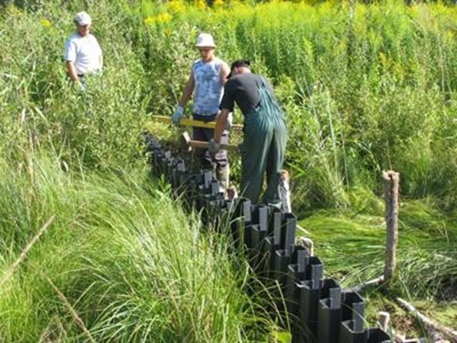
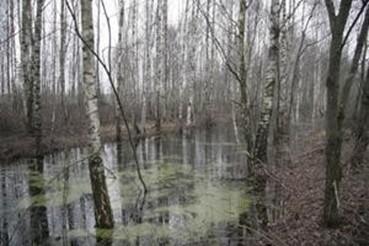
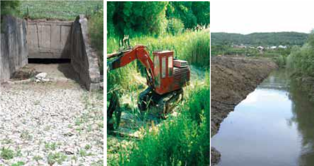
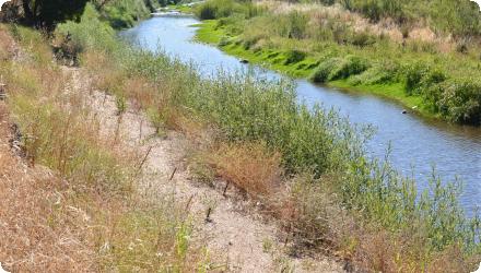
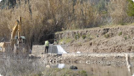
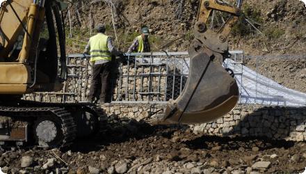
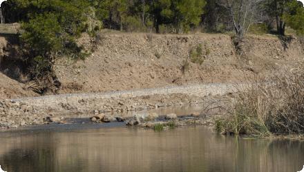
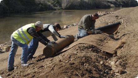
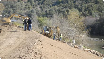
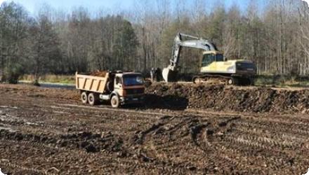
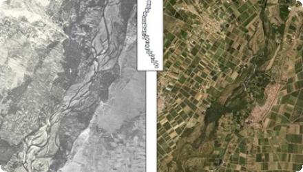
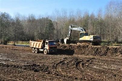
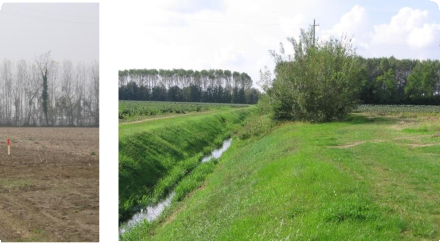
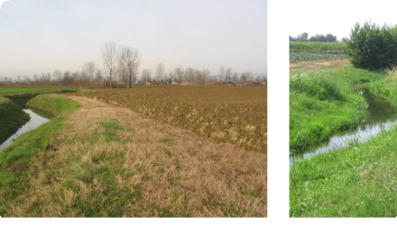
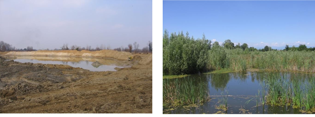
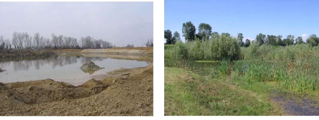
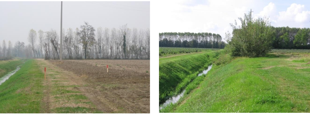
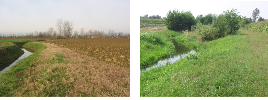
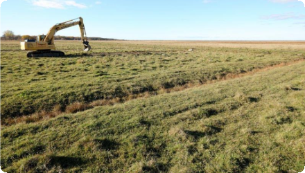
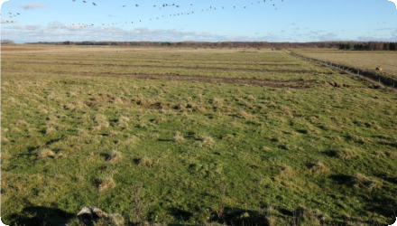
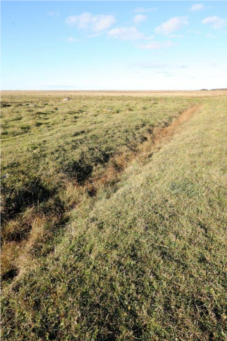
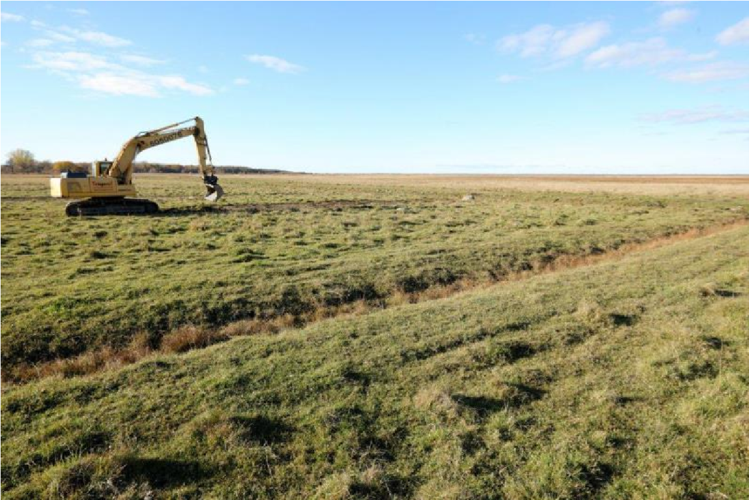
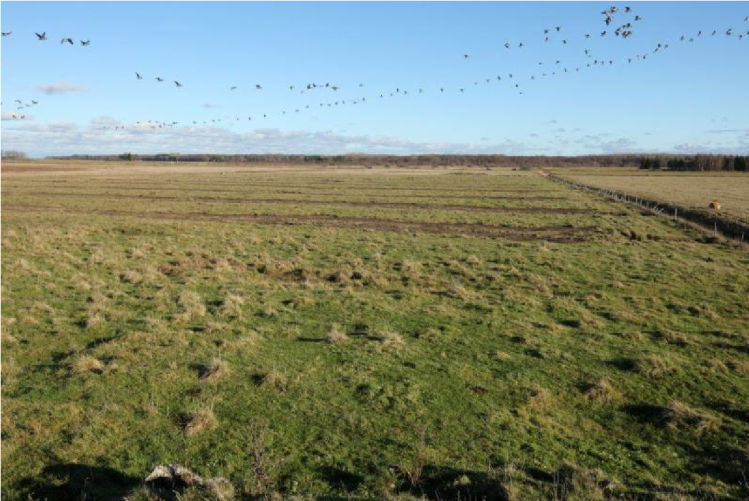
The measure was implemented in 2013 in Matsalu National Park (Natura 2000, Ramsar), at a former coastal meadow beside the large Salmi complex. Old, non-functioning field ditches were closed and scraped to restore wetland hydrology and breeding/feeding habitat for waders and amphibians. Grazing continued as before, with better access to drinking water for cattle.
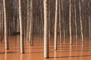
Since then, the site has been managed as part of the wider Keemu–Salmi coastal meadow system (~360 ha) within a park that maintains ~3,000 ha of coastal meadows, among the largest in Europe. National guidance and the 2021–2027 Action Plan for semi-natural grasslands reinforce long-term maintenance (grazing/mowing, shrub control) and allow restoration actions such as closing drainage to keep meadows wet.
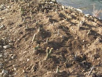
For fauna, Salmi–Keemu is a priority area for the natterjack toad; the species plan recommends sustaining sufficient grazing to keep short-sward habitat and preserving shallow, temporary pools created by micro-relief. In response to very high nest predation on coastal meadows, a pilot predator-control programme (2021–2024) was introduced at Keemu and Salmi to improve wader breeding outcomes.
Overall, the 2013 hydrological works are now embedded in park- and nation-wide management that keeps the meadows open and wet while targeting key bird and amphibian conservation needs.
The project was a rather small-scale restoration effort, which was originally intended to be expanded, but for various reasons this did not take place. No monitoring activities have been carried out to assess the effectiveness of the restoration.
Last update
2025
Summary
The WETLIFE project (2009–2012) in Amalva and Žuvintas mires sought to reverse negative changes by restoring hydrology (converting sluices to spillways, raising embankments, renovating the Amalva polder pump, blocking drainage) and by encouraging more sustainable peatland farming. It also aimed to raise awareness and provide a replicable model.
Since then, restoration has been expanded under LIFE WETLIFE 2 (2014–2018), which upgraded about 6.6 km of embankments, added spillways and a dam on the perimeter ditch, blocked underground drains and removed encroaching trees, with the goal of re-establishing “active raised bog” over ~775 ha in central and southern Amalva. Further rewetting (2019–2022, LIFE Peat Restore) targeted ~215 ha in southern Amalva with 28 retention structures across nine main ditches, four low berms with overflow crests, removal of woody growth and additional drain decommissioning.
Today the reserve operates long-term monitoring (2023–2033) of water levels and quality, while catchment management remains important due to pulsed discharges from the Simnas fishpond system that can affect Žuvintas Lake. Public access has been improved with a short boardwalk and viewing platform (2018), reinforcing outreach and stewardship.
Last update
2025
Summary
The short term project objectives were to create 250 ha of wetland by raising the water level of the embanked area with a regulating water outlet structure, creation of a variety of habitats -from dry land to spots with deep water- by digging and opening up of old river meanders that had been filled up.
The project is a good experience in the field of ecological restoration, involving purchase of land, participatory planning and co-operation with other organizations, including NGO’s.
The project also had long term objectives related to the creation of a network of wetlands, integration and nature and water policies, the implementation of European directives and the strengthening environmental NGOs and education. The project was implemented by a Romanian regional water authority with the support of Dutch partners.
The Ciobarciu project was evaluated at the end of the project by the project team and by a Romanian University, who interviewed 55 inhabitants of villages where the (previous) owners lived. After a period of five years, the project was evaluated again.
Last update
2025
Summary
The Odelouca River: Natural bank stabilization and riparian buffer galleries as part of mitigation and compensatory measures and through the use of bio-engineering techniques.
This project carried out in the Odelouca River (sub-catchment of the Arade River Basin, Algarve Region, South of Portugal) entailed the implementation of measures focused on the use of bio-engineering or natural techniques for rehabilitation of riparian buffer zones and river banks (such as river banks resectioning and placement of geotextile; live crib walls and vegetated gabions/rock armour construction and placement; planting of rehabilitated banks with native plant species; construction of artificial islands in the river channel, and clearance of invasive riparian plant species).
Today it remains a relevant and effective implementation. However it needs restoration, but there is apparently no intention to restart the project to the original goals.

The measures implemented focus on the use of bio-engineering or natural techniques for rehabilitation of riparian buffer zones and river banks such as: i) resectioning of river banks and placement of geotextile to prevent erosion, retain soil moisture, prevent (re) growth of weeds and invasive plants and create favourable conditions for planted native plants (reed bed removal / placement of geotextile; 100% coco fibre with 2 polypropylene nets); ii) construction of a crib wall and placement of stone filled gabions to stabilise river banks (vegetated rock armour, live cribwalls (i.e Krainer wall), and vegetated gabions); iii) planting of rehabilitated banks with native plant species, collected from cuttings and seeds in the area and grown on in local nurseries (e.g. Tamarix, Oleander, buckthorn and ash); iv) construction of artificial islands in the river channel; v) clearance of invasive riparian plant species (Arundo donax and Acacia sp).
Last update
2025
Summary
Órbigo River (Duero Basin, NW Spain) ecological status improvement. A bundle of sponge measures - levee removal/set-back, rip-rap removal, recovery of secondary channels, floodplain reconnection, natural bank stabilisation, and riparian buffer restoration - was implemented under the WFD and Floods Directive; the project was a 2013 IRF European Riverprize finalist.
Section I (upper ~23.5 km) was built in 2011–2013: ≈4.72 km of rip-rap and 8.71 km of levees were removed, 3.13 km set back, ~10 km of side channels reopened, and ~300 ha of floodplain reconnected; limited works followed in Sections II–III. The Alcoba weir was modified by cutting a central notch (~15–16 m) with seasonal removable boards and a ramp to restore fish passage and sediment/nutrient continuity, reconnecting ~25 km of river.

Post-project assessments report increased channel dynamism and sinuosity and riparian vegetation regeneration - moderate effectiveness in the short term, underscoring the need for long-term monitoring. Overall, actions improved lateral and longitudinal connectivity and enhanced natural flood attenuation; AdapteCCa summarises ~480 ha of floodplain now functioning with the river.
Last update
2025
Summary
The case study lies in the draining basin of the Venice Lagoon, an intensively farmed area crossed by a dense network of drainage channels. Here, measures were implemented on channels discharging to the Dese River, a major tributary of the Lagoon. The Veneto Region financed riverbed recalibration and ecological restoration under the “Plan for diffuse pollution prevention and restoration of water in the draining basins of the Venice Lagoon”; Consorzio Acque Risorgive delivered the works around 2008–2009.
The project re-structured the mid-course effluents of the Dese - Rio San Martino, Rio Sant’Ambrogio and Scolo Desolino - whose primary function is to drain agricultural fields. Objectives were to retain nitrogen and phosphorus through phytodepuration and to mitigate frequent floods aggravated by urban sprawl, soil sealing and culverts (notably highlighted by the 2006–2007 Mestre events). Measures included riparian buffer strips, in- and out-of-channel wetlands, channel widening/meandering, and floodplain reconnection.
Subsequent technical documentation shows the programme extended beyond these three reaches to other local drains (e.g., Piovega di Scandolara, Piovega di Cappella, Piovega di Levada, Piovega dei Tre Comuni). Overall cost was about €4.13 million. Hydrological modelling and design analyses indicate peak flows delivered to the Dese fell from ~29 to ~25 m³/s (≈14% reduction), with tributary-scale decreases (e.g., Rio S. Martino 10.3→8.0 m³/s; Scolo Desolino 7.0→5.5 m³/s; Rio Sant’Ambrogio 11.5→10.5 m³/s).
Evidence from the implementer adds scale and design detail: about 14 km of channels were tackled in the Dese sub-basin; ~5.3 km of woody buffer strips were established across these reaches, and an out-of-channel wetland with a “double flow path” was created at Rio San Martino. On the Rio San Martino & Piovega di Scandolara sub-site specifically, ~1.6 km of new riparian woodland was planted.
Monitoring remains limited in the public domain: ARPAV was expected to monitor but little was published; the consortium ran some site-specific monitoring and used results from its NICOLAS experimental site for nutrient-removal parameters. Nonetheless, the combination of buffers, wetlands and planform restoration is credited by local sources with significant nutrient retention and visible flood-risk mitigation, supporting positive public perception.
Status on external registries is “complete”, and consortium material documents continued maintenance and allied works within the jurisdiction into the late 2010s. The case demonstrates multi-benefit restoration at drainage-network scale in a low-slope agricultural plain, aligning water-quality and flood-risk objectives under the Venice Lagoon Plan.
Last update
2025