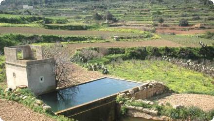
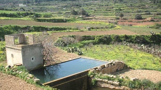
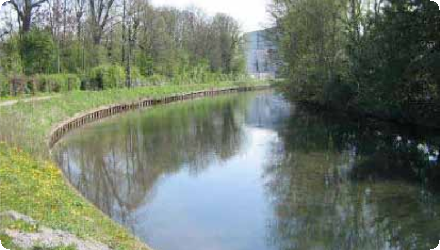
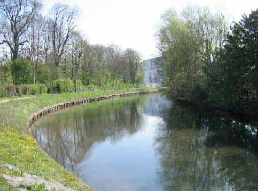
Completed

Summary
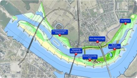
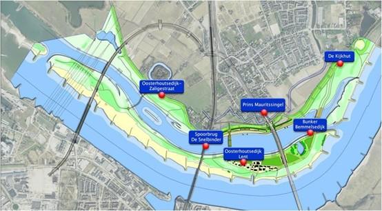
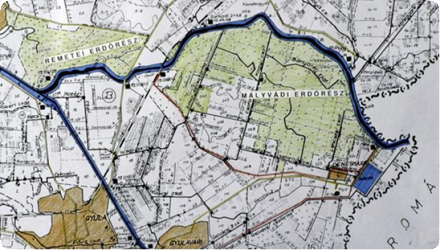
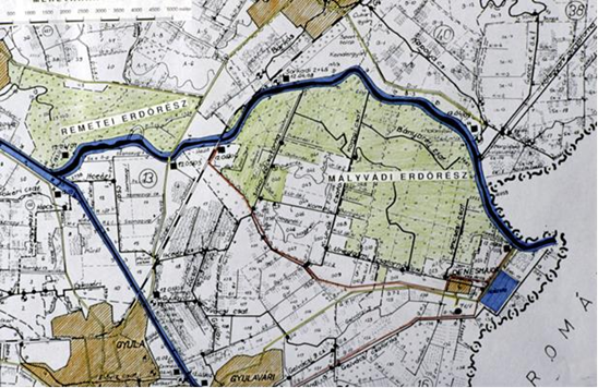
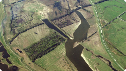
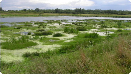
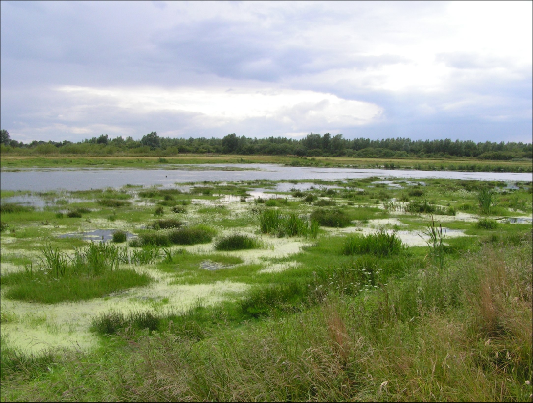
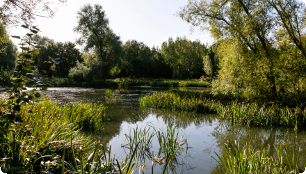
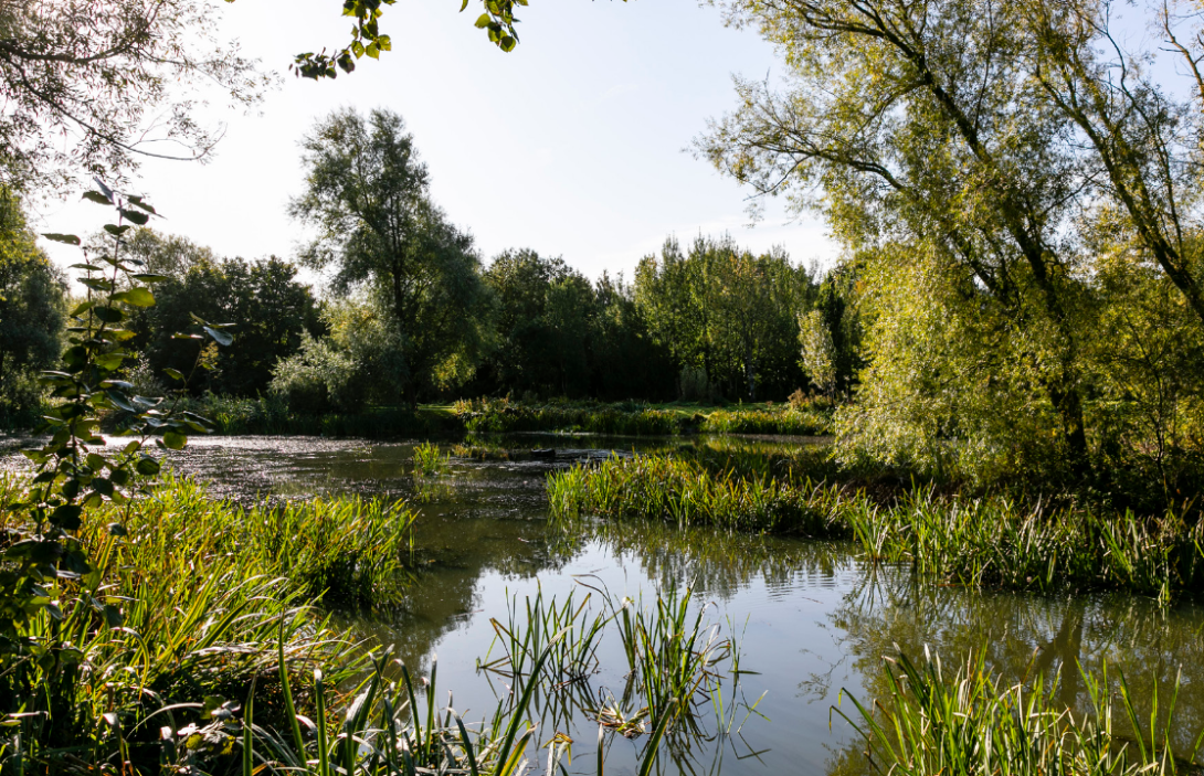
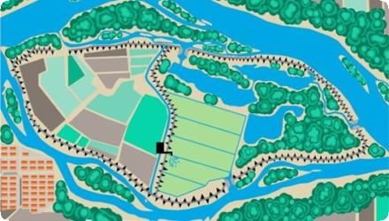
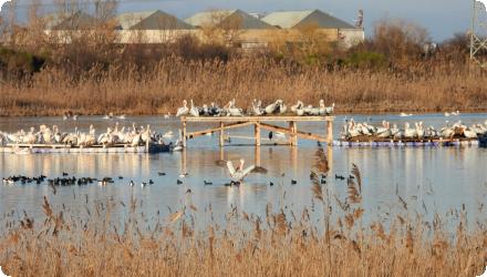
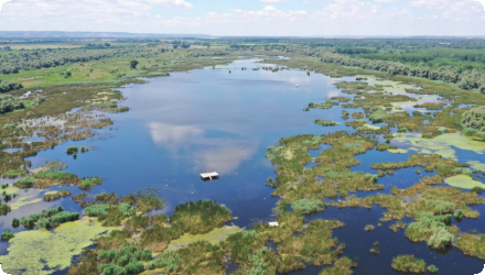
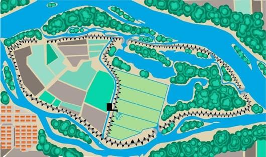
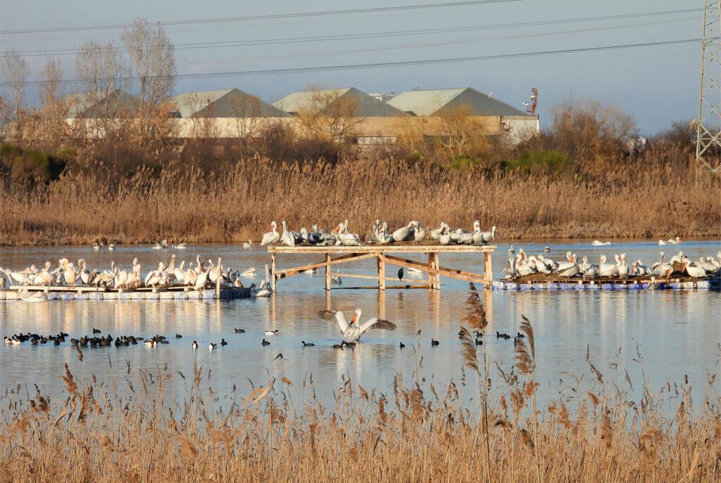
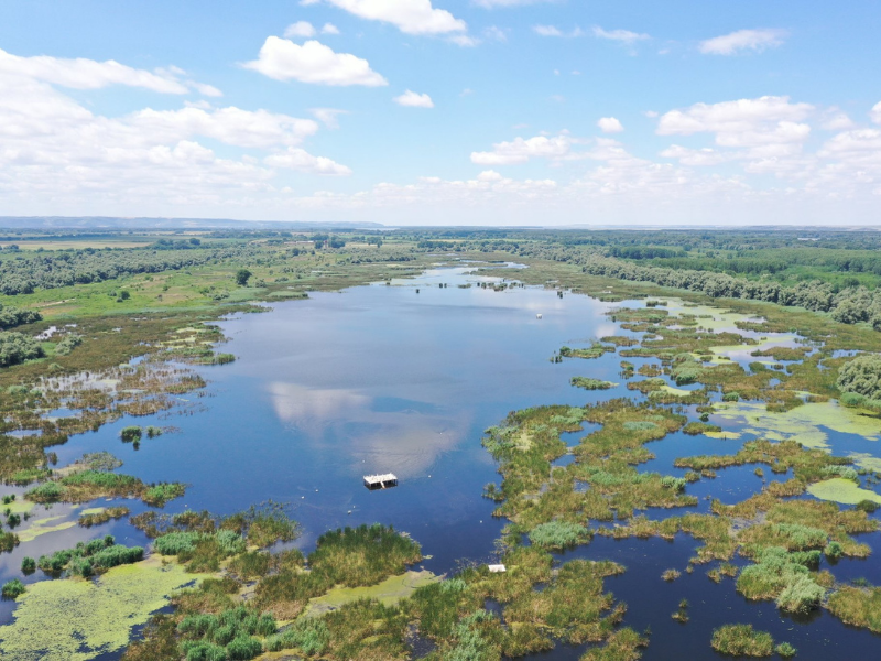
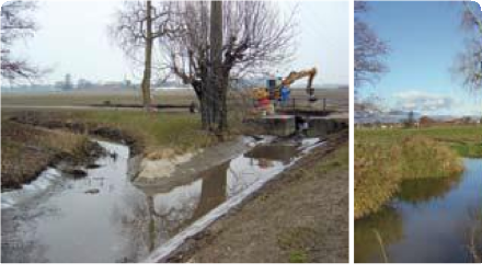
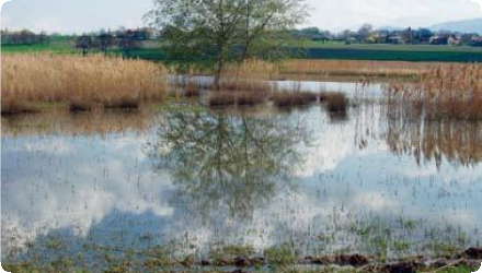
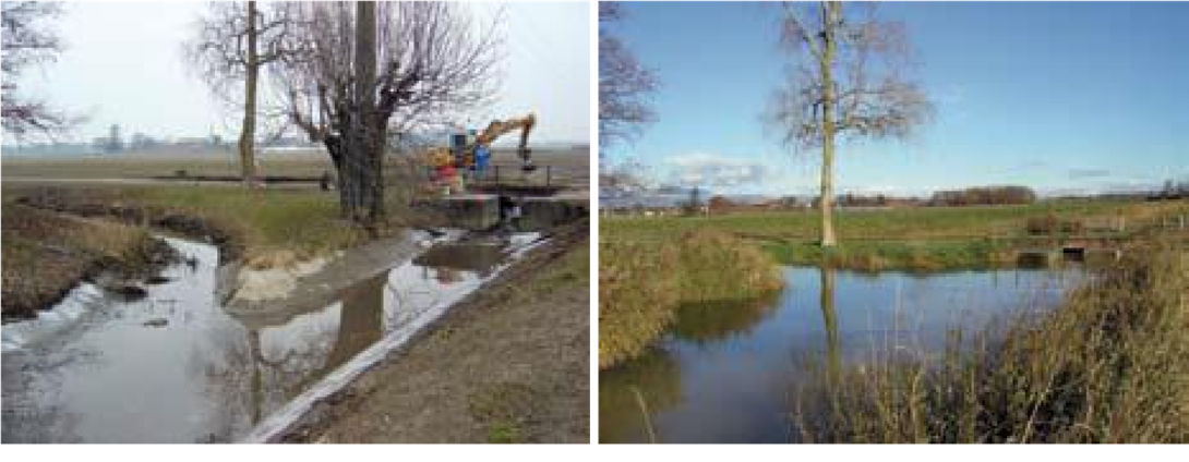
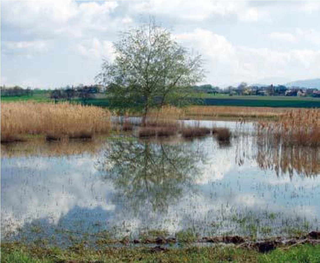
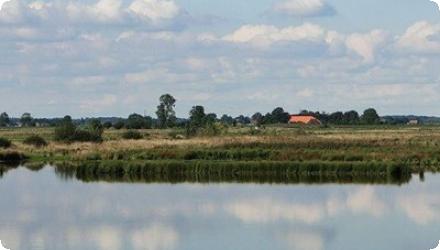
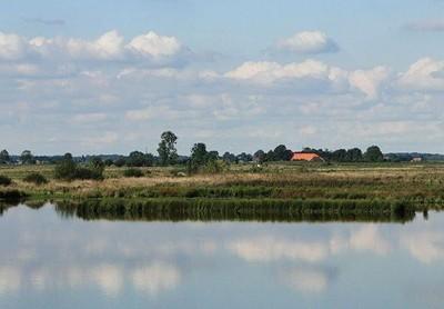
The Holter-Hammrich project combined several natural water retention measures: floodplain restoration, meadow and pasture rehabilitation, and reduced tillage. Located in north-west Germany within the Weser river basin (DE4000), it supports Lower Saxony's otter and wetlands protection programs and contributes to WFD goals. Since its implementation, the 240 ha flood retention polder—activated in 2011—has enhanced flood protection and become a key habitat for over 60 bird species and other wildlife, including the returning European otter. It now also serves educational and recreational purposes, with a 7 km nature trail and observation points. The project stands out for its integration of ecological, hydraulic, and public engagement goals, achieved through multi-stakeholder cooperation involving environmental agencies, water managers, local authorities, and farmers.
Last update
2025
Summary
Aquifer recharge with highly polished treated effluents. With a high population density and almost no surface waters, Malta faces chronic over-abstraction: total demand exceeds the sustainable yield of naturally renewable freshwater. Demand comes from domestic and agricultural uses (domestic peaks can exceed agriculture during the tourist season). Groundwater quality is threatened by nitrates and seawater intrusion.

A pilot at Bulebel (2010–2013, MEDIWAT) tested injection of ultra-polished reclaimed water via an injection well under strict quality monitoring. Since then, Malta has pursued MAR within a broader strategy: the EU MARSOL demonstrator (2013–2017) designed an injection-well barrier near the Malta South plant (Ta’ Barkat) to counter seawater intrusion; the national New Water programme is expanding reclaimed-water production (~7 Mm³/yr capacity) and distribution for agriculture, creating seasonal surpluses that can supply MAR. Under the LIFE-IP RBMP (2021–2027), Action C8 is developing a pilot MAR scheme in the Pwales coastal groundwater body using reclaimed water when irrigation demand is low; a 2024 hydrogeological study characterised Pwales to support MAR design.
Last update
2025
Summary
The Scarpe in Arras (long canalised) was renatured (2009–2012) to balance navigation, recreation and ecology. Actions included removal of sheet piling, gentle bank reprofiling, mixed bio-engineering (hemp bundles, vegetated geonets, gabion mattresses where needed), riparian restoration (invasives removal, seeding, pollarded white willows), controlled access, and creation of a lagoon.
The project treated 1,760 m of banks and built two reedbeds (≈1,000 m² and 1,450 m²). In the same programme, a 1.4 ha pike spawning area at Fampoux was re-opened and reconnected to the Scarpe. Governance shifted in 2012 via a VNF→Arras Urban Community (CUA) convention; FDAAPPMA 62 manages the spawning sites. Baseline surveys were done in 2010 with a five-year follow-up planned.
Total cost €1,321,310 (studies €132,277; works €1,189,032), co-funded by Artois-Picardie Water Agency 51%, ERDF 48%, CUA 1%.
The reach remains actively managed. In 2022 the environmental authority (MRAe) reviewed a 10-year dredging plan (~180,000 m³) to secure a 1.65 m navigation draft, notably around the Saint-Laurent-Blangy water-sports base, and requested stronger WFD compliance, better fish/European eel assessment, and a catchment-scale response to upstream sediment inputs. Together, the restoration and ongoing management aim to diversify habitats while keeping the canal’s socio-economic uses.
Last update
2025
Summary
This flagship of the national Room for the River programme at Nijmegen set back the dyke at Lent and excavated the Spiegelwaal side channel, creating the Veur-Lent island and an urban river park that can take additional flood flow from the Waal. Completed in 2016, the scheme achieves about 35 cm lower design water levels—exceeding the original 27 cm target—and safely diverts high flows; the channel first overtopped its threshold in February 2016. Since delivery, the area has been reshaped as public space with new bridges and intense recreational use. In 2022 the city decided not to build housing on Veur-Lent, keeping the island largely as parkland (with limited facilities), while planning proceeds nearby. The Spiegelwaal now serves as a pilot in “Connected River” to balance flood safety, water quality and heavy leisure demand; bathing advice has at times been negative due to bacteriological risks. Funding came mainly from the State, with total costs reported at about €351 million.
Last update
2025
Summary
The project focuses on post-fire water retention management in the broader area of Ancient Olympia, Elia, Peloponnese, Greece. It involves afforestation of mountainous areas and the temporary installation of wooden structures using locally available timber to retain water, stabilize slopes, and reduce erosion. These natural measures aim primarily at flood control and risk mitigation, with secondary benefits for biodiversity conservation.

Recent scientific studies (2022–2025) have confirmed the effectiveness of these interventions. Field measurements showed that post-fire treatments in Olympia significantly improved soil infiltration capacity, up to 300% higher in deposition zones compared to eroded ones two years after implementation. Satellite-based erosion models (using Sentinel-2 and RUSLE) also indicated a sharp increase in soil erosion after wildfires, which was partly mitigated by restoration works that reduced erosion rates by approximately 18%. These findings demonstrate the long-term hydrological benefits of such nature-based solutions under Mediterranean conditions.

Key success factors remain the strong engagement of decision-makers, the willingness of local stakeholders, positive public perception, and the availability of expert knowledge and tools. The project is an example of adaptive, evidence-based post-fire watershed management in a culturally and environmentally sensitive region.
Last update
2025
Summary
The Körös-ér catchment lies in a drought-prone part of Hungary and is a heavily modified water body with nutrient inputs from urban and agricultural sources. Recurrent water-logging causes temporary flooding in spring and after cloudbursts. To address both extremes (floods and shortages) the water directorate upgraded control structures, reconnected ~2.5 km of former floodplain at the estuary, improved sluices to allow retention while clearing bottlenecks for flood conveyance, increased urban drainage capacity (via a closed conduit), and added an upstream retention pond. Since completion (2011), management has shifted toward active small-water retention: today water is stored at three points along the Körös-ér - at the mouth (0+000), at 5+850 (betétpallós gate), and at 16+675, where DINPI built a retention structure in 2022 with a lateral sluice and ditch to inundate low-lying grasslands, boosting retained volumes and waterfowl habitat (boards are removed at high water; overtopping is possible). In 2025, under the “Vizet a tájba / Water to the Landscape” programme, managed in-channel storage and controlled inundation were also implemented near 22+884 (≈14 ha, ≈46,000 m³). Fish from the Tisza have re-appeared in reaches previously isolated.
Last update
2025
Summary
In the framework of the large-scale nature conservation project "Lenzener Elbtalaue", a dyke along the river Elbe (in Germany) has been relocated. This created a new retention area with a diverse floodplain, including alluvial forests, half-open pasture landscapes and other typical habitats of lowland floodplains. With 420 ha it is the biggest application of this type of measure in Germany so far. The project successfully combines flood protection and nature conservation objectives. Since the cutting of the old dyke in 2009, the measure could proof its effectiveness during several high water events.
The specific measures applied include:
- Construction of a new, 6.1 km long dyke which has been shifted backward up to 1.3 km
- Opening of the old, 7.2 km long dyke, situated close to the river, in sections of 200-500 m length
- Planting of 160 ha of alluvial forest, with further 130 ha of succession areas for alluvial forests
- Establishment of half-open pasture landscapes on 85 ha
- Profiling of 45 ha of flood channels in the area concerned by the relocated dyke
- Implementation of a land re-organization process in order to make areas available for the project
Last update
2025
Summary
The River Tolka runs through Dublin, Ireland. In Tolka Valley Park, a suite of measures was implemented to slow flood flows, reduce pollution and support wildlife: runoff retention ponds, bank re-profiling to slow flows and prevent erosion, riparian tree planting, and integrated constructed wetlands (ICWs) to improve water quality (once leachate from a former landfill was detected). Later, a fountain and barley-straw bales were used to limit algal blooms, and invasive plants were managed with biodegradable matting and planting.

Built in two phases (1999–2001; 2009–2013 Greenway), the ICWs treat polluted stormwater from the Finglaswood Stream before it enters the Tolka. Since 2019, sources confirm the site remains operational and biodiversity-rich (reed/sedge swamps, breeding mute swan; spawning common frog). Dublin City Council reports active invasive-alien-species control in the park, and the Luas Finglas project includes remediation/mitigation works to the existing ICW, with design notes that low flows are routed through the ICW and higher flows bypass to the river. Governance/cost snapshots add context: the first ICW was relatively low-cost (~€40k) while the 2009–2013 phase exceeded €3 m. Tolka Valley Park is now ranked among Dublin’s most important biodiversity sites due to the river and wetland chain.
Last update
2025
Summary
Restoration of two wetlands along the Danube River within Persina Nature Park, through engineering works including sluices, channels, dykes and access roads, enabling controlled flooding, water flow to former wetlands, nutrient retention, and recovery of biodiversity and fish populations. Baseline data on water, birds, fish, mammals, reptiles and vegetation were collected for monitoring.

Implemented 2002–2008 by the Bulgarian Ministry of Environment and Water, with main funding from the Global Environment Facility (GEF) via the World Bank, the project also covered the Kalimok-Brashlen and Belene Islands Complex. Works improved hydrological connectivity and reduced pollution, supported by WWF Bulgaria and local communities.

Subsequent initiatives have continued restoration and management, including sluice maintenance, construction of a pelican nesting platform, and reintroduction of the white water lily. In 2025, the Persina4Nature project, under the DANUBEPARKS network, was launched to promote citizen science for wetland conservation and monitoring, further enhancing ecological and community engagement outcomes.
Last update
2025
Summary
Located in eastern Geneva canton, the Seymaz renaturation replaces concrete channelization with a softer, wider river corridor and recreates marshland, under the canton’s long-running programme to improve ecological and landscape quality and reduce flood risk by managing peak flows. Governance has relied on the “Charte Seymaz” negotiation forum and a management group to coordinate local arrangements; land tenure and agricultural impacts were key constraints that required dialogue and compensation for farmers.

Since 2020 the canton has consolidated and showcased results (book + short film). In 2024–25 a new phase at Bel-Air (Vandœuvres–Thônex–Chêne-Bourg) removed illegal bank fill, narrowed the low-flow channel, installed terraces, root wads/blocks and fish shelters, and stabilized banks with bioengineering, while reorganising heavy recreational use along the riverside path. Client: Office cantonal de l’eau; engineering: Karakas & Français SA and EcoEng SA; works: SCRASA SA and SITEL Environnement-Paysage. Six months on, beaver activity is already structuring flows and habitat. Maintenance of the Haute-Seymaz wetlands and channel has been handled by SITEL since 2019 with local association oversight; mowing/faucardage is adapted to hydrological conditions. Coordination around Bel-Air also required short Greenway bridge closures in March 2024.
Last update
2025