Last update
2026
Summary
Sponge Scapes case study NL 01
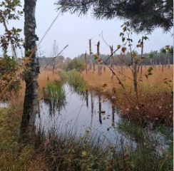
The Chaamse beken area is part of the Northern Temperate Atlantic ecological region which streches from southwestern and northern France, Belgium, the Netherlands, northwestern Germany and western Denmark. Most of the region's forests have been converted to fields or pastures, and its once-extensive wetlands have mostly been drained and filled for agriculture, as is the case in Chaamse Beken. For this case study, the sponge function is mainly based on the management of aquifer/groundwater recharge. Local stakeholders are particularly interested in the possibilities to prevent/reduce floods and droughts due to previous extreme events in the area. For this case study, long-term data and high-end groundwater and surface water modeling tools are already in place to assess the overall sponge function potential of this area.
The Chaamse beken area is part of the Northern Temperate Atlantic ecological region which streches from southwestern and northern France, Belgium, the Netherlands, northwestern Germany and western Denmark. Most of the region's forests have been converted to fields or pastures, and its once-extensive wetlands have mostly been drained and filled for agriculture, as is the case in Chaamse Beken. For this case study, the sponge function is mainly based on the management of aquifer/groundwater recharge. Local stakeholders are particularly interested in the possibilities to prevent/reduce floods and droughts due to previous extreme events in the area. For this case study, long-term data and high-end groundwater and surface water modeling tools are already in place to assess the overall sponge function potential of this area.
Position
Latitude
51.3645
Longitude
4.4724
Project
SpongeScapes
Transboundary
0
Photo gallery


Location of the project
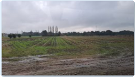
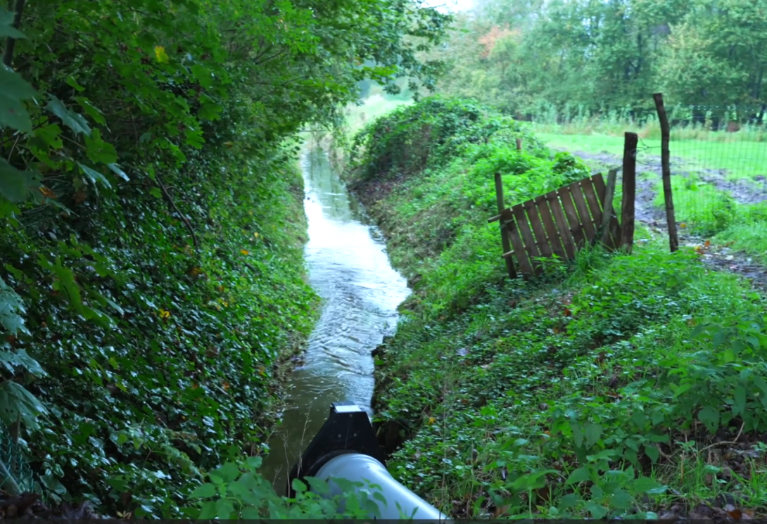
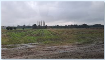
The Chaamse Beken area is located south-east of the city of Breda in the province Noord-Brabant and consists of several small streams that merge into a single stream discharging into the river Mark. The catchment consists of a mosaic of agricultural fields, pastures, small villages and several larger forested zones. Here, the soil type is mainly sandy, with some local loam layers in the subsurface that may influence infiltration characteristics.
Project's objectives
For this case study the core objective is how to enhance the sponge functioning in a modern, optimized drained landscape. The goal is to improve the understanding of the system to increase groundwater levels, seepage, and stream discharge during summer. Some of the aspects that will be further explored include: stimulating groundwater recharge through infiltration and reducing drainage throughout the catchment.
Involved Partners
| Authority type | Authority name | Role | Comments |
|---|---|---|---|
Climate zone
cool temperate moist
Community involvment
No
Design consultation activity
| Activity stage | Name | Key issues | Comments |
|---|---|---|---|
Policy target
| Target purpose |
|---|
Policy pressure
| Pressure directive | Relevant pressure |
|---|---|
Policy impact
| Impact directive | Relevant impact |
|---|---|
Requirement directive
| Requirement directive | Specification |
|---|---|
Contractual arrangements
0
| Arrangement type | Responsibility | Role | Name | Comments |
|---|---|---|---|---|
Part of wider plan
0
Wider plan type
| Wider plan type | Wider plan focus | Name | Comments |
|---|---|---|---|
High-end groundwater and surface water modeling tools.
Type of sponge measures: Removing drains, reducing depth of ditches and streams, increasing surface water levels, reducing irrigation abstraction from groundwater and surface water.
Type of sponge measures: Removing drains, reducing depth of ditches and streams, increasing surface water levels, reducing irrigation abstraction from groundwater and surface water.
Long-term data and high-end groundwater and surface water modeling tools are already in place to assess the overall sponge function potential of this area. Efforts will focus on combining these data and tools to assess the effectivity and impact of sponge functioning measures during droughts and floods.
Success factor(s)
| Success factor type | Success factor role | Comments | Order |
|---|---|---|---|
Driver
| Driver type | Driver role | Comments | Order |
|---|---|---|---|
English