Last update
2026
Summary
Sponge Scapes case study UK05
Is the Riseholme site effective as a form of flood risk management using sponge measure?
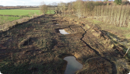
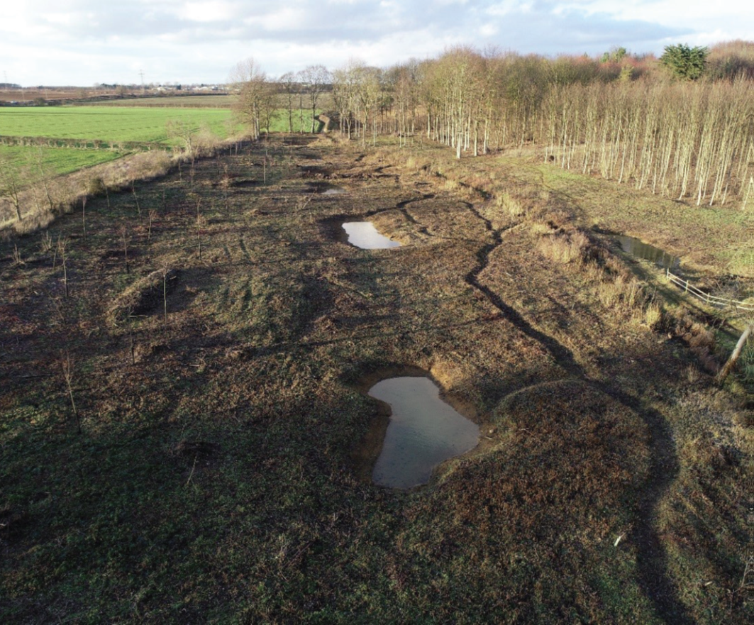
Riseholme is a part of the catchment of the River Witham. The case study concerns the presence of 7 ponds, several different side channels, leaky barriers, in-channel and floodplain vegetation and their role in reducing flood peak and in allowing infiltration.
Is the Riseholme site effective as a form of flood risk management using sponge measure?
Riseholme is a part of the catchment of the River Witham. The case study concerns the presence of 7 ponds, several different side channels, leaky barriers, in-channel and floodplain vegetation and their role in reducing flood peak and in allowing infiltration.
Position
Latitude
53.1542
Longitude
0.3133
Project
SpongeScapes
Transboundary
0
Photo gallery
Location of the project
Riseholme case study is located in the Anglian River Basin District (RBD), in the east of England. It is part of the catchment of the River Witham, which covers an area of approximately 3,000 km2 and a population of around 375,000 people. The catchment is predominantly rural and there is high grade agricultural land in the Fens. The catchment has a history of flooding. The site is an example of the unique chalk streams. It is part of the Riseholme College Campus which is part of the University of Lincoln.
Project's objectives
Our objective is to better understand how the ponds allow for infiltration and reduce flood peaks making the site effective at managing flooding downstream. There is also an interest in how management (e.g., vegetation trimming) might affect sponge functions.
Involved Partners
| Authority type | Authority name | Role | Comments |
|---|---|---|---|
Climate zone
cool temperate moist
Project scale
Micro
Project area
400
Area specifications
The Riseholme site in particular is situated on a Jurassic limestone aquifer. This aquifer within Lincolnshire is quite shallow. Notably high groundwaters tend to be seasonally driven.
Community involvment
No
Design consultation activity
| Activity stage | Name | Key issues | Comments |
|---|---|---|---|
Policy target
| Target purpose |
|---|
Policy pressure
| Pressure directive | Relevant pressure |
|---|---|
Policy impact
| Impact directive | Relevant impact |
|---|---|
Requirement directive
| Requirement directive | Specification |
|---|---|
Contractual arrangements
0
| Arrangement type | Responsibility | Role | Name | Comments |
|---|---|---|---|---|
Part of wider plan
0
Wider plan type
| Wider plan type | Wider plan focus | Name | Comments |
|---|---|---|---|
Available data include monitoring precipitation, water levels and flows in and out of online ponds since 2018, where the case owner is the UK Environment Agency. Calibrated hydraulic and geomorphic models are available. A combination of low-cost and high-tech monitoring efforts and the 2023 change of online pond vegetation management will allow before/after comparison of Sponge function (and co-benefits).
Available data include monitoring precipitation, water levels and flows in and out of online ponds since 2018, where the case owner is the UK Environment Agency. Calibrated hydraulic and geomorphic models are available. A combination of low-cost and high-tech monitoring efforts and the 2023 change of online pond vegetation management will allow before/after comparison of Sponge function (and co-benefits).
Success factor(s)
| Success factor type | Success factor role | Comments | Order |
|---|---|---|---|
Driver
| Driver type | Driver role | Comments | Order |
|---|---|---|---|
English