
Completed

Summary
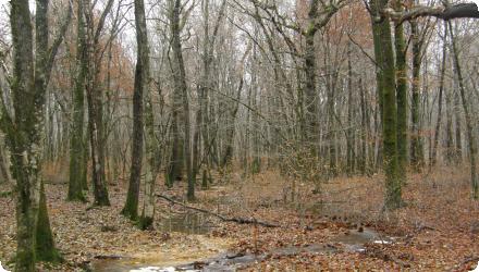
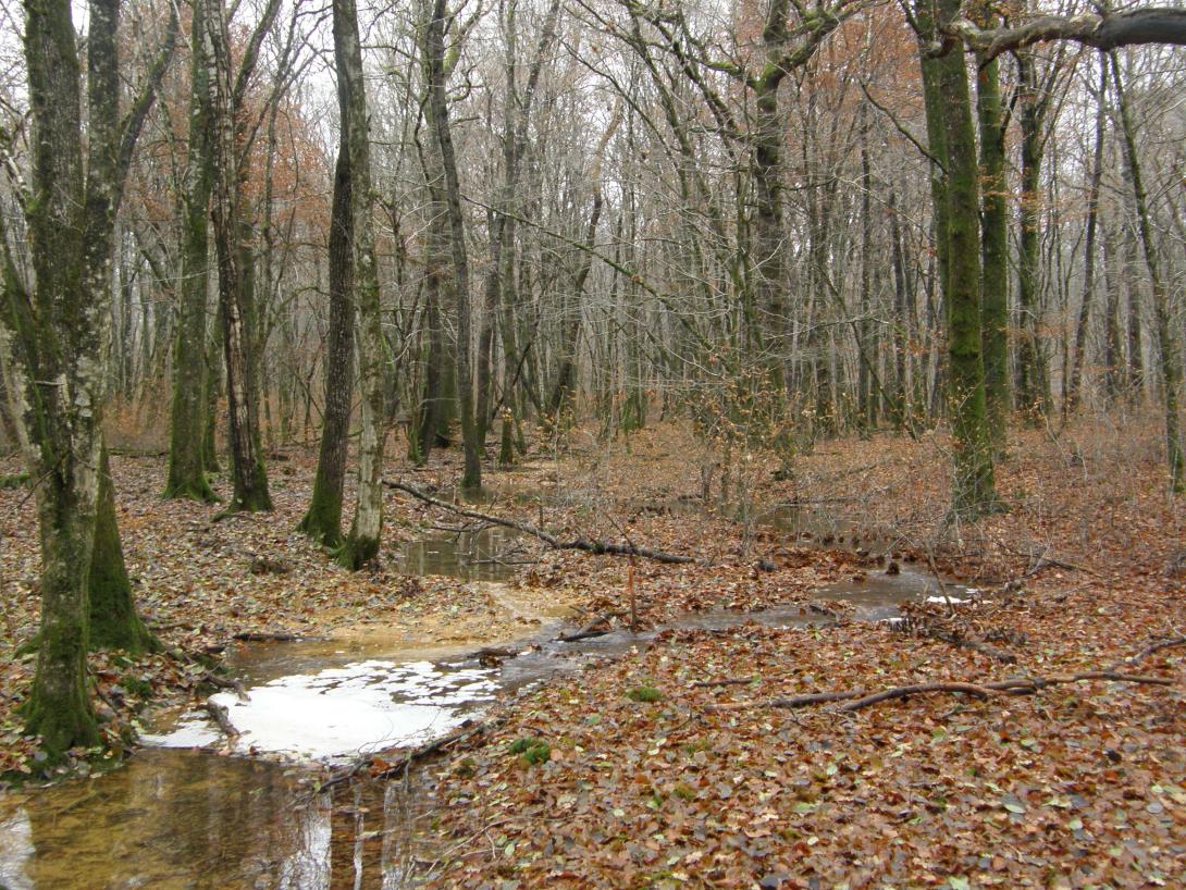
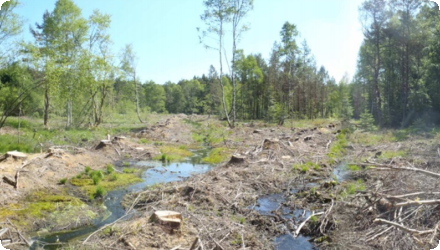
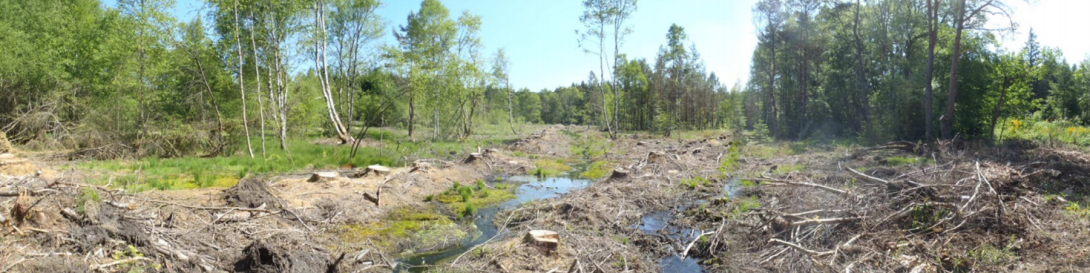
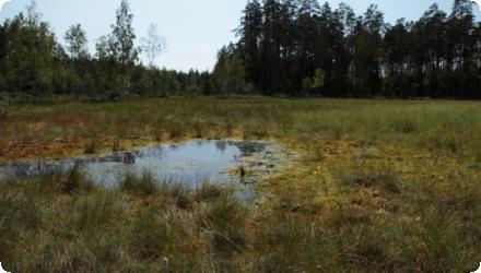
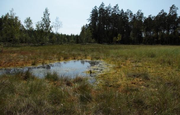
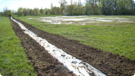
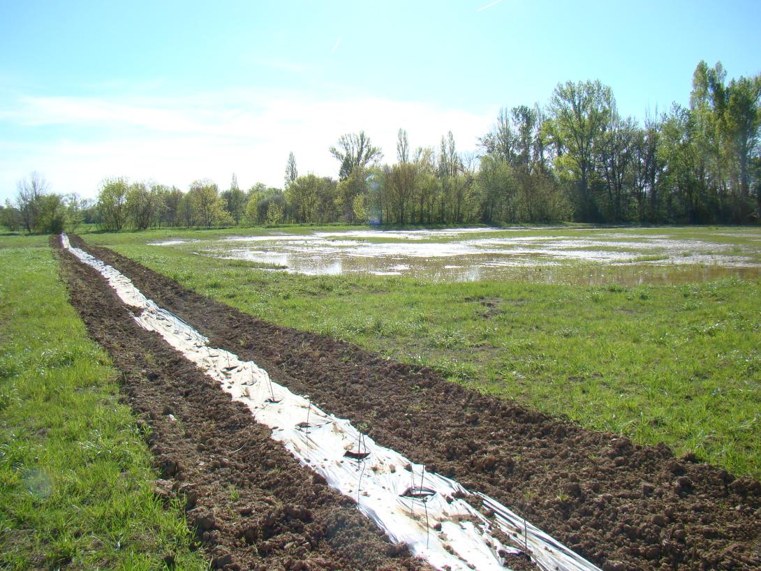
Upstream of L’Isle-Jourdain (Gers), the Save’s active floodplain hosts a complex of wet meadows. To safeguard the downstream drinking-water abstraction, restore wetland habitats and slow floods, the Gascogne Toulousaine community acquired a 13-ha riparian parcel (“Quintarets”), leased it under an agri-environmental contract, converted it to permanent natural grassland using late-cut “hay-flower” transfer, and dug shallow detention basins to retain floodwater and favour wetland plants. Since 2013 the municipality has embedded this action within a wider priority wetland area (~468 ha) and a Departmental Sensitive Natural Area (≈456 ha), with ongoing land purchases and site management led by the SYGESave river syndicate. Technical follow-up (2013–2017) reports rapid grassland naturalisation after hay transfer and longer water residence in the excavated basins. A major update is the June 2022 biotope protection order (APPB) for Bellevalia romana, which secures >22 ha within the L’Isle-Jourdain wetland. Overall, the Quintarets restoration is now part of multi-year catchment management that couples biodiversity protection, drinking-water safety, flood attenuation and public awareness.
Last update
2025
Summary
Chaux Forest is a timber production area threaded by many small, originally sinuous headwater streams. A 2006–2008 LIFE pilot restored two intermittent tributaries; building on those results, the National Forest Office (ONF) scaled up to ~45 km of temporary tributaries from 2015, redirecting flows to former meanders, adding coarse woody material and sediment to counter decades of straightening/drainage that had widened and incised channels, sped floods and lowered near-surface water tables. Since 2021, ONF and the Doubs-Loue river syndicate have restored ~13 km of the Clauge mainstem inside the forest (2021–2023): narrowing/raising the bed with vegetated berms, gravel recharge, selective infilling of over-wide sections and engineered log structures. Monitoring reports a strong hydrological response: depending on context, the hydropériode of the Clauge headwaters and intermittent tributaries now increases by ~2–6 months per year (including +3–12 weeks in spring), alongside recovery of aquatic bio-indicators. In June 2025 the project received the national “Rivière en bon état” distinction and the Nature-based Solutions award from the Rhône-Méditerranée-Corse Water Agency. Next step: design for restoring the Tanche tributary, with works targeted for 2026.
Last update
2025
Summary
Fourqueux (≈4,000 inh.) requalified its centre with new housing and created the “Jardin des Eaux” to manage stormwater from ~1.7 ha. The park routes runoff through a sequence of dry basins to a planted permanent pond, infiltrating frequent rain and avoiding direct discharge to the separate sewer draining to the Seine via the ru de Buzot. Delivered in 2016 after 2014–15 studies (as part of the Cœur de village programme), the site is both hydraulic infrastructure and neighbourhood amenity. Recent technical records report ~482 m³ of storage and ~5,000 m³/year of volumes kept out of sewers (≈80% of ~700 mm annual rainfall) over ~9,000 m² of active surfaces; typical events up to ~8 mm are handled on site, with measured infiltration times of 15–58 h depending on the basin. The landscaped area itself is ~3,800 m², reconnects clean water to the ru, and supports colonisation by aquatic fauna. The project has been showcased in professional visits and local programming, and remains highlighted by Saint-Germain-en-Laye; it was co-funded by AESN, Île-de-France Region and Yvelines Department.
Last update
2025
Summary
More than half of the territory of the regional natural park of the Millevaches in Limousin (PNR) is covered with forest, some of which is the subject of intensive forestry exploitation. A peat bog restoration project in the headwater sector of the catchment area was initiated between the PNR (project manager) and the forestry cooperative Bourgogne Limousin (technical partner). The goal was to remove the softwood stand from the single-species plantation on the plot in order to restore the hydrological functioning of the peat bog. The work was carried out by aerial skidding using a cable mast. In addition to initiating collaboration between forestry and environmental management, the project has made it possible to restore the natural hydrological functioning of the bog and the associated specific habitats.
Last update
2025
Summary
Liberty Island (Szabadság-sziget) lies north of Mohács on the Danube’s left bank; it is ~3 km long, 150–200 m wide and 47 ha, strictly protected within Danube–Drava National Park and the Natura 2000 network. Bank-filtered wells along this bank supply South Baranya settlements.
From 2009–2013 a LIFE+ project led by WWF Hungary with DDNP, the Lower-Danube Water Directorate and DRV Zrt. reopened the side-arm by partially removing the 1980s rock-fill dam, relocating the drinking-water pipe beneath the bed, and dredging ≈160,000 m³ of sediment; invasive trees were removed and native softwood floodplain forest restored.
Since completion, the arm flows freely again (about 40–60 m wide and ~2 m deep even at low water), improving natural bank filtration and reducing treatment needs; a boat-accessible nature trail was created.
Post-project monitoring (2018–2020) found 35 fish species, including protected EU/HU taxa, and confirmed spawning use of the reconnected arm. Bathymetric observations indicate overall slowed infilling, though in very low flows upstream sections can still be intermittently disconnected by shoals/wood jams; management is guided by the Béda-Karapancsa Natura 2000 plan.
Last update
2025
Summary
Barking Riverside piloted an ecomimicry approach to green roofs to conserve a regionally important brownfield invertebrate community, including target species such as the brown-banded carder bee (Bombus humilis) and Gymnosoma nitens. Roof test bays reproduced open-mosaic niches (varied substrate depths, recycled aggregates, ephemeral pools), and monitoring showed these designs could retain pre-development biodiversity while delivering connectivity and ecosystem services. Since then, the method has been formalised in guidance and peer-reviewed research and used to inform wider green infrastructure across the development. At borough scale, by end-2017 Barking & Dagenham hosted 51,658 m² of green roofs, with over 25,000 m² at Barking Riverside (nearly half the borough total), evidencing roll-out beyond the initial trials. Current planning documents continue to mandate ecologically sensitive roofs, with Stage 2 South (2023) targeting 40% of total roof area as green roofs and 10% as brown roofs, and the 2024 Local Plan reinforcing green/brown roofs and locally appropriate planting. Early delivery included ~50 homes (≈20 m² each) and a 2,100 m² roof (1,500 m² vegetated), preceding the broader programme.
Last update
2025
Summary
Groundwork London, with Hammersmith & Fulham Council, delivered the LIFE+ “Climate-Proofing Social Housing Landscapes” programme (2013–Sep 2016) across three estates (Queen Caroline, Cheeseman’s Terrace, and Cyril Thatcher/Eric MacDonald/Richard Knight) using affordable, light-engineering retrofits of blue-green infrastructure. The project coupled design with deep resident engagement and training for council staff and local apprentices.

Since completion, City Hall has published per-estate schemes and costs (Queen Caroline ~£254k; Cheeseman’s ~£117k; Cyril/Eric/Richard ~£79k) and a detailed measure matrix (e.g., Schotterrasen at Queen Caroline; trench tree pit at Richard Knight). Monitoring by the University of East London shows strong performance: 100% diversion of rainfall from 3,160 m² of impermeable areas into ground-level SuDS, up to 98% reduction in peak flows from pram-shed green roofs, notable roof-surface cooling during heat events, and ≈1.2 million litres of rainwater retained/diverted annually. Post-project, H&F reports continued roll-out of green roofs and SuDS across estates and highways, with mapping to target new sites. Recognition includes the Landscape Institute’s 2016 College of Fellows’ Award (plus a commendation) and susdrain’s 2018 SuDS Awards (Highly Commended).
Last update
2025
Summary
The Alzette river restoration at “Am Brill” (Schifflange) reversed earlier channelisation that had uniformised the river and impoverished habitats. The project re-meandered the channel (+140 m length), raised and widened the bed (summer/winter profiles), and removed an artificial dyke to reconnect the river to existing ponds; a new pond was also created. Works were delivered in 2000 over ~600–700 m as part of the LIFE-Nature project “Ecological valorisation of the upper Alzette.” Reported outcomes include ≈30 cm reduction of high-water levels, ~20,000 m³ of floodplain storage, a delayed flood peak (~15 min) and shorter peak duration (42→24 min), together with improved self-purification capacity and habitat diversity. Since completion, the site has been opened to the public via a 3 km interpretive nature trail (2005), and in 2024 it was incorporated into the nationally protected “Brill – Am Pudel” reserve, confirming its long-term conservation status and management.
Last update
2025
Summary
The Aklais Mire is a degraded raised bog located in western Latvia, within the Aklais Mire Nature Reserve, part of the Natura 2000 network. Covering approximately 2003 hectares, the site suffered significant drainage during the 20th century, which disrupted its natural hydrology and led to a decline in typical bog habitats and biodiversity.

From 2010 to 2013, Aklais was one of four sites restored under the EU-funded LIFE+ project “Restoration of Raised Bog Habitats in the Especially Protected Nature Areas of Latvia” (LIFE08 NAT/LV/000449). The project was led by the University of Latvia, with several national partners including the Nature Conservation Agency, the Latvian Fund for Nature, ELM Media, and the municipal company Rīgas meži. Restoration actions at Aklais focused primarily on blocking old drainage ditches using peat dams to raise the water table and restore natural bog hydrology. The project also involved the development of a management plan, ecological monitoring of vegetation, birds and invertebrates, and outreach activities such as exhibitions and public communication.

The goal was to enable the regeneration of active raised bog habitats and associated species, particularly *Sphagnum* mosses. Some edges of the site are adjacent to former peat extraction areas, which have further altered local conditions. By restoring hydrology, the project sought to create favourable conditions for long-term peat accumulation and biodiversity recovery.

Follow-up assessments between 2013 and 2017 showed that the rewetting actions were effective in raising the water table, but changes in vegetation composition were still limited in the short term. No significant increase in typical bog species or *Sphagnum* mosses was observed during the first years after restoration. This suggests that full ecological recovery will take longer or may require additional active interventions.

Although Aklais was not directly included in the later LIFE REstore project (2015–2019), this initiative offered valuable complementary knowledge for Latvian peatland restoration. It emphasized the importance of combining rewetting with plant reintroduction and of monitoring greenhouse gas fluxes in restored peatlands. The case of Aklais thus contributes to a broader understanding of peatland restoration dynamics in the Baltic region, highlighting both the opportunities and challenges of large-scale hydrological rehabilitation.
Last update
2025
Summary
Water retention spaces, reforestation and grazing management in southern Portugal.
At Tamera (Monte do Cerro, Odemira), an ecovillage of 190 permanent residents and >100 non-permanent inhabitants, a “Water Retention Landscape” has been implemented since 2006 using reforestation and mixed groundcover, holistic grazing, keyline design, terracing, swales, and decentralized lakes and ponds. By 2015, 29 lakes/retention spaces expanded open water from 0.62 ha to ~8.3 ha across a 154–156 ha property; subsequent work shifted to infiltration, mulching, vegetation and dam maintenance. Reported outcomes include autonomous water supply, stabilization of groundwater levels and increased biodiversity; the lakes also supported neighbours and firefighters in drought and fire periods. A cost–benefit assessment for 2015–2050 was carried out (NPV sensitive to assumptions). Water-quality monitoring (2012–2014) found several lakes eutrophic, while distributed water met EU thresholds, underscoring the need for continued management. Legally, the site has been framed within a Rural Intervention Plan (PIER) for Monte do Cerro and Vale da Mua (156.35 ha), with public participation opened in 2015 and the process entering a decisive phase in 2023.
Last update
2025