
Completed

Summary
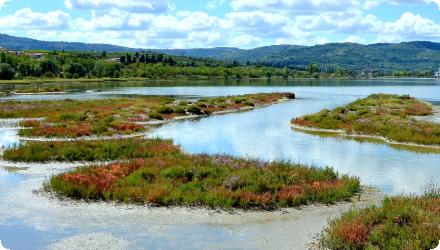
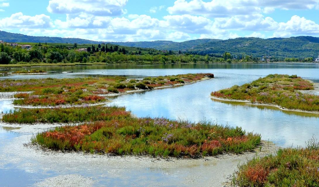
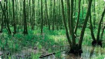
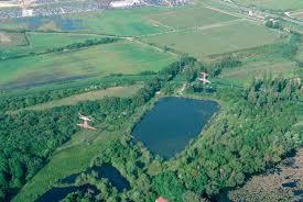
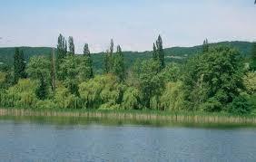
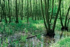
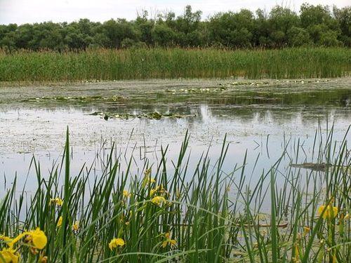
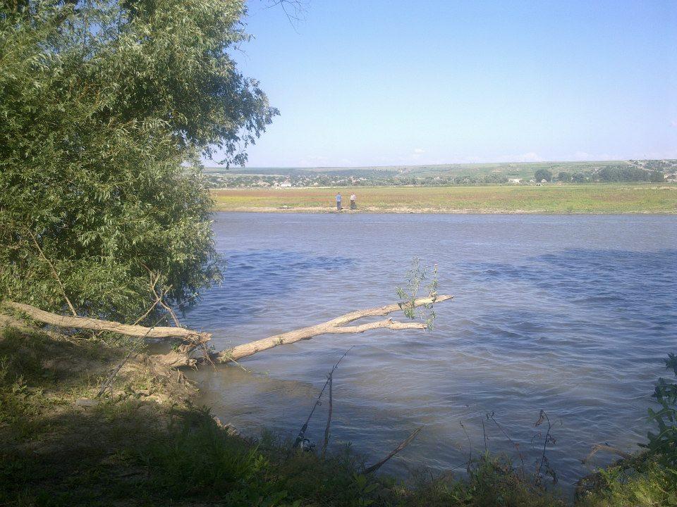
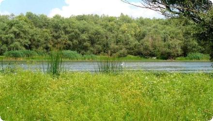
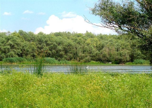
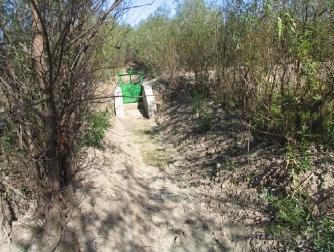
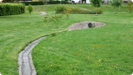
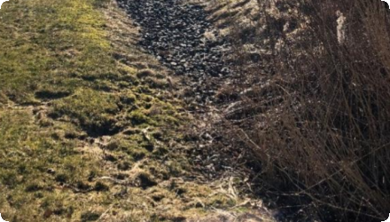
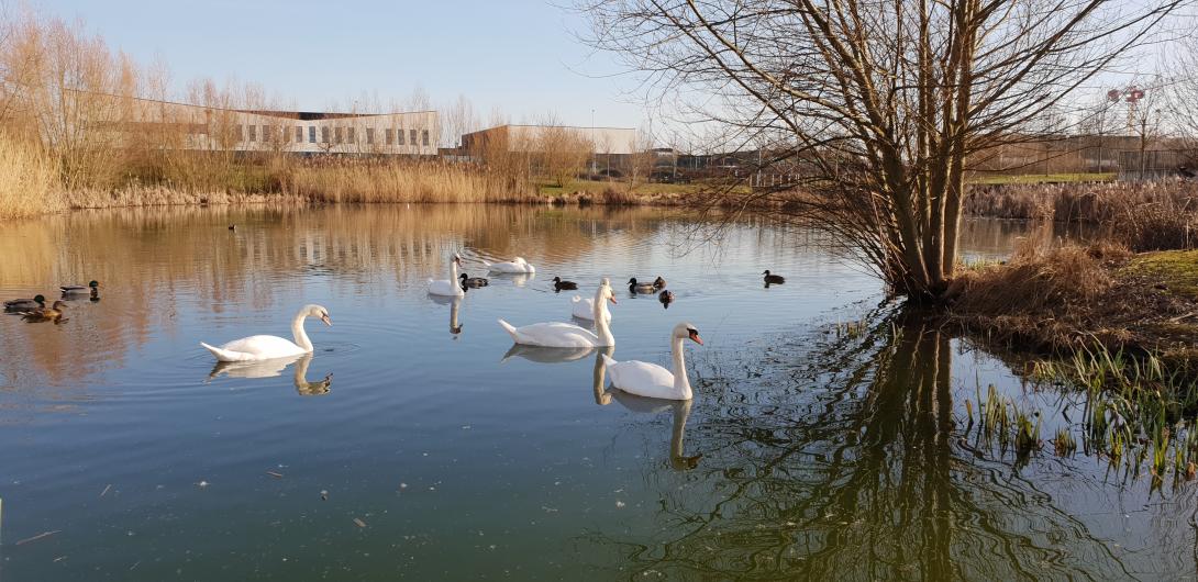
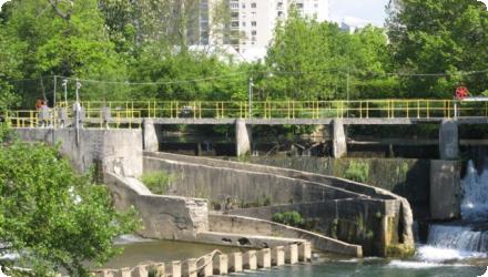
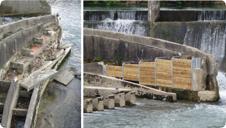
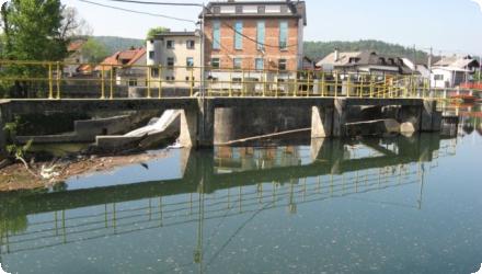
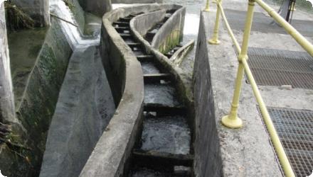
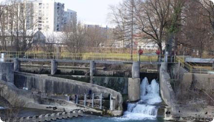
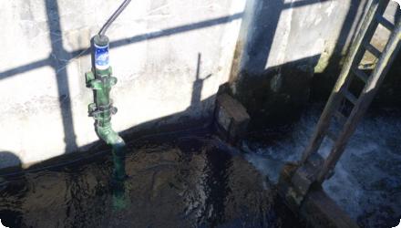
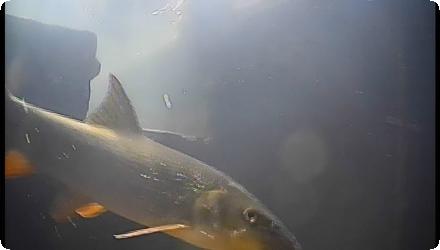
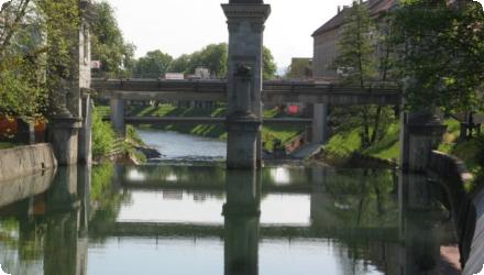
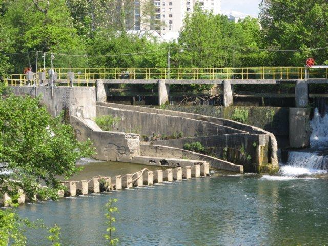
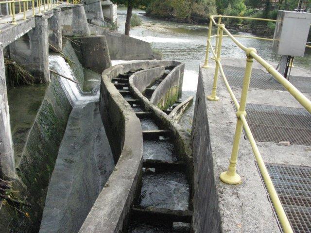
Removing barriers to fish migration, enhancing and restoring habitats, improving water-management infrastructure, and establishing a monitoring system. Funded by LIFE+ and implemented by Purgator Engineering Ltd. under the responsibility of the University of Ljubljana (UL FGG), the 2012–2016 “Ljubljanica connects” project rebuilt two dysfunctional fish passes (Fužine weir and Ambrožev trg), modernised the lifting gates at Ambrožev trg, and raised the Zalog sill by 20 cm to improve levels and oxygenation in upstream oxbows. A low-cost IR “fishcam” system was installed in both passes, providing continuous, online monitoring and confirming passage of 12 fish species, including the target Hucho hucho, Rutilus pigus and Leuciscus souffia. An After-LIFE plan maintains monitoring and knowledge transfer. While urban-section connectivity improved, full longitudinal continuity to the Sava remains constrained: the paper-mill weir at Vevče is the first impassable barrier upstream from the confluence, and the Gruber Canal sluice lacks a fish pass; national planning documents list measures to establish passability at Gruber. Coordinator: University of Ljubljana; partners: Purgator and Geateh.
Last update
2025
Summary
The project, part of a wider pollution-reduction programme, restored key habitats for bird conservation by improving lagoon water circulation, removing ~185 000 m³ of polluted sediments, creating a new freshwater marsh at Bertoška bonifika, flooding former farmland, and installing sluices to regulate marine and freshwater inflows. About 40 000 m³ of clean material was reused to form mudflats and nesting islets, enhancing habitats for species such as little bittern, great reed warbler, and little grebe. The restoration also included construction of visitor facilities and observation points (2009–2015), and establishment of a circular educational trail. Management is ongoing under DOPPS – BirdLife Slovenia, with adaptive measures such as late mowing and grazing by Istrian cattle and Camargue horses to maintain wet meadows. The reserve is involved in recent cross-border projects (e.g. POSEIDONE 2023–2025) promoting green and blue infrastructure, and continues active monitoring of birds, water quality, and hydrology.
Last update
2025
Summary
Reconstruction of dams and sluice gates, blocking of drainage ditches and creation of a hydrological network to route water from the Little Carpathians through the Šúr Fen National Nature Reserve (near Svätý Jur), funded by the LIFE programme (LIFE03 NAT/SK/000096). The works were prepared and initiated in 2003–2007 and complemented the intake built in 2001 on the Šúrsky Canal (rkm 10.197), which diverts water into the reserve when canal flow exceeds Q5 (up to ~7.4 m³/s). The Danube Flood Risk Management Plan (2015) describes a system of inverted siphons, canals and an aqueduct enabling year-round supply and water level management inside the fen. Project materials detail the refurbishment of control structures (e.g. on the Blahutov Canal), conversion of a drainage canal to irrigation, and raising water levels in the Čierna Voda to limit peat drawdown; interpretation and a nature trail were also delivered.
Since 2017–2018, management has reintroduced wood-pasture grazing in the Panónsky háj (southern part of the reserve) with local partners. Recent monitoring (2023–2024) reports marked increases in wild bee abundance in restored areas, indicating positive ecological response.
Last update
2025
Summary
In the Xiropotamos River Basin, near the town of Naoussa in Central Macedonia, Greece, a set of natural water retention measures was implemented to address severe erosion, flash flooding, and reduced water availability. The area, affected by deforestation and land degradation, required restoration to stabilize soils and improve hydrological regulation.

The project, initiated in 2004 and approved under national environmental terms in 2013, combined afforestation, riverbed reshaping, and small-scale retention structures. Around 70 hectares of degraded land were reforested with native tree species to reduce runoff and increase infiltration. In parallel, a 2 km stretch of the river was reprofiled to reduce its slope, and a series of check-dams and retention basins were constructed to slow water flow and trap sediments.

Implementation was led by the Municipality of Naoussa with the support of a private contractor, and the public development agency AN.KO A.E. contributed to forest technical works in the mountainous upstream areas. The intervention stands out as one of the first in Greece to combine forest hydrological engineering with landscape restoration at basin scale.

The project helped decrease peak flows, reduce sediment transport, and improve local water retention. It also provided environmental co-benefits by restoring vegetation cover and stabilizing the catchment. Its approval under Greek environmental regulations highlights its formal recognition and alignment with national water and forest policy objectives.
Last update
2025
Summary
The project’s objective was to improve the conservation status of aquatic bird species in Lower Prut Floodplain Natural Park (Galați County, RO) through scientific inventory, monitoring, site restoration, awareness-raising, implementation of the park management plan, and the designation of Natura 2000 SPAs. Partners were the University of Bucharest, the Romanian Ornithological Society and Romsilva – Galați Forestry.

At Vlăscuța, connectivity with the Prut was re-established by de-clogging the access (366 m) and outflow (176 m) channels and installing two sluices to stabilise lake levels; a birdwatching tower was also built here. The site is a national natural reserve (RONPA0433, 41.8 ha) within the Natura 2000 network (park overlaps ROSCI0105 and SPAs including ROSPA0070). Recent management documents confirm these works and facilities.
Last update
2025
Summary
The project’s objective was to improve the conservation status of aquatic bird species in Lower Prut Floodplain Natural Park (Galați County, RO) through scientific inventory, monitoring, site restoration, awareness-raising, implementation of the park management plan, and the designation of Natura 2000 SPAs. Partners were the University of Bucharest, the Romanian Ornithological Society and Romsilva – Galați Forestry.

At Pochina, two Prut–lake channels were cleaned and re-profiled (supply L = 362 m; evacuation L = 235 m), with small dykes/footbridges to maintain levels and enable gravitational flushing of sediments; a birdwatching tower was installed. Pochina is a national natural reserve (RONPA0432, 74.8 ha) located near Rogojeni (Suceveni Commune) and lies within the park’s Natura 2000 framework.
Last update
2025
Summary
Flow-weighted sampling was performed at the inlet and outlet of one of the infiltration trenches beneath the parking lot of a supermarket in Kungsbacka, south of Gothenburg. Monitoring ran from April–June 2012 and five storm events were originally analysed. The trench is part of a larger system serving the Maxi ICA site (≈3.1 ha) with three subsurface macadam trenches; the monitored “trench 1” had ~176 m³ storage with a permitted outflow of 6.17 L s⁻¹ (site cap 15 L s⁻¹). Runoff passes an oil separator and then discharges to stormwater ponds located between the car park and the Björkris residential area (toward Björkrisån/Kungsbackaån). Reported pollutant removals were high for TSS and metals and moderate for nitrogen, alongside clear flow attenuation. A subsequent peer-reviewed paper expanded the dataset to seven events and confirmed these trends. More recent municipal stormwater guidance (2023) highlights the Björkris/Hede ponds as part of the local network; while this corroborates the downstream arrangement, publicly available sources do not document the current maintenance or operational status of the specific trenches.
Last update
2025
Summary
Integrated rainwater retention was applied to recover degraded landscapes and local climate in north-eastern Slovakia, using small check dams, retention ponds, rain gardens and re-cultivated logging roads. Coordinated by People & Water (Ľudia a voda) and co-financed by the LIFE programme (LIFE11 ENV/SK/001019), the project worked across the Ondávka micro-region (Humenné district; eight municipalities). Implemented from August 2012, it ended early in May 2015 after loss of co-financing. By closure, 1,148 small barriers, 7 rain gardens and ~1 km of logging roads had been built or re-profiled; planned fishponds were cancelled. Local reporting indicates the measures reduced flood peaks during intense storms in 2013–2014 and were estimated to enhance the “small water cycle” by ~140,000 m³/year. The project also created short-term jobs (e.g., 56 unemployed people engaged in 2013 via the Humenné Labour Office). Since 2015, similar water-retention approaches have been incorporated into regional plans (e.g., the Košice Region’s 2021–2030 landscape and river-basin restoration programme) and referenced in national flood-risk planning updates (2024) covering the area.
Last update
2025
Summary
The intensive urban development of the Bezannes joint development zone (ZAC), near Reims, has led to the artificialization of 172 hectares of land, along with a growing need for stormwater management. Vegetated swales were implemented in the southern part of the area, while in the north, stormwater is collected and directed to a facility that includes an artificial wetland, an artificial lagoon, and a reed bed filter.
The construction of this facility, initiated by the Greater Reims Urban Community (project owner) and Sinbio (project manager), aimed to incorporate a nature-based solution to manage stormwater inflows upstream of the Muire River, improve the quality of discharged water, and create a 5-hectare natural space that would benefit both local residents and biodiversity called Parc de la Roselière.

This project illustrates a shift from traditional civil engineering to ecological engineering, combining water regulation, pollution control, biodiversity enhancement, and public amenities.
Last update
2015
Summary
On the Lower Danube between Silistra and Brăila, the LIFE project RESTOREWETLANDS (LIFE06 NAT/RO/000172) ran from 2006–2011 (eligible budget €1,017,396; EU contribution €489,209) to preserve, restore and sustainably manage the Small Islands of Brăila. Targets covered ~2,949 ha: planting alluvial forest on 449 ha, removing Amorpha fruticosa (planned 212 ha; achieved 237 ha), and restoring the natural hydrological regime on ~2,500 ha (incl. 1,366 ha of lakes). Forest and invasive-species actions met goals; however, prolonged floods limited lake works—Fundu Mare was only partial and the Navodari action failed.
The hydrological concept envisaged keeping permanent water via sluices in two zones (Egreta, Fundu Mare) and de-silting in a third (Navodari), with later expansion to other lakes; the plan also set out monitoring of siltation, banks and habitats.
Post-project reviews note that dredged channels re-closed where maintenance lapsed, reducing connectivity—an unexpected negative outcome.
Follow-up at Fundu Mare under EEA/SEE funding installed two sluices and channel works serving four lakes (~837 ha of open water); the park also maintains two educational water routes through light de-silting and removal of floating invasive vegetation.
Governance and planning have been updated with a Management Plan published by the park administration in 2024.
Last update
2025