Last update
2025
Summary
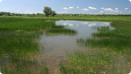
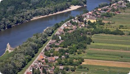
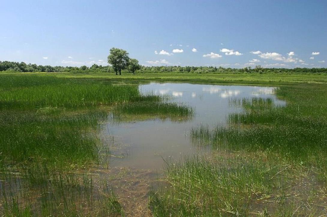
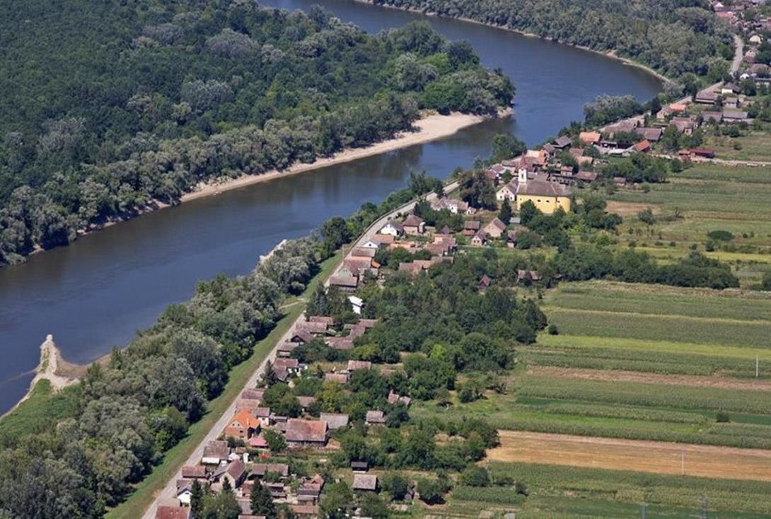
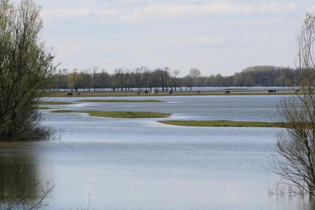
The Lonjsko Polje Nature Park, located along the Sava River, is one of the largest floodplains in Europe and a key retention area in the Croatian section of the Sava basin. Between 2006 and 2008, the restoration project aimed to improve the natural flood retention capacity of the floodplain by enhancing its ability to store excess water and reduce downstream flood risks. The intervention contributed to increasing the water retention volume from 634 million to 733 million cubic meters, using non-structural measures and improved management of embankments and natural flood dynamics. The area also serves as a vital biodiversity hotspot, especially for migratory birds and wetland habitats.
Since the original project, further efforts have continued under the Sava Parks II programme and national conservation strategies. As of 2025, restoration activities include the re-connection of former meanders, targeted flooding of over 200 ha of wetland areas, and the rehabilitation of at least 500 ha of degraded pastures in zones like Krapje Đol and Rakita. Monitoring and long-term management have been reinforced through the implementation of the PEM 103 management plan (2024–2033), including biodiversity tracking, invasive species control, and education programs. Remote sensing and satellite tools are now used to support environmental monitoring in collaboration with OIKON and the European Space Agency.
These ongoing efforts confirm the strategic importance of Lonjsko Polje for nature-based flood management, ecological restoration, and landscape-scale wetland conservation in the Sava River basin.
Position
Latitude
45.3616
Longitude
16.8333
Project
NWRM
National Id
Croatia_01
Installation date
2006
Implementation Status
Contact
Adriana Raveau, ACTeon
Transboundary
0
Photo gallery
Location of the project
The Central Sava Basin (CSB), located in Croatia, is an area that combines natural values with the function of storage of floodwaters of the Sava River. One of the most important areas is the Lonjsko Polje area. About 23 706 ha of this Nature Park, which has an area of approximately 50 600 ha, is used as the largest detention area in the Central Sava Basin.
NUTS Code
HR04 - Kontinentalna Hrvatska
Involved Partners
| Authority type | Authority name | Role | Comments |
|---|---|---|---|
Climate zone
cool temperate moist
Temperature
9,5
Precipitation
872
Annual rainfall range
600 - 900 mm
Runoff
680
Runoff range
600 - 750 mm
Elevation range
113
Slope range
gentle (2-5%)
Vegetation class
Natural landscape elements and European riverine lowlands (reed, poplar, willow, ash, willow reed, alder, beech, oak hornbeam...).
Water bodies: Ecological Status
Bad
Water bodies: Chemical Status
Failing to achieve good
Water quality status
Upstream pollution comes from cities like Zagreb, Kutina, Bjelovar, and Sisak, where sewage plants, a fertilizer dump, an oil refinery, and an herbicide plant contribute to water quality pressures in the Sava basin.
Project scale
Large
Project scale specification
About 23 706 ha (237 km²) of this Nature Park is used as the largest detention area in the Central Sava Basin.
Project area
23706
Area specifications
Lonjsko Polje represents approximately 184 km² of retention area out of a total basin of 246 km²; 60% in floodplain forests, 30% wet meadows and pastures, the rest agricultural or aquatic areas.
Area subject to Land use change or Management/Practice change (ha)
17100
Integrative planning, integration of demands, acceptable costs, impact on public perception and acceptability, aesthetic benefic, functionality, adaptability.
Design capacity description
The storage capacity would be increased from 634 billion cubic meters (BCM) to 733 BCM.
Costs total information
The project saves considerable costs, by reducing the amount of water engineering construction: both the length of dikes and the number of distribution facilities are lessened. Accordingly, maintenance costs are also reduced. Additional costs are incurred for designing the new facilities, for modelling the flood waves and for carrying out the risk assessment on the new system.
Incremental costs are needed for important improvements to the system, which will secure the longterm sustainable use of the floodplains. Restoration and rehabilitation projects are needed to achieve an integrated water management.
Incremental costs are needed for important improvements to the system, which will secure the longterm sustainable use of the floodplains. Restoration and rehabilitation projects are needed to achieve an integrated water management.
Costs operation maintenance information
Information not found
Financing authorities
Type of funding
EU-funds: LIFE+
Comments
LIFE05‑TCY‑CRO‑000111
496 845 €
496 845 €
Type of funding
National funds
Type of funding
Other
Comments
Croatian Inland Waters Project
Compensations
0
Policy context
After severe flooding of the river Sava (Zagreb 1964, Sisak and Karlovac 1965 and 1966) a flood prevention scheme, "Sava 2000" was set up and approved in 1972, with the aim not only to prevent flooding, but also to develop the agriculture. The project was a combination of the construction of large storage areas to retain excess flood water which the Sava cannot discharge, and conventional works (construction of dikes and regulation of the river canal). About 40% of the plan was completed when the region was plunged into conflict in 1990 and Yugoslavia fell apart, leaving large alluvial wetlands unregulated. In the meantime, the vision on ecological values changed. In the year 2000, the World Bank recommended to adjust the 1972 plan to a flood protection scheme that takes into consideration the ecological and landscape diversity values of the floodplains. This 'World Bankplan' proposed measures to mitigate the detrimental impacts on the biodiversity caused by the implementation of the first phase of the 1972 plan. Additional objectives of this new approach were to stimulate the preservation and development of the natural and cultural heritage of the Sava area. The Life project "Central Posavina - Wading toward Integrated Basin Management"; fits in this context in particular by promoting an Integrated Sava Basin Management Plan that meets the requirements of the Water Framework Directive.
Community involvment
No
Design consultation activity
| Activity stage | Name | Key issues | Comments |
|---|
Policy target
| Target purpose |
|---|
|
Improved Biodiversity
|
|
Peak-flow reduction
|
Policy pressure
| Pressure directive | Relevant pressure |
|---|---|
|
WFD identified pressure
|
4.1.1 Physical alteration of channel/bed/riparian area/shore of water body for flood protection
|
|
WFD identified pressure
|
4.2.2 Dams, barriers and locks for flood protection
|
|
Other non-EU
|
Croatia’s Nature Protection Act
|
|
Other non-EU
|
Ramsar’s Frameworks for managing Wetlands of International Importance
|
Policy impact
| Impact directive | Relevant impact |
|---|---|
|
WFD identified impact
|
Altered habitats due to morphological changes
|
Requirement directive
| Requirement directive | Specification |
|---|
Contractual arrangements
0
| Arrangement type | Responsibility | Role | Name | Comments |
|---|
Part of wider plan
1
Wider plan type
| Wider plan type | Wider plan focus | Name | Comments |
|---|---|---|---|
|
National
|
Water
|
Croatian Inland Waters Project
|
Funded by a World Bank loan.
|
Laboratory
The project saves considerable costs, by reducing the amount of water engineering construction: both the length of dikes and the number of distribution facilities are lessened. Accordingly maintenance costs are also reduced. Additional costs are incurred for designing the new facilities, for modelling the flood waves and for carrying out the risk assessment on the new system.
Incremental costs are needed for important improvements to the system, which will secure the long term sustainable use of the floodplains. Restoration and rehabilitation projects are needed to achieve an integrated water management.
Value added by the preservation and restoration plan results from the improvement of the nutrient sink capacity, protection of the valuable cultural and natural heritage, and the long-term conservation of large inundation areas for transboundary flood protection. The impact on the alluvial forest cannot been foreseen.
Increased water storage
16
Increased water storage unit
% Percent
Information on runoff reduction
Information not found
Information on Soil moisture
The storage capacity would be increased from 634 billion m3 to 733 billion m3, a 16 % augmentation.
Information on Reducing flood risks, quantity
Long-term conservation of large inundation areas for transboundary flood protection.
Information on Restoring hydraulic connections
A very important component of the programme is the improved connectivity of water bodies. 27 oxbow lakes and floodplain areas, which were cut off from the ‘live’ river channel, would be preserved in addition.
Water quality overall improvements
Neutral impact-no change in WQ status
Soil quality overall soil improvements
Positive impact-SQ improvement
Information on Soil quality overall soil improvements
Improvement of the nutrient sink capacity.
1
Value added by the preservation and restoration plan results from the improvement of the nutrient sink capacity, protection of the valuable cultural and natural heritage, and the long-term conservation of large inundation areas for transboundary flood protection. The impact on the alluvial forest cannot been foreseen.
Ecosystem impact climate regulation
No specific impact
Information on Ecosystem provisioning services
- Water provision to deliver water services to the economy both for drinking and non-drinking purposes.
- Flood security and protection.
- Amenities (associated to habitat protection): fish and plants, tourism, recreation, and others.
- Flood security and protection.
- Amenities (associated to habitat protection): fish and plants, tourism, recreation, and others.
Key lessons
The purpose of the Life project "Central Posavina - Wading towards Integrated Basin Management" (2006 -2008) was to develop and improve an integrated river basin management approach in Lonjsko Polje Nature Park and at least on a Central Posavina scale. This has been done by in particular developing consultative processes and appropriate structures which involve the various stakeholders for the conservation, utilisation and management of the water resources by ensuring non-structural flood control methods which take advantage of the natural functions of wetlands to supplement or replace existing flood control infrastructure.
Success factor(s)
| Success factor type | Success factor role | Comments | Order |
|---|---|---|---|
|
Successful coordination between authorities
|
main factor
|
1
|
Driver
| Driver type | Driver role | Comments | Order |
|---|---|---|---|
|
Balancing different objectives
|
main driver
|
In the year 2000, the World Bank recommended to adjust the 1972 plan to a flood protection scheme that takes into consideration the ecological and landscape diversity values of the floodplains. This 'World Bankplan' would propose measures to mitigate the detrimental impacts on the biodiversity caused by the implementation of the first phase of the 1972 plan. Additional objectives of this new approach are to stimulate the preservation and development of the natural and cultural heritage of the Sava area
|
1
|
Transferability
The project has had a high demonstration value for other nature parks in Croatia and can act as a good example for how to develop similar management plans in other regions.
English