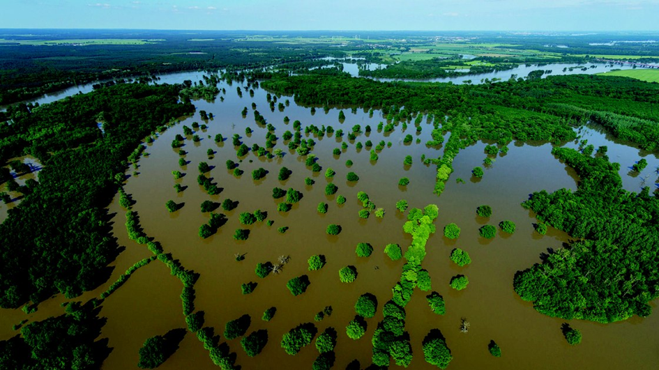
- Floodplain reconnection
A floodplain is the area bordering a river that naturally provides space for the retention of flood and rainwater. Because of regular flooding, floodplain soils are generally very fertile and they have often been dried-out to be used as agricultural land. Floodplains in many places have also been separated from the river by dikes, berms or other structures designed to control the flow of the river. They have also been covered by legacy sediments.
Floodplains are essential for flood protection, water management, nature conservation, and agriculture. However, hydromorphological alterations—such as land drainage, urbanisation, and river channelisation—have significantly disrupted these functions. In Europe, floodplains cover approximately 7% of the continent and account for around 30% of the terrestrial Natura 2000 site area. Studies indicate that 70% to 90% of these areas have experienced environmental degradation.
Major floodplains roles have thus been lost, due to land drainage, intensive urbanisation and river channelisation. The objective is to restore them, their retention capacity and ecosystem functions, by reconnecting them to the river.
Restoring the floodplain roles requires measures such as:
Modification of the channel,
Rremoving legacy sediment
Ccreation of lakes or ponds in the floodplain
Nnew/modification of agricultural practices, - afforestation, etc.
Pplantation of native grasses, shrubs and trees
Ccreation of grassy basins and swales
Wwetland creation
Iinvasive species removal
Rriparian buffer installation and development