Last update
2025
Summary
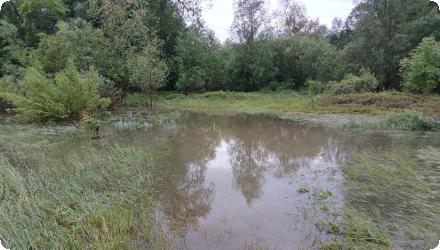
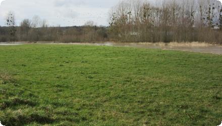
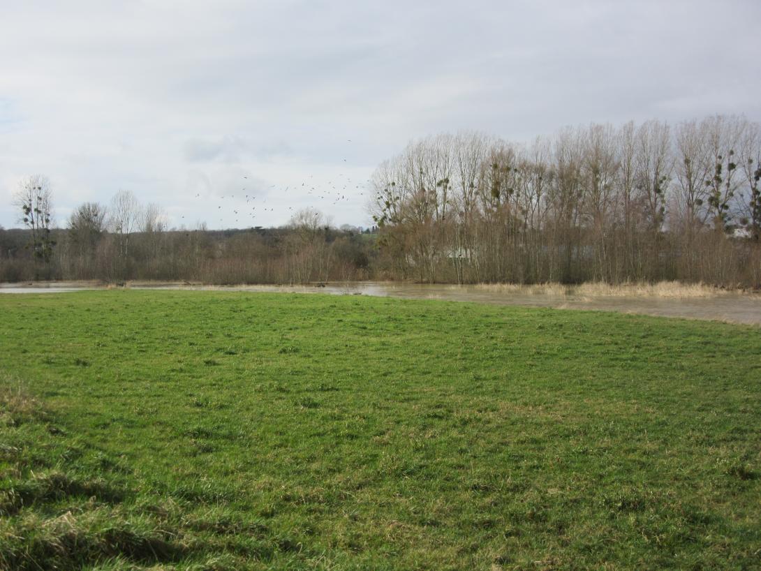
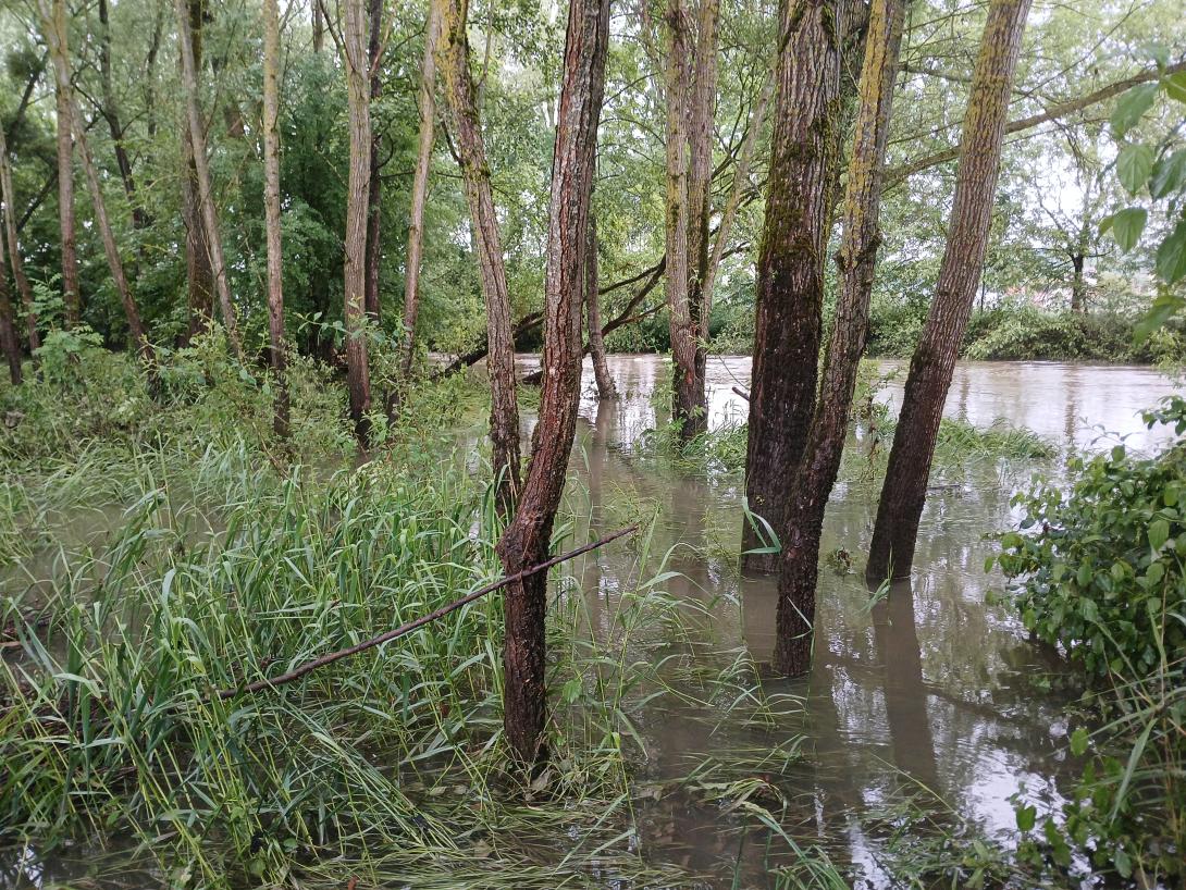
The 75 km-long Vezouze river regulary overflows, leading to increasingly violent floods especially in the urbanized sector of Lunéville, worsen by the degradation of the natural river bed upstream. After the violent 1983, 1998 and 2004 floods, the local municipalities launched restoration work to reduce the impacts of future floods. It involved widening parts of the riverbed by leveling a levee on the left bank. Two one-meter-wide flood channels were excavated over six hectares, creating 60,000 m³ of cleared material. Wetland habitats like ponds and side channels were established, with trees and helophytes planted.
Position
Latitude
48.589
Longitude
6.502
Project
NWRM
National Id
France_04
Installation date
2007
Implementation Status
Contact
Elia Desmot, OIEau
RBD code
FRB1
Transboundary
0
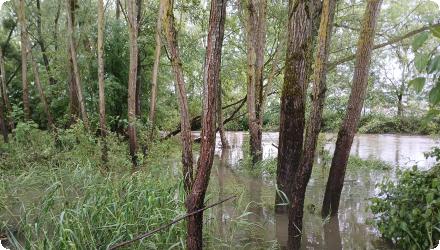
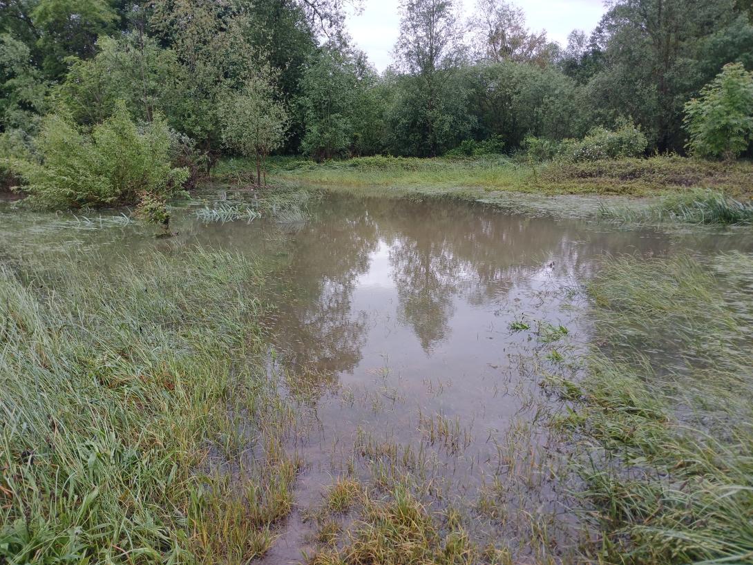
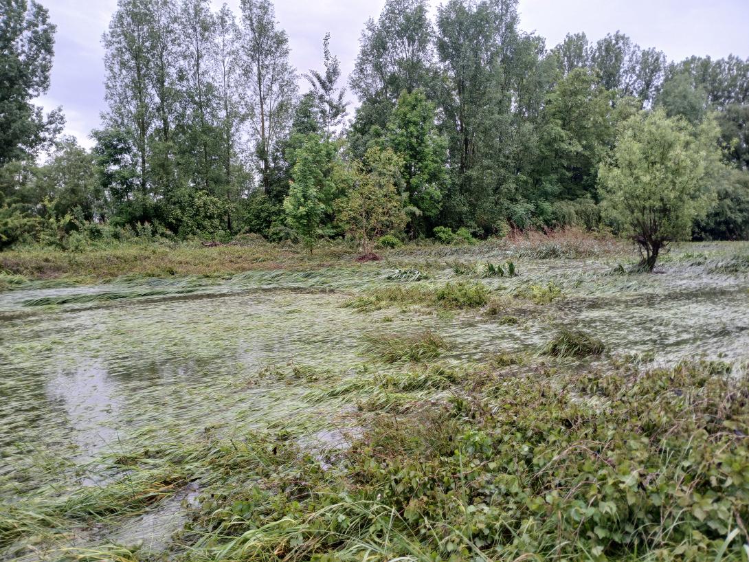
Photo gallery
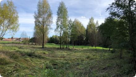
Location of the project
The Vezouze is a French river that flows through the Meurthe-et-Moselle department in the Grand Est region. It is a right-bank tributary of the Meurthe, and therefore a sub-tributary of the Rhine via the Moselle.
NUTS Code
FR41 - Lorraine
Involved Partners
| Authority type | Authority name | Role | Comments |
|---|---|---|---|
Climate zone
cool temperate moist
Temperature
10°C
Precipitation
939
Annual rainfall range
900 - 1200 mm
Elevation range
227
Slope range
0-1%
Depth groundwater
0 m.
Vegetation class
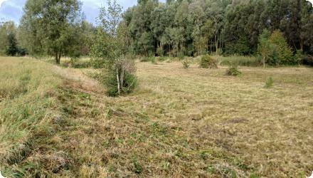
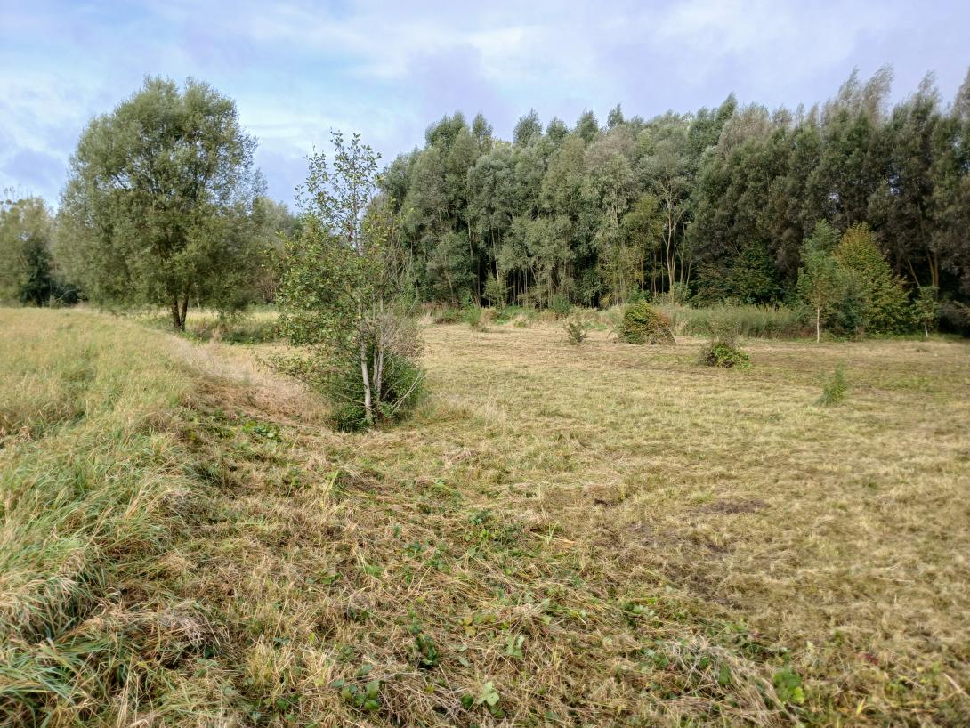
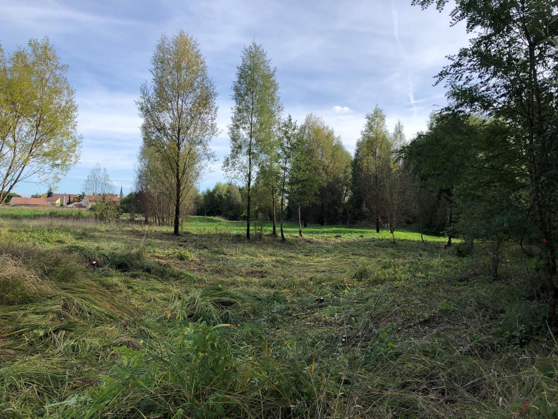
The functional riparian forest has been preserved. Plantings were made on the rest of the site after the work (willows, ash trees).
The risk of proliferation of invasive species is being monitored. Two Japanese knotweed (Reynoutria japonica) plants have been spotted on the left bank.
The risk of proliferation of invasive species is being monitored. Two Japanese knotweed (Reynoutria japonica) plants have been spotted on the left bank.
Water bodies: Ecological Status
Poor
Water bodies: Chemical Status
Failing to achieve good
Project scale
Micro
Project scale specification
Single site of small area.
Performance timescale
< 1 year
Lifespan
100
The scheme was made possible by a desire for integrated water management.
There were no technical contraints like site access due to urban proximity.
There were no technical contraints like site access due to urban proximity.
Total cost
€ 1,930,000
Costs total information
This total sum is from 2007. Additional costs are not taken into account, and conducting a similar project would be significantly more expensive today.
Costs investment
€ 230,000
Costs investment information
Studies and land acquisition
Costs operational
€ 1,700,000
Financing authorities
Type of funding
Sub-national funds
Type of funding
Sub-national funds
Type of funding
Local funds
Comments
Intermunicipality
Compensations
1
Compensations annual information
The acquisition of land on the left bank was legally forced for public interest in exchange for fair compensation.
Policy context
Facing recurring importoant and damaging flood events, this project aims to improve safety for the population.
Land ownership
Public land owned by the project owner.
Community involvment
No
Design consultation activity
| Activity stage | Name | Key issues | Comments |
|---|---|---|---|
|
Other
|
Information panels and a water-themed walking route in the city
|
The sensiblization to biodiversity presevation did not reduce significantly the degradations on the site.
|
The toursitic success was limited. The panels were removed.
|
|
Other
|
Animations for school classes
|
Nature and environment associations carry out over 200 animations per year in Lunéville and its surroundings. This site is often used as it allows to show natural spaces to children next to the city center (at wlaking distance from many schools).
|
Policy target
| Target purpose |
|---|
|
Increase Water Storage
|
|
Improved Biodiversity
|
|
Oher Societal Benefits
|
Target Remarks
Reduce the waterflow in urban areas during floods as the main goal of this project.
Create biodiversity hotspots with the restored floodplain and hydraulic annexes as a secondary objective.
Create biodiversity hotspots with the restored floodplain and hydraulic annexes as a secondary objective.
Policy pressure
| Pressure directive | Relevant pressure |
|---|
Policy impact
| Impact directive | Relevant impact |
|---|
Requirement directive
| Requirement directive | Specification |
|---|
Contractual arrangements
1
| Arrangement type | Responsibility | Role | Name | Comments |
|---|---|---|---|---|
|
Institutional arrangement
|
Partnership between the local authority (Communauté de Communes du Territoire de Lunéville à Baccarat) and the water agency (Agence de l'Eau Rhin Meuse).
|
Contrat de partenariat Agence de l'Eau
|
This partnership ended in 2018.
|
|
|
Contractual agreement
|
Agreement between the local water authority (Communauté de Communes du Territoire de Lunéville à Baccarat) and a farmer responsible for yearly meadow grass cut.
|
Maintenance of meadow vegetation
|
The farmer has to carry out the cut every year before 15th of june.
The biomas produced is used for his own agricultural livestock activity. |
Part of wider plan
0
Wider plan type
| Wider plan type | Wider plan focus | Name | Comments |
|---|
There is very limted monitoring. An ecological study was conducted in 2015, and a flood monitoring station was installed on the Vezouze river next to the floodplain.
Hydromorphology, Biological communities (ecology), fauna, flora.
Flood Monitoring station in the Vezouze right next to the floodplain :
Vigicrue Station Lunéville (Vezouze)
https://www.vigicrues.gouv.fr/station/A657111001
Vigicrue Station Lunéville (Vezouze)
https://www.vigicrues.gouv.fr/station/A657111001
Maintenance
Selective vegetation management operations (in left bank wetlands and hydraulic side channels) were carried out between 2022 and 2024, otherwise few maintenance in this area. The wet meadow is managed with a yearly early cut and biomass removal.
Catchment outlet
Species present before and after implementation, decrease of flood impacts.
The main economic benefits are the prevention of damage repair costs due to flood events.
Other social benefits include the creation of an urban anemity space, which allows recreation activities such as fishing, walking, camping, etc. in a natural environment next to the city center.
Other social benefits include the creation of an urban anemity space, which allows recreation activities such as fishing, walking, camping, etc. in a natural environment next to the city center.
Information on Reducing flood risks, quantity
A 30 cm drop in water level in the town during the floods.
Water quality overall improvements
Neutral impact-no change in WQ status
Information on Water quality overall improvements
No real monitoring of water quality was carried out. But as a small portion of a large river, the effecti of this measure alone is hard to quantify. There are still wuality issues due to storm overflowing of upstream combined sanitation networks.
Information on Water quality Improvements (W T°)
The shading provided allows local cool areas connected to the river, which supports the aquatic fauna during the warm summer temperatures observed by the local fishing associations.
Soil quality overall soil improvements
N/A info
1
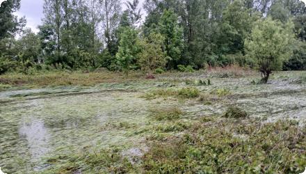
The habitats have evolved naturally. The shallow hydraulic side channels on the left bank have filled in and become vegetated, and the riparian forest has developed. The plant species introduced during the works have declined, giving way to native species of the valley. Currently, only 2 small patches of the invasive Japanese knotweed has been identified.
The site hosts many bird species, serving as a refuge area in an urban environment. Since 2022, the European beaver has also been observed on the site, showing the site's recolonization by a patrimonial species.
Some invasive fauna (nutria, crayfish, muskrat) are present, but not specifically to this site in the whole river basin.
Ecosystem impact climate regulation
No specific impact
Information on Ecosystem impact climate regulation
Not measured precisely, but it is suspected.
Key lessons
The monitoring of the project shows that the improvement of biodiversity, as well as flood impacts decrease, are very satisfactory.
However, the design was flawed : the too limited depth of the hydraulic annexes (0.8 m max) lead to their natural closing over the years.
The site maintains its hydraulic efficiency. No flood exceeding the Q20 level (the 2006 event) has affected the town since the completion of the project. The site functions effectively during each seasonal flood. The combination of various measures allowed to prevent any damage from the 2024 flood event.
The site is heavily frequented by walkers and local residents, which has led to issues with illegal dumping and a fire incident in the meadow.
Success factor(s)
| Success factor type | Success factor role | Comments | Order |
|---|---|---|---|
|
Attitude of relevant stakeholders
|
main factor
|
1
|
|
|
Existing technical standards
|
secondary factor
|
3
|
|
|
Existing institutional framework
|
secondary factor
|
4
|
Driver
| Driver type | Driver role | Comments | Order |
|---|---|---|---|
|
Past flooding events
|
main driver
|
Past events heavily motivated the local politic officials to carry out this project.
|
1
|
Transferability
A similar project can technically be carried out in plenty of other cities. However, land control and high financing possiblities are critical for the success.
Cost effectiveness
No cost-effectiveness assessment was realized.
English