
Ongoing

Small scale measures under the 'Waters neighborhood Days' in Hamburg, Germany

Summary
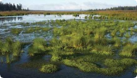
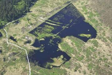
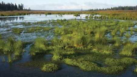
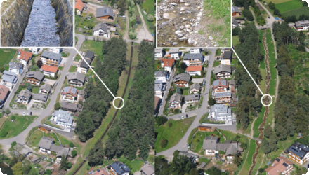
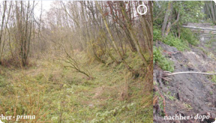
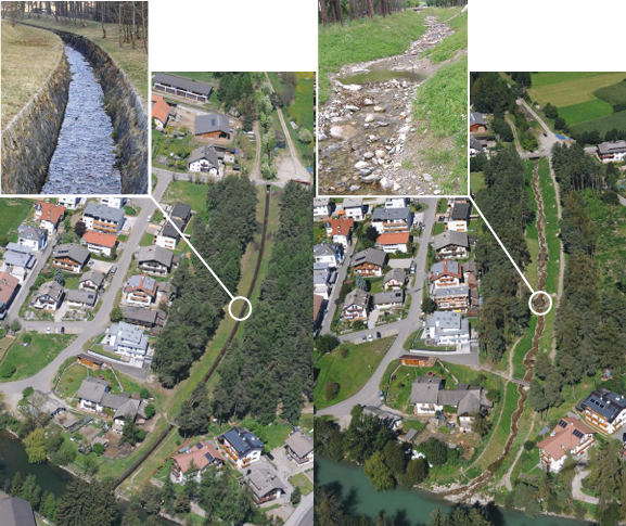
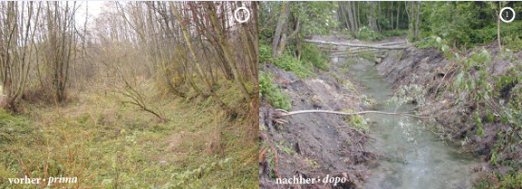
The measures implemented at two river within the city of Hamburg (Germany) included the restoration of rivers and ponds (N1), the revitalization of flowing waters (N5), natural bank stabilization (N10), and channels and rills (U5). They targeted the National Biodiversity Strategy of Germany as well as the achievement of a good ecological status as defined by the WFD. For the identification of locations for possible measures the general public was involved using online forms. The implementation was then carried out by a local chapter of the German nature conservation NGO NABU. This measure proves to be highly effective while easy and cheap to implement, it is therefore considered a success.
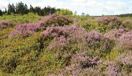
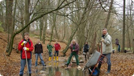
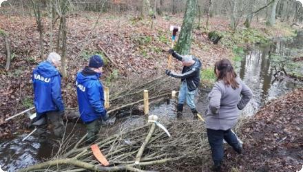
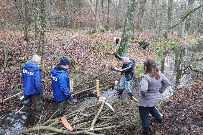
Since 2006, the “Waters Neighborhood Days” evolved into regular Bach-Aktionstage, engaging citizens and school groups in restoring small urban streams in Hamburg. Led by NABU and supported by SDW and local authorities, actions include placing deadwood, adding gravel, and removing concrete structures to improve stream morphology and biodiversity. Over 40 events have taken place across multiple streams, with long-term educational and ecological goals.
Last update
2023

Rehabilitation of heaths and mires on the Hautes-Fagnes Plateau, Belgium

Summary
The project to rehabilitate heaths and mires on the Hautes-Fagnes Plateau (Belgium) is a long-running peatland restoration programme. A LIFE project (2007–2012) initiated large-scale works and the effort has continued since 2012, with additional operations funded mainly through the Walloon Rural Development Programme (PwDR). The 2007–2012 LIFE achievements were:
• 137 ha of private land purchased, restored and designated as nature reserves (RND);
• 208 ha of public land restored and designated as RND;
• 362 ha of municipal and private land restored under conservation agreements;
• 712 ha of spruce plantations on peat/peaty/hydromorphic soils cleared;
• 259 ha of dense spruce regeneration removed on former clear-cuts on peat/peaty/hydromorphic soils;
• 178 km of drainage ditches neutralized (peat/clay plugs every 25–30 m);
• 4,519 ponds created (~20 ha);
• 23 ha of degraded peatlands restored through rewetting;
• 157 ha of degraded peatlands restored through topsoil removal;
• 94 ha of (mainly peaty) heath restored through sod-cutting;
• 50 ha of heath/peat/meadows/Nardus grasslands restored by restorative mowing;
• 373 ha of heath/peat fenced for grazing;
• 124 ha of clear-cuts fenced to promote natural regeneration of deciduous trees;
• 98 cryoturbation features (lithalsas) repaired;
• 8 ha of stripped peatlands revegetated (shredded Sphagnum, cotton-grass planting);
• 1,540 ha of heath/peat cleared of natural tree seedlings (mostly conifers);
• 22 ha of non-native deciduous trees (Alnus incana) removed.

Since 2012, restoration under PwDR has progressed across many sites (e.g., Misten, Fagne Wallonne, Cléfaye, Fagne des Wés, Potales, Fagne de la Poleûr, Helle & Soor valleys, Brackvenn North, Grande Fange, Geitzbusch). Official updates indicate that, to date, ~348 ha of high bogs in the High Fens have been treated using two main techniques - rewetting by engineered bunds/dams (~97 ha) and large-scale topsoil removal/decapage (~251 ha) - with ongoing works in several sectors (monitoring shows positive vegetation trajectories and higher drought resilience in restored plots). Technical practice has evolved from drain-blocking alone to extensive decapage (typically 20–40 cm to remove mineralised peat and Molinia tussocks) and managed re-inundation; the use of excavators operating on modular rafts minimizes substrate damage and enables work in very soft peat. Beyond habitat works, the site has also hosted species-focused actions (e.g., the black grouse reinforcement programme led by ULiège/RBINS/DNF).

Broader recognition and governance: the LIFE project PLTHautes-Fagnes received the “Best of the Best” LIFE Nature award (2013). According to LIFE/Ramsar sources, project actions have restored on the order of ~2,800 ha of degraded heath and mires and contributed to increases in certain breeding bird populations. After-LIFE management is led by the Walloon public services (SPW-DEMNA/DNF) with partners, and complementary landscape-scale actions are running in the wider Ardennes (e.g., LIFE “Vallées ardennaises”, 2020–2028), supporting riverine and forest processes connected to the peatland hydrology.
Last update
2024

River restoration of the lower Aurino in Italy

Summary
This case study focuses on the restoration of the Aurino stream as part of a 20-year management plan (1999–2020), during which several interventions were implemented between Molini di Tures and Brunico. The main goal was flood protection, alongside ecological restoration.

Since 2003, several restoration and requalification interventions have been carried out on areas of public water property. The measures included widening the riverbed, reactivating side channels, lowering embankments, and restoring sediment dynamics. Specific interventions carried out under these objectives included: the widening of the Aurino river section at Molini II; requalification of the Aurino at Molini; requalification of the Stockweiher; requalification of the Gatzaue area; requalification of the Schmidt-Aue floodplain; and requalification of the lower course of the Rio di Fontecervo. Additional efforts included the creation of the San Giorgio River Park “Beach”; widening of the “Im Sack” meander; and widening of the “Raut” area, including the oxbow lake. Complementary awareness and recreational initiatives such as Views on the Aurino, the Experience the Aurino trail (Lower Aurino river recreation), and the river recreation area in Eile further supported the engagement and multifunctional use of the restored areas. Most works were conducted on public land; however, one intervention (Gatzauer/Gais Lot III) required compensation due to the use of private property.

Stakeholder involvement from farmers to local communities was crucial. Negotiations helped balance environmental goals with agricultural needs, leading to broad acceptance. The restored floodplains improved retention capacity (from 17% to 20%), effectively reducing flood risk, as proven during heavy rainfall in 2020 with no reported damages.

The project is still ongoing and there is work being done every year. There is also a monitoring program which is being repeated around every 7 years. Until today the project still proves its effectiveness. Naturally there is some deterioration for example due to the missing sediment input in the catchment. However, to this day there were no restoration works needed for any of the revitalization measures. However, in the near future there will surely be some work done to fight deteriation due to the limited land availability.
Last update
2025