Last update
2026
Summary
Sponge Scapes case study UK 06
The New Forest Lymington Catchment Restoration began through the EU LIFE New Forest Wetland Restoration Project between 2002 and 2006. The project aimed to reverse more than a century of artificial drainage and channel modification that had altered the hydrology of the New Forest's river systems. Historic straightening and deepening of streams had disconnected rivers from their floodplains, lowered groundwater levels and degraded wetland habitats. Restoration works focused on infilling artificial drainage channels, reinstating historic meanders, reconnecting rivers with their floodplains and restoring natural geomorphological processes. More than 10km of river channel and over 600ha of wetland habitats were restored across the New Forest river basins. Subsequent restoration programmes have continued this work by re-meandering additional sections of the stream, introducing large woody material and heather bale installation, mire restoration and adaptive catchment management. ; The River Cole
Restoration was implemented between 1994 and 1996 as part of the European Union LIFE Demonstration Project to restore a heavily modified lowland river and demonstrate the benefits of nature-based river restoration. The project focused on a 2.5 km reach of the River Cole near Coleshill, Oxfordshire, where historical channel straightening had disrupted natural river processes, disconnected the river from its floodplain, and reduced habitat diversity.
Restoration works included re-meandering the river, re-establishing a more natural floodplain profile by insetting the floodplain, introducing large woody material to the upstream reaches, and creating reedbeds and backwaters to enhance habitat diversity. At the time, this was one of the largest river restoration projects undertaken in the UK and Europe, demonstrating the potential for restoring natural river processes as an alternative to traditional engineered river management.
Since its completion, the River Cole has become one of the UK's most influential river restoration demonstration sites and is featured within the River Restoration Centre (RRC) guidance and handbook. Long-term monitoring has documented sustained improvements in channel morphology, biodiversity, and floodplain connectivity. In 2023, the site became part of the SpongeScapes project, further reinforcing its role as an internationally recognised example of nature-based river restoration and an important reference for future river restoration initiatives across Europe.
The New Forest Lymington Catchment Restoration began through the EU LIFE New Forest Wetland Restoration Project between 2002 and 2006. The project aimed to reverse more than a century of artificial drainage and channel modification that had altered the hydrology of the New Forest's river systems. Historic straightening and deepening of streams had disconnected rivers from their floodplains, lowered groundwater levels and degraded wetland habitats. Restoration works focused on infilling artificial drainage channels, reinstating historic meanders, reconnecting rivers with their floodplains and restoring natural geomorphological processes. More than 10km of river channel and over 600ha of wetland habitats were restored across the New Forest river basins. Subsequent restoration programmes have continued this work by re-meandering additional sections of the stream, introducing large woody material and heather bale installation, mire restoration and adaptive catchment management. ; The River Cole
Restoration was implemented between 1994 and 1996 as part of the European Union LIFE Demonstration Project to restore a heavily modified lowland river and demonstrate the benefits of nature-based river restoration. The project focused on a 2.5 km reach of the River Cole near Coleshill, Oxfordshire, where historical channel straightening had disrupted natural river processes, disconnected the river from its floodplain, and reduced habitat diversity.
Restoration works included re-meandering the river, re-establishing a more natural floodplain profile by insetting the floodplain, introducing large woody material to the upstream reaches, and creating reedbeds and backwaters to enhance habitat diversity. At the time, this was one of the largest river restoration projects undertaken in the UK and Europe, demonstrating the potential for restoring natural river processes as an alternative to traditional engineered river management.
Since its completion, the River Cole has become one of the UK's most influential river restoration demonstration sites and is featured within the River Restoration Centre (RRC) guidance and handbook. Long-term monitoring has documented sustained improvements in channel morphology, biodiversity, and floodplain connectivity. In 2023, the site became part of the SpongeScapes project, further reinforcing its role as an internationally recognised example of nature-based river restoration and an important reference for future river restoration initiatives across Europe.
Position
Latitude
50.535
Longitude
1.3848
Project
SpongeScapes
Installation date
1995, 2002
Implementation Status
Transboundary
0
Photo gallery
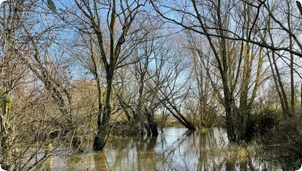
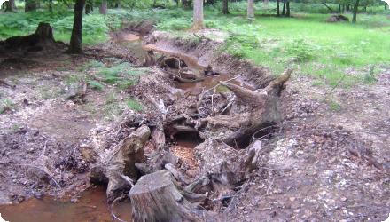
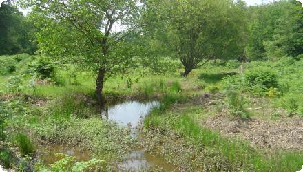
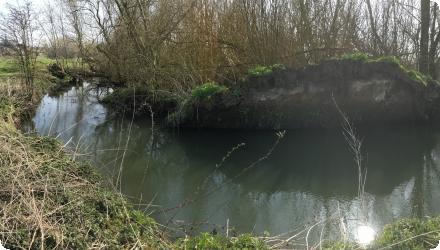
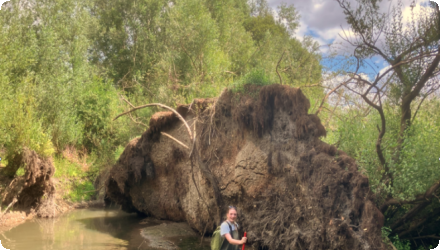
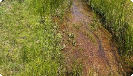
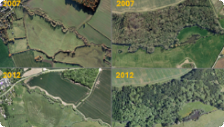
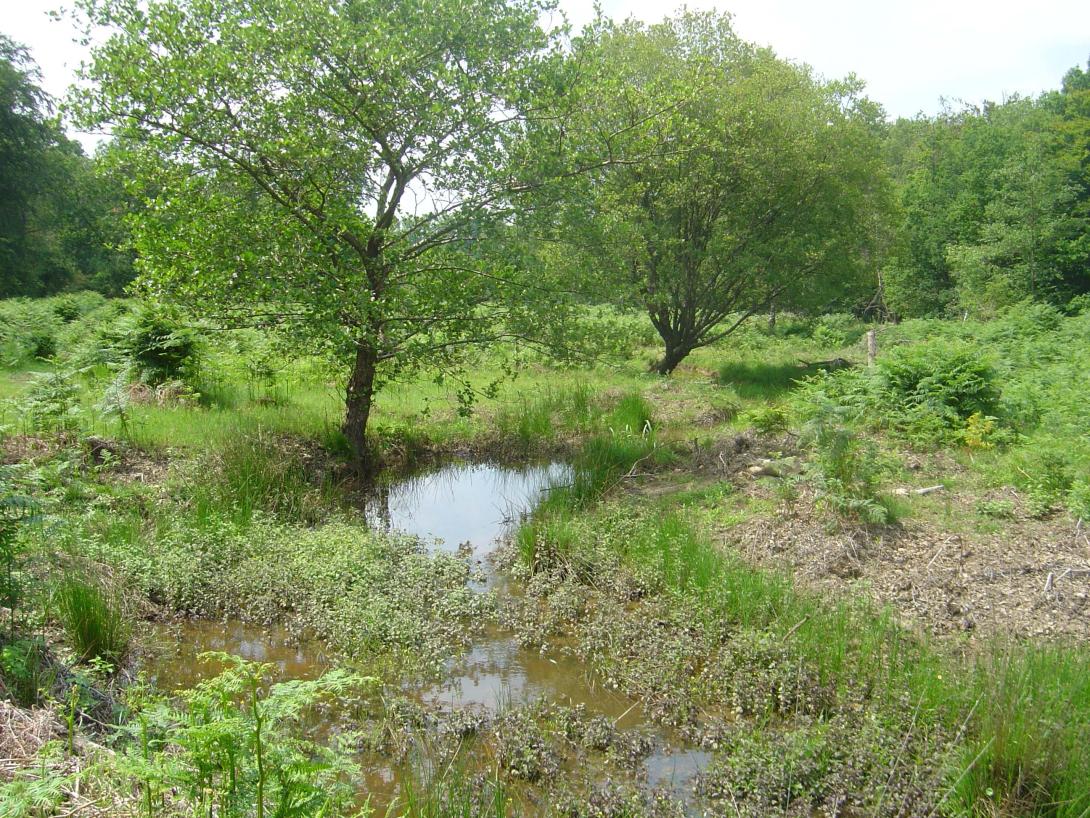
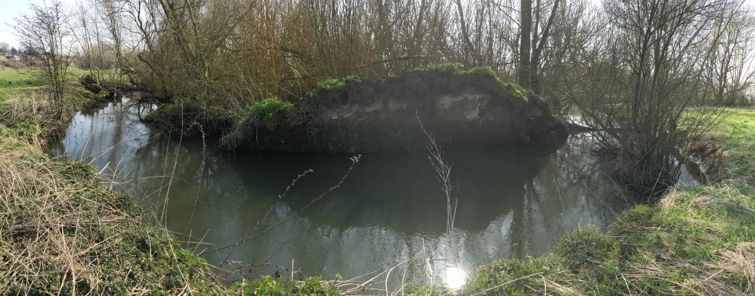
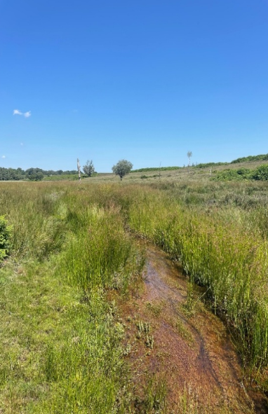
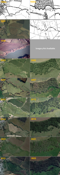
Location of the project
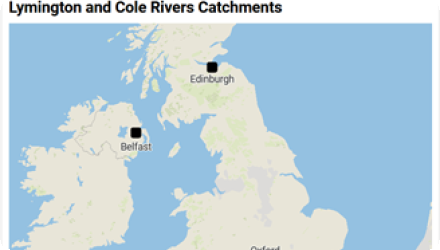
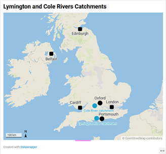
Blackwater and Highland Water are sub-catchments of the Lymington river in the New Forest National Park (in the UK South-East River Basin District). The River Cole is located in the Thames River Basin District, west of Oxford.
These two catchments benefited from floodplain restoration (river remeandering, logjams, etc) in the early 2000’s.
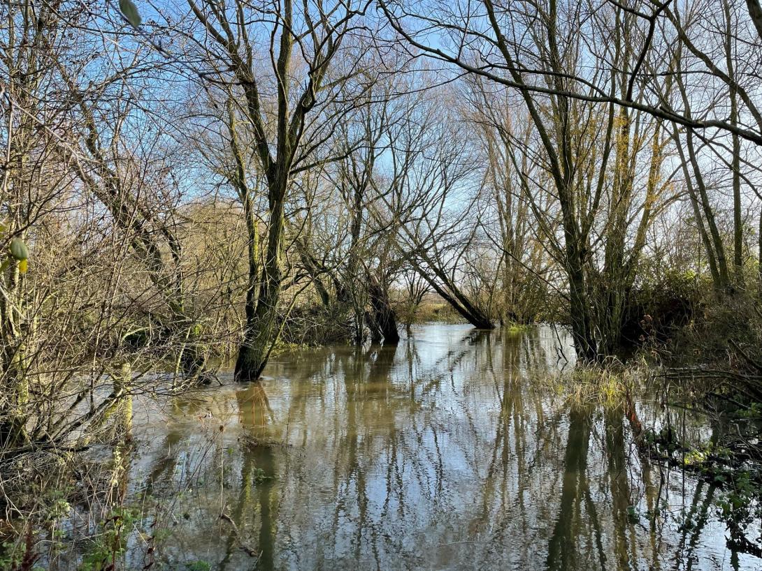
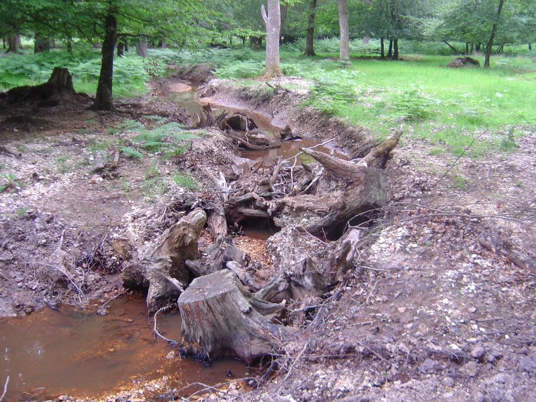
Blackwater and Highland Water, sub-catchments of the Lymington river in the New Forest National Park (in the UK South-East River Basin District), underwent restoration in the early 2000s. Straightening of historic woodland streams in the 19th century disrupted natural seasonal flooding, dried the forest, limited animal access, and accelerated erosion. Restoration efforts reconnected the river with its floodplain, restored its natural forms, and revitalized the surrounding floodplain forest habitats.
The River Cole is located in the Thames River Basin District, west of Oxford. Predominantly rural, the river catchment faces flooding and water quality issues, worsened by urban run-off from the urban area of Swindon at is headwaters. Rehabilitation projects in the early 2010s addressed these challenges, enhancing wildlife corridors and benefiting key species.
These two catchments benefited from floodplain restoration (river remeandering, logjams, etc) in the early 2000’s.
Blackwater and Highland Water, sub-catchments of the Lymington river in the New Forest National Park (in the UK South-East River Basin District), underwent restoration in the early 2000s. Straightening of historic woodland streams in the 19th century disrupted natural seasonal flooding, dried the forest, limited animal access, and accelerated erosion. Restoration efforts reconnected the river with its floodplain, restored its natural forms, and revitalized the surrounding floodplain forest habitats.
The River Cole is located in the Thames River Basin District, west of Oxford. Predominantly rural, the river catchment faces flooding and water quality issues, worsened by urban run-off from the urban area of Swindon at is headwaters. Rehabilitation projects in the early 2010s addressed these challenges, enhancing wildlife corridors and benefiting key species.
Project's objectives
The New Forest and Coleshill are long-term environmental monitoring sites which were established to improve understanding of the performance and longevity of Nature-based Solutions (NbS) and Natural Flood Management (NFM) interventions. Many NbS projects are monitored for only a few years, leaving significant uncertainty about how their effectiveness changes over decades. These sites provide rare, long-term datasets spanning more than 30 years, enabling assessment of hydrological performance, maintenance requirements, ecological change, water quality, carbon storage and resilience to climate change.
Involved Partners
| Authority type | Authority name | Role | Comments |
|---|---|---|---|
Climate zone
cool temperate moist
Temperature
11
Precipitation
722-924
Annual rainfall range
600 - 900 mm
Elevation range
0-150 (Coleshill) 80-170 (New forest)
Water bodies: Ecological Status
Moderate
Water quality status
Moderate
Project scale
Meso
Project scale specification
Colshill: Reach Scale long term
New forest: Catchment-scale, long term monitoring iste
New forest: Catchment-scale, long term monitoring iste
Area subject to Land use change or Management/Practice change (ha)
Contributing catchment area:
New forest: 94 ha
Coleshill: 140 ha
Land use:
New forest : Semi-natural woodland, heatland and wetland, grazing (commoning)
Coleshill : Agriculture (arable and grassland), Woodland
Soils:
New forest: Peaty and acidic sandy with alluvial soils in valley bottoms
Coleshill: Predominantly slowly permeable clay soils (with some loamy soils depending on location)
New forest: 94 ha
Coleshill: 140 ha
Land use:
New forest : Semi-natural woodland, heatland and wetland, grazing (commoning)
Coleshill : Agriculture (arable and grassland), Woodland
Soils:
New forest: Peaty and acidic sandy with alluvial soils in valley bottoms
Coleshill: Predominantly slowly permeable clay soils (with some loamy soils depending on location)
Primary design objectives
New Forest: Reduce downstream flood risk by slowing and storing surface water.
Cole: Demonstration site for River Restoration. Primary aim increase biodiversity through physical restoration actions.
Secondary design objectives:
Improve water quality, increase biodiversity, restore natural hydrological processes, enhance habitat connectivity, and increase carbon storage.
New Forest: Reduce downstream flood risk by slowing and storing surface water.
Cole: Demonstration site for River Restoration. Primary aim increase biodiversity through physical restoration actions.
Secondary design objectives:
Improve water quality, increase biodiversity, restore natural hydrological processes, enhance habitat connectivity, and increase carbon storage.
Coleshill: National Rivers Authority, Thames Water, University of Southampton
New forest: University of Southampton informed designs and monitoring.
New forest: University of Southampton informed designs and monitoring.
Costs total information
Funding source:
Coleshill: EU Life
New Forest: EU Life, DEFRA
Coleshill: EU Life
New Forest: EU Life, DEFRA
Land ownership
Coleshill: National trust, Newforest: Multiple landowners including Forestry England, Crown Estate and private landowners
Community involvment
No
Design consultation activity
| Activity stage | Name | Key issues | Comments |
|---|---|---|---|
Policy target
| Target purpose |
|---|
Policy pressure
| Pressure directive | Relevant pressure |
|---|---|
Pressures remarks
Along the Lymington river, straightening of historic woodland streams in the 19th century disrupted natural seasonal flooding, dried the forest, limited animal access, and accelerated erosion.
The river Cole catchment faces flooding and water quality issues, worsened by urban run-off from the urban area of Swindon at is headwaters.
The river Cole catchment faces flooding and water quality issues, worsened by urban run-off from the urban area of Swindon at is headwaters.
Policy impact
| Impact directive | Relevant impact |
|---|---|
Requirement directive
| Requirement directive | Specification |
|---|---|
|
European Natura 2000 Network
|
Natura 2000 Species and Suport improvements to SSSI Condition.
|
|
Water Framework Directive (WFD) 2000/60/EC
|
Requirement directive remarks
National policy challenges being addressed: different Uk policies over the last 30 years
Contractual arrangements
0
| Arrangement type | Responsibility | Role | Name | Comments |
|---|---|---|---|---|
Part of wider plan
0
Wider plan type
| Wider plan type | Wider plan focus | Name | Comments |
|---|---|---|---|
1. Water Level / Discharge (NF and Cole)
* What (Parameters): Water level and discharge monitoring.
* Where (Sensor Locations): Main stream and tributary monitoring.
* How (Equipment): Pressure transducers.
* When (Frequency & Start): Continuous monitoring at 15–30 minute intervals.
- Start Date: NF started in 2002; Cole started in 1995.
* Who (Sampler, Analyst, Data Manager): University of Southampton (UoS).
2. Rainfall (NF)
* What (Parameters): Rainfall monitoring.
* Where (Sensor Locations): Catchment rain gauges.
* How (Equipment): Rain gauges.
* When (Frequency & Start): Continuous monitoring.
- Start Date: NF started in 2002; Cole started in 1995.
* Who (Sampler, Analyst, Data Manager): University of Southampton (UoS).
3. Water Quality (NF and Cole)
* What (Parameters): Water quality monitoring.
* Where (Sensor Locations): Environment Agency (EA) gauging stations.
* How (Equipment): [Not explicitly listed]
* When (Frequency & Start): Continuous monitoring.
- Start Date: NF started in 2002; Cole started in 1995.
* Who (Sampler, Analyst, Data Manager): Environment Agency (EA).
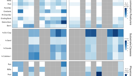
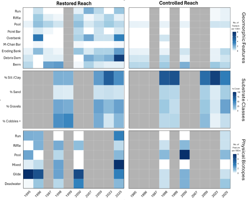
4. Physical Biotopes and Geomorphological Feature Surveys (Cole)
* What (Parameters): Physical biotopes and geomorphological feature surveys.
* Where (Sensor Locations): Within the River Cole restored reach.
* How (Equipment): Field geomorphological surveys, repeat cross-sections, longitudinal profiles, sediment assessments, and photographic monitoring.
* When (Frequency & Start): Conducted when funding allowed (1990s, 2009, 2025).
* Who (Sampler, Analyst, Data Manager): University of Southampton (UoS).
5. Macroinvertebrate and Macrophyte Survey (Cole)
* What (Parameters): Macroinvertebrate and macrophyte survey.
* Where (Sensor Locations): Within the River Cole restored reach.
* How (Equipment): 3-minute kick samples.
* When (Frequency & Start): Periodic surveys (1998, 1999, 2009, 2025).
* Who (Sampler, Analyst, Data Manager): University of Southampton (UoS).
6. Logjam Survey (NF)
* What (Parameters): Logjam survey.
* Where (Sensor Locations): Across the New Forest Catchment.
* How (Equipment): Field surveys.
* When (Frequency & Start): Early 2000s, repeated in 2024.
* Who (Sampler, Analyst, Data Manager): University of Southampton (UoS).
KEY TAKEAWAYS
* Roles & Responsibilities: The University of Southampton (UoS) is responsible for the vast majority of the monitoring tasks (1, 2, 4, 5, and 6), while the Environment Agency (EA) handles water quality monitoring (3).
* Timeline & Continuity: Hydrological and meteorological parameters (1, 2, 3) are monitored continuously and have long-term historical records starting in 1995 (Cole) and 2002 (NF). Ecological and geomorphological parameters (4, 5, 6) are monitored periodically or when funding is available.
* What (Parameters): Water level and discharge monitoring.
* Where (Sensor Locations): Main stream and tributary monitoring.
* How (Equipment): Pressure transducers.
* When (Frequency & Start): Continuous monitoring at 15–30 minute intervals.
- Start Date: NF started in 2002; Cole started in 1995.
* Who (Sampler, Analyst, Data Manager): University of Southampton (UoS).
2. Rainfall (NF)
* What (Parameters): Rainfall monitoring.
* Where (Sensor Locations): Catchment rain gauges.
* How (Equipment): Rain gauges.
* When (Frequency & Start): Continuous monitoring.
- Start Date: NF started in 2002; Cole started in 1995.
* Who (Sampler, Analyst, Data Manager): University of Southampton (UoS).
3. Water Quality (NF and Cole)
* What (Parameters): Water quality monitoring.
* Where (Sensor Locations): Environment Agency (EA) gauging stations.
* How (Equipment): [Not explicitly listed]
* When (Frequency & Start): Continuous monitoring.
- Start Date: NF started in 2002; Cole started in 1995.
* Who (Sampler, Analyst, Data Manager): Environment Agency (EA).
4. Physical Biotopes and Geomorphological Feature Surveys (Cole)
* What (Parameters): Physical biotopes and geomorphological feature surveys.
* Where (Sensor Locations): Within the River Cole restored reach.
* How (Equipment): Field geomorphological surveys, repeat cross-sections, longitudinal profiles, sediment assessments, and photographic monitoring.
* When (Frequency & Start): Conducted when funding allowed (1990s, 2009, 2025).
* Who (Sampler, Analyst, Data Manager): University of Southampton (UoS).
5. Macroinvertebrate and Macrophyte Survey (Cole)
* What (Parameters): Macroinvertebrate and macrophyte survey.
* Where (Sensor Locations): Within the River Cole restored reach.
* How (Equipment): 3-minute kick samples.
* When (Frequency & Start): Periodic surveys (1998, 1999, 2009, 2025).
* Who (Sampler, Analyst, Data Manager): University of Southampton (UoS).
6. Logjam Survey (NF)
* What (Parameters): Logjam survey.
* Where (Sensor Locations): Across the New Forest Catchment.
* How (Equipment): Field surveys.
* When (Frequency & Start): Early 2000s, repeated in 2024.
* Who (Sampler, Analyst, Data Manager): University of Southampton (UoS).
KEY TAKEAWAYS
* Roles & Responsibilities: The University of Southampton (UoS) is responsible for the vast majority of the monitoring tasks (1, 2, 4, 5, and 6), while the Environment Agency (EA) handles water quality monitoring (3).
* Timeline & Continuity: Hydrological and meteorological parameters (1, 2, 3) are monitored continuously and have long-term historical records starting in 1995 (Cole) and 2002 (NF). Ecological and geomorphological parameters (4, 5, 6) are monitored periodically or when funding is available.
For this case-study, we have long-term data (since 1994) on river flow, calibrated hydraulic models before/after floodplain restoration and ecological data (macrophytes and macroinvertebrates) at the restored and a control site taken after the restoration. Data gathering, analysis and modelling will help identify sponge functioning over the past 18 years relative to 26 years of natural variability. We will also repeat the eco-survey to quantify and understand changing biodiversity.
New forest:
Runoff attenuation: from headwater wetlands and valley sides
Peak flow reduction: looking at cganges in runoff generation and catchment response following varying degrees of restoration levels
Hydrological connectivity: reconnection of floodplain
Water quality improvement: Long term EA water-quality records acquired
Reduce erosion and sediment reduction: New forest blocked channels and bed level raising to reduce incision and bank collapse.
Create/ restore aquatic habitat: New Aquatic Habitat created and restored (Mire Restoration and Pond)
Coleshill:
Runoff attenuation: some sloweing of flood wave through reach
Water quality improvement: Long term EA water-quality records acquired
Create/ restore aquatic habitat: New Aquatic Habitat created and restored (Backwaters and reedbeds)
Create/ restore riparian habitat: New riparian habitat created
Links to ecosystem services: Flood regulation; water quality improvement; biodiversity conservation; habitat provision; carbon storage; groundwater recharge; recreation; education and research.
Runoff attenuation: from headwater wetlands and valley sides
Peak flow reduction: looking at cganges in runoff generation and catchment response following varying degrees of restoration levels
Hydrological connectivity: reconnection of floodplain
Water quality improvement: Long term EA water-quality records acquired
Reduce erosion and sediment reduction: New forest blocked channels and bed level raising to reduce incision and bank collapse.
Create/ restore aquatic habitat: New Aquatic Habitat created and restored (Mire Restoration and Pond)
Coleshill:
Runoff attenuation: some sloweing of flood wave through reach
Water quality improvement: Long term EA water-quality records acquired
Create/ restore aquatic habitat: New Aquatic Habitat created and restored (Backwaters and reedbeds)
Create/ restore riparian habitat: New riparian habitat created
Links to ecosystem services: Flood regulation; water quality improvement; biodiversity conservation; habitat provision; carbon storage; groundwater recharge; recreation; education and research.
Trade offs/ disbenefits:
New forest:
Hydrological regime negative impacts: Not yet assessed but potential for this to be seen in the New forest
Accumulation of wood debris: Significant accumulation of woody debris
Decay of expected co-benefits: Ongoing research in the New Forest about whether there is a decay and decline in effectiveness of restoration measures over time
Acceptability: Generally high
Coleshill:
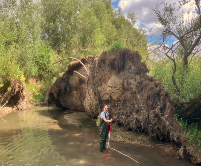
Accumulation of wood debris: Significant accumulation of woody debris, In the Cole there was a surge of this after a threshold driven event where trees have fallen and root plates have been exposed in channel
Habitat reduction: Habitat reduction for macrophyte communties in the Cole has occurred due to the amount of ripairan shading limiting their growth
Reduced aesthetic value: (This is an opinion seen a lot from local residents near the Coleshill Restoration site and that the channel is now 'messy')
Acceptability: Generally high
Outcome not aligning with expectations The biodiversity goals for macroinvertebrates and macrophytes at Coleshill were not achieved
Historical value: Contributing to guidance including the River Restoration Centre Manual of River Restoration Techniques
New forest:
Hydrological regime negative impacts: Not yet assessed but potential for this to be seen in the New forest
Accumulation of wood debris: Significant accumulation of woody debris
Decay of expected co-benefits: Ongoing research in the New Forest about whether there is a decay and decline in effectiveness of restoration measures over time
Acceptability: Generally high
Coleshill:
Accumulation of wood debris: Significant accumulation of woody debris, In the Cole there was a surge of this after a threshold driven event where trees have fallen and root plates have been exposed in channel
Habitat reduction: Habitat reduction for macrophyte communties in the Cole has occurred due to the amount of ripairan shading limiting their growth
Reduced aesthetic value: (This is an opinion seen a lot from local residents near the Coleshill Restoration site and that the channel is now 'messy')
Acceptability: Generally high
Outcome not aligning with expectations The biodiversity goals for macroinvertebrates and macrophytes at Coleshill were not achieved
Historical value: Contributing to guidance including the River Restoration Centre Manual of River Restoration Techniques
Key lessons
Important to capture consistent standard monitoring data for measures against their original targets to determine if project is delivering. Keep stakeholders informed as project evolves.
NF initial project was guided by Catchment Forum of stakeholders with expert advisors. Clear communication of aims and objectives. Subsequently roll out if initial project under different funding drivers was challenged and lacked same level of underpinning research. Break down of communications. Cole - initial project funded under EU and UKRI grant for monitoring but after funding ran out for latter in 2001 no mor monitoring undertaken except by MSc students and latterly Spongescapes.
For the New Cole site, The communication and maintenance of forum with expert advisors could have been better as well as delivery bodies who were not up to the job.
For the Coleshill site, continuation of reporting across ecology, hydrology and geomorphology would have helped maintain learning and demonstration benefit of site.
NF initial project was guided by Catchment Forum of stakeholders with expert advisors. Clear communication of aims and objectives. Subsequently roll out if initial project under different funding drivers was challenged and lacked same level of underpinning research. Break down of communications. Cole - initial project funded under EU and UKRI grant for monitoring but after funding ran out for latter in 2001 no mor monitoring undertaken except by MSc students and latterly Spongescapes.
For the New Cole site, The communication and maintenance of forum with expert advisors could have been better as well as delivery bodies who were not up to the job.
For the Coleshill site, continuation of reporting across ecology, hydrology and geomorphology would have helped maintain learning and demonstration benefit of site.
Success factor(s)
| Success factor type | Success factor role | Comments | Order |
|---|---|---|---|
Driver
| Driver type | Driver role | Comments | Order |
|---|---|---|---|
English