Last update
2025
Summary
The Aa of Weerijs pilot tests how Nature-based Solutions can build drought resilience in a flat, sandy catchment between Flanders and Noord-Brabant. Led by IHE Delft within the EIFFEL H2020 program from 2021 to 2024, partners include Open University, the Province of Noord-Brabant and Water Board Brabantse Delta. The team co-designed a decision-support web app to compare options and support planning.
Models combine GEOSS and local datasets with KNMI’23 climate scenarios. KPIs track surface water availability, groundwater availability and soil moisture. Provincial opportunity maps and green-blue policy zones steer siting where benefits and feasibility align.
The strategies assessed cover ditch blocking, infiltration ponds, wetland restoration, heathland restoration, brook bed barriers and tree planting. Results indicate the strongest gains for groundwater and soil moisture from ditch blocking, infiltration ponds and heathland restoration. Wetland restoration and brook bed barriers show mixed performance across subareas. Tree planting often reduces drought indicators in some locations due to higher evapotranspiration.
Outputs include prioritised maps, combined strategies aligned with policy zones and agricultural areas, and a transparent web interface used in workshops. No physical works were built within the project window. The package readies local actors for investment and monitoring. The pilot links WFD objectives with provincial nature and water policies, including the Nature Management Plan and Green-Blue values layer, to scale NBS where they deliver multiple benefits. Cross-border hydrological controls, canalised networks and competing water uses remain constraints. Key lesson: in sandy lowland basins, infiltration-focused measures outperform planting for hydrological drought resilience. The toolset persists beyond the grant to support implementation and monitoring.
Position
Latitude
51.5926
Longitude
4.7714
Project
NWRM
SpongeScapes
Installation date
2021 to 2024
Implementation Status
Contact
IHE Delft
Transboundary
0
Photo gallery
Location of the project
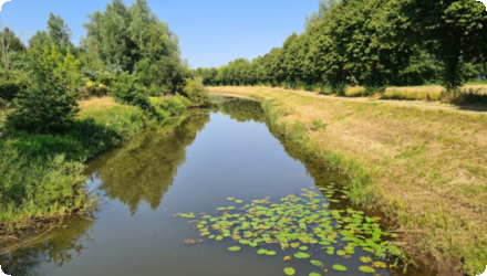
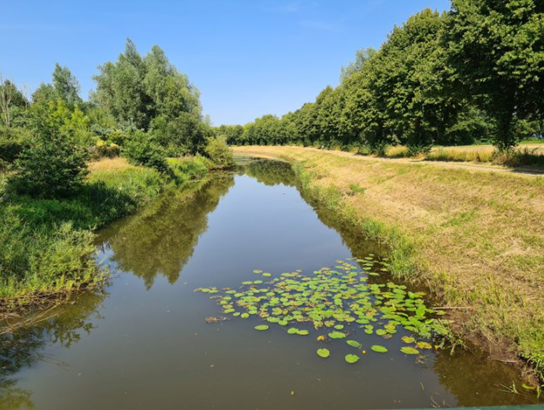
Transboundary Aa of Weerijs catchment, upstream Flanders and downstream Noord-Brabant, NL.
NUTS Code
NL41 - Noord-Brabant
Project's objectives
Increase surface and groundwater availability and soil moisture under KNMI’23 scenarios
Assess soil carbon co-benefits for selected NBS
Support co-design and decision-making with a web application.
Assess soil carbon co-benefits for selected NBS
Support co-design and decision-making with a web application.
Involved Partners
| Authority type | Authority name | Role | Comments |
|---|---|---|---|
Climate zone
cool temperate moist
Temperature
10°C
Annual rainfall range
600 - 900 mm
Runoff coefficient
0.4
Runoff coefficient range
0.3 - 0.5
Evapotranspiration
500
Elevation range
5 to 30 m
Slope range
Very low slopes under 1%
Groundwater level
Shallow groundwater 0.5 to 3 m below surface
Vegetation class
Predominant land cover cropland, grassland, wetlands, heathland.
Water bodies: Ecological Status
Poor
Water bodies: Chemical Status
Failing to achieve good
Water quality status
Historic drainage and canalisation, drought stress, irrigation demand, and habitat degradation.
Project scale
Meso
Project scale specification
river-basin planning and modelling
Project area
149 km²
Lifespan
Models and web app intended for long-term use beyond project end.
Co-design with stakeholders
Use of GEOSS and local data in an integrated surface–subsurface model
Opportunity-map-led siting of NBS
Evaluation with drought-related KPIs.
Use of GEOSS and local data in an integrated surface–subsurface model
Opportunity-map-led siting of NBS
Evaluation with drought-related KPIs.
Flat relief and sandy soils favour infiltration-type NBS
Canalised network and cross-border influences constrain control on low flows and water tables.
Canalised network and cross-border influences constrain control on low flows and water tables.
Financing authorities
Type of funding
Other
Comments
EU Horizon 2020, EIFFEL Grant Agreement 101003518
4,999,466.25 € for the project, including this pilot.
4,999,466.25 € for the project, including this pilot.
Compensations
0
Policy context
Water Framework Directive objectives and provincial nature and water policies in Noord-Brabant, including the Nature Management Plan areas and the Green-Blue Mantle concept used to frame Strategy 1 and Strategy 2.
Community involvment
No
Design consultation activity
| Activity stage | Name | Key issues | Comments |
|---|---|---|---|
|
Screening phase
|
Workshops and consultations with province and water board using the pilot web application interface.
|
Policy impact
| Impact directive | Relevant impact |
|---|---|
Contractual arrangements
0
Part of wider plan
0
Wider plan type
| Wider plan type | Wider plan focus | Name | Comments |
|---|---|---|---|
|
Climate adaptation
|
EIFFEL Project
|
Earth Observation applications for climate change adaptation & mitigation
|
Monitoring system and methods
Hydrological model calibrated and validated with GEOSS and local data
KPIs include surface water availability, groundwater availability and soil moisture index
Climate forcing from KNMI’23 scenarios.
Hydrological model calibrated and validated with GEOSS and local data
KPIs include surface water availability, groundwater availability and soil moisture index
Climate forcing from KNMI’23 scenarios.
Maintenance
Not applicable yet, as physical measures were not implemented during the project.
Decision support improves planning for drought resilience and engages stakeholders across sectors.
Information on retained water
Modeled impacts :
Best performance on groundwater and soil moisture from ditch blocking, infiltration ponds and heathland restoration
Tree planting produced negative effects in several sections due to higher evapotranspiration
Wetland restoration and brook bed barriers showed mixed effects across sub-areas.
Best performance on groundwater and soil moisture from ditch blocking, infiltration ponds and heathland restoration
Tree planting produced negative effects in several sections due to higher evapotranspiration
Wetland restoration and brook bed barriers showed mixed effects across sub-areas.
Key lessons
Prioritise infiltration-focused NBS on sandy soils for drought resilience
Evaluate combined strategies across policy-defined zones to scale up effects
Tree planting can worsen drought metrics in some sub-catchments.
Evaluate combined strategies across policy-defined zones to scale up effects
Tree planting can worsen drought metrics in some sub-catchments.
Success factor(s)
| Success factor type | Success factor role | Comments | Order |
|---|---|---|---|
|
Existing staff and consultant knowledge
|
main factor
|
<p>robust modelling tools, existing opportunity maps and provincial policy frameworks</p>
|
|
|
Attitude of relevant stakeholders
|
main factor
|
<p>Active role of province and water board in co-design</p>
|
Driver
| Driver type | Driver role | Comments | Order |
|---|---|---|---|
|
Availability of subsidies
|
main driver
|
EU funding
|
Source(s)
English