Last update
2026
Summary
Sponge Scapes case study SI 08
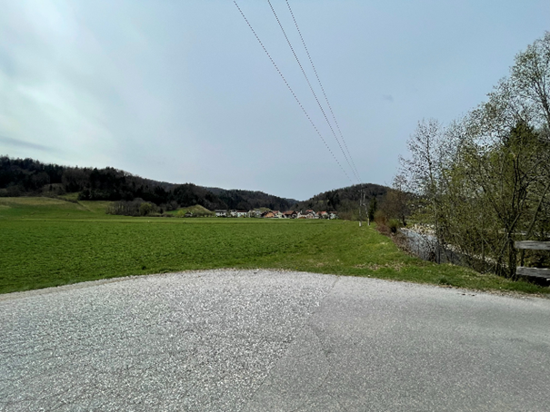
The rainfall partitioning study plot is situated in the city of Ljubljana, Slovenia and is part of the Gradaščica river catchment (that covers 160km2). The Gradaščica River has typical torrential characteristics in the headwater part of the catchment, which increases the risk of floods in the downstream areas that are populated and urbanized, such as the city of Ljubljana.
This case study research is not only key to evaluating the sponge function of forests but also holds significant interest for local stakeholders and the general population in terms of reducing flood and drought risks, as well as mitigating related issues like soil erosion.
The rainfall partitioning study plot is situated in the city of Ljubljana, Slovenia and is part of the Gradaščica river catchment (that covers 160km2). The Gradaščica River has typical torrential characteristics in the headwater part of the catchment, which increases the risk of floods in the downstream areas that are populated and urbanized, such as the city of Ljubljana.
This case study research is not only key to evaluating the sponge function of forests but also holds significant interest for local stakeholders and the general population in terms of reducing flood and drought risks, as well as mitigating related issues like soil erosion.
Position
Latitude
46.0422222
Longitude
14.4925
Project
SpongeScapes
Installation date
2014
Implementation Status
Transboundary
0
Photo gallery
Location of the project
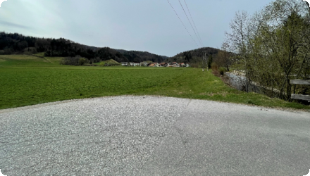
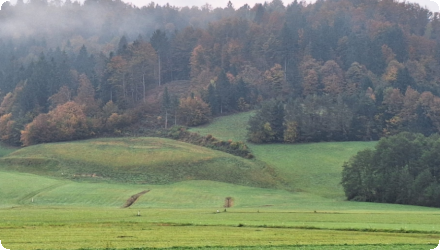
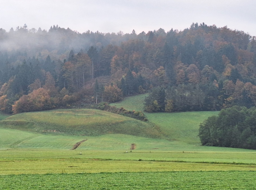
The Gradaščica catchment in Ljubljana is located in a hilly pre-alpine region, with elevations ranging from 300 to 1000 meters above sea level. Approximately 70% of this area is forested, mainly with broad-leaved and mixed forests, which play a crucial role in the local ecosystem and water management. Within SpongeScapes, we are investigating how trees reduce rainwater run-off, which is crucial in flood-prone areas.
Project's objectives
The objective of this case study is to quantify the decrease in stormwater runoff resulting from rainwater intercepted by trees.
Involved Partners
| Authority type | Authority name | Role | Comments |
|---|---|---|---|
Climate zone
cool temperate moist
Temperature
11.5
Precipitation
1500
Annual rainfall range
1200 - 1500 mm
Runoff
850
Runoff coefficient
0.57
Runoff coefficient range
0.3 - 0.5
Elevation range
300-1000
Project scale specification
The topography of the Gradaščica river catchment is characterised by steep slopes in the upper part of the catchment, which results in the runoff from precipitation being almost immediate during periods of heavy rainfall. This has led to a swift response from the river system, transportation of material, significant soil erosion and the potential for flooding in the lower reaches of the catchment.
Project area
600 m2 (research plot); 160 km2 (catchment)
Area specifications
The rainfall partitioning study plot is situated in the city of Ljubljana, Slovenia and is part of the Gradaščica river catchment. The Gradaščica River has typical torrential characteristics in the headwater part of the catchment, which increases the risk of floods in the downstream areas that are populated and urbanized, such as the city of Ljubljana.
The Gradaščica river catchment covers 160 km² and is almost 70% forested.
The topography of the Gradaščica river catchment is characterised by steep slopes in the upper part of the catchment, which results in the runoff from precipitation being almost immediate during periods of heavy rainfall. This has led to a swift response from the river system, transportation of material, significant soil erosion and the potential for flooding in the lower reaches of the catchment.
The Gradaščica river catchment covers 160 km² and is almost 70% forested.
The topography of the Gradaščica river catchment is characterised by steep slopes in the upper part of the catchment, which results in the runoff from precipitation being almost immediate during periods of heavy rainfall. This has led to a swift response from the river system, transportation of material, significant soil erosion and the potential for flooding in the lower reaches of the catchment.
Area subject to Land use change or Management/Practice change (ha)
Forest, grassland, agricultural and urban areas
Design capacity description
Surface runoff reduction and increase in soil water retention capacity so the impact being mitigated are: flooding, soil erosion and drought
Financing authorities
Land ownership
UL FGG (research plot); a lot of different private owners as well as public land (whole catchment)
Community involvment
No
Design consultation activity
| Activity stage | Name | Key issues | Comments |
|---|---|---|---|
Policy target
| Target purpose |
|---|
Policy pressure
| Pressure directive | Relevant pressure |
|---|---|
Policy impact
| Impact directive | Relevant impact |
|---|---|
Requirement directive
| Requirement directive | Specification |
|---|---|
Contractual arrangements
0
| Arrangement type | Responsibility | Role | Name | Comments |
|---|---|---|---|---|
Part of wider plan
0
Wider plan type
| Wider plan type | Wider plan focus | Name | Comments |
|---|---|---|---|
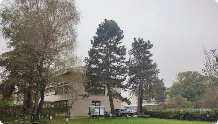
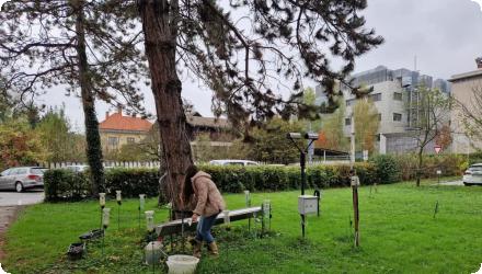
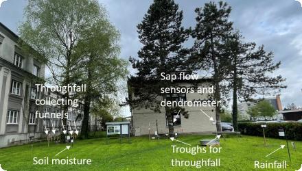
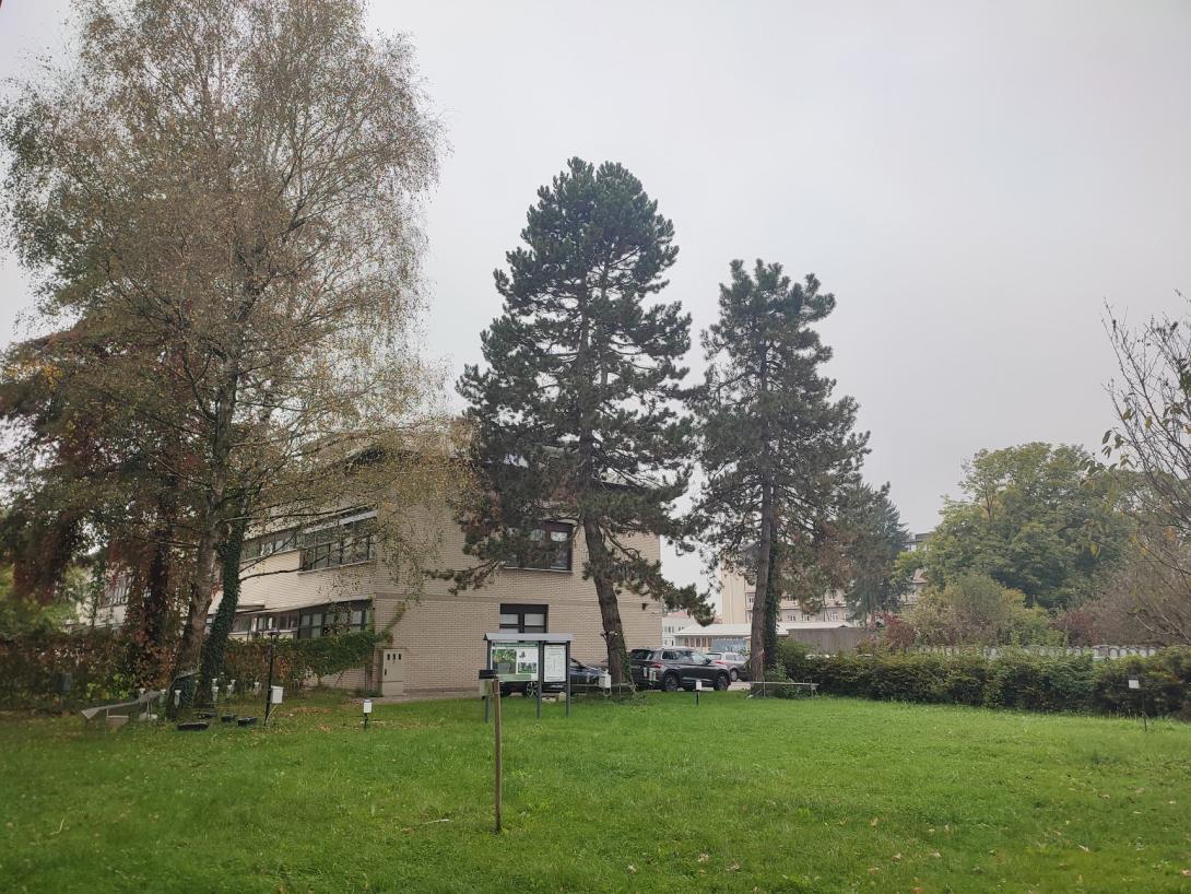
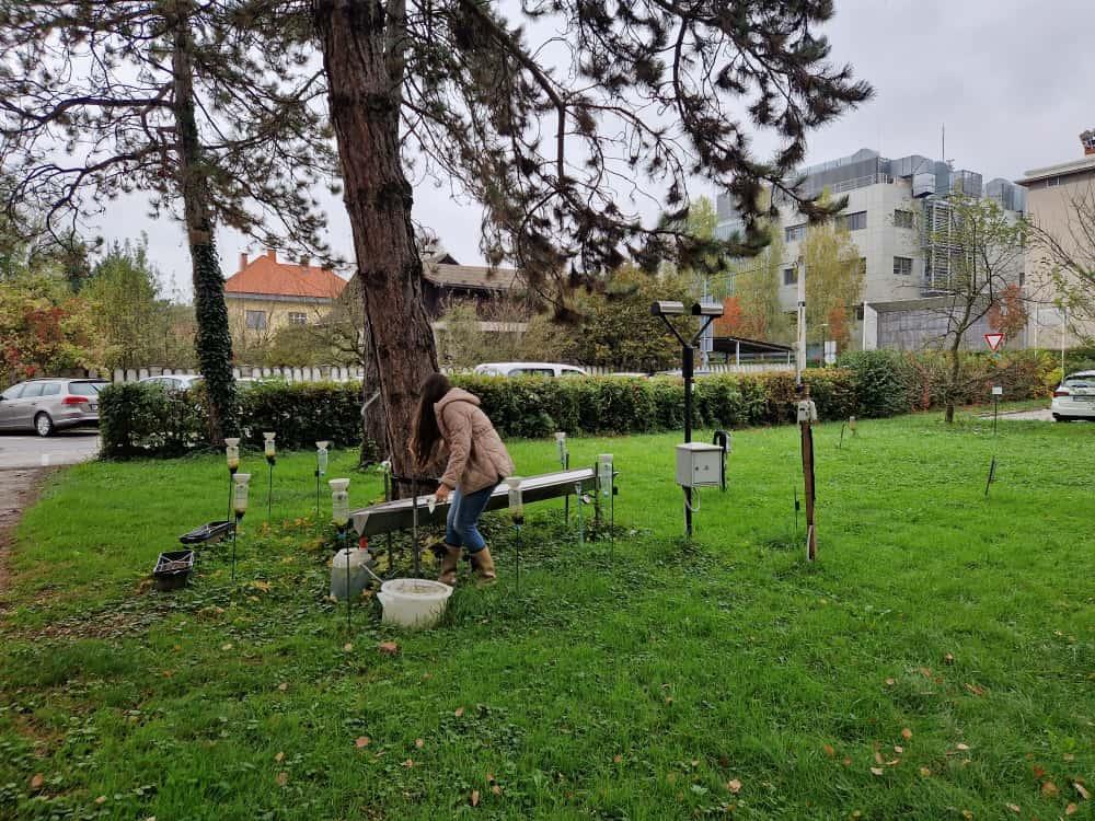
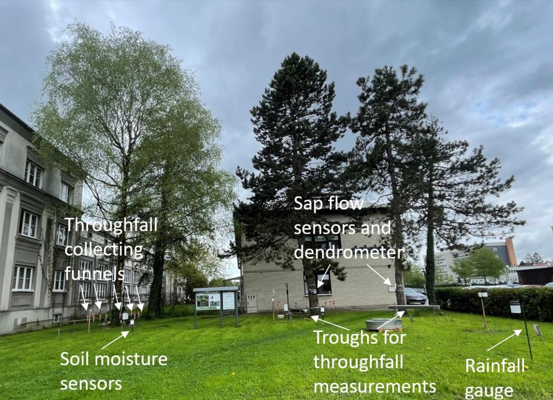
Measurements of rainfall interception and throughfall have been taken at a study plot for two different tree species, pine and birch. In addition, the drop size distribution has been recorded. The soil characteristics of the plot area have been thoroughly investigated, with several soil profiles in place for ongoing monitoring of soil moisture temporal dynamics.
These high-frequency and long-term datasets are very useful in understanding the soil water retention capacity. However, it should be noted that making predictions for the entire catchment can be difficult due to high spatial variability and the anthropogenic character of the soil in the plot.
Long-term measurements of water level and river discharge in the catchment have been carried out at three gauging stations, two on Gradaščica and one on its tributary Šujica. In addition, there are three meteorological stations in the catchment area, namely, Dvor, Topol and Pasja ravan. These long-term hydrological and meteorological measurements will be essential in assessing the sponge function of forests in the catchment.
- Water Level & River Discharge: Monitored at three hydrological stations within the catchment (including Dvor and Bokalce) using pressure probes and radar sensors. Data has been collected every 10 minutes since 2012 (and earlier) by ARSO to assess the overall impact on river discharge.
- Precipitation & Temperature: Tracked via three meteorological stations inside the catchment and another four nearby. These automatic weather stations record data every 10 minutes (operational since 2016 and earlier) under ARSO's management to serve as direct inputs for hydrological modelling.
- Rainfall Interception: Analyzed within a dedicated research plot focusing on two tree types. It tracks throughfall, stemflow, and open rainfall using automatic tipping buckets ($0,2\text{ mm}$ per tip) and 11 manual collectors per tree type. Initiated in 2014 by UL FGG, this setup aims to estimate the specific rainfall interception component.
- Soil Moisture (VWC): Measured within the research plot across three distinct locations and at three different depths per location. Automatic sensors record data at 10-minute intervals (started in 2022) to evaluate the direct influence of tree cover on soil moisture, managed by UL FGG.
- Sap Flow: Monitored on two individual trees (one of each type) within the research plot using automatic sensors. Data is collected every 30 minutes (started in 2025) by UL FGG to evaluate evapotranspiration and water use by trees.
All five monitoring categories have mandatory maintenance requirements to ensure continuous and accurate data collection. While macroscopic meteorological and hydrological parameters are handled entirely by ARSO, the specialized vegetation and soil metrics within the research plot are managed by UL FGG.
These high-frequency and long-term datasets are very useful in understanding the soil water retention capacity. However, it should be noted that making predictions for the entire catchment can be difficult due to high spatial variability and the anthropogenic character of the soil in the plot.
Long-term measurements of water level and river discharge in the catchment have been carried out at three gauging stations, two on Gradaščica and one on its tributary Šujica. In addition, there are three meteorological stations in the catchment area, namely, Dvor, Topol and Pasja ravan. These long-term hydrological and meteorological measurements will be essential in assessing the sponge function of forests in the catchment.
- Water Level & River Discharge: Monitored at three hydrological stations within the catchment (including Dvor and Bokalce) using pressure probes and radar sensors. Data has been collected every 10 minutes since 2012 (and earlier) by ARSO to assess the overall impact on river discharge.
- Precipitation & Temperature: Tracked via three meteorological stations inside the catchment and another four nearby. These automatic weather stations record data every 10 minutes (operational since 2016 and earlier) under ARSO's management to serve as direct inputs for hydrological modelling.
- Rainfall Interception: Analyzed within a dedicated research plot focusing on two tree types. It tracks throughfall, stemflow, and open rainfall using automatic tipping buckets ($0,2\text{ mm}$ per tip) and 11 manual collectors per tree type. Initiated in 2014 by UL FGG, this setup aims to estimate the specific rainfall interception component.
- Soil Moisture (VWC): Measured within the research plot across three distinct locations and at three different depths per location. Automatic sensors record data at 10-minute intervals (started in 2022) to evaluate the direct influence of tree cover on soil moisture, managed by UL FGG.
- Sap Flow: Monitored on two individual trees (one of each type) within the research plot using automatic sensors. Data is collected every 30 minutes (started in 2025) by UL FGG to evaluate evapotranspiration and water use by trees.
All five monitoring categories have mandatory maintenance requirements to ensure continuous and accurate data collection. While macroscopic meteorological and hydrological parameters are handled entirely by ARSO, the specialized vegetation and soil metrics within the research plot are managed by UL FGG.
Land use change. Forests have an important impact on the water balance, reducing runoff and changing groundwater levels. Through modelling and field measurements we will evaluate the influences in land use change in the catchment on runoff and water retention.
Runoff attenuation: reducing and delaying surface runoff by increasing temporary water storage
Peak flow reduction: reducing flow peaks by delaying and spreading runoff overtime
Air quality: improved air quality by local filtration of pollutants
Reduce erosion and sediment reduction: reducing erosion on steep parts of catchment
Create/ restore terrestrial habitat: because it is an existing forest, it is about maintening the terrestrial habitat
Reduce peak temperatures: reduce peak air temperature through canopy shading and evapotranspirative cooling
Absorb CO2: carbon uptake and storage in forest biomass
Peak flow reduction: reducing flow peaks by delaying and spreading runoff overtime
Air quality: improved air quality by local filtration of pollutants
Reduce erosion and sediment reduction: reducing erosion on steep parts of catchment
Create/ restore terrestrial habitat: because it is an existing forest, it is about maintening the terrestrial habitat
Reduce peak temperatures: reduce peak air temperature through canopy shading and evapotranspirative cooling
Absorb CO2: carbon uptake and storage in forest biomass
Trade-offs/ disbenefits:
Change in water cycle:
Lack of water: reduced summer baseflow
Hydrological regime negative impacts: less water at drought condition
Change of soil use and related outcomes:
Accumulation of wood debris: can worsen flooding due to damming
Change in water cycle:
Lack of water: reduced summer baseflow
Hydrological regime negative impacts: less water at drought condition
Change of soil use and related outcomes:
Accumulation of wood debris: can worsen flooding due to damming
Key lessons
The possibility of reducing both flood and drought risks, as well as related risks such as soil erosion, will be of particular interest to local stakeholders and the general population.
Success factor(s)
| Success factor type | Success factor role | Comments | Order |
|---|---|---|---|
Driver
| Driver type | Driver role | Comments | Order |
|---|---|---|---|
Transferability
Yes, this measure is generally transferable, but it must be adapted to local conditions, including climate, soils, hydrology, and native vegetation
English