Last update
2026
Summary
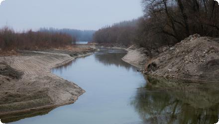
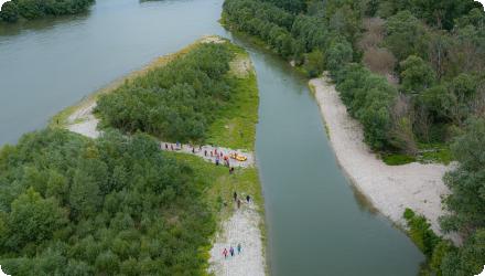
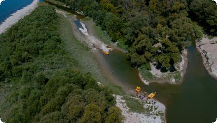
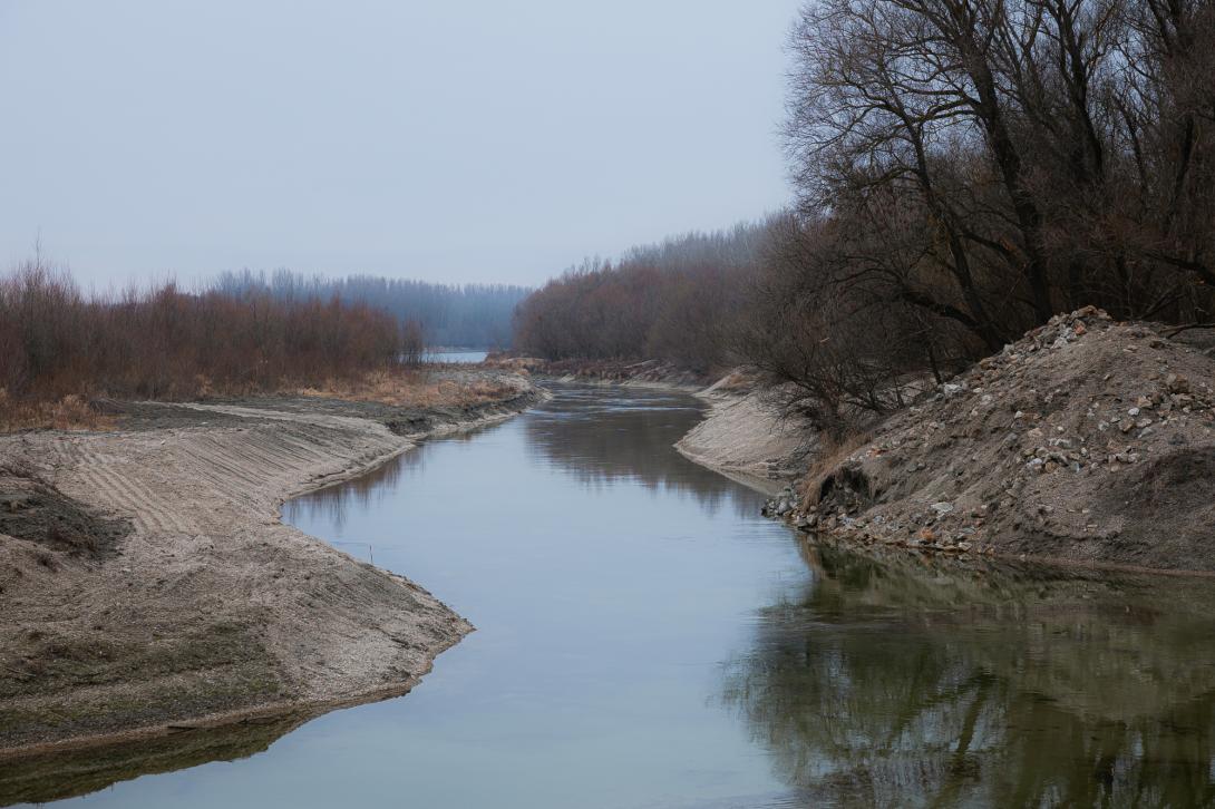
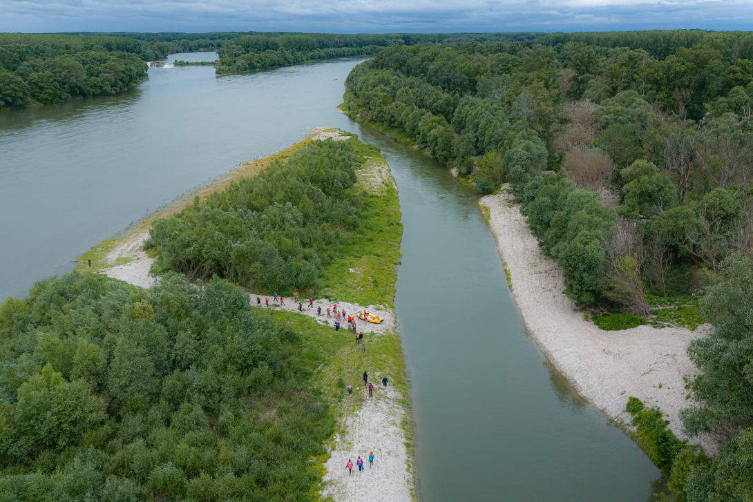
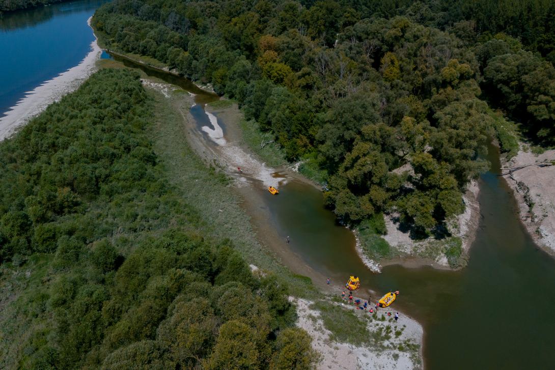
The Foki side arm is a historic Danube branch in the Inland Delta about 40 km from Bratislava. Sediment accumulation reduced water flow and disconnected it from the river. The pilot restored 350 m of the branch by removing sediments to improve water circulation and support floodplain ecosystem stability.
Position
Latitude
5648973.492
Longitude
2478126.776
Project
NWRM
Installation date
January 2026
Implementation Status
Transboundary
0
Photo gallery
Location of the project
Gabčíkovo, Slovak-Hungarian Border
NUTS Code
SK02 - Západné Slovensko
Involved Partners
| Authority type | Authority name | Role | Comments |
|---|---|---|---|
Climate zone
warm temperate dry
Temperature
10,8 °C
Precipitation
500-590
Annual rainfall range
300 - 600 mm
Project scale
Micro
Project scale specification
While the Small Foki itself in about 350 m long, it is a part of a larger system - the Foki side arm of about 2km lenght.
Project area
0.9 ha
Area specifications
The Foki side arm is a historic Danube branch in the Inland Delta about 40 km from Bratislava.
The area was negatively affected by the hydrological alteration caused by the construction and operation of the Gabčíkovo Waterworks.
Sediment accumulation reduced water flow and disconnected it from the river. The pilot restored 350 m of the branch by removing sediments to improve water circulation and support floodplain ecosystem stability.
- the side‑arm disconnected from the Danube, led to changes in water regime,
- the ecological stability declined,
- the water retention capacity decreased.
The surrounding area’s ability to cope with floods and droughts also weakened.
The Foki side arm, incl. Small Foki is not directly connected to the Danube Inland delta; therefore, they cannot benefit from simulated floods through the Dobrohost inlet. The Danube is the only source of water for the Foki side arm, and its connection to the Danube is crucial to the improvement of the water regime in the side arm.
The area was negatively affected by the hydrological alteration caused by the construction and operation of the Gabčíkovo Waterworks.
Sediment accumulation reduced water flow and disconnected it from the river. The pilot restored 350 m of the branch by removing sediments to improve water circulation and support floodplain ecosystem stability.
- the side‑arm disconnected from the Danube, led to changes in water regime,
- the ecological stability declined,
- the water retention capacity decreased.
The surrounding area’s ability to cope with floods and droughts also weakened.
The Foki side arm, incl. Small Foki is not directly connected to the Danube Inland delta; therefore, they cannot benefit from simulated floods through the Dobrohost inlet. The Danube is the only source of water for the Foki side arm, and its connection to the Danube is crucial to the improvement of the water regime in the side arm.
Size
350
Size unit
m
The main principle is to support natural processes in the area.
The intervention was designed as maintenance-free - the river processes will modify the area naturaly.
8790 m³ at peak water levels in the Danube
Design capacity description
The flooded surface area in the Malé Foki side channel is variable and depends on the current hydrological conditions of the Danube River. At low flow rates—approximately 850 m3—the permanently inundated area covers 5,800 m2, with a water volume in the channel of approximately 4,226 m3. This state represents the baseline inundation of the main channel during low-water periods.As discharge in the Danube increases, there is a gradual rise in the channel's water stage and an expansion of the inundated volume. Under high-flow conditions, when the entire channel is fully bank-full, the flooded surface area reaches approximately $7,000 m2, representing a water volume of about 8,790 m3. With any further increase in the water level, overbank flow occurs, resulting in the flooding of the adjacent terrain—particularly the island situated south below the Malé Foki channel. At this stage, the flow regime transitions from in-channel flow to the inundation of the floodplain, significantly increasing the retention potential of the entire locality. Such periodic flooding has a major ecological impact, as it supports habitat restoration, increases the diversity of aquatic habitats, and improves the water regime of the adjacent floodplain forests (alluvial forests).
Total cost
70612.66
Costs total information
Interreg Danube Region Programme - RESTORIVER = 49484.01 EUR infrastructure costs
Interreg Danube Region Programme - RESTORIVER = 738 EUR construction supervisor
Private donor = 19898.65 EUR infrastructure costs
Private donor = 492 EUR construction supervisor
Interreg Danube Region Programme - RESTORIVER = 738 EUR construction supervisor
Private donor = 19898.65 EUR infrastructure costs
Private donor = 492 EUR construction supervisor
Costs land acquisition
0
Costs land acquisition unit
€ (total value)
Costs land acquisition information
The landowner agreed to allow the intervention to be done on the lots without any acquisition/lease costs.
Costs operation maintenance
0
Costs operation maintenance information
designed as maintenance-free
Costs maintenance
0
Costs maintenance information
designed as maintenance-free
Financing authorities
Type of funding
EU-funds: Cohesion and regional development funds
Comments
RESTORIVER DRP0200419
Type of funding
Private funds
Land ownership
The land is owned by a nature conservancy NGO.
Community involvment
No
Design consultation activity
| Activity stage | Name | Key issues | Comments |
|---|---|---|---|
Policy target
| Target purpose |
|---|
Policy pressure
| Pressure directive | Relevant pressure |
|---|---|
Policy impact
| Impact directive | Relevant impact |
|---|---|
Requirement directive
| Requirement directive | Specification |
|---|---|
Contractual arrangements
0
| Arrangement type | Responsibility | Role | Name | Comments |
|---|---|---|---|---|
Part of wider plan
0
Wider plan type
| Wider plan type | Wider plan focus | Name | Comments |
|---|---|---|---|
Key lessons
The crucial factor of success was coordination and smooth cooperation between the Water Reseach Institute, BROZ - the landowner, and WWF Slovakia.
Success factor(s)
| Success factor type | Success factor role | Comments | Order |
|---|---|---|---|
|
Successful coordination between authorities
|
main factor
|
||
|
Attitude of relevant stakeholders
|
main factor
|
Driver
| Driver type | Driver role | Comments | Order |
|---|---|---|---|
English