Last update
2026
Summary
The Júcar River Basin faces significant environmental challenges, including sedimentation, soil degradation and increased pressures from extreme weather events and land-use changes. The Associated Region 6 (of the SpongeWorks project) utilizes an integrated nature-based solutions approach that incorporates riparian vegetation restoration and sustainable agricultural practices with cover crops. These interventions are designed to stabilize riverbanks, reduce sediment mobilization, improve agricultural resilience and increase the basin’s water retention capacity. Collectively, the Associated Region of the Júcar River Basin advances climate adaptation and ecosystem restoration in a semi-arid Mediterranean context.
Position
Biogeographical Region
Mediterranean
Project
NWRM
National Id
Spain
Installation date
2026
Implementation Status
Contact
emilio.real@chj.es +34 669 84 34 24
Transboundary
0
Photo gallery
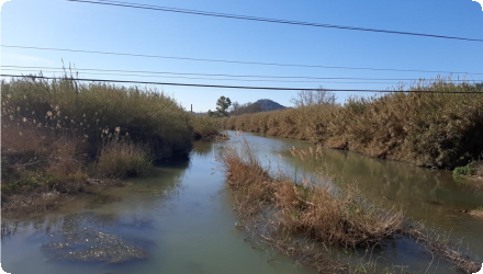
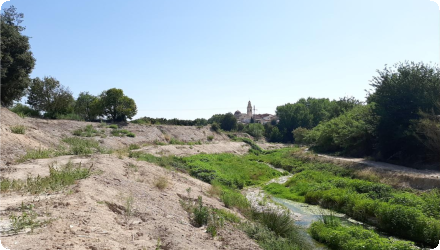
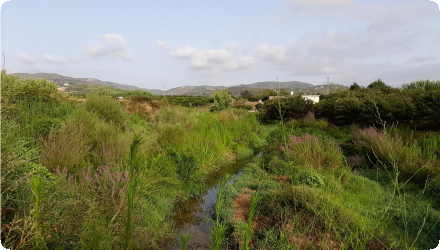
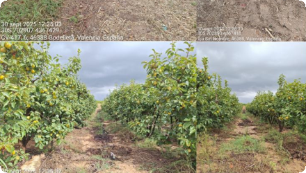
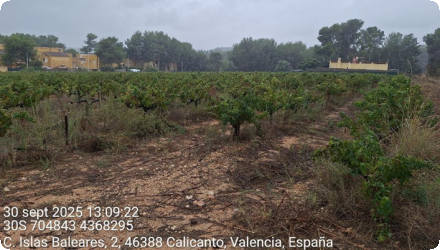
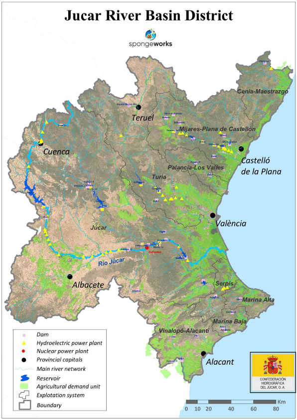
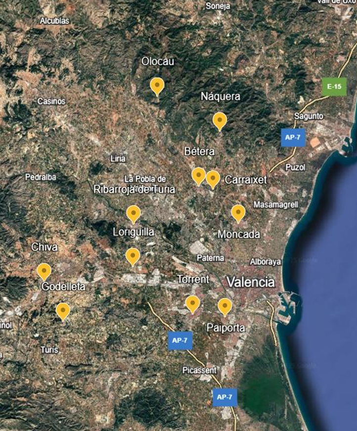
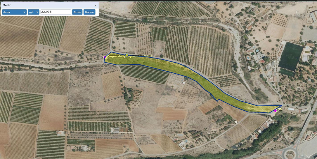
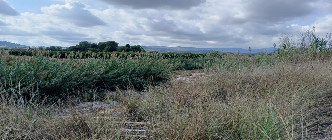
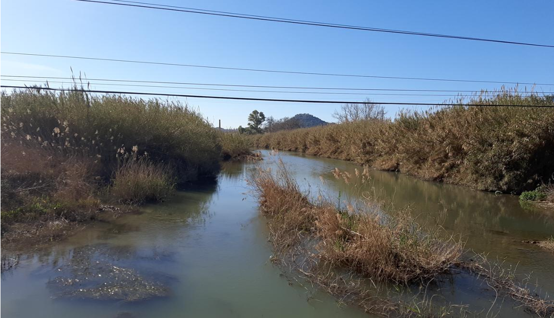
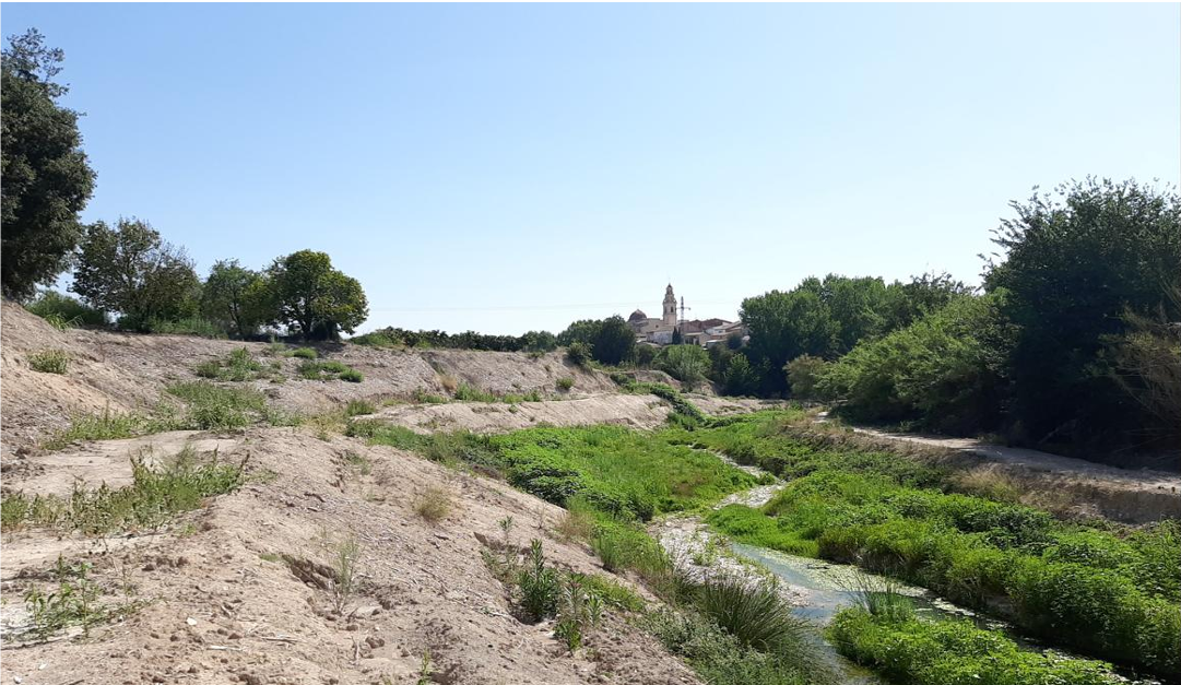
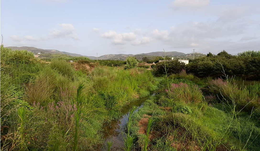
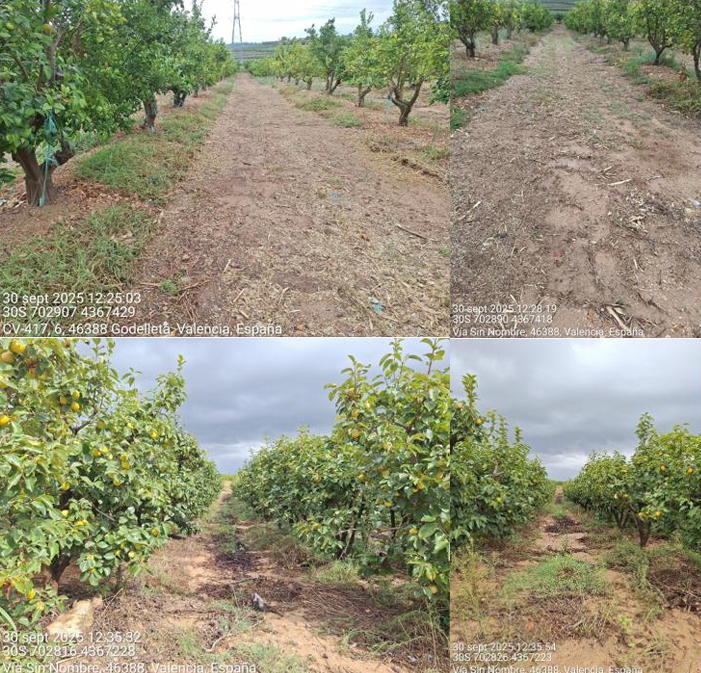
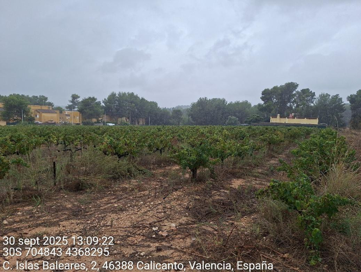
Location of the project
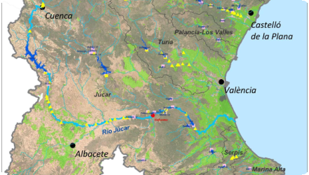
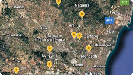
The five pilot areas are located in the Júcar River Basin District (within the province of Valencia in Spain), the Júcar River Basin District spans approximately 42,735 km² and is home to over five million inhabitants. The basin is also home to ecosystems of high ecological value, such as the Mancha Oriental Aquifer and the L’Albufera de Valencia Wetland, a designated RAMSAR site.
NUTS Code
ES52 - Comunidad Valenciana
Project's objectives
This implementation plan focuses on sediment and soil management in the Júcar River Basin, with particular attention to semi-arid sub-basins highly exposed to erosion and sediment mobilisation. The overarching objective is to develop and apply NBS that stabilise soils, reduce sediment transport and water run-off, and enhance the resilience of agricultural and natural systems against extreme hydrological events. The plan outlines measures that combine riparian vegetation restoration and the introduction of cover crops, all supported by active stakeholder engagement. By promoting sustainable resource management practices at the field, basin, and governance levels, the plan aims to generate tangible benefits for soil health, water quality, flood protection, and biodiversity, while also creating transferable knowledge for other Mediterranean basins with similar challenges. The results obtain in the pilot catchments will enable to upscale the initiative to the whole basin to achieve a significant impact.
Involved Partners
| Authority type | Authority name | Role | Comments |
|---|---|---|---|
Climate zone
warm temperate dry
Temperature
17
Annual rainfall range
300 - 600 mm
Runoff
140-235
Runoff range
150 - 300 mm
Evapotranspiration
1150
Slope range
Pilot zone #1 Macastre: (39º22'59.2''N 0º47'00.9''W) P5: Slope range = plain
PZ #2 Godelleta: (39º26'23.5''N 0º37'11.1''W). Plain vineyard P1: Slope range = plain
PZ #3 Godelleta: (39º25'55.3''N 0º38'34.7''W) P2. Citrus field: Slope range = 5-10%
PZ #4 Godelleta: (39º25'27.9''N 0º41'49.8''W) P3. Sloped vineyard: Slope range = 5-10%
PZ #5 Bétera: (39º35'42.3''N 0º27'06.7''W) P4: Slope range= plain
PZ #2 Godelleta: (39º26'23.5''N 0º37'11.1''W). Plain vineyard P1: Slope range = plain
PZ #3 Godelleta: (39º25'55.3''N 0º38'34.7''W) P2. Citrus field: Slope range = 5-10%
PZ #4 Godelleta: (39º25'27.9''N 0º41'49.8''W) P3. Sloped vineyard: Slope range = 5-10%
PZ #5 Bétera: (39º35'42.3''N 0º27'06.7''W) P4: Slope range= plain
Vegetation class
Pilot zone #1 Macastre: (39º22'59.2''N 0º47'00.9''W) P5: Grass
PZ #2 Godelleta: (39º26'23.5''N 0º37'11.1''W). P1: Vineyard field
PZ #3 Godelleta: (39º25'55.3''N 0º38'34.7''W) P2: Citrus field
PZ #4 Godelleta: (39º25'27.9''N 0º41'49.8''W) P3: Vineyard field
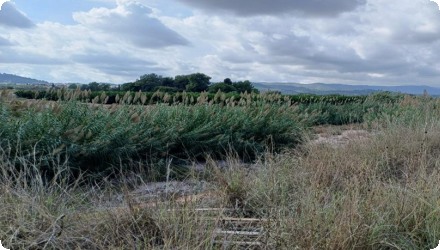
PZ #5 Bétera: (39º35'42.3''N 0º27'06.7''W) P4: Fully colonized by Arundo donax (giant cane). Vegetation to be substituded by riparian local plants.
PZ #2 Godelleta: (39º26'23.5''N 0º37'11.1''W). P1: Vineyard field
PZ #3 Godelleta: (39º25'55.3''N 0º38'34.7''W) P2: Citrus field
PZ #4 Godelleta: (39º25'27.9''N 0º41'49.8''W) P3: Vineyard field
PZ #5 Bétera: (39º35'42.3''N 0º27'06.7''W) P4: Fully colonized by Arundo donax (giant cane). Vegetation to be substituded by riparian local plants.
Water bodies: Ecological Status
Unknown
Water bodies: Chemical Status
Unknown
Water quality status
Unknown
Soil quality
Moderate
Project scale
Micro
Performance timescale
1 - 4 years
Area specifications
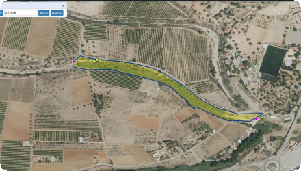
4 out of 5 pilot areas are small agronomic fields between 1-2 ha. The pilot area in the riverbed is a 10-20 ha worksite where Arundo donax is going to be replaced by local riparian species.
Area subject to Land use change or Management/Practice change (ha)
4 out of 5 pilot areas are small agronomic fields between 1-2 ha. The pilot area in the riverbed is a 10-20 ha worksite where Arundo donax is going to be replaced by local riparian species.
Nature base solution. In the agronomic fields plow technic is going to be replaced by permanent grass cover between the lanes of crops. Also mulching of organic mater from prunining.
In the riverbed floods can damage our pilot area. In the fields, we expect the owners don't change the spongework measures during the projects lifespan.
Awareness of sponge measures importance by land owners. Good collaboration and communications.
Positive influence effectiveness
Land owner is the president of the farmers associations. High influence on nearby farmers which will help upscalling.
Total cost
1000
Costs total information
Personnel costs: 27 000€
Subcontracting (Consultancy Services): 28 000€
Travel & Subsistence (Project meeting and visit to other pilot region): 10 000€
Equipment (Workstation for data collection and analysis, Soil sensors and Agro-Meteo station): 10 600€
Other goods, works and services (field material & soil sample analysis, and very high resolution images): 10 000€
Indirect Costs: 14 400€
Subcontracting (Consultancy Services): 28 000€
Travel & Subsistence (Project meeting and visit to other pilot region): 10 000€
Equipment (Workstation for data collection and analysis, Soil sensors and Agro-Meteo station): 10 600€
Other goods, works and services (field material & soil sample analysis, and very high resolution images): 10 000€
Indirect Costs: 14 400€
Financing authorities
Community involvment
No
Design consultation activity
| Activity stage | Name | Key issues | Comments |
|---|---|---|---|
Policy target
| Target purpose |
|---|
Policy pressure
| Pressure directive | Relevant pressure |
|---|---|
Policy impact
| Impact directive | Relevant impact |
|---|---|
Requirement directive
| Requirement directive | Specification |
|---|---|
Contractual arrangements
0
| Arrangement type | Responsibility | Role | Name | Comments |
|---|---|---|---|---|
Part of wider plan
0
Wider plan type
| Wider plan type | Wider plan focus | Name | Comments |
|---|---|---|---|
Define soil characteristics and monitor their progress due to sponge measures
Soil composition and texture, pH, electric conductivity, densisty, % organic mater concentration, % of carbon, ks (infiltration capacity), mechanical resistance, biological activity
Each pilot project is monitored in 2 different points, one where sponge measure is implemented and another point with no sponge measure.
Monitoring done onsite with infiltration instrument and on lab with chemical analyses of samples.
Maintenance
None, the monitoring is done very 3 months
Whole monitoring program estimated to sum up around 20.000 €.
Low impact of monitoring system on ecosystem.
Success factor(s)
| Success factor type | Success factor role | Comments | Order |
|---|---|---|---|
Driver
| Driver type | Driver role | Comments | Order |
|---|---|---|---|
English