- Stone dams
- Stone Weirs
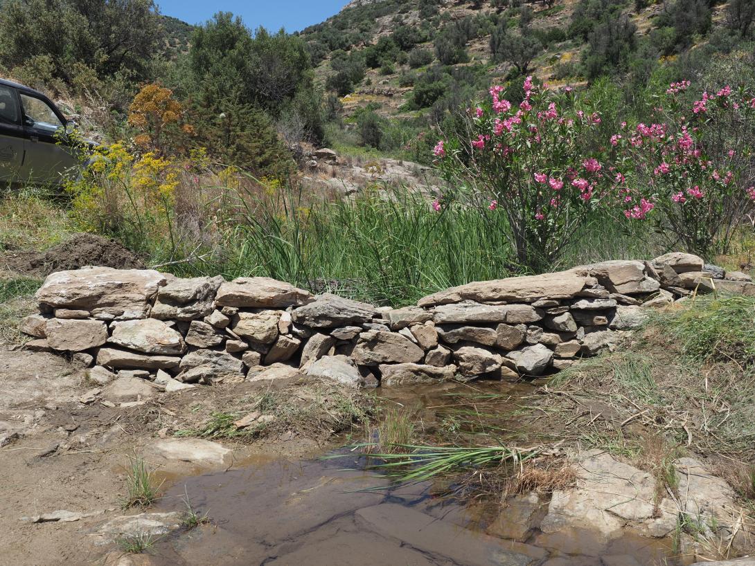
- Gully plugs
Check dams, also referred to as gully plugs, are transverse structures constructed across channels, gullies, torrents, or ephemeral streams with the purpose of reducing water flow velocity, controlling erosion, and promoting sediment deposition. In addition to their core hydraulic function, they are often employed in arid and semiarid regions to facilitate managed aquifer recharge and to create shallow upstream ponds that serve as biodiversity hotspots. These techniques have been extensively adopted in degraded landscapes where vegetation cover has been depleted or is inadequate for ensuring soil stability.
The categorisation of check dams is typically divided into two classifications: temporary and permanent. Temporary check dams, with a lifespan of three to ten years, are typically constructed using materials such as brushwood, logs, rocks, or wire. The primary function of these structures is to promote vegetation regrowth and stabilise gullies, following which they can be removed. Conversely, permanent check dams are characterised by their substantial size and robustness. These structures are typically constructed from durable materials, such as concrete, gabions, or steel, and are designed to withstand significant flood events while maintaining their effectiveness over extended periods, often spanning decades.
The utilisation of check dams confers numerous advantages, including the mitigation of erosion and the reduction of sediment transport. The implementation of check dams has been demonstrated to retard runoff, thereby enhancing water percolation and facilitating recharge in aquifers, a particularly salient benefit in arid Mediterranean regions. In these environments, check dams are often employed as part of managed aquifer recharge strategies, capturing winter runoff and storing it underground for use during dry seasons in irrigation, livestock watering, and drinking water supply. Additionally, the shallow ponds formed upstream of check dams can act as micro-wetlands or biodiversity hotspots, providing critical habitat for flora and fauna during dry periods and supporting ecological resilience in otherwise harsh landscapes.
However, the implementation of such measures is not without its limitations. These include the necessity for regular maintenance, particularly in the aftermath of flood events, the risk of clogging due to sediment accumulation, and the potential for downstream erosion if the design is not adequate. The effectiveness of these systems is contingent upon a number of site-specific factors, including but not limited to slope, precipitation patterns, and material availability.
Check dams are utilised across a broad spectrum of climates and land uses to achieve hydrological, geomorphological, and ecological objectives. It is imperative that the design is adapted to local conditions, including but not limited to topography, sediment load, and water flow characteristics. In recent years, there has been a growing preference for open and grid-type check dams (see Peak flow control structures F13) due to their ability to allow the passage of fine sediments during low-magnitude events while maintaining their capacity to trap debris. It is evident that these structures can be regarded as a versatile and cost-effective solution for watershed restoration and erosion control, provided that they are planned, constructed and maintained in an appropriate manner.