
Modeled

OPTAIN: Sävjaan river catchment [Sweden]

Summary
Sävjaån catchment is a lowland mixed land use catchment characteristic of central Sweden. Headwaters in the catchment drain a mixture of forest and agricultural land. Streams draining agricultural land are general deepened and straightened to promote drainage. Localized spring floods are common and summer droughts are increasing. Eutrophication is an issue throughout the catchment.
Last update
2025

OPTAIN : Kebele and Szentgyörgyvölgyi valley [Hungary/Slovenia]

Summary
HU: The Hungarian part of Kebele catchment with its 209 km2 size is located in the south-western corner of the country, in the West-transdanubian Water Directorate’s operational area, as part of the Drava sub-basin and Mura sub-unit. About 60% of the area is agricultural land, typically with wheat, barley, corn cultivation and pasture management. The Kebele Valley and Szentgyörgyvölgyi stream valley is NATURA 2000 classified. Main challenges identified in the area: management of nitrate-sensitive areas, prevention and mitigation of soil erosion and flash floods.

The Hungarian-Slovenian cross-border water cooperation dates back to 1994.

SI: The Slovenian part of Kobiljski potok (Hungarian "Kebele") is located in the Pomurska region and forms part of a transboundary agricultural catchment shared with Hungary. The area is characterized by intensive cereal production and pig farming, with sections falling under Natura 2000 and designated water protection zones. Key challenges include seasonal droughts, flood risk during heavy rainfall, limited space for buffer strips, and low groundwater availability for irrigation due to extensive drainage infrastructure.

OPTAIN seeks to identify efficient NSWRM to better adapt to extreme events (floods, droughts) and reduce conflicts between agricultural water uses and other human and environmental demands on water in small catchments across Europe in close cooperation with local actors.
Last update
2025

OPTAIN : Upper Zglowiaczka River Basin [Poland]

Summary
The case study is located in the north central Poland, in Kuyavian-Pomeranian province. The catchment area is about 150 km2. Due to highly fertile soils, arable land prevails (nearly 90%) in the catchment. The main crops are cereals, maize, oilseed rape, sugar beet, alfalfa, vegetables and herbal crops. An area covered by catch crops is increasing. Share of irrigated crops is small. The catchment is coping with an increasing water deficit for crop production and high nitrate loads and concentrations in water. These problems are amplified by low precipitation (annual average equals to 500 mm being the lowest in the country, 300 mm in the growing season) and the extensive drainage system (open ditches and subsurface tiles) that drains water excess in wet periods.The OPTAIN project will support the case study team with identifying and developing efficient land management strategies and small technical solutions to improve the soils’ infiltration and water holding capacities as well as its capacity to filter, buffer and transform pollutants.
Last update
2025

OPTAIN : Csorsza and Felső-Válicka [Hungary]

Summary
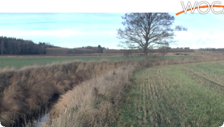
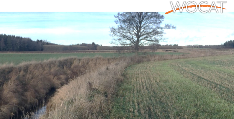
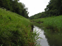
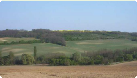
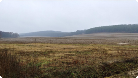
The Csorsza case study is located in Veszprém County, Hungary. The size of the study site is 21.3 km2, where 29% of the total catchment area is forest, 29% orchards and vineyards, 17% shrubs, 13% is arable land, 6% is grassland, and 5% is urban.

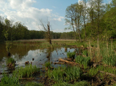
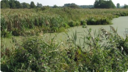
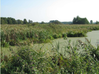
Some selected analysis are performed at the Felső-Válicka catchment, too. The Felső-Válicka study site is located in Zala County, flows in south-north direction into the River Zala. The size of the catchment is 131 km2. 27% of the total catchment area is forest, 35% is cropland, 11% is grassland, 3% is wetland and 11% is urban.

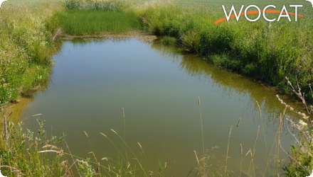
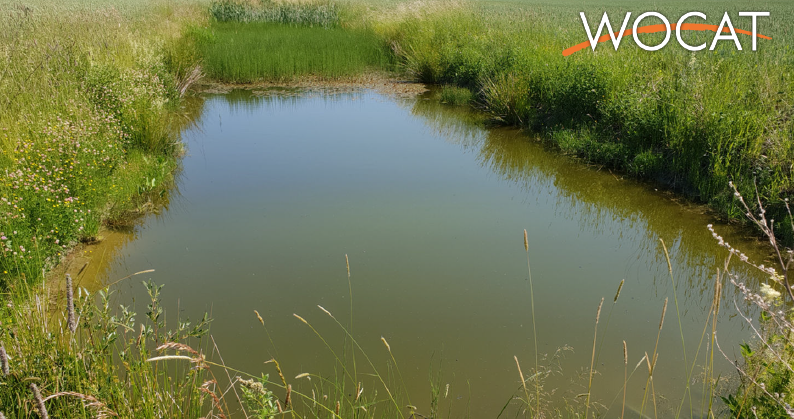
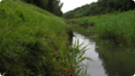
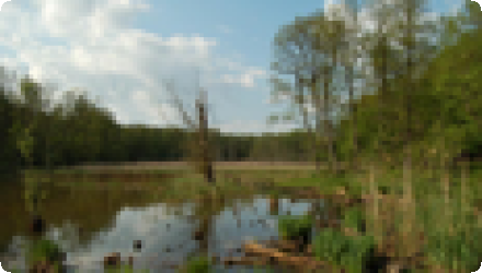
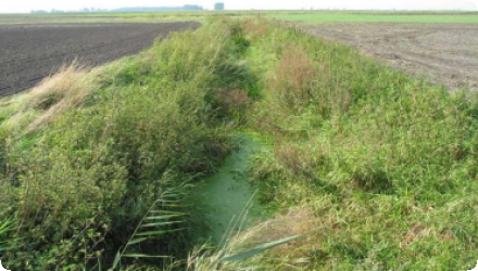
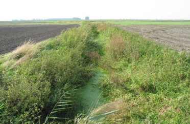
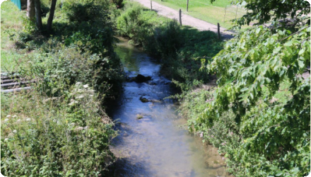
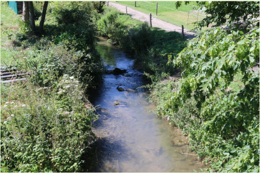
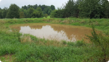
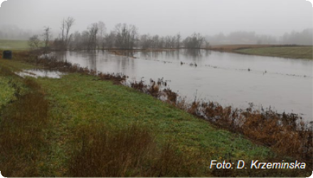
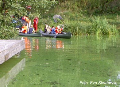
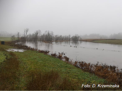
Both study sites are located in the catchment of Lake Balaton, therefore state of the environment and nature in these small catchments influences the touristic and economic potential of the Balaton region. Their water and nutrient management affects water quantity and quality of the lake. Extreme weather events will increase the environmental and social conflicts in the region.

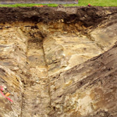
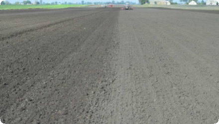
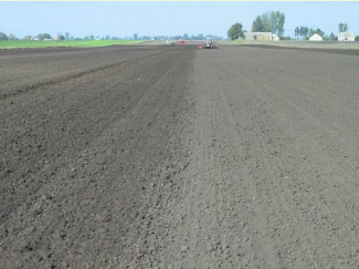
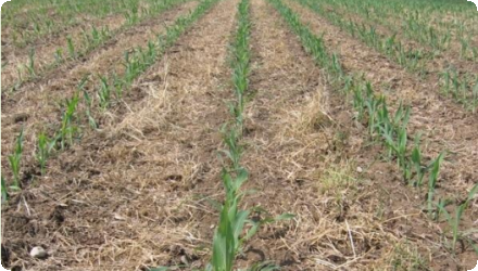
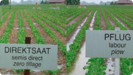
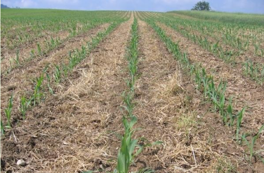
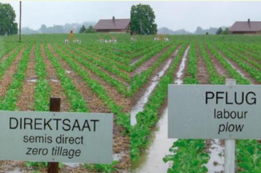
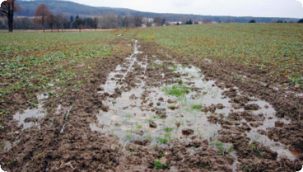
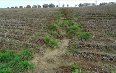
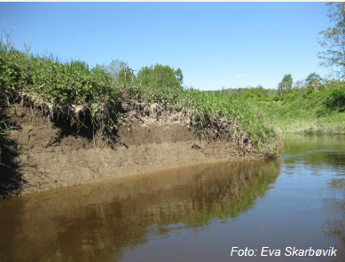
Main challenges identified in both sites are decreasing soil erosion and nutrient load, preventing flash floods, and implementing integrated water resources conservation.

OPTAIN project aims to identify effective combination of the NSWRMs and optimize their allocation, in order to improve water and nutrient retention in the soil and the catchments. Emphasis will be put on suitable options to foster the resilience of agricultural production to climate change.
Last update
2025

OPTAIN : Cherio river basin [Italy]

Summary
The Cherio River basin is located in the eastern part of Bergamo province, Lombardy region. It extends from the pre-alpine reliefs to the irrigated plain area, down to the confluence of Cherio River into Oglio River. The catchment area is about 153 km2, broken down mainly into forest (42%) and agricultural (39%) land. The territory is vulnerable to overflows and flooding events, which requires constant reclamation activities. Moreover, the increasing water withdrawals from Cherio River for industrial and agricultural purposes compromises the possibility to ensure environmental flows, especially during summer and drought periods. Pollution from nitrogen, phosphorus and wastewaters finally contributes to deteriorate the overall water quality.
OPTAIN seeks the involvement of local actors to identify strategies and solutions for an efficient water management, aimed at ensuring quali-quantitative standards to safeguard natural and aquatic habitats and to support an agricultural system deeply dependent on water resources.
Last update
2025

OPTAIN : Petite Glâne River Basin [Switzerland]

Summary
The case study area “Petite Glâne” belongs to the Broye catchment in the southwestern part of the Swiss Plateau. The river Petite Glâne is about 30 km long, repeatedly crosses borders between the cantons of Vaud and Fribourg, and has a catchment area of 94 km2. Its upper reaches have remained fairly natural and are lined with forest, whereas its lower reaches in the Broye plain have been canalized and straightened. The soils and climate here are highly suitable for arable farming. Overall, the catchment of the Petite Glâne is strongly characterized by agriculture: nearly three quarters of its area consists of pastures and cropland. However, the region is increasingly experiencing water shortages in summer, and there is often not enough water in the Broye and Petite Glâne to irrigate the fields. Climate change will further aggravate the situation. Farmers are therefore considering new options to mitigate the increasing drought events – for example an irrigation project using water from Lake Neuchâtel.Against this background, OPTAIN explores efficient land use and land management strategies as well as technical measures that increase the capacity of soils to absorb and store water while improving nutrient retention and decomposition. These natural and small water retention measures (NSWRMs) are discussed and evaluated jointly with regional stakeholders.
Based on model calculations, OPTAIN works to determine the maximum possible water and nutrient retention potential that can be achieved with NSWRMs if they are optimally combined and positioned in the catchment. Although the focus is on the Petite Glâne, the case study extends to the entire Broye catchment when it comes to modelling and stakeholder involvement.

The OPTAIN project supported the case study team with identifying and developing efficient land management strategies and small technical solutions to improve the soils’ infiltration and water holding capacities as well as its capacity to filter, buffer and transform pollutants.
Last update
2025

OPTAIN : Tetves [Hungary]

Summary
The study site is the sub catchment of Tetves, is considered a priority area in terms of water protection. The size of the study site is 68 km2. 49% of the total catchment area is forest, 39% is arable land, 1% orchards, 1% vineyard, 1% is grassland and 2% is urban.

The study site is sensitive to nutrient and nitrate loss. Extreme weather events, the presence of loose parent material and a lack of best management practices in some part of the study site increase soil degradation, especially gully erosion. The water and nutrient management of this small catchment affects water quantity and quality of Lake Balaton. Extreme weather events will increase the environmental and social conflicts in the region.

The most pressing issues recognized in the study site are: revise the aspects considered for the delineation of soil erosion prone areas, wider application of measures that efficiently decrease soil erosion and nutrient load, and implementation of integrated water resources conservation.

OPTAIN project aims to identify effective combination of the NSWRMs and optimize their allocation, in order to improve water and nutrient retention in the soil and the catchments. Emphasis will be put on suitable options to foster the resilience of agricultural production to climate change.
Last update
2025

OPTAIN : Schwarzer Schöps [Germany]

Summary
The Schwarzer Schöps case study is located in the East of Germany. The catchment area is about 137 km2, most of which is used as cropland (48%), forest (25%) and grassland (15%). The area is facing an increase in severe floods, soil erosion, and droughts, with negative implications for crop yield stability. In addition, the downstream reservoir Quitzdorf suffers more often from low water tables and high phosphorus pollution which is causing blue-green algae bloom and threatening its multiple services, in particular its important role for nature protection, recreation, and maintaining downstream environmental flows.
Last update
2025

OPTAIN : Kråkstad Catchment [Norway]

Summary
The Kråkstadelva catchment, as case study area, is located within the Hobølelva watershed, located ca. 30km S-SE of Oslo, Norway. The area of the Kråkstadelva catchment is approximately 51 km². Agricultural land covers circa 43% of the catchment (22km²) and it is dominated by cereal production. Forest covers ca. 45% of the catchment. Heavy clay soils dominate in the area (up to 80% of clay content). Mean annual temperature is 5.3°C and average annual precipitation is ca. 864 mm. Floods of varied magnitude occur frequently in the catchment, typically during spring snow melt and autumn rainstorms. The main challenge in the area is water quality (incl. high phosphorus pollution) and soil erosion (incl. riverbank erosion and quick-clay landslides). There is already high focus on environmental mitigation measures, for example reduced tillage (no tillage in autumn), buffer zones (grassed bufferzones, in addition to natural buffer zones, in cropland along streams and lakes), grass-covered water ways, constructed wetlands and the use of catch-crops.
Last update
2025